All Activity
- Past hour
-
positivity! yay!
-
Agreed......
-
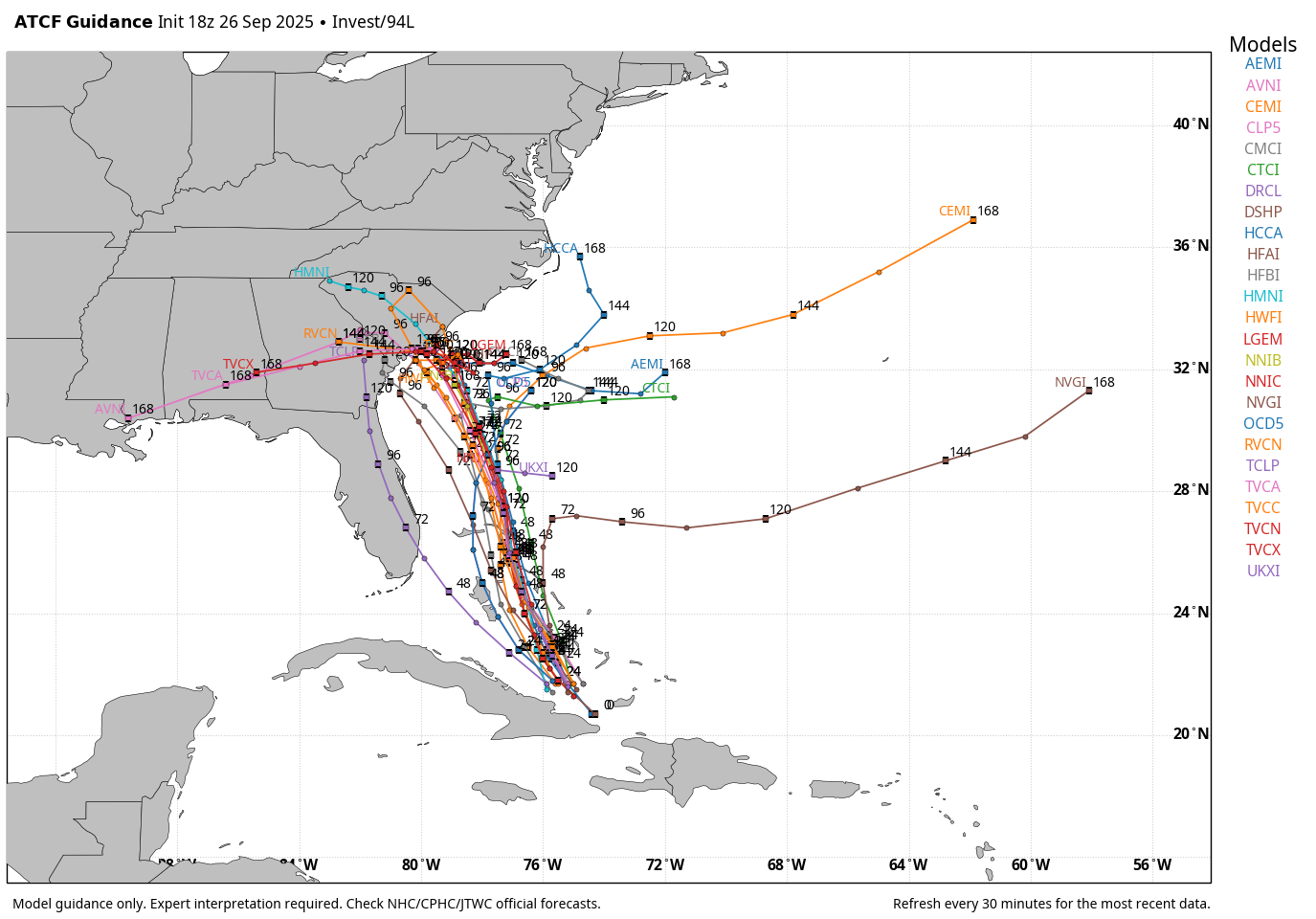
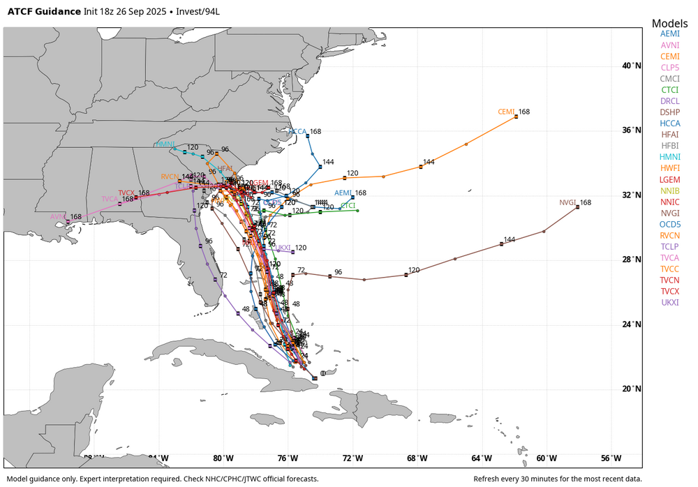
WB 18Z tracks
-
Meanwhile Euro pretty much undid yesterday’s walk backs.
-
Agreed except Irene took down a shitload of trees in my woods.
-

E PA/NJ/DE Autumn 2025 Obs/Discussion
Hurricane Agnes replied to PhiEaglesfan712's topic in Philadelphia Region
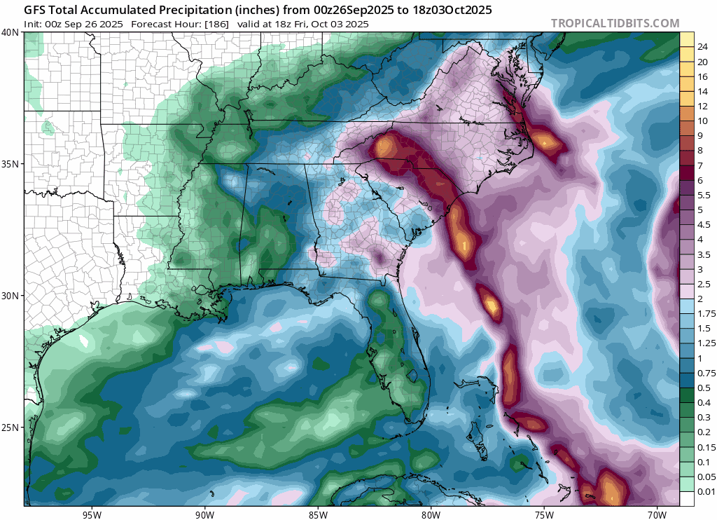
I saw one weather site talking about Fujiwhara. I remember that in the eastern Pacific in 2017 with Hurricane Hilary and TS Irwin - NASA had an interesting write-up and graphic of that - https://gpm.nasa.gov/extreme-weather/hilary-and-irwin-interaction-shown I got really screwed the past 3 days with the rain. Only got a total of 0.47" over those 3 days,with yesterday's 0.29" as the largest of the series. As an obs, I bottomed out at 66 this morning and got up to 81 as a high. Was surprised to see so much blue sky! Currently 74 with dp 64. -
Barely moderate color in those pictures . Looks like great warm sunny hike !
-
the last couple of frames it looks to be heading wsw https://www.tropicaltidbits.com/sat/satlooper.php?region=08L&product=ir
-
Hopefully but we know in 6 hours there will be another solution. Not surprised at all by this though.
-
It would be an all time win for the second tier models.
-

Potential Tropical Cyclone Nine
Kevin Reilly replied to WxWatcher007's topic in Tropical Headquarters
One thing that is constant on the models all of them is a blocking area of high pressure streaming down from Eastern Canada and off the New England Coast. Both of these systems Humberto and Imelda have no chance of getting north of say Outer Banks points northward. Looks like 18z GFS just changes everything and the westerlies take over along the East Coast and send everything packing up and heading out to sea it is plausible I suppose. I would say at this juncture that the Outer Banks points north are out of the woods from direct impacts, but we could be setting the stage for rough surf and waves from the systems themselves and also the tight pressure gradient from the high up north and the lows down south. Honestly these blocking highs up the coast in the Mid-Atlantic and to SE Canada and New England have been a steady feature going back to July and August. I would not let your guard down Florida to say Cape Fear NC and head any warnings as Neuman eluded to early. Looks like the blocking gates to the east will open to let Imelda to follow Humberto right out to sea as the blocking comes down from the north and the systems bounce east quite plausible. -
Euro ai shows low pressures for humberto at the 12z time so we'll see how it does.
-
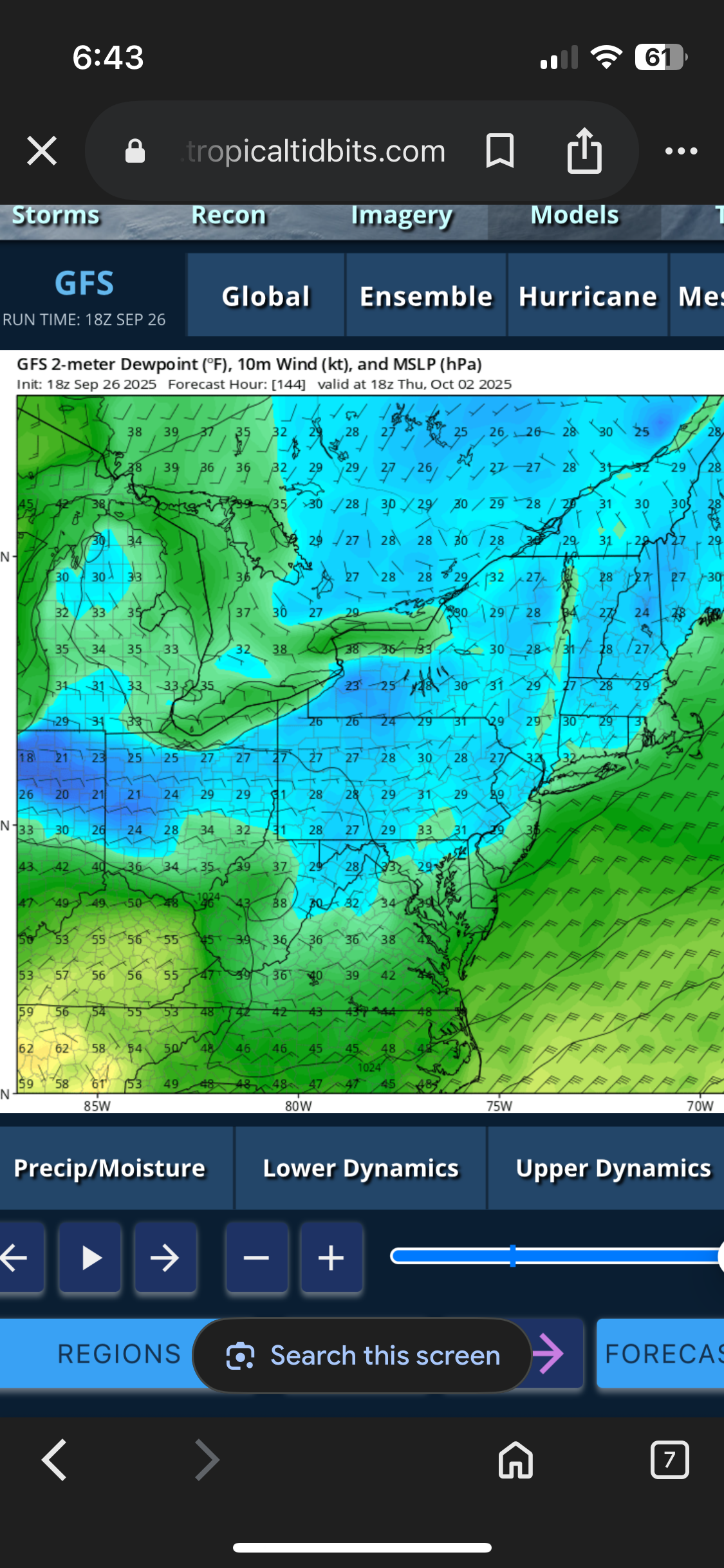
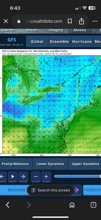
29F dew point on Thursday per happy hour!
-

Potential Tropical Cyclone Nine
olafminesaw replied to WxWatcher007's topic in Tropical Headquarters
No landfall would be a big win for the Euro AI -
Icon starts going up coast by florida then gets pulled towards humberto...
-
Gefs supports the no landfall the op showed. This time around there showing how strong humberto is with pressures in the 900s versus 1000+
-

2025-2026 Fall/Winter Mountain Thread
ncjoaquin replied to Buckethead's topic in Southeastern States
Hopefully, that is the final solution. -

Potential Tropical Cyclone Nine
Coach McGuirk replied to WxWatcher007's topic in Tropical Headquarters
18z GFS is bizarre. -

-

Potential Tropical Cyclone Nine
NorthHillsWx replied to WxWatcher007's topic in Tropical Headquarters
If this “busts” I hope the public understands how tough a forecast this is and the difference between a major impact vs a non event is literally anyone’s guess right now. Good for South Carolina being proactive -
18zgfs no landfall!!!!
-
Potential Tropical Cyclone Nine
Coach McGuirk replied to WxWatcher007's topic in Tropical Headquarters
It's nothing right now, nobody knows what will happen. -
18z GFS says that Imelda stalls before moving east
-
They’re call “ever” greens for a reason.
-
Well that was a rough Summary from a professional meteorologist I see online before.