All Activity
- Past hour
-
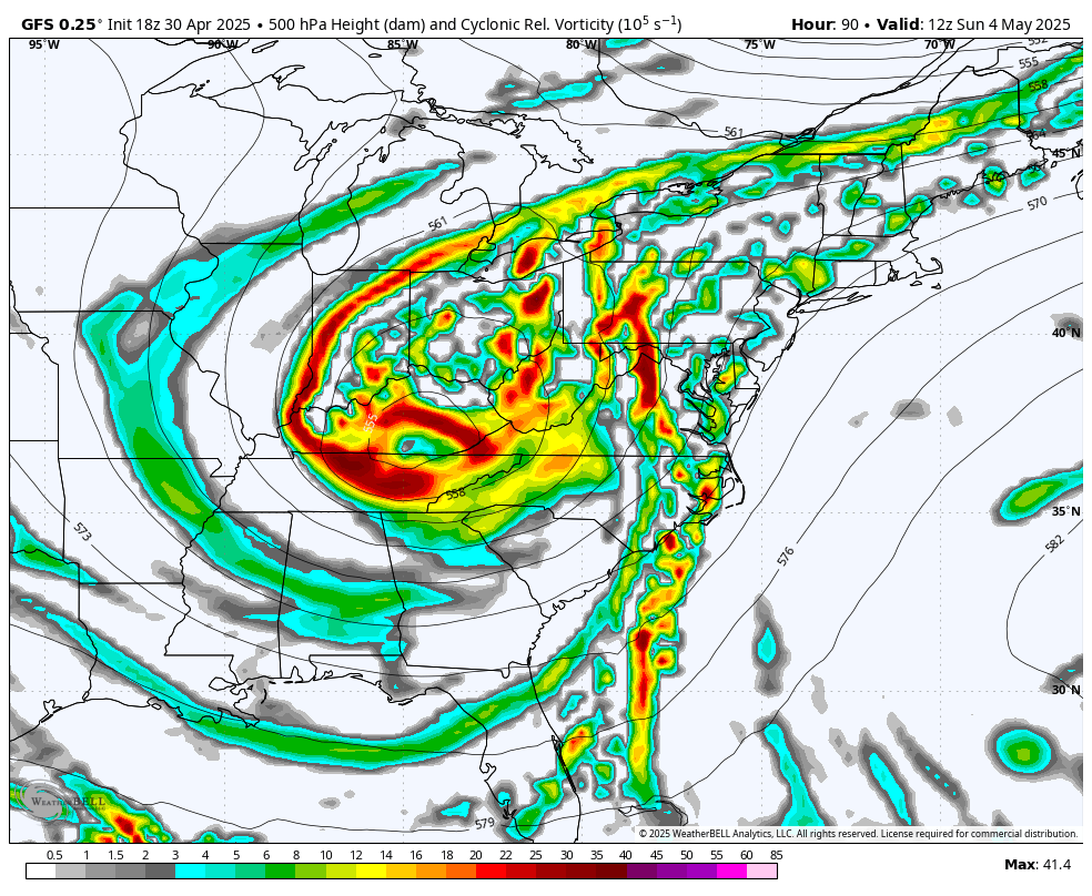
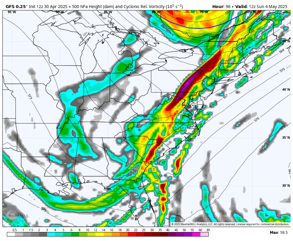
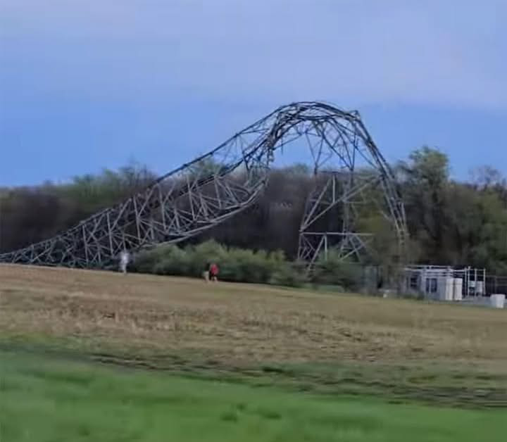
There hasn’t been much major severe to write home about in this part of Central PA for what seems like the last several years but this year has definitely been off to a wild start. Prior to yesterday there was a widespread severe event on 3/16 that really impacted some of the same areas with a few NWS confirmed tornadoes and lots of straight line wind damage in the I-80 corridor as well as the 99 corridor too. That one really hit Bellefonte and surrounding hard. Last nights line really hit a bit further south.. getting Cambria/Blair/southern Centre/Huntingdon coming in from western PA where it had its largest impacts in and around Pittsburgh. Carrolltown in Cambria County had the most notable damage report, with a cell phone tower being destroyed by the winds. Something you don’t see often outside hurricanes or maybe direct hits from tornadoes. The NWS reportedly surveyed this today and reported that to be straight line wind damage of 110-120mph winds. https://www.wtaj.com/weather/nws-survey-confirms-straight-line-wind-damage-in-cambria-county/ There was other widespread issues around here and tens of thousands of folks without power. I was out here for a couple hours and my parents up the road didn’t get theirs back until earlier today. No damage here at home fortunately.
-
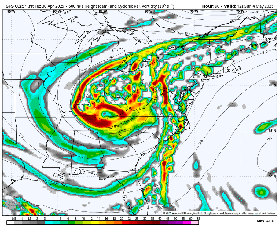
Ok, what’s the excuse now? You’ve got every model showing a multi-day wet period.
-
Eventually migrates east. What a disaster that model is.
-
Power is back on
-
Bc it’s a shit model lately. What a joke and a cave
-
Yeah that’s not even close to 12z’s look. Sort of spares SE MA but that’s just pumping moisture on SE flow for days.
-
eastern areas not so bad yet though... western areas
-

2025-2026 ENSO
Stormchaserchuck1 replied to 40/70 Benchmark's topic in Weather Forecasting and Discussion
The problem with decadal cycles is that they are in such a short timeframe that you can say "Whatever X is, has to do with Y", and there's not enough data to disprove this.. I bet if the PDO was running 25 years positive, that would definitely be linked to climate change, no doubt. And that one you can probably make a stronger case for too. I don't think things like the NAO/AO/PDO are obsolete in this "new climate". For everytime the -NAO has linked up with a SE ridge, there are 3-4x more examples of warmer days happening when the NAO is positive.. Jan 26, 2024 it hit 80* in DC with the strongest +NAO for that timeframe, maybe on record (-300dm for a 5-day surrounding period). These fluctuations are still strong and constant in an overall warmer climate. I'm not going to make everything happening about a 2c global skew. Anyway, just an example: In the older climate: -NAO -0.5 correlation with temperature +NAO +0.5 correlation with temperature New climate: -NAO -0.2 correlation with temperature +NAO +0.8 correlation with temperature It's the same thing! 1.0 = 1.0. NAO remains just as impactful. -
nice fire hose from that south at hr 141
-
probably be back to nothing at 0z
-
Man that model is broken again.
-
we flood!
-
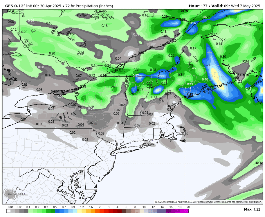
WB 18Z GFS rain totals through day 7.

-
yup now will @Damage In Tolland
-
Trending wetter
-
Gfs massively caving
-
GFS caved to EURO...WB 18Z GFS compared to 12Z at 8am Sunday.

-
Well when it's every model vs the GFS then ya
-
Possibly a full cave on 18z gfs
-
With snow there are more things that can go wrong that don’t apply this time of year.
-
You guys do the same in winter.Post the snowy models and ignore the non snowy . Now y’all doing it with potential rains lol
-
Those qpf maps look pretty and I am hoping! April's almost over and I have just 5.7 inches on the year -- parents in Calvert have 13.5
-
My mom took these flying over the Rocky Mountains yesterday on her way to Vegas.. I told her I would of jumped out of the plane


-
Not even 2 inches below normal. I'll pass on the weekend rain.
-
At least I won’t have to water the grass seed.