All Activity
- Past hour
-
I see Upton has blessed the title of this thread. Excellent
-
Barely a dusting here. There are some cool crystal shapes in it. Yeah what's with that Hudson Valley gap?
-

Central PA Winter 25/26 Discussion and Obs
MickeyTim6533 replied to MAG5035's topic in Upstate New York/Pennsylvania
what are they basing this off? 6z gfs shows eastern berks getting almost two feet -
Agreed I think only Anthony and Weathergeek might have been the only 2 humans to want that to continue - I told my son " I just wish the one weather model that is holding out will cave so I can get some sleep and just end this slow pain "
-
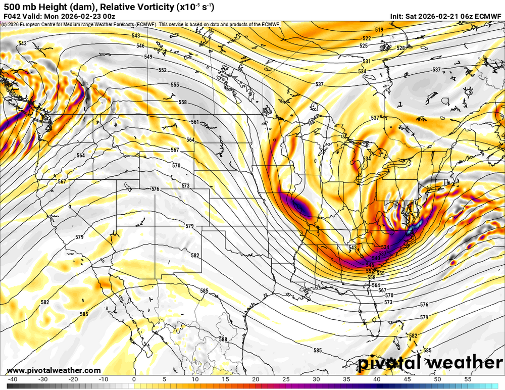
never give up good morning, i see some of my posts were deleted. I think this is just a sign that the westerly trend is over and the models will correct back to around where the GFS is. Remember all models trended towards the GFS yesterday 80% models had nothing. We will see by tomorrow but I honestly still think the euro is the most overrated model there is, icon may be better at this point! We'll see but to me it just looks like the west trend is over and they'll just wobble back and forth between GFS and maybe Euro AI solution!
-

Central PA Winter 25/26 Discussion and Obs
Blizzard of 93 replied to MAG5035's topic in Upstate New York/Pennsylvania
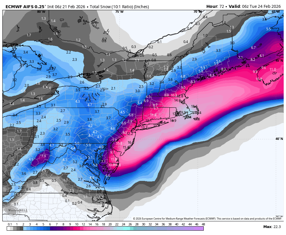
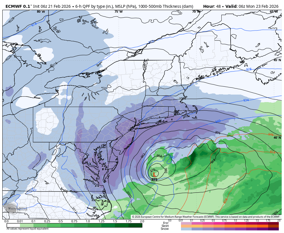
CTP reissued the Watch early this morning and is going with 5 to 10 inches of snow at this point with winds up to 35 mph. (yes @canderson this includes downtown Harrisburg…lol) Winter Storm Watch URGENT - WINTER WEATHER MESSAGE National Weather Service State College PA 439 AM EST Sat Feb 21 2026 PAZ057>059-064>066-220000- /O.CON.KCTP.WS.A.0004.260222T1000Z-260223T1800Z/ Dauphin-Schuylkill-Lebanon-Adams-York-Lancaster- Including the cities of Hershey, Harrisburg, Gettysburg, Pottsville, Lancaster, York, and Lebanon 439 AM EST Sat Feb 21 2026 ...WINTER STORM WATCH REMAINS IN EFFECT FROM LATE TONIGHT THROUGH MONDAY AFTERNOON... * WHAT...Heavy snow possible. Total snow accumulations between 5 and 10 inches possible. Winds could gust as high as 35 mph Sunday night and Monday. * WHERE...A portion of central Pennsylvania. * WHEN...From late tonight through Monday afternoon. * IMPACTS...Travel could be very difficult. The hazardous conditions could impact the Monday morning commute. * ADDITIONAL DETAILS...There is still some uncertainty regarding the track of this storm. Any westward shifts in the track may result in higher snowfall amounts. PRECAUTIONARY/PREPAREDNESS ACTIONS... Monitor the latest forecasts for updates on this situation. -
“Cory’s in NYC! Let’s HECS!” Feb. 22-24 Disco
Bostonseminole replied to TheSnowman's topic in New England
Wohoo!! . -

“Cory’s in NYC! Let’s HECS!” Feb. 22-24 Disco
CoastalWx replied to TheSnowman's topic in New England
Should be some. You can thank me. -

Central PA Winter 25/26 Discussion and Obs
mahantango#1 replied to MAG5035's topic in Upstate New York/Pennsylvania
-
Got a glorified dusting overnight. All surfaces covered. Waiting for my watch to become a warning, amazing that Albany is still hesitant. .
-
I honestly think everyone was except the Gfs
-
6.0" Salem NH. 18" OTG. -SN 30F.
-
I was about to give up Thursday afternoon but the GFS refused to let it go.
-
Thanks, I’m hoping that they’ll be willing to land in light snow. As for making it back to NJ if we land, I guess I’ll leave my life in the hands of the Uber gods.
-
accuweather forecasts are the worst and their even worse on the radio side where they have 3-6 inches as of last night..
-
Just a dusting overnight but trees are caked in ice . Beautiful out there https://imgur.com/a/FNNUBoS#5wEzfVH
-
Just wild to think of where we were at and what the models were showing ( besides the GFS ) 48 hours ago and where we are right now
-
.thumb.jpg.6a4895b2a43f87359e4e7d04a6fa0d14.jpg)
Central PA Winter 25/26 Discussion and Obs
Yardstickgozinya replied to MAG5035's topic in Upstate New York/Pennsylvania
Foxyynew just gave me a solid, 1 to 3 .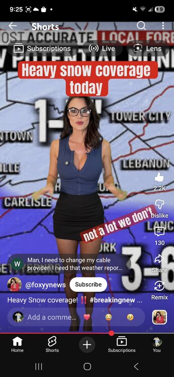
-
AI was unchanged

-

“Cory’s in NYC! Let’s HECS!” Feb. 22-24 Disco
Damage In Tolland replied to TheSnowman's topic in New England
Interesting later today into tonight from about ORH west and south . Nice convergence zone showing up along the back door . Drops an inch or so evening into overnight -
That's a sigh of relief that the euro looks a bit better then it's 0z run.
-

“Cory’s in NYC! Let’s HECS!” Feb. 22-24 Disco
rnaude241 replied to TheSnowman's topic in New England
Mattapoisett is wonderful. I grew up in Rochester, nothing like that area. -
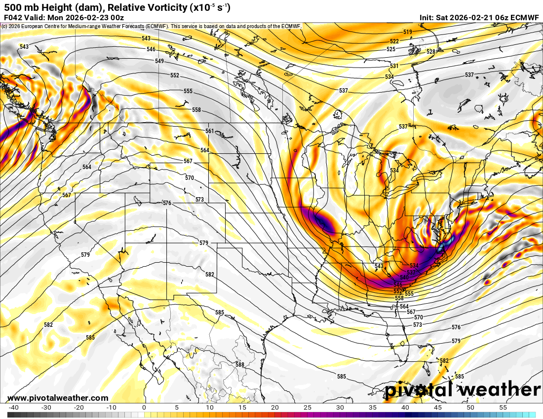
6z Euro would give most of us low end warning level snow coming mostly from the IVT
-
6z euro is amped