All Activity
- Past hour
-
If this works…..
-
This weather is truly a treat. 10/10 in every way possible. I think this is the best Labor Day Weekend weather wise in over 30 years.
-

eastern Atlantic blob 0/20
BarryStantonGBP replied to BarryStantonGBP's topic in Tropical Headquarters
Any other storms? -
First time I think I’ve noticed clean air mode on RadarScope. Thought there was a light shower moving in from the NNE lol.
-
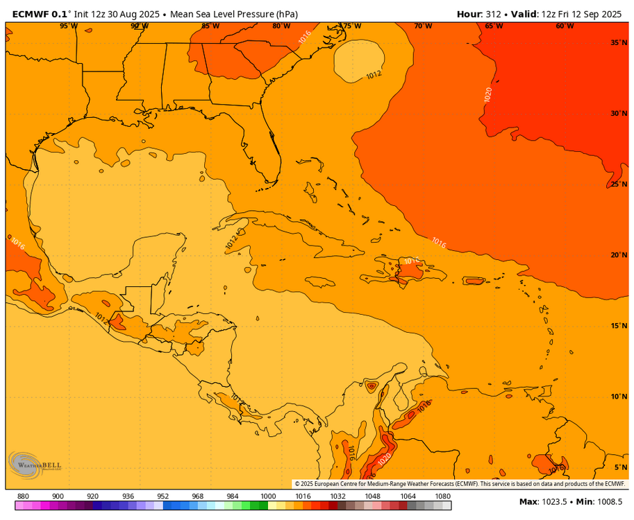
Today’s 12Z ops are much more active for the E MDR lemon than the runs from 24 hours ago: -Euro has a MH hit Bermuda on 9/14 (fwiw). -GFS has a H pass 250 miles E of Bermuda on 9/13 (fwiw). -ICON has a minimal TS moving ~due W at 180 hours near 16N, 45W. That would be far enough S when also considering its near due W movement and a 600 dam H5 high to its N to be a potential concern for at least the NE Caribbean. -CMC has a TD that later dissipates. -UKMET has two separate weak lows and no TC. I’m throwing this weird solution out since it’s a clear outlier. -JMA has a TD the furthest S of any major model with a TC. It’s at 14N, 45W, and moving WSW (unlike any other model with a TC) at end of its run (192). If that were to be real, it could be a legit concern for the Lesser Antilles and beyond. But all others are up at 16-19N then. And this is the JMA. An outlier JMA, especially to the left, is usually wrong. But we’ll see. @BarryStantonGBP
-
Sad. It's not the same, but I've seen Sebago turn from light 1' chop to 5'+ white caps in a matter of minutes. I imagine it's the same for other significant bodies of water in NNE. Even if you're responsible, prepared and constantly monitoring conditions, the rapid change can catch you totally off guard.
-
If those SST'S remain pretty much as are around Newfoundland and those in the GOA warm a bit we could be looking at both. 50-50 Lows should be more prevalent. +TNH Pattern possible with the NPAC SST Profile. Let's not forget the QBO as well.
-

eastern Atlantic blob 0/20
BarryStantonGBP replied to BarryStantonGBP's topic in Tropical Headquarters
@GaWxthoughts on that run? Thoughts on the lemon giving birth / splitting? -
Fantastic G.S.D. day. (Get Shit Done)
-
75° / 47°. Folks out enjoying a cold beer on an absolute stunner. *Excluding the kook from Connecticut and his red-headed stepchild
-

eastern Atlantic blob 0/20
BarryStantonGBP replied to BarryStantonGBP's topic in Tropical Headquarters
Might get another storm not just gabsy wabsy -

2025 Atlantic Hurricane Season
BarryStantonGBP replied to BarryStantonGBP's topic in Tropical Headquarters
kiko chan also we may get another storm not just gabsy wabsy -
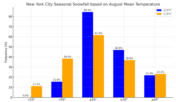
Fun speculation: The kind of cool August NYC has seen has typically been followed by 20" or more snow in most cases and 30" or more snow in nearly half of cases. Looking at the 30" cases following an August with a monthly mean temperature of 73.0° or below, 80% had seen 6" or more snow by December 31. In contrast, 83.3% of the seasons with less than 20" seasonal snowfall following cool Augusts had less than 6" snow by December 31.
- Today
-
-
Followup: As a result of recently formed TS Kiko in the EPAC, 2025 is no longer the quietest Labor Day weekend tropically globally of Joe Bastardi’s lifetime. Why? Going back to 1950: -1980: no TC in EPAC, WPAC, or N Indian. The only TC was TD7 forming 8PM Sun in the NATL and lasting through Mon. Thus, 2025 now having a TS already beats 1980 globally. -1991 is debatable: -no TC in EPAC or N Indian -WPAC had a dissipating Harry, probably down to only a TD, on Sat, and a new TD on Mon -NATL: TD 5 dissipated on Sat -So, unlike 2025, 1991 had no TS+ but there were 3 TDs during the weekend.
-

2025 Atlantic Hurricane Season
BarryStantonGBP replied to BarryStantonGBP's topic in Tropical Headquarters
I thought the tutt is there already -
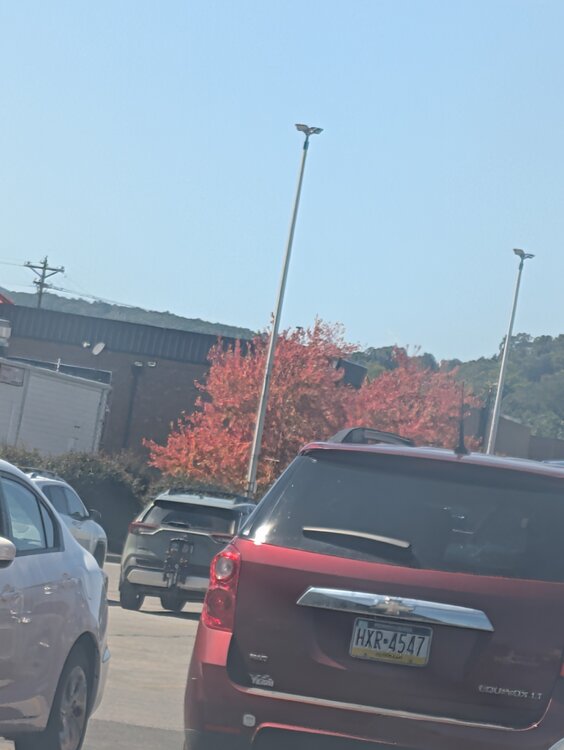
Same up this way but I'm seeing some color in a few trees here and there. With how cool and sunny it's been, I'm thinking the plant life is confused.
-
Dropping here due to how dry it is
-

2025 Atlantic Hurricane Season
WxWatcher007 replied to BarryStantonGBP's topic in Tropical Headquarters
I think this first wave is most likely to be the beneficiary of a CCKW and may be early enough to avoid a developing TUTT. Anything caught near that will get ripped apart. The basin is still hostile and won’t change until the basin wide forcing changes with the cycling MJO. It’s almost September so I don’t think it’s a huge departure from climo. -
Yo are the leaves already changing?
-
2025 Atlantic Hurricane Season
LoboLeader1 replied to BarryStantonGBP's topic in Tropical Headquarters
It ain't over till it's over.


.jpg.2f946c0cdbdbff8662a11d2fba50af94.jpg)


