All Activity
- Past hour
-
no, I don’t buy that at all lol. The CANSIPS was honking its horn on a +PDO nino last year as well and that forecast sucked lol
-
That's only through 7 am. I suspect that the final number will show measurable snowfall at LaGuardia.
-

New Years Day 2026 - 1st snows of the new year possible
dendrite replied to Baroclinic Zone's topic in New England
ORH 2.6” BDL 1.7” PVD 0.8” BOS 0.7” BDL 0.2” -
Just midnight through 7 am. As noted some locations were still receiving snowfall. A subsequent update should cover the final amounts. Moreover, since I was showing only snowfall from the squall, that omitted the 0.1" that fell at Newark yesterday.
-

January 2026 regional war/obs/disco thread
ORH_wxman replied to Baroclinic Zone's topic in New England
Euro coming in colder for 1/7 also compared to 00z. Quick shot of snow/ice even into SNE. -
Was Snowing hard here at 5am. Potent, but short lived. You might have done a bit better in this one. Eyeballing I’d say 4” here. .
-
We cant figure out mid January now we r hanging hope on a 26-27 enso event?
-
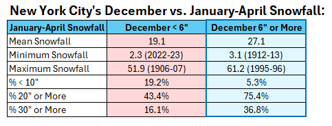
While some might be tempted to cancel winter with the 12z guidance having few, if any, snow threats beyond mid-January, a snowy December typically favors more snow during January-April than when December is not snowy. I'd take my chances given where things stand.
-
Was very surprised by how much snow fell in a short amount of time. Looked like half to 3/4 of an inch. Enough to make my boxer go insane and not want to come back inside. These dam winds though... Ooofaa
-

New Years Day 2026 - 1st snows of the new year possible
The 4 Seasons replied to Baroclinic Zone's topic in New England
Seems really low, but can't say im surprised. -
The LGA number is a little suspect, especially when looking at the radar. It's nice to see the Park getting two measurements in a row correct. They have been especially bad the last 4-5 years on the under 1 inch amounts, often times ignoring them or recording a T.
-
Thats just from midnight-7AM or the whole event? looks like its just the calendar day, BDR should def be higher. Also, where did you get that from? i was looking for climo sites snowfall totals this morning but the CLI wasn't out yet
-
Thanks Don. Last year and this year so far have reminded me a lot of the 80s growing up. Figures. 2018/2019 through 2023/2024 a good representation of the 90s.
-
New Years Day 2026 - 1st snows of the new year possible
dendrite replied to Baroclinic Zone's topic in New England
The PNS had 0.2” but that was as of 8am -
There it is. One of, if not the more likely ways we could win this month. Not a monster storm look but would fit the Nina climo with a SWFE. Lets ride. Eta: -epo, neutral/slight -pna, split flow energy coming out of SW US, flattish SER, GL ridhing.
-
Happy New Year Everyone!! My total rain and melted snow in 2025 was 35.73". This was 6.07 " below the 40 year average of 41.80".
-
Looks like the recent GFS runs are solidly hammering that idea too - LOL (...it's garbage ... we hope. ' just havin fun with it)
-
It was pretty much consistent low/mid grade cold the entire month. The first week was higher end anomaly wise, but being on the front bookend obviously made the actual values less extreme in terms of DJF. The min for the month here was only -1°. Looking ahead, there’s a good chance that min holds right to the climo min around 1/20.
-

New Years Day 2026 - 1st snows of the new year possible
EastonSN+ replied to Baroclinic Zone's topic in New England
Don posted in the New York forum -
Holy +PDO Nino
-

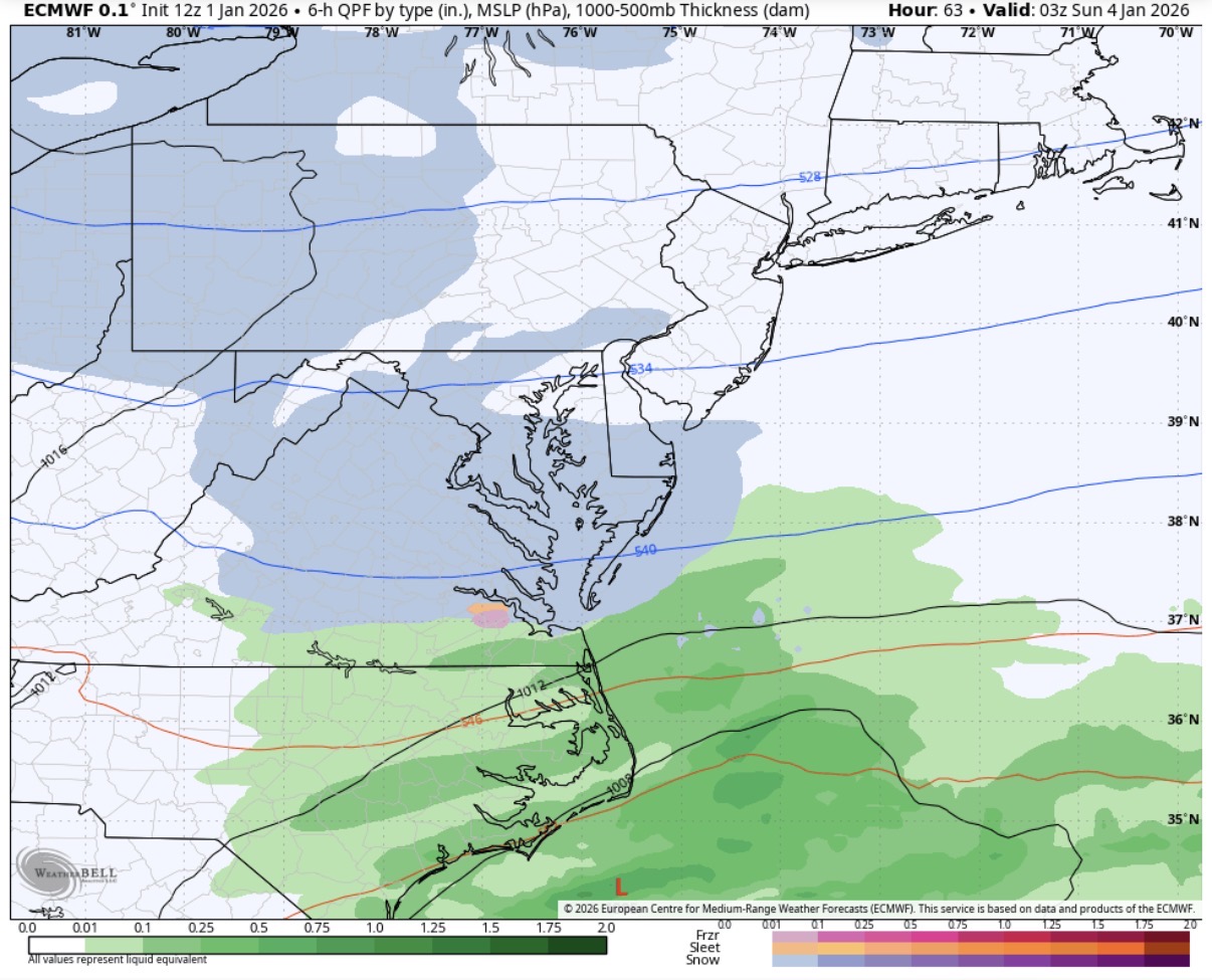
12/31-1/1 Possible Snow Showers/Squalls to Start 2026
J.Mike replied to bncho's topic in Mid Atlantic
It only snowed on my frozen pond. Weird.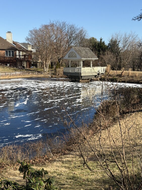
-
I'll just casually drop this here with no commentary. @Ralph Wiggum
-
much improved

-
Go ahead and give your self a weenie post for this.
-

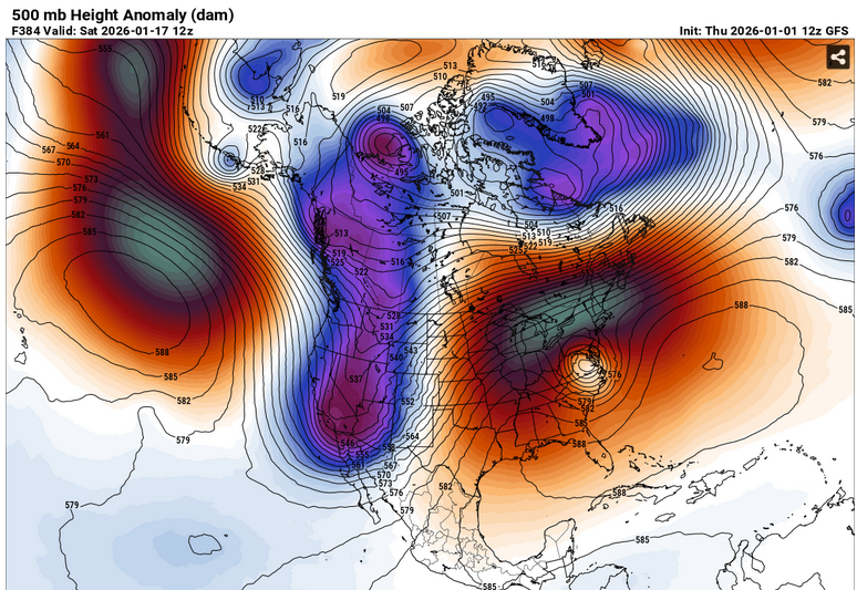
January 2026 Medium/Long Range Discussion
NorthArlington101 replied to snowfan's topic in Mid Atlantic
Just can’t quit this storm. Little bit of phasing was all it took to get a bit of action back. Having something to track is half the fun for me so I appreciate the digital entertainment