All Activity
- Past hour
-
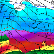
Don’t think we want a closed upper level low over Michigan…slight change lol
-
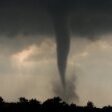
On nearly every chase day I've had where I've seen tornadoes, or was within striking distance of tornadoes but missed them due to being dumb, I've seen that sky when approaching/arriving in the target area.
-
I'm not sure it means anything, but the 0z GFS-AI looks much better for next week than the GFS. It's also an improvement over 18z. The only time this year that the GFS consistently gave our area snowy runs was Dec 26. And it was wrong. Pretty much any other time it has differed from other guidance and didn't show a wintry outcome, it was right.
-
GFS ain't looking so hot attm
-
Easy call for cansips back in October
-
GFS doesn't look great through 120hr. The developing trof axis is very far east and the ULL is completely shut out. It's looking like we'll still be 8+ days out from anything promising on the GFS.
-
Actually December was quite cold Almost 5 degrees below normal at bwi
-

January 2026 Medium/Long Range Discussion
Stormchaserchuck1 replied to snowfan's topic in Mid Atlantic
Need to break this pattern -
It's very funny lol
-
Much more elegant than my analysis. But I do absolutely agree.
-
I've heard everybody from Steve spagnolo to Flores, to lafluer from green bay. I even heard on the radio that former raven anthony weaver was gonna interview for it...The ravens are gonna interview a lot of them over next couple weeks.
-
The subsurface rapidly warming in the cold season tends to correspond to colder periods out here. We should have an actual, real, cold day locally tommorow - in line with that idea, and the observed rapid warming. High of 38F/low of 19F forecast for tommorow. Already seeing rain transition over to snow. It's actually kind of neat that we're still getting snow in this pattern since we're literally running >10F above average winter to date (Dec 1-). Month to date, as in December, the greatest warmth relative to averages is found in the Northwest (+15-20F so far). We're already just about at/over average precipitation locally for January as of 1/8. We're already above Nov-Jan mean precipitation too. I've seen people liken the winter to 2017-18, and the warmth concentrating in the West so far is a bit like that. But precip is very different - we went 96 days without any measurable precip here from Oct-Jan in that winter, and went from Oct-Feb without 0.1" total at one point. This is a much warmer, but much wetter (better) pattern for the West. I still expect January to see the beginning of a cold retrograde to the West, but everything has been running a week later than I expected. The relatively widespread eastern/plains cold I thought would come in wk1 January is showing up for week 2/3 in the CPC 8-14 outlook (with 2022-23 showing as an analog each run). That cold should settle in for a bit and then retrograde West in late January and especially February. Locally the MJO/harmonic storm cycle seems to be ~48 days this cold-season, ~early Oct/late Nov/early Jan so far. So I'd expect more decent rain/snow events here in late Feb/early Apr before the pattern breaks.
-
Pouring here - prolly have flood puddles everywhere by morning if this keeps up. 44th straight day of snow cover - streak may be ending.
-

January 2026 Medium/Long Range Discussion
Stormchaserchuck1 replied to snowfan's topic in Mid Atlantic
Yeah I only track snowstorms if we are in a cold airmass with room to spare -
Well it's the icon 7-8 days out so I'm not gonna jump off a cliff quite yet lol
-
Meso models hinting at some squalls for Sunday morning out here way west of town. Especially the RGEM. But they all show it to an extent. we will see.
-
It’s coming.
-

E PA/NJ/DE Winter 2025-26 Obs/Discussion
Kevin Reilly replied to LVblizzard's topic in Philadelphia Region
They are getting ready to chase the storms out to sea next week? -
-
It's never a lock. Just a constant long-range tease. The trick is to get a solid threat inside 7 days on multiple models for consecutive runs. That has been extremely elusive in recent years. Long range average ensemble anomaly charts don't accurately predict storm threats. That's because the favorable "patterns" and "looks" usually don't look so favorable when they shift from blended long range averages to the intricacies and complex interactions of actual 500mb height fields.
-
Gotta admit that is hilarious, lol
-
12z ICON tracked the northern stream shortwave through Wyoming and phased in the ULL early. The 0z is much further east and misses the phase with the ULL. No Gulf low as a result. Also a more positively tilted trof and an Atlantic SLP along the offshore baroclinicity like other guidance. The 12z seemed unlikely since it had no support. But it showed the type of evolution that gives us our best shot at getting a significant coastal snowstorm.
-
A coastal is coming in the next 7-10 days, almost a lock. Only concern is precip type.
-
He is odd for sure, but kinda funny and an offensive guru. Love to have him as an OC if we end up hiring a defensive minded HC like Flores. He would get the most out of Lamar, unlike Monken who wanted to abandon the run and make Lamar run around behind a crap OL and buy time to throw downfield.
-

January 2026 regional war/obs/disco thread
40/70 Benchmark replied to Baroclinic Zone's topic in New England
The first on that I buy is the Adams total.


