All Activity
- Past hour
-
I know we joke, but in all seriousness hopefully it’s not too bad up there.
-
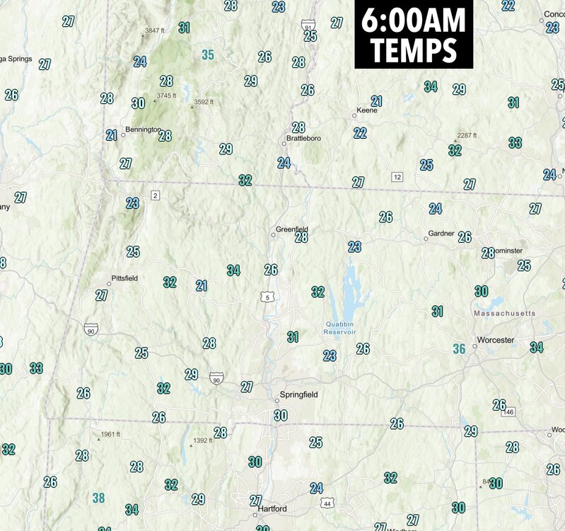
Pick out your favorite hilltop on this map .. any state
-
BWI: 0.3” DCA: 0.3” IAD: 0.7” RIC: 0.1” SBY: 0.2” Precip won’t be the issue, timing it with cold will.
-
No way... you're telling me there could be cold air or even snow sometime in the winter in the midwest? what a bold call!
-
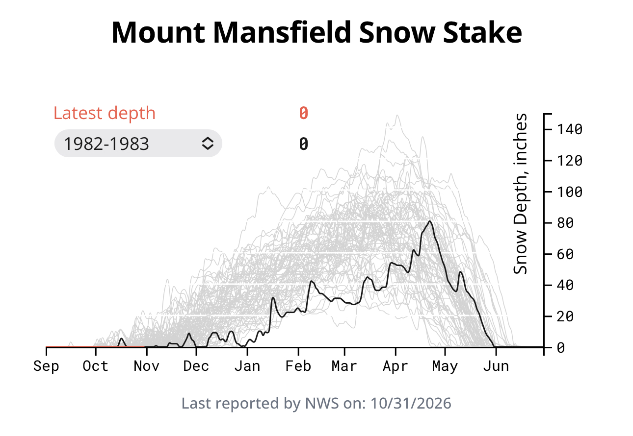
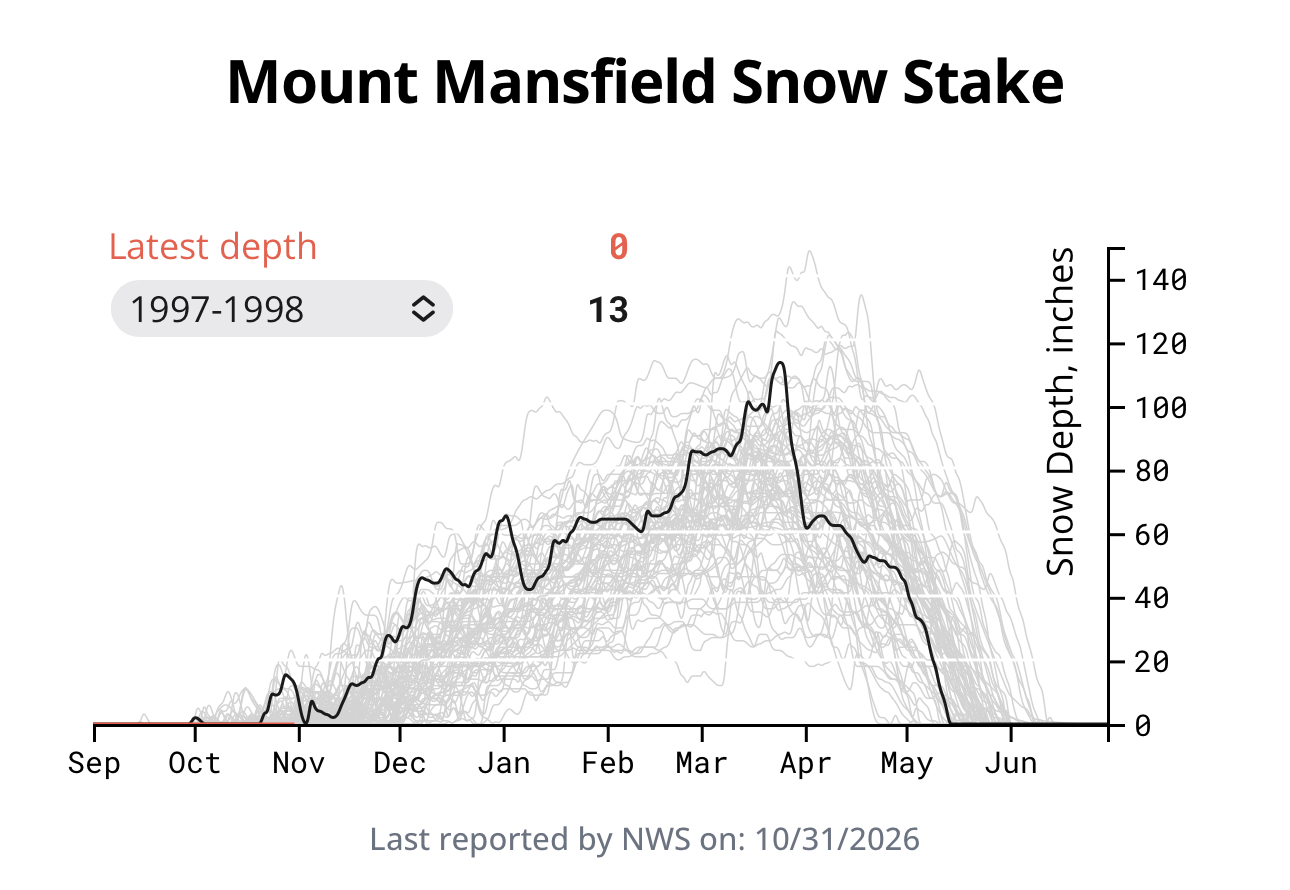
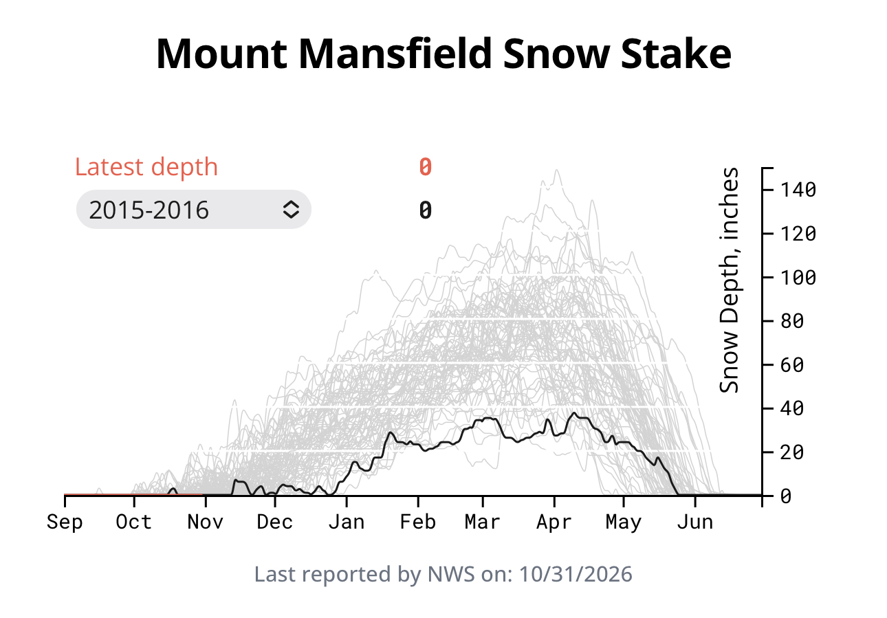
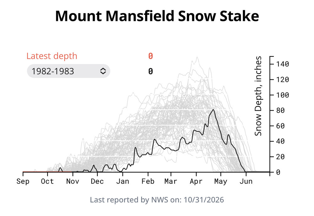
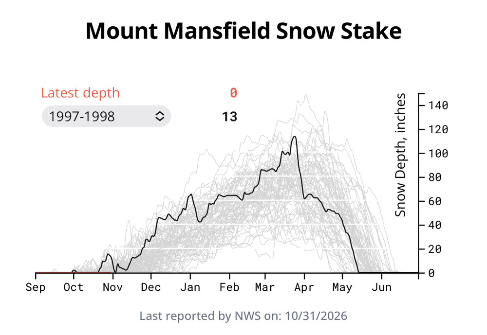
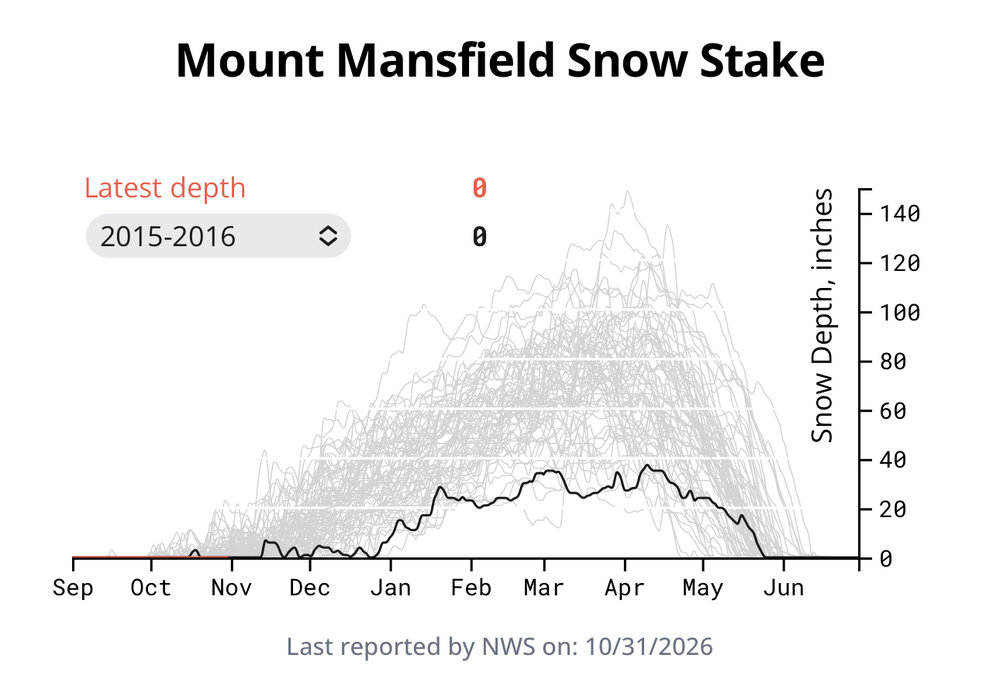
Snowfall and depth not great, though 1997-98 was ok at the summit. Numerous events were just cold enough for elevation snows. It was not good down low. 15-16, disaster, 82-83 disaster.
-
 antibiotics: buy zithromax antibiotic - antibiotics
-
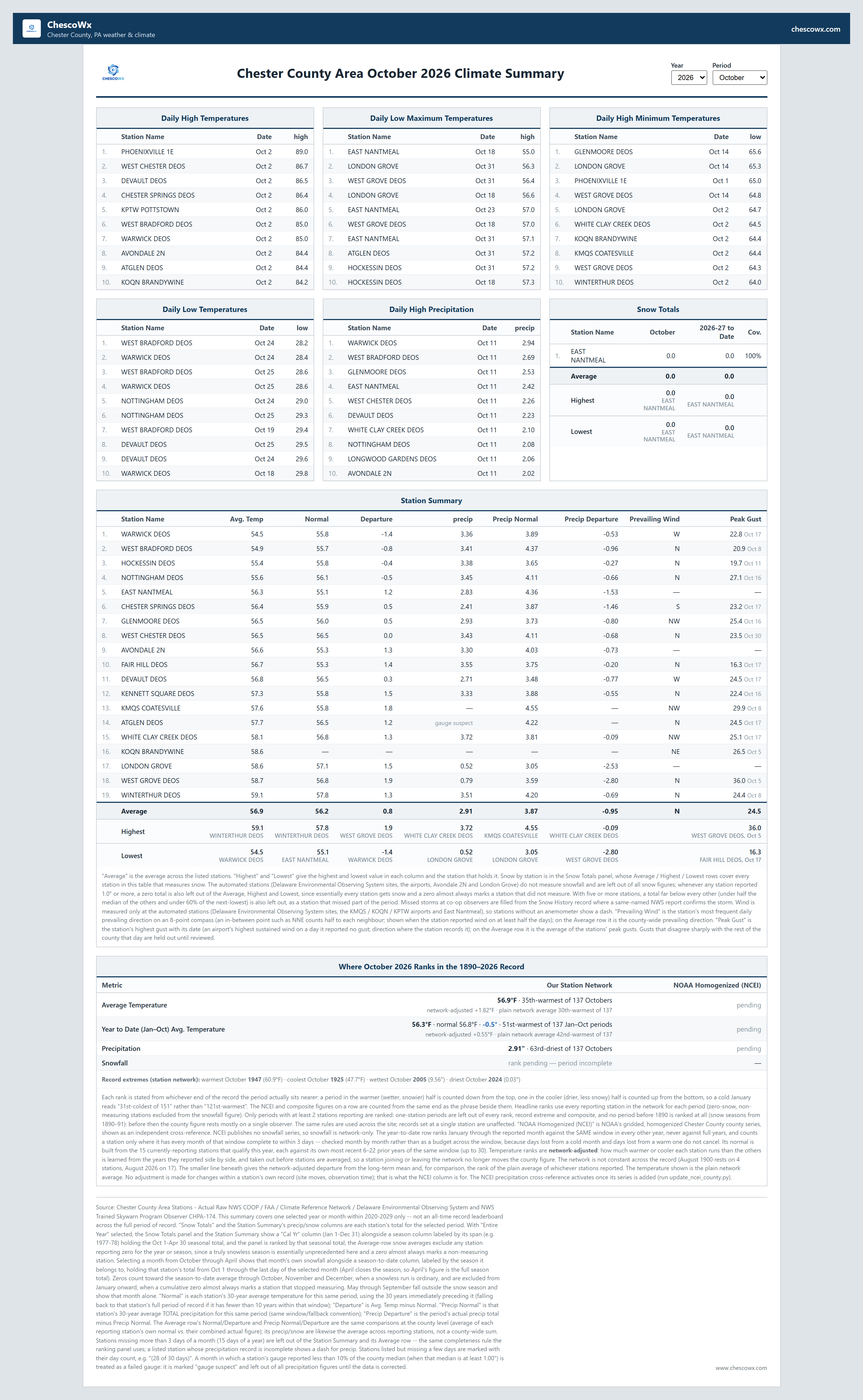
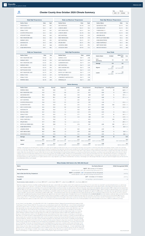
October Climate Summary - Chester County Area. See details and overall rankings since 1890 below. We were slightly warmer than normal +0.8 and about average regarding precipitation. Through the 1st 10 months of the year we are running at 0.5 degrees below normal temperatures.
-

E PA/NJ/DE Autumn 2026 Obs/Discussion
ChescoWx replied to PhiEaglesfan712's topic in Philadelphia Region
October Climate Summary - Chester County Area. See details and overall rankings since 1890 below. We were slightly warmer than normal +0.8 and about average regarding precipitation. Through the 1st 10 months of the year we are running at 0.5 degrees below normal temperatures.
-
Balmy morning with humidity out there!! at 11am I am 60 degrees!
-
You wonder if it ever opens or is shut wire to wire ?Certainly a possibility management is discussing
-
Snowfall/depth
-
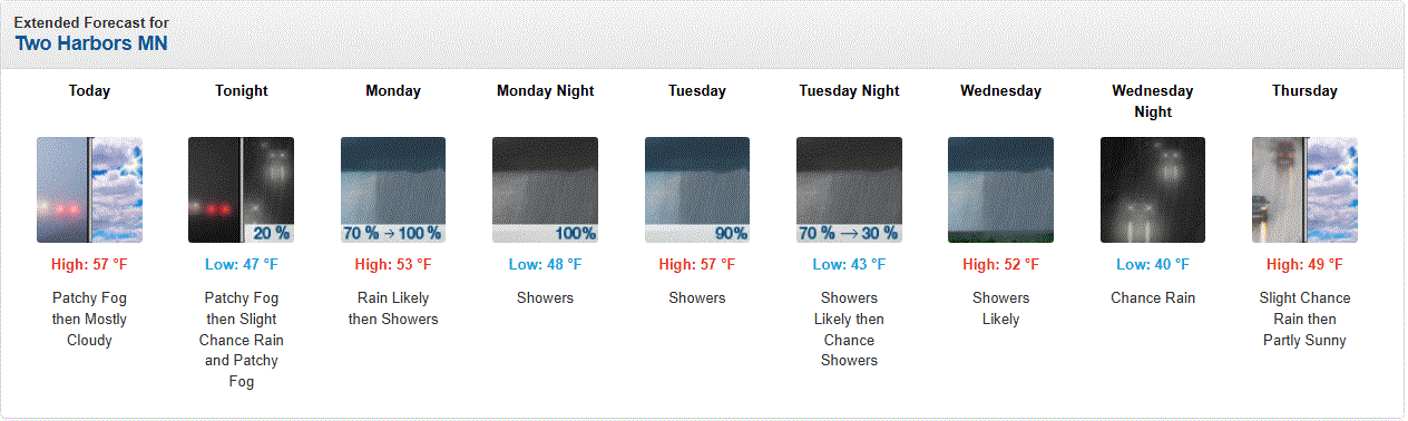
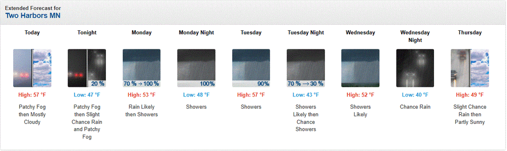
Mild n wet for the start of Nov. Foggy with light rain currently, and plenty more on tap. Good to see.
-
In terms of snow depth or temps?
-
Days and days above freezing up here

-
Waiting on the October number
-
60s and 70s into mid nov on the gfs
-
Do you know offhand what the Mansfield super Nino climo is?
-
DLH Oct mean of 49.5 tied 9th warmest of 92 unique temps. Midpoint temp is 44.6. PWS near old wx bureau site in downtown DLH recorded 51.3. Precip of 1.90" was tied 80th wettest (tied 56th driest). Midpoint amount is 2.29". TH co-op Oct mean of 49.8 tied 12th warmest of 73 unique temps. Midpoint temp is 46.4. Precip of 2.16" was 61st wettest of 121 unique amounts. Midpoint amount is 2.16". Old wx bureau-PWS/DLH arpt mean temps 10/48 48.1/45.2 10/49 47.1/45.2 10/50 46.5/45.8 10/51 41.9/42.0 10/52 39.8/38.7 10/53 49.8/50.3 10/54 42.2/41.7 10/55 45.2/45.1 10/56 48.8/49.3 10/57 43.9/43.2 10/58 45.3/45.2 **** 10/23 47.4/45.6 10/24 52.0/50.1 * 10/26 51.3/49.5
-
Yeah, I’m not either but like you’ve seen, we can fall behind pretty fast and if the bread and butter snows are off, it’s very hard to make it up synoptically. We can’t have Canada be mild and advent in moderated air masses after each low or front. The cold is really the wildcard. And one or two off events just don’t cut it. If two weeks of every month is sort of moderate, it’s enough to keep every month below average snow.
-

13th Annual Mid-Atlantic Snowfall Contest
NorthArlington101 replied to RodneyS's topic in Mid Atlantic
Leaning negative but I'll give myself plenty of time to change my mind. Assuming we get a more classic N/W storm in there and sneak in a relatively minor suppression mix, but otherwise we're mostly rain for the big storms. BWI: 4.3” DCA: 1.5” IAD: 7.1” RIC: 3.2” SBY: 1.4" - Today
-
BWI: 1.7" DCA: 0.8" IAD: 4.4" RIC: 0.2" SBY: T Will be happy to be wrong.. or completely adjust this in a few weeks.
-
http://antibiofastdirect.com/# get antibiotics quickly
-
November can be explosive too, but we need to get a big push of cold to produce. Expectations are in check for sure. Unlike SNE, the daily stuff seems to be the bread and butter rather than siggy events so we can't afford weeks of nothing. If our cold source is under a Chinook this winter we're cooked. Literally lol. I'm just not convinced yet that we fully blowtorch.
-
-
‘15-‘16 but without the ‘16