All Activity
- Past hour
-
-
It’s fantastic but I do love four distinct seasons. I love variation.
-
One of the tornadoes hit the London/Corbin Airport and destroyed the medivac helicopter. I read that this is being considered a mass casualty event in Somerset.
-
Spring 2025 Medium/Long Range Discussion
Spartman replied to Chicago Storm's topic in Lakes/Ohio Valley
YOU SHUT UP! Well, excuse me if I ever posted on this forum in the first place! I DIDN'T COME HERE TO BE INSULTED! Hope you get banned for this kind of comment, you troll. This is not the place for these type of insults. -
Power has been out for over 6 hours
- Today
-
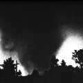
Unbelievable now another tornado in London. Back to back. Sadly this is most likely an historic event unfolding in the SE KY area. More than likely 2-EF4 tornadoes back to back. Truly sad.
-
There's another tornado warning just west of Somerset, moving its way at 70mph.
-
Spring 2025 Medium/Long Range Discussion
dewydews replied to Chicago Storm's topic in Lakes/Ohio Valley
Good, now are you going to stop crying like a little bitch? Everyone's tired of your nonsense, so shut the fuck up. -
https://www.facebook.com/share/v/14ukssL7gD/ Video of the tornado in Somerset.
-
New severe thunderstorm watch up for WV until 5am https://www.spc.noaa.gov/products/watch/ww0273.html URGENT - IMMEDIATE BROADCAST REQUESTED Severe Thunderstorm Watch Number 273 NWS Storm Prediction Center Norman OK 1130 PM EDT Fri May 16 2025 The NWS Storm Prediction Center has issued a * Severe Thunderstorm Watch for portions of Far Southeast Ohio Western Virginia West Virginia * Effective this Friday night and Saturday morning from 1130 PM until 500 AM EDT. * Primary threats include... Scattered damaging wind gusts to 70 mph likely Isolated large hail events to 1.5 inches in diameter possible A tornado or two possible SUMMARY...Clusters of thunderstorms should spread eastward overnight while posing a threat for mainly scattered severe/damaging winds, with peak gusts up to 60-70 mph. Isolated hail and perhaps a tornado or two may also occur. The severe thunderstorm watch area is approximately along and 50 statute miles east and west of a line from 35 miles east northeast of Parkersburg WV to 5 miles west southwest of Bluefield WV. For a complete depiction of the watch see the associated watch outline update (WOUS64 KWNS WOU3). PRECAUTIONARY/PREPAREDNESS ACTIONS... REMEMBER...A Severe Thunderstorm Watch means conditions are favorable for severe thunderstorms in and close to the watch area. Persons in these areas should be on the lookout for threatening weather conditions and listen for later statements and possible warnings. Severe thunderstorms can and occasionally do produce tornadoes.
- 744 replies
-
- 2
-

-

-
- severe
- thunderstorms
-
(and 2 more)
Tagged with:
-
The warning sounds pretty grim. Decently populated area around London plus it's crossing the interstate.
-
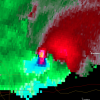
Severe Weather Statement National Weather Service JACKSON KY 1118 PM EDT Fri May 16 2025 KYC121-125-199-203-170400- /O.CON.KJKL.TO.W.0026.000000T0000Z-250517T0400Z/ Laurel KY-Knox KY-Pulaski KY-Rockcastle KY- 1118 PM EDT Fri May 16 2025 ...A TORNADO WARNING REMAINS IN EFFECT UNTIL MIDNIGHT EDT FOR LAUREL...NORTHWESTERN KNOX...EAST CENTRAL PULASKI AND SOUTH CENTRAL ROCKCASTLE COUNTIES... At 1118 PM EDT, a confirmed large and extremely dangerous tornado was located near Mount Victory, or 13 miles east of Somerset, moving east at 45 mph. This is a PARTICULARLY DANGEROUS SITUATION. TAKE COVER NOW! HAZARD...Damaging tornado. SOURCE...Radar confirmed tornado. IMPACT...You are in a life-threatening situation. Flying debris may be deadly to those caught without shelter. Mobile homes will be destroyed. Considerable damage to homes, businesses, and vehicles is likely and complete destruction is possible. The tornado will be near... Bunch around 1125 PM EDT. Other locations in the path of this tornadic thunderstorm include Bernstadt, London, Levi Jackson S.P. and Lida. PRECAUTIONARY/PREPAREDNESS ACTIONS... To repeat, a large, extremely dangerous and potentially deadly tornado is on the ground. To protect your life, TAKE COVER NOW! Move to a basement or an interior room on the lowest floor of a sturdy building. Avoid windows. If you are outdoors, in a mobile home, or in a vehicle, move to the closest substantial shelter and protect yourself from flying debris.
-
That cell is trucking 70mph
-
Mr. J texted me that sirens were going off in Bowling Green KY. Him and his dad went into the bathroom in their hotel. There was a confirmed tornado on the ground to their SW and it continued to stay to the south. They are all safe now.
-
Tornado on the ground just blew through Somerset and is going to pass about a county north of me. It is a confirmed large and extremely dangerous tornado per the warning. It's in @Kentucky backyard. Hope he's okay.
-
I believe this video is from Stowe that weekend:
-
Spring 2025 Medium/Long Range Discussion
Spartman replied to Chicago Storm's topic in Lakes/Ohio Valley
-
65.3 v 64.6 remarkable. We currently have roughly the same monthly average temperatures as middle Tennessee. Paducah will be in the 80s and Minneapolis the 60s next week though. High of 53 today with scattered wind driven light rain. Drove to Des Moines this afternoon. Wicked 40mph crosswind the whole drive.
-
Just as crazy, if not crazier is that Minneapolis has been warmer than Paducah this month. No idea what is happening to our climate, but it isn't good, that's for sure.
-
A while ago Northern NH had a decent amount of snow Memorial Day weekend: https://www.wmur.com/article/memorial-day-weekend-snowfall-in-nh/5133050 and https://weather.com/storms/winter/news/snow-winter-memorial-day-weekend-maine


.thumb.png.4150b06c63a21f61052e47a612bf1818.png)

