All Activity
- Past hour
-
That does happen sometimes if Blocks strengthen. Retrogression. There's been quite a number of Occasions of that transpiring. Thing is, it doesn't always of which is a no brainer. Depends on forcing and resistance.
-

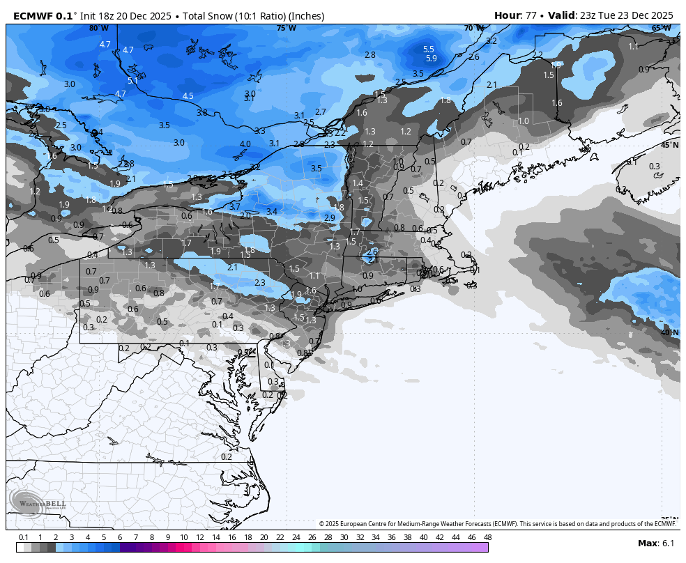
Possible Light Snowfall (1" - 4") on Tuesday Dec 23
MJO812 replied to Northof78's topic in New York City Metro
This is why I think mostly accumulations for the city on colder surfaces. - Yesterday
-

White Christmas Miracle? December 23-24th
TauntonBlizzard2013 replied to Baroclinic Zone's topic in New England
I know which one is right -

Possible Light Snowfall (1" - 4") on Tuesday Dec 23
Stormlover74 replied to Northof78's topic in New York City Metro
No more marginal than last week -
Possible Light Snowfall (1" - 4") on Tuesday Dec 23
MJO812 replied to Northof78's topic in New York City Metro
Its not a strong low . Its a shredded low with blocking . -
Possible Light Snowfall (1" - 4") on Tuesday Dec 23
MJO812 replied to Northof78's topic in New York City Metro
No one is Coating to 2 inches possible , higher end if the southern trend continue. -

Possible Light Snowfall (1" - 4") on Tuesday Dec 23
jm1220 replied to Northof78's topic in New York City Metro
If the snow/overrunning move in quickly while the cold air is still in place it can work. If it delays and the cold air moves out, it won’t. We’ve seen this game before. -

White Christmas Miracle? December 23-24th
CoastalWx replied to Baroclinic Zone's topic in New England
Yep. Not Weedwhacker, but maybe hedge trimmer. -

White Christmas Miracle? December 23-24th
Damage In Tolland replied to Baroclinic Zone's topic in New England
Couple inches -
White Christmas Miracle? December 23-24th
CoastalWx replied to Baroclinic Zone's topic in New England
Hopefully a compromise. -
Weak but further south
-
White Christmas Miracle? December 23-24th
CoastalWx replied to Baroclinic Zone's topic in New England
Euro sucks here. -

Possible Light Snowfall (1" - 4") on Tuesday Dec 23
the_other_guy replied to Northof78's topic in New York City Metro
Are we really talking about a 4 inch snowstorm in NYC metro off a warm front with marginal cold to start? Hey, I hope it works! -

Possible Light Snowfall (1" - 4") on Tuesday Dec 23
sussexcountyobs replied to Northof78's topic in New York City Metro
Lol! Gotcha. -
Let's hope he's right this time!
-
White Christmas Miracle? December 23-24th
Damage In Tolland replied to Baroclinic Zone's topic in New England
Euro looks solid SNE -
DIT just made a mess in his dungarees.
-
Possible Light Snowfall (1" - 4") on Tuesday Dec 23
Stormlover74 replied to Northof78's topic in New York City Metro
1 to 2" -
JB says there is a 10 to 15 day lag after Europe gets cold until it gets cold in the east. He believes the trough will back in from the North Atlantic into the east.
-

Possible Light Snowfall (1" - 4") on Tuesday Dec 23
WeatherGeek2025 replied to Northof78's topic in New York City Metro
what does the euro show -
I only have looked through a handful of the big dogs but the accumulation maps are spot on for every single one so far. There are so many maps of these storms that are way overdone and just wrong in general. Even the KU book has some glaring snowfall map errors. I know this will bring me much joy and reminiscing in the days ahead.
-
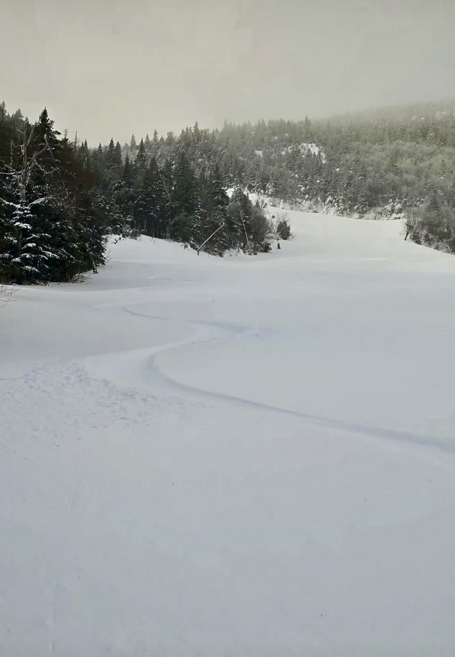
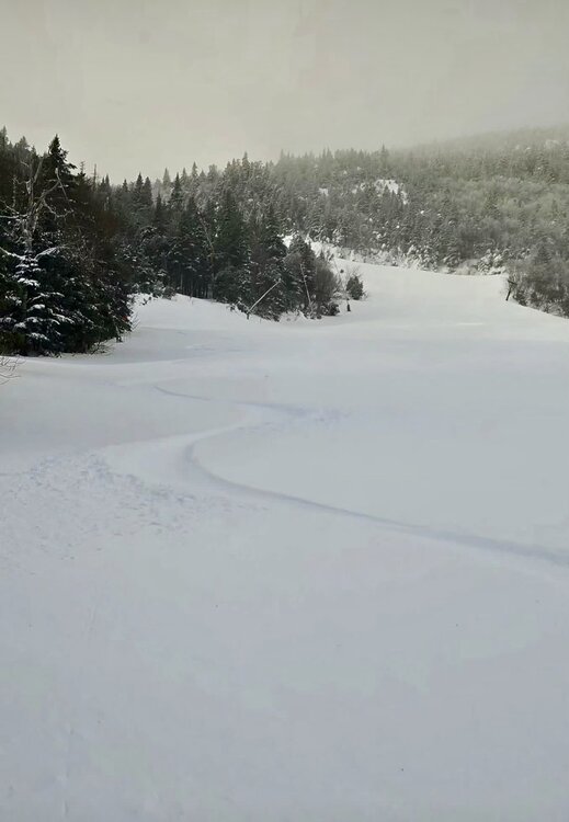
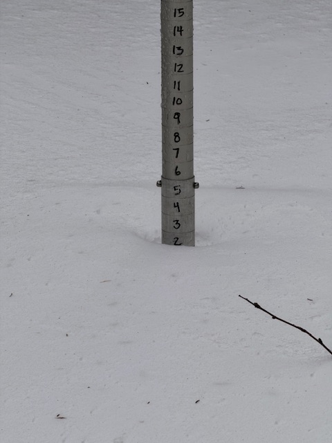
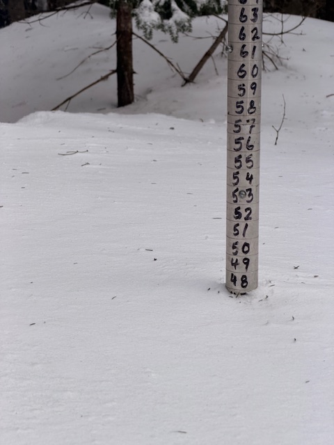
I figure some of you will appreciate the obsessive anal-retentive details of snow reporting on Mansfield... Yesterday we had 1.75" or so that we called 2"... then it snowed a bit overnight... but was very windy and the grooming team thought several inches fell. The snow cam went off-line briefly around the time of the morning report and it was called 2" more overnight for a 24-hour total of 4". Snow cam came back and only had just over 3". Say 3.1" or 3.2". The early reports on the hill from skinners was 4-5". It actually looked good (photo from friend JA). However, once we got to High Road, we saw that was also a wind-blown 3" (barely, if you got level with the snowpack). The funny part is that folks on the hill thought at least 4" was a good number and were trying to talk us into it. However, the argument is if you have multiple source points saying 3".... maybe it is just 3". And we removed an inch from the snow report and Stowe seasonal total to reflect an accurate total, from 114" to 113" after considering the evidence. This hobby is like an exhibit in OCD, ha. The good news is the snow depth is still stout and only compacted about 7” at the 3,000ft level.
-

Possible Light Snowfall (1" - 4") on Tuesday Dec 23
dmillz25 replied to Northof78's topic in New York City Metro
The lol wasn’t enough to say I was joking? -

Possible Light Snowfall (1" - 4") on Tuesday Dec 23
snowman19 replied to Northof78's topic in New York City Metro
Huh? The link to the NWS blend of models is the TOTAL snowfall out to 89 hours, which is Wednesday. Look at what it’s showing…that’s now till Wednesday, total. And the GEFS is in complete disagreement with its own operational run, that is fact and it’s a red flag -
Possible Light Snowfall (1" - 4") on Tuesday Dec 23
MJO812 replied to Northof78's topic in New York City Metro
Ignore him Euro is further south but weaker