All Activity
- Past hour
-
 shop medicine online [url=http://geninduspharma.com/#]buy meds online[/url] sending medicines from india to usa
 -

Strong Nor'Easter/Hybrid Storm Late September 2026
wthrmn654 replied to Rjay's topic in New York City Metro
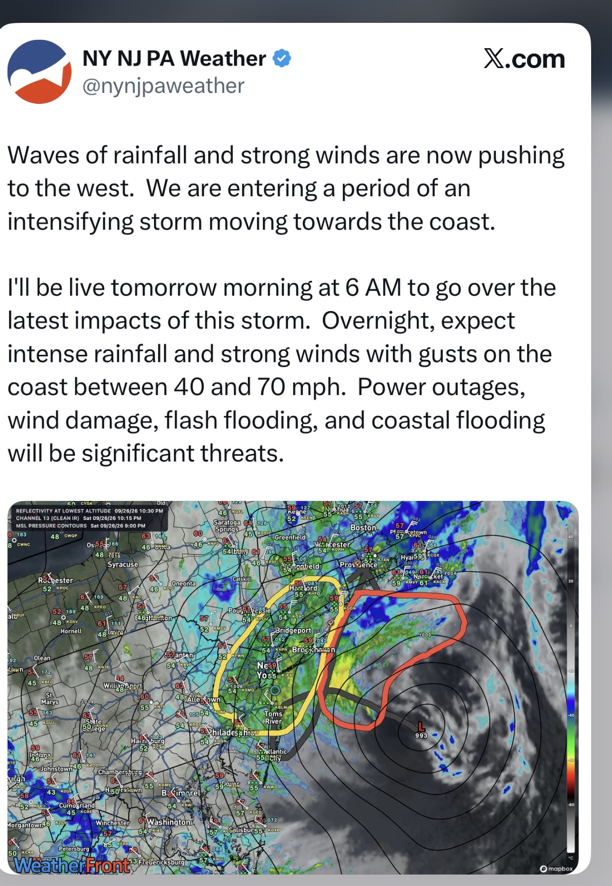
Huh? They 100% have been behind this entire storm.... they weren't so bad with the coastal flooding but we're slow at first, the winds well... yeah they were very behind. High winds have verified, coastal flooding has verified, jersey shore has no sand left long island beaches have no sand left. A storm this jazzed up, this early in season with so many leaves on trees is like a tree massacre.... and such a long duration is unusual. -
thats not true this enso state is not "histroically unfavroable" we only have two events like it one torched and had no snow the other had a torch dec then near normal jan feb that had a blizzard in there There are defenitly more unfavorable enso states for mid atl snow
-

Strong Nor'Easter/Hybrid Storm Late September 2026
Breene replied to Rjay's topic in New York City Metro
anyone slamming upton yesterday for being asleep and/or stubborn should give a little hat tip of respect. not a nuisance storm for the areas warned to flood that always flood but its basically just a september storm elsewhere right? -

Strong Nor'Easter/Hybrid Storm Late September 2026
Intensewind002 replied to Rjay's topic in New York City Metro
I was gonna say still mostly in the 40s here for gusts, wind was stronger early saturday morning. I guess we'll see if the high wind warning was justified as the night goes on -
I keep seeing people talk about the 2015 - 2016 record El Nino and how the winter of 2015 - 2016 was so horrible. I sure as heck don't remember anyone complaining about the 27.5 inches of snow Central Park got in one storm.
-
because 1983 had literally the same setup and produced a big mid atlantic snowstorm?
-
.thumb.gif.f92b16c631a1d15d405ed77b33f0710d.gif)
October Comes Early: Late September Multi-Hazard Hybrid Storm
Torch Tiger replied to WxWatcher007's topic in New England
looks peaceful -
Strong Nor'Easter/Hybrid Storm Late September 2026
wthrmn654 replied to Rjay's topic in New York City Metro
Fucking blowing like a mother hefer right now! Just got home from a rescue But it's scary standing under trees. My yard and road looks like a war happened. Winds blowing 50 mph. It's nuts right now. -

Strong Nor'Easter/Hybrid Storm Late September 2026
nycsnow replied to Rjay's topic in New York City Metro
Nice band about to hit south shore of LI -

2026-2027 Record-breaking El Nino
40/70 Benchmark replied to Stormchaserchuck1's topic in Weather Forecasting and Discussion
100% dead-on. ...I just hit on all of that in he piece I just published...competing convective forcing nodes....one in the central Pacific in association with the western warm pool that was dislodged eastward, and one with the El Niño....we are now rooting for the same warm pool that we have spent the better part of a decade cursing out. -

Strong Nor'Easter/Hybrid Storm Late September 2026
Amped replied to Rjay's topic in New York City Metro
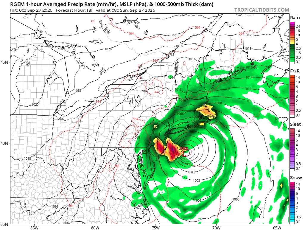
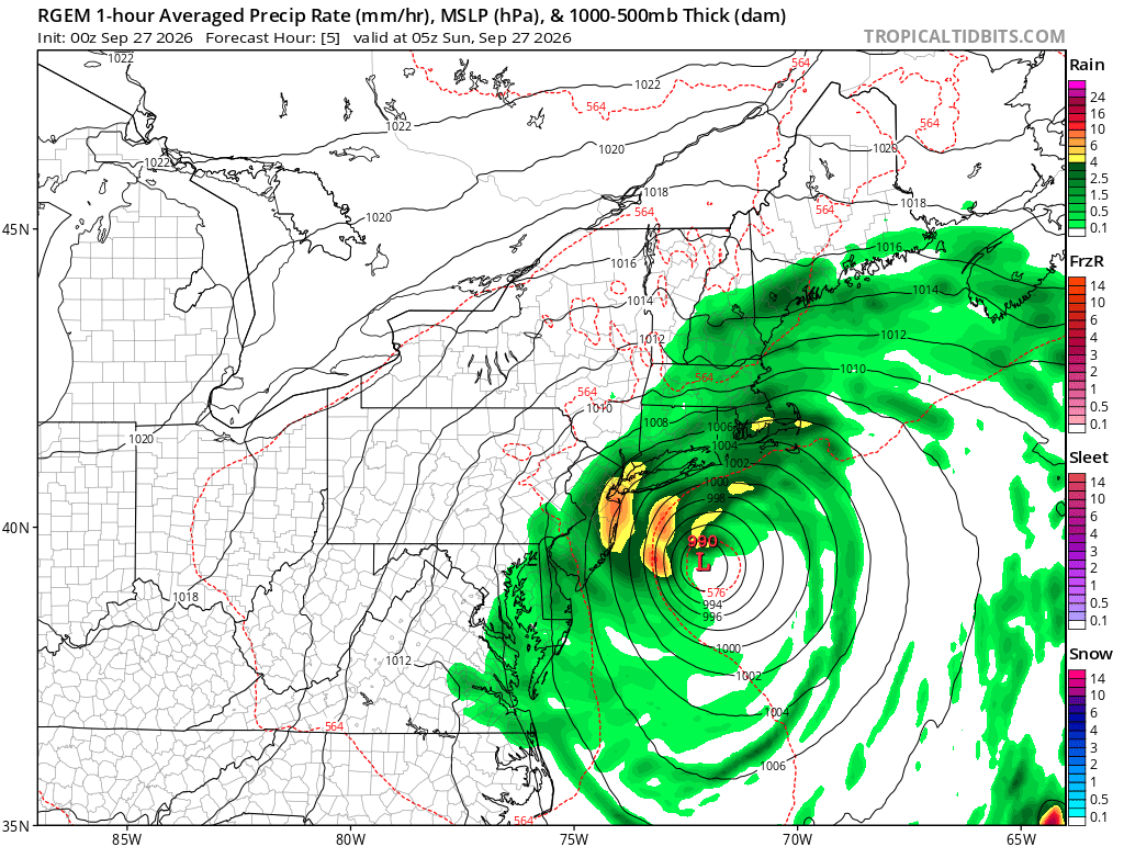
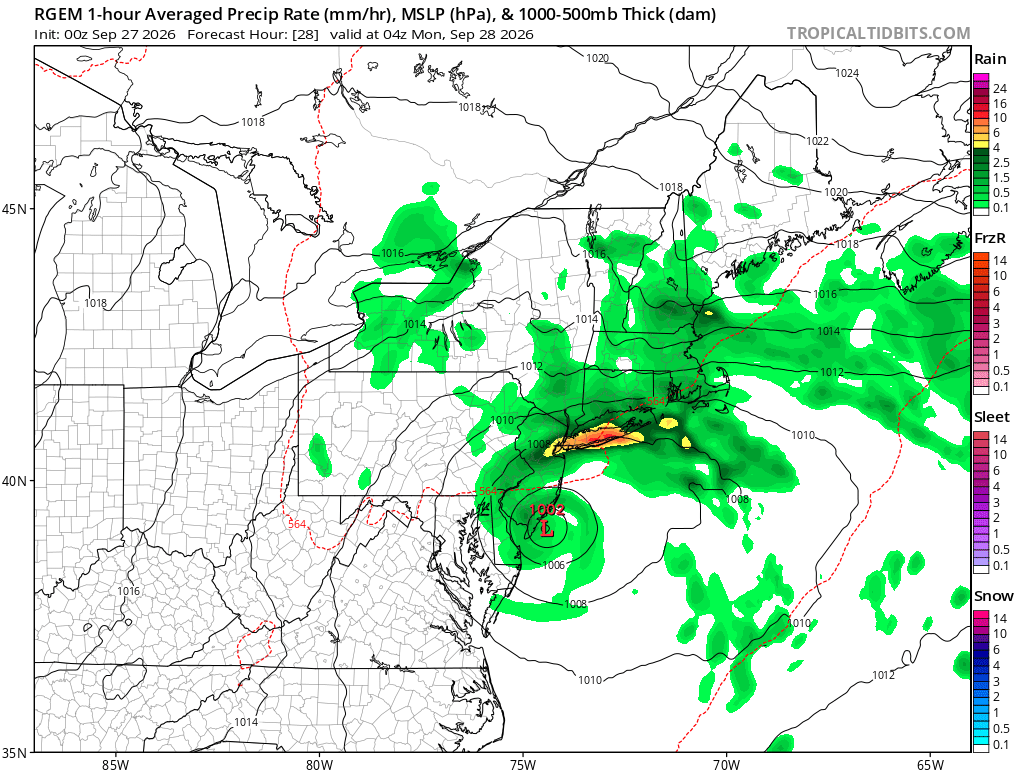
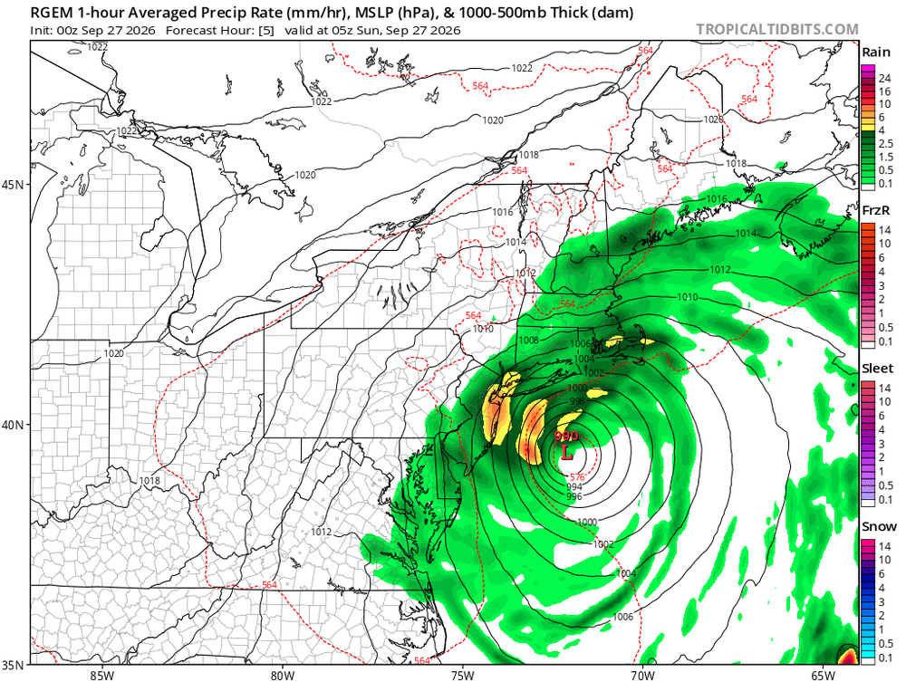
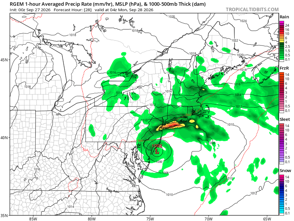
Rgem, hrdps, and hrrr all show an intense rain band over LI/NYC tomorrow night. -

Strong Nor'Easter/Hybrid Storm Late September 2026
Snowlover11 replied to Rjay's topic in New York City Metro
How’s it looking tomorrow? I’m leaving AC sometime in the afternoon if I could get out of here. -

Strong Nor'Easter/Hybrid Storm Late September 2026
NJwx85 replied to Rjay's topic in New York City Metro
Just getting started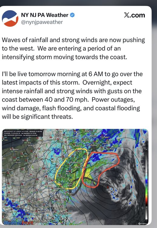
-

October Comes Early: Late September Multi-Hazard Hybrid Storm
powderfreak replied to WxWatcher007's topic in New England
Partly cloudy up north.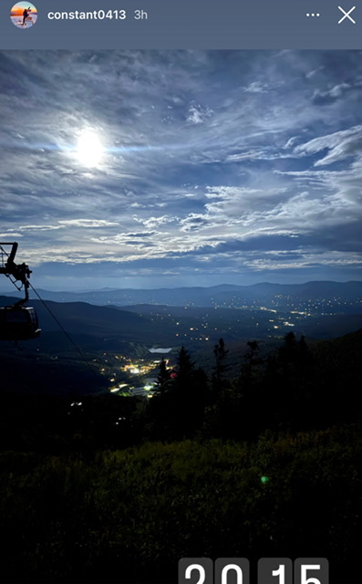
-
2026-2027 Record-breaking El Nino
40/70 Benchmark replied to Stormchaserchuck1's topic in Weather Forecasting and Discussion
Good....not bad timing for a deviation from warm ENSO climo, especially a record one. -

2026-2027 Record-breaking El Nino
Jebman replied to Stormchaserchuck1's topic in Weather Forecasting and Discussion
Congrats on getting Polo's rain! Hey could you send a little of that rain down to south central Texas please? -
2026-2027 Record-breaking El Nino
Jebman replied to Stormchaserchuck1's topic in Weather Forecasting and Discussion
40/70 REALLY gets deep into the analysis on his blog! -
Strong Nor'Easter/Hybrid Storm Late September 2026
nycsnow replied to Rjay's topic in New York City Metro
Hi res models had the winds ramping up next few hours as the low passes close, guess we’ll see, by far strongest of today so far out in Massapequa -

Strong Nor'Easter/Hybrid Storm Late September 2026
MJO812 replied to Rjay's topic in New York City Metro
Rgem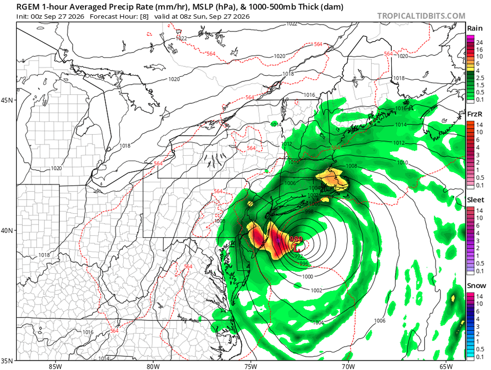
-
Strong Nor'Easter/Hybrid Storm Late September 2026
nycsnow replied to Rjay's topic in New York City Metro
Seems to be blossoming last few frames looks like island gets into it now -

Fall 2026 Medium/Long Range Pattern Thread
Carvers Gap replied to John1122's topic in Tennessee Valley
OTH, you get to experience the heartbreaks of winter again with us. I am thankful for that(to have you back! to clarify!) Haha!!!! -
Fall 2026 Medium/Long Range Pattern Thread
Carvers Gap replied to John1122's topic in Tennessee Valley
I kind of suspected this might not be temporary. LR ensembles are showing the ridge parking itself out West. -

Strong Nor'Easter/Hybrid Storm Late September 2026
guinness77 replied to Rjay's topic in New York City Metro
Looks like we’re missing a big bit of moisture off the coast of LI now. Probably headed for Central/Southern Jersey though. - Today
-
E PA/NJ/DE Autumn 2026 Obs/Discussion
Albedoman replied to PhiEaglesfan712's topic in Philadelphia Region
METEOROLOGIST’S LONG-RANGE WATCH — IS OUR FIRST REAL SHOT OF FALL COLD SHOWING UP? For those of us in the Lehigh Valley who have been waiting for some genuine crisp fall weather, the extended-range guidance is finally starting to get interesting. The GFS model is beginning to show a potentially much cooler pattern developing around the October 9–11 time frame, with colder air pushing into Pennsylvania and the Northeast. At this distance, I am NOT calling for a freeze yet, and certainly no Frost Advisory or Freeze Warning can be issued this far in advance. But the overall pattern is worth watching. The important signal isn't an exact temperature on one particular GFS run. What meteorologists look for this far out is whether the larger atmospheric pattern begins favoring Canadian air moving southeast, lower dew points, clearing skies and high pressure settling over the region. If those ingredients eventually come together, overnight temperatures can drop very quickly across eastern Pennsylvania. And remember, the Lehigh Valley has some significant microclimates. Temperatures at the airport don't always tell the whole story. Rural valleys, open farmland and sheltered locations can become several degrees colder on a clear, calm October night. Those are the places that could see frost first. So for now, let's call October 9–11 a period to watch for the possibility of our first legitimate frost conditions and perhaps our first real taste of late-fall nighttime temperatures. We will need several more model runs — and especially better agreement among the ensembles — before putting much confidence in an actual freeze. But after what seems like an endless stretch of warm and humid weather, I'll take the signal. I'm ready for those clear 50-degree evenings dropping into the 40s after sunset, the smell of leaves in the air, a fire going in the burn ring, and a glass of wine in hand. Now THAT is fall weather. I'll be watching the GFS and ensemble trends closely over the next week to see whether this colder October 9–11 signal strengthens, disappears, or shifts in timing. Stay tuned — fall may finally be getting ready to make its move in the Lehigh Valley.