All Activity
- Past hour
-
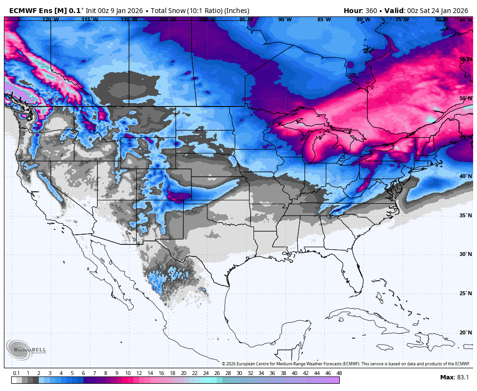
33 / 31 clear more upper 40s / low 50s today. Cloudy cooler / wet Saturday into Sunday with 0.5 tp 1 inch of rain mainly in the afternoon and into the lat evening. Overall a bit above normal Sun - Thu before trough digs in. Next storm threats between the 15 - 19 as it turns below normal.
-

January 2026 regional war/obs/disco thread
40/70 Benchmark replied to Baroclinic Zone's topic in New England
Very low confidence on this....but the 2013 analog that I discussed with Will is in the back of my mind and we do have some catching up to do. I like early March better, but eyes should be peeled in February. I was so torn on including that year in my February composite, but opted against at the last moment bc it was too warm ENSOish...but I wouldn't argue with anyone that did. -
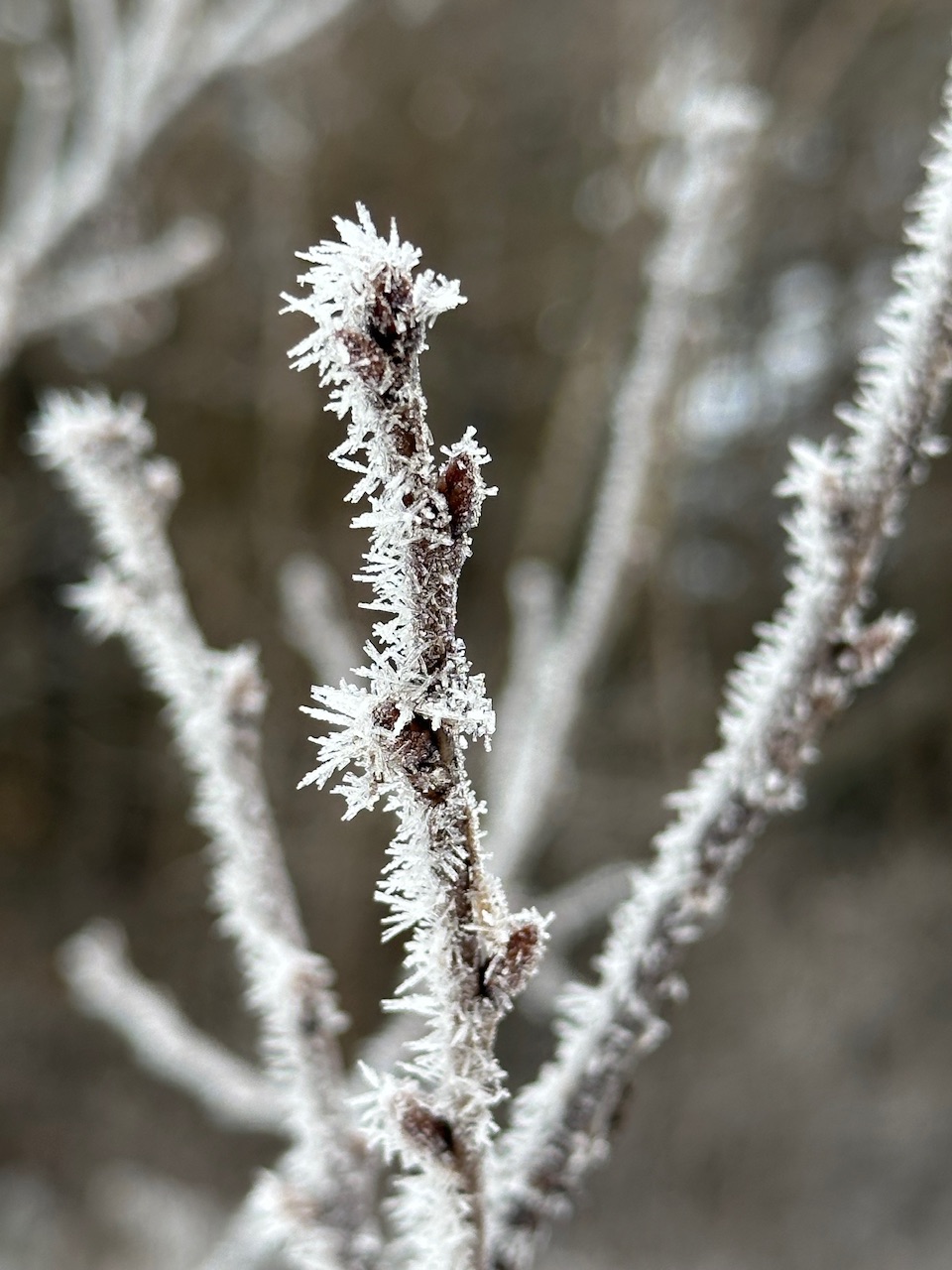
Frosty morning, upper 20s
-

January 2026 regional war/obs/disco thread
dendrite replied to Baroclinic Zone's topic in New England
Mid level clouds now and we fogged up early. But yeah, I saw wx2fish was colder than me for awhile too. There’s a bunch of WU stations down the hill from me in the river valleys and they’re usually a good 3-5° cooler on rad nights. -
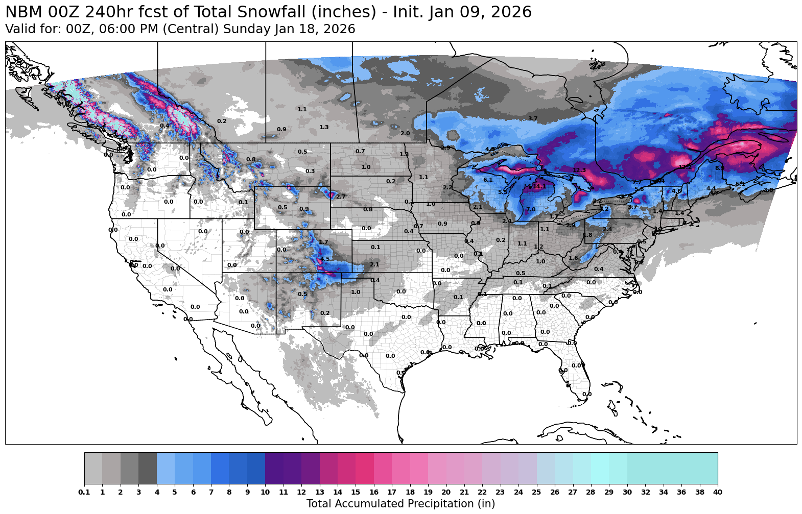
0z EPS, 6z GEFS & 6z AI EPS show the potential for the upcoming period.

-

Winter 2025-26 Medium/Long Range Discussion
DocATL replied to michsnowfreak's topic in Lakes/Ohio Valley
EPS and GEFS aren’t bad with temps. No arctic hammer. I mean that’s a win. . -

January 2026 regional war/obs/disco thread
Lava Rock replied to Baroclinic Zone's topic in New England
what a pit. 29f for us -
January 2026 regional war/obs/disco thread
40/70 Benchmark replied to Baroclinic Zone's topic in New England
Put the lips' n' hips on ice, the dog logs should be covered soon. -
I’m with you North Hills.
-

January 2026 regional war/obs/disco thread
Ginx snewx replied to Baroclinic Zone's topic in New England
Holy! why look at this Jeremiah.png.b3855e4d98022784d909d304b1648156.png)
-
January 2026 regional war/obs/disco thread
40/70 Benchmark replied to Baroclinic Zone's topic in New England
No doubt it's radiational cooling when I am lower than you lol -
January 2026 regional war/obs/disco thread
dendrite replied to Baroclinic Zone's topic in New England
20.5° here There’s some decent rime on the trees (for our standards)
-
Central/west Denver and from south of there did OK. I probably mustered together 2", most of that coming last night.
-
January 2026 regional war/obs/disco thread
40/70 Benchmark replied to Baroclinic Zone's topic in New England
I would bet anyone, any amount of money the monkey is long gone by February 1. -
It’s an outlier among all the available guidance.

-
January 2026 regional war/obs/disco thread
40/70 Benchmark replied to Baroclinic Zone's topic in New England
I was a bit surprised it got down to 19.8....figured there would have been a higher launching pad. I'm sure it's mostly fake born of radiational cooling and will be wiped out shortly, but still- -

January 2026 regional war/obs/disco thread
CoastalWx replied to Baroclinic Zone's topic in New England
Exactly. Just frustrating and I paid my dues. Especially frustrating when the cape had 6+ I think at least 2 times since. -

January 2026 regional war/obs/disco thread
dryslot replied to Baroclinic Zone's topic in New England
Yeah, Low was 13.8°F this morning, Its a bit slick out there. -
January 2026 regional war/obs/disco thread
40/70 Benchmark replied to Baroclinic Zone's topic in New England
Combination of cold and low solar irradiance has really maximized snow cover. -
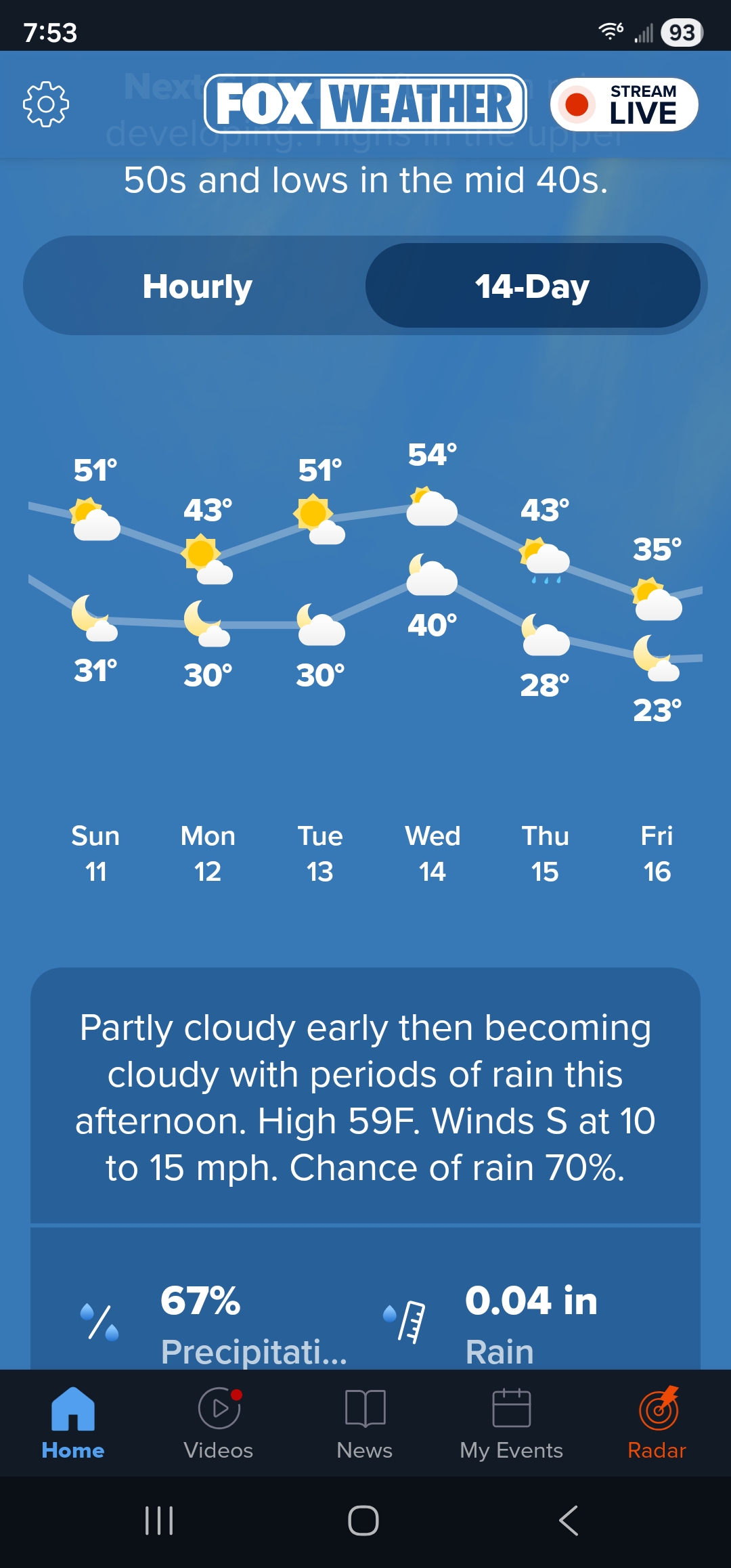
I agree with you and the lo g range looks like warm weather at least here near Dover Delaware. Of course things can change. Beyond the 16th the weather remains in the 30s during the day and upper 20s at night through 21st and start to climb into the 40s 23rd with slight chance of snow showers those days. That's to far into the future and will change. I'm heading to the farm below eagles Mere PA next week for the last weekend of bow hunting. The weather there is even nice with temps day upper 20s and lows middle to upper teens.

-

January 2026 regional war/obs/disco thread
ORH_wxman replied to Baroclinic Zone's topic in New England
Shit snow totals but I’m on like day 33 of snow cover, lol. I don’t think I’ve had more than 4” OTG at any time either. Normally 33 days at this point would mean a great start to the winter with likely multiple warning events, but not this year. As much as I hate brown frozen ground, if we are going to get a decent storm next Friday, then I wouldn’t mind starting clean. -
January 2026 regional war/obs/disco thread
40/70 Benchmark replied to Baroclinic Zone's topic in New England
I think spiking the MJO amplitude in phase 7 later this month would further bolster confidence in this outcome, but my confidence is already pretty high. -
The shrinking Northern Hemisphere cold pool is leading to these Arctic outbreaks covering a smaller geographic region than they used to.
-
January 2026 regional war/obs/disco thread
dryslot replied to Baroclinic Zone's topic in New England
Well that was a short thaw period.
-
January 2026 regional war/obs/disco thread
40/70 Benchmark replied to Baroclinic Zone's topic in New England
Man, no wonder you've both been so cranky...4 years...