All Activity
- Past hour
-
Thunderstorms fell apart by the time they hit my area. Only got .10" from them. Big news was the much cooler weather and lower dew points. High was 87 with dew points in the low 70's much of the day. Nice breeze all day long. Not looking forward to next week.
-
tbh I am really sensitive to any stinging/blood-sucking insects, and the usual allergies. epipen. some other me. lol Carhartt/Hoodie until it's like 95/75 or unbearable
-
80% of us basically have natural immunity. https://www.rockefeller.edu/news/34384-an-immune-flaw-may-cause-west-nile-viruss-deadliest-symptoms/
-
It’s been awhile for a super long track derecho. See how it plays out.
-
Some people not really expecting severe weather could get quite a surprise if the Derecho keeps up steam
-
I was just reading into some of the old analogs. That’s a good one
-
01z outlook is a perfect match to the track of the 1995 right turn Derecho
-
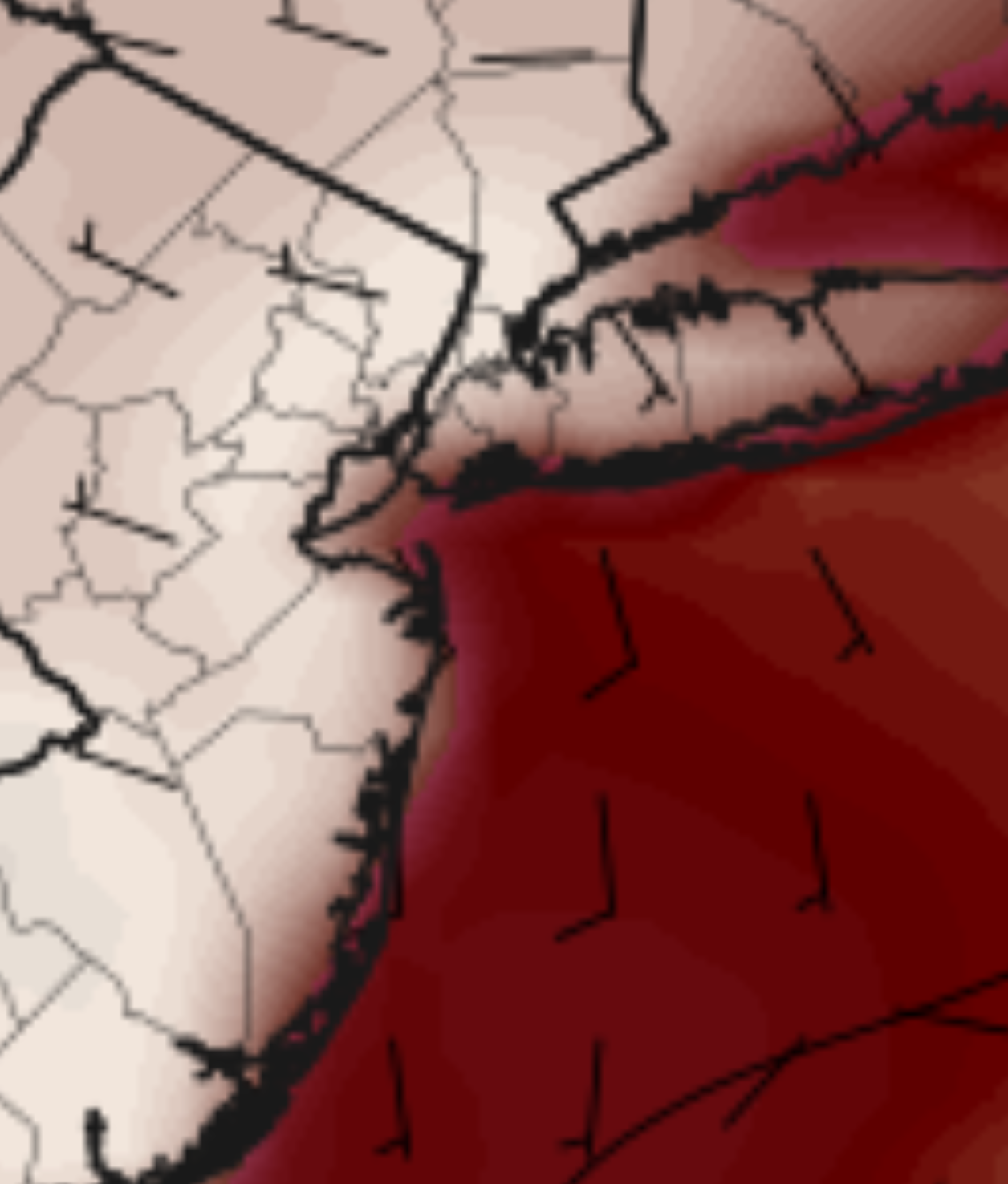
That's one of the hottest parts of the NJ coast on the 18z NAM at 5PM Monday. This is fickle though so I'm sure it will change:

-
How much of a sea breeze will there be in places like Long Branch NJ on Monday?
-
105 mph is wild. URGENT - IMMEDIATE BROADCAST REQUESTED Tornado Watch Number 448 NWS Storm Prediction Center Norman OK 750 PM CDT Fri Jun 20 2025 The NWS Storm Prediction Center has issued a * Tornado Watch for portions of Northwest into West-Central Minnesota Central and Eastern North Dakota Northern South Dakota * Effective this Friday night and Saturday morning from 750 PM until 300 AM CDT. * Primary threats include... A couple tornadoes possible Widespread damaging winds expected with isolated significant gusts to 105 mph likely Scattered large hail and isolated very large hail events to 2 inches in diameter possible SUMMARY...An intense squall line is forecast to rapidly move east across the Watch area this evening into the overnight period. A potential supercell tornado risk may develop with any storms that develop ahead of the squall line. A tornado risk may accompany the stronger and more persistent embedded circulations within the line. Widespread severe gusts (60-80 mph) are expected. Swaths of 80-105 mph gusts are possible with the more intense portions of the convective line.
-
I mowed today too, so there you go lock it up
-
Never heard of any; yellow perch my have the upper hand now...
-
It was a phenomenal evening. Spent most of the afternoon/evening in ORH with some friends.
-
shorts though? That's brutal. I hate that "eaten alive" feeling, so wear the same thing/attire year-round. T-shirt when it's 90 or 100
-
I've been wearing a sweatshirt and a hat to protect me, also getting bit by little black flies.
-
Yeah, a real mosquito summer out there. Be sure to wear plenty of layers and protect yourself from that WNV.
-
79 / 59 a gorgeous summer evening.
- Today
-
July 1, 1963 (102).
-
I love cooler temps, not if they're fake though
-
102 July 1, 1963 all others were 99 in June
-
Wife just got back from a walk and the tore up her ankles while walking . I mean I’ve never heard of anything like that
-
Glad I acclimated myself to the +110F temps. LFG! Bring it!
-
Incidentally it would have been 90 here with more sunshine.
-
I thought you like cooler temps
-
That 82 is sickening