All Activity
- Past hour
-
I already miss the stiff northeast breeze.
-
Stein is gone, and back on the set of “Welcome Back Kotter!”
-
A stein summer with rain every weekend. Go figure.
-
And Sunday was supposed to be the best chance lol.
-
To the extent that we don’t typically see all 3 Memorial Day extended weekend days with measurable rain. The last time for NYC was back in 2021. I believe the 2020s may be the first decade with 2 Memorial Day weekends having measurable rain on each day from Saturday to Monday. Plus this weekend will rank very high on the rainiest Memorial Day weekends list.
-
46 hrs of nonstop rain…the jackpot for this thing has been right f’n here. And still raining moderately. As I said yesterday relentless. Started 10:30 Saturday morning…and hasn’t stopped yet. Kevin there hasn’t been a dry period yet this 3 day weekend….can a brotha get a break later today…please?
-
This spring has been excellent for young plants establishing and seed starting.
-
52F/ .39 since midnight, waiting for the crap to the west to come through, first day off after 55 days straight , wanted to do some yard stuff, will see this afternoon.
-
Big jump in humidity. Dewpoint up to 64.
-
Dont see much of any severe the next several days just some possible thunder,guess its that time to go hibernate back into seasonal threads..lol
-
Good call. Nearly an inch here since midnight.
-
Only Vort95 is calling for cold and snow now. Even Ineedsnow gave up
-
Not as modeled
- Today
-

2026-2027 Strong/Super El Nino
bluewave replied to Stormchaserchuck1's topic in Weather Forecasting and Discussion
Most of the guidance missed the record 100° heat last week from the long range guidance earlier in the month. Models don’t do very well with extremes beyond the week one and week two forecast periods. My guess is that the guidance beyond 15 days just reverts to whatever ENSO climo applies to the situation. In this case it was the usually cooler May climo it was forecasting to continue. So it missed the strong MJO 4-6 pulse which is very warm in the East. This was also why the Euro and other seasonal models missed the warmth in the East for the 2023-2024 super El Niño. They had the stock El Niño composite with a deep trough in the East. Instead we got the record MJO 4-6 pulse with the more Niña-like January 2024 even with the recent +2.1 ONI in Nino 3.4. So the long range model forecasts were reverting to the typical El Niño 500mb composite. Something similar happened in December 2015 with the long range model forecasts missing the record warmth in the East due to the record MJO 5. So long range models like to forecast just for whatever the ENSO is and they can’t resolve the MJO activity in the IO to WPAC. The record warm pool there has been resulting in more frequent and stronger MJO 4-7 activity than the old days when the SSTs were significantly cooler there. -

Central PA Spring 2026 Discussion/Obs Thread
Mount Joy Snowman replied to Voyager's topic in Upstate New York/Pennsylvania
Wife dragging me yard saling. 58 when I left the house with .11” of additional rainfall. -
3.98” IMBY since Wednesday
-
Does a Ditty calendar week include a Thursday, Friday, Saturday and Sunday?
-
Models didn't fail this weekend. They predicted ass and it certainly has been. If anything, they under did the extent of the ass.
-
It’s mainly NNE rain
-
All models have something
-
Next weekend looks like poop even on ensembles
-
Next weekend looks fine. 60’s and dry . Gfs will fail again
-
Decent slug of rain now; should clear out by late morning. Maybe we can salvage the afternoon?
-

Central PA Spring 2026 Discussion/Obs Thread
pawatch replied to Voyager's topic in Upstate New York/Pennsylvania
.27 “ of rain over night. 57 degrees and a light drizzle this morning. Coal stove still fired up 70 degrees. -
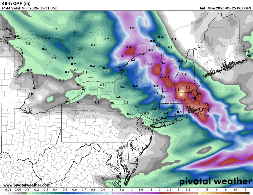
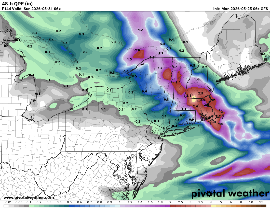
It will be worth it for the sneaky S+ risk! Noted the 06z GFS has a max of 4.55" rainfall right over FIT. Seems a lot for such a low track. Where is all the moisture coming from, esp. since there is not much of a sfc low initially? GFS not so OTL it seems b/c the 00z ECMWF has a max of 2.81" in the same exact spot. That kind of pcpn intensity and a cold 850? Things that make you go hmmmm....