All Activity
- Past hour
-
I know most folks on here don't like the wx pattern, but as for me, it's just normal fare up my way. 0.30" of rn yesterday. 1.48" for the month. 3.30" is the May avg, and the wx pattern looks fairly dry for me for the rest of the month. Frost adv for tomorrow a.m. across NE MN into N WI & U.P. MI.
-
If loop below it really exemplifies... really is about as bad a synoptic predicament as possible without a comet impact on Earth ... https://weather.cod.edu/satrad/
-
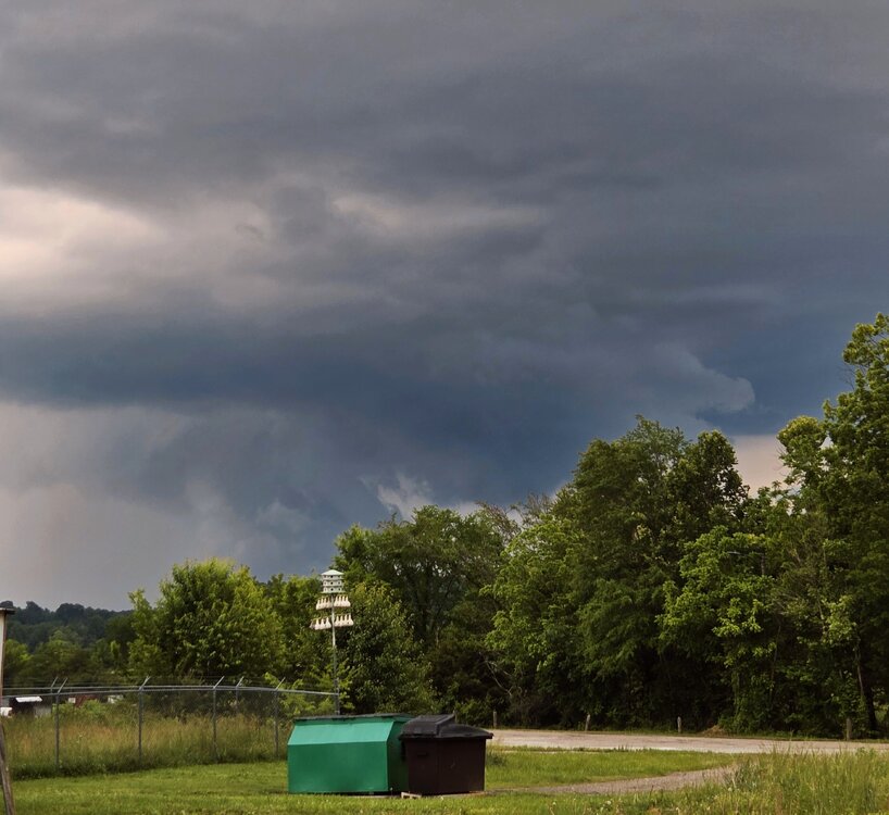
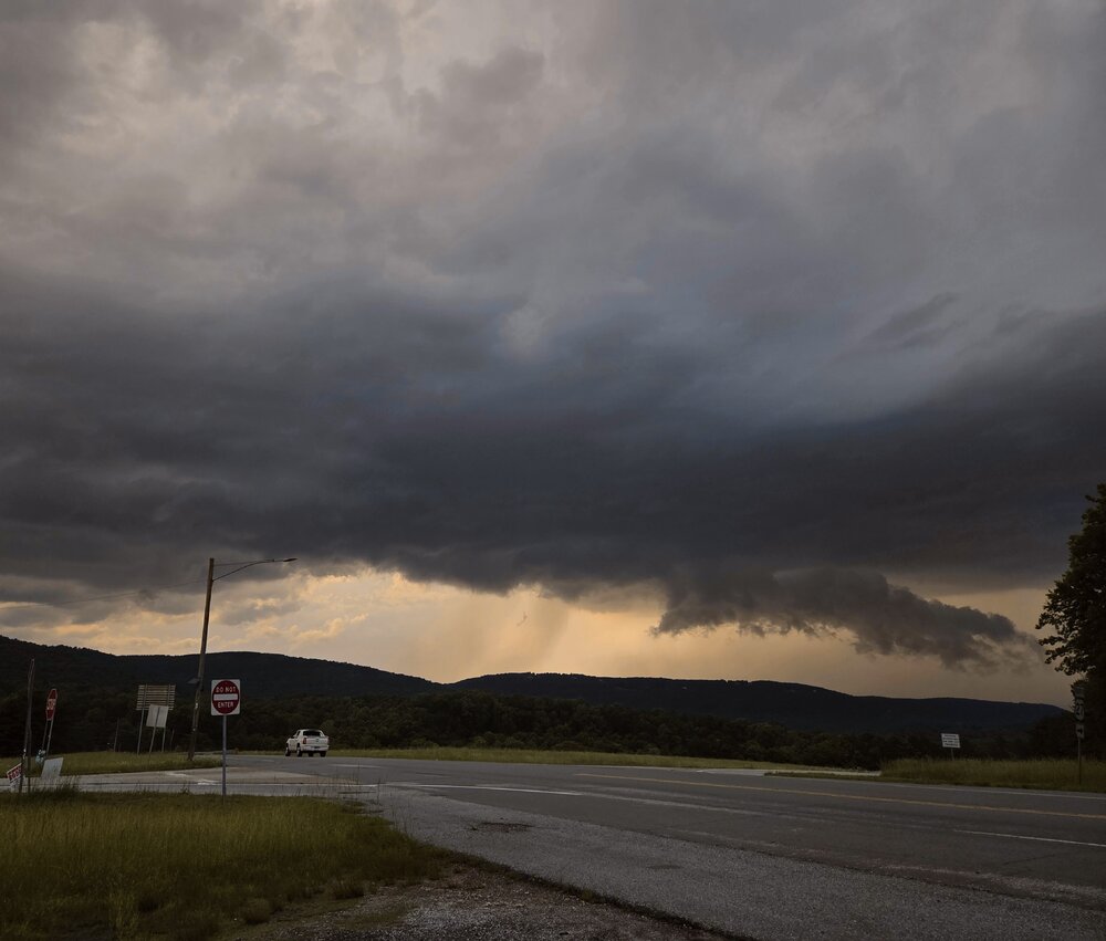
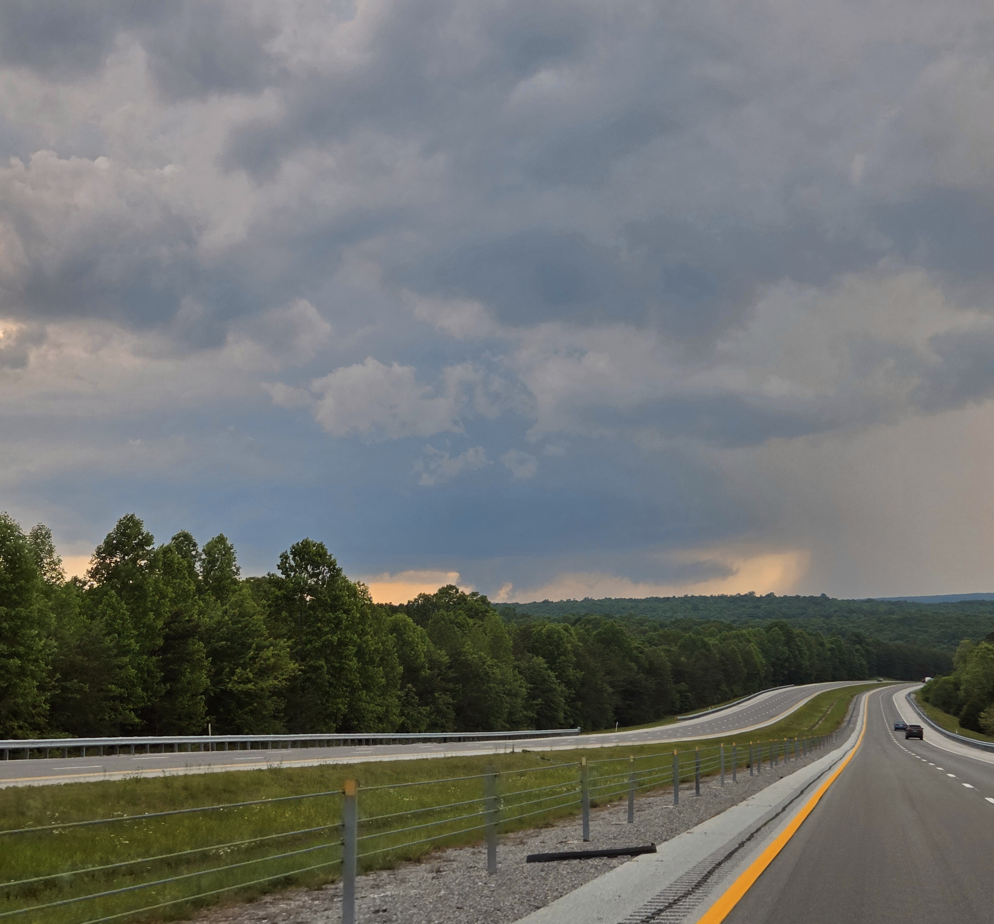
Unfortunately lots of scattered but significant damage is reported in North Alamba. James Spann posted. Also saw text reports from EMs. Sad deal more like an April event. Haven't heard much from the Nashville 'burbs. Meanwhile sups split Chattanooga so we lucked out here. I was unable to truly chase on Tuesday due to work requirements. However during a lull between the Cherokee, AL / Pickwick Reservoir tornado and evening trouble I was able to get out locally. A severe warned cell (actually the Cherokee cell hours later) tracked from Monteagle, to Dunlap, to Soddy Daisy all Tennessee. I-24 is a no-fly zone for me at rush hour, so no Monteagle, but I was able to track it from Dunlap to Soddy just north of Chattanooga. It was between 6-7 pm EDT before the Madison, AL and Huntsville stuff got really ugly. Here are my low-lights. While the first is arguably structure out of the spotter's guide, less crisp but good for East Tenn... the rest is scuddy crap. Oh well! At least I got out of the house. So while the Cherokee cell stopped producing tornadoes, it retained supercell characteristics for several hours. I believe it was on the intersection of the outflow boundary and a prefrontal trough. Evening cells were associated more with the main surface trough - enhanced by the same outflow boundary.

-
An ugly couple of unseasonably chilly and wet days ahead of us. Both today and tomorrow will feature rain and temps not too far from the low 50's....tomorrow some higher spots may actually struggle to escape the 40's! We should see around a half inch of rain today and about the same tomorrow. We start to dry out a bit by Friday PM and we start The Memorial Day weekend with sunny skies but with a continued unseasonable chill in the air. Temperatures look to remain below normal for at least the next week.
-

E PA/NJ/DE Spring 2025 Obs/Discussion
ChescoWx replied to PhiEaglesfan712's topic in Philadelphia Region
An ugly couple of unseasonably chilly and wet days ahead of us. Both today and tomorrow will feature rain and temps not too far from the low 50's....tomorrow some higher spots may actually struggle to escape the 40's! We should see around a half inch of rain today and about the same tomorrow. We start to dry out a bit by Friday PM and we start The Memorial Day weekend with sunny skies but with a continued unseasonable chill in the air. Temperatures look to remain below normal for at least the next week.
-
I'm just glad it gone by late Friday... Saturday's gonna suck though - but it won't be sheets of rain with nape soothing cat paws in the hills at least. The flow on the backside of this thing isn't strong. Not enough gradient. That actually limits the downslope drying potential as this thing stalls while death gasping up there over the N GOM ... stagnating a saturated low level that is capped over by post system inversion just above. So that means a putrid Saturday - if more actual NW wind occurs, that might help offset that. We'll see. Otherwise, Sunday should be a marked improvement.
-
probably this summer 'initiation event' ...first of it's kind, if it indeed takes place as currently hinted in that time frame, won't be of the higher DP ilk. It's got the over top appeal. DPs tend to be higher when we get WAR retrogrades with source arriving from the Arklotex region/Gulf. When the ridge blossoms and is well timed with a heat expulsion from the west ( as I outlined above a -d(PNA) switch in the index), it's pulling air up and over the ridge and it's thus arid kinetically charged air from the the Sonora Desert to west TX region. These source/origin differences matter. The over-top variant can then evolve into a DP richer scenario given time ... because as they then go on to relax, the flow veers more SW, switching from the initial WNW delivery. Then the source is more deep south's continental bio farts and also Gulf of Mexico entrained air. This is all meaningless if the current signal changes - just as it sets right now in the guidance, the initial arrival is from that more arid description above. It's kind of like a mid 80s/62 DP ... 90/63. If the expulsion/'Sonoran heat release' is upper tier, than the temperature side of that would naturally be higher.
-
extended ireland mode not really a fan
-
HRRR even changes over here briefly.. if we can get some heavier precip in at the right time it might be fun..
.thumb.png.3092f1ce577c98f428ff6515db5eb188.png)
-
As if this shit doesn't suck enough, you gotta keep reminding us how sick in the head you are. Who enjoys this shit in may.
-
12z HRRR pos Depth maps show I might not have to go far
-
I might have to take a drive to see it one more time
-
who cares if it gets hot and humid in June and July.. Then we can hopefully look forward to beach days and big storms.. Ive been thinking we start heating up the first week of June
-
Horrific. But your trip sounds awesome.
-
we want this kind of violence though
-
The rainy week really is falling apart for sure.
-
Was kayaking on the Colorado River yesterday. 97°. What’s happening back home is an abomination.
-
0.19
-
It’s coming soon and hot , moist and heavy. They are worried
-
One of the banks I did work for sets up a tent every year on the 10th hole, I got to go for free and enjoy food and libations. Only went a couple times but its a good time.
-
My final rain total is 2.74".
-
Looks like a violent afternoon here tomorrow.
-
That would be a great trip around the state.
- Today
-
My golf partner played there and always wanted to take me up there, he had a heart attack and won't be golfing for a while if ever,


.png.da29b77a3a584b618268e4e49512f2c4.png)