All Activity
- Past hour
-
 Things are popping down S and SE of Roanoke into NC, currently 3 separate warnings.
 -

Central PA Spring 2026 Discussion/Obs Thread
Jsauss replied to Voyager's topic in Upstate New York/Pennsylvania
i have been blocked/banned several years. y'all are late -
If you look at Euro, GFS, NAM’s, HRRR.. all of them gust over 60 and some over 70. The Euro is the weakest and has 60+. Interesting
-
 Yeah, as long as the experts are excited, I'll remain optimistic
 -
IP and SN reports almost all the way to New Orleans! What a dynamic system
-
yeah, perhaps but ... the convection in S CT seemed coincident.
-
Tornado warning issued for the triad. I understand issuing a large scale warning to get everyone's attention, but this just feels so messy, scattered and wrong. Not sure the word I want to use. Overly broad maybe?
-
Change in climate by raw numbers since 1980 implies that in nominal forcing, March in New England ( regional variance notwithstanding) is ~ +1F for 1980 thru 2010. Hint, it hasn't gone down since, either. If one were back in early February and said a warmer than normal March, that's not a bad gamble.
-
I grade this Winter an A. It started off with multiple accumulating snow events in December, followed by a 20"+ snowfall in January and another double digit snowfall in February, with a few smaller events mixed in. The last of my snowpack didn't melt until the 80's last week, some of it still left from the January storm. We also had multiple episodes of brutal and lasting cold. Best winter locally here since 2019. Now it's time to put away the shovels and get ready for Spring. My crocuses are already popping up.
-
.thumb.jpg.6a4895b2a43f87359e4e7d04a6fa0d14.jpg)
Central PA Spring 2026 Discussion/Obs Thread
Yardstickgozinya replied to Voyager's topic in Upstate New York/Pennsylvania
I didn't even get started on Max.because I don't know where to start. A good place to start is with his youtube reviews, i'm not the only person that finds his b******* ridiculous. Monster bomb slammer jammer killer cyclones. -
 SVR for Madison now has the TOR: possible tag?
 -
 Think central Va south will do decent though. dc north not so sure
 -
Did they miss the 0Z GFS 30+" storm?
-
ASOS out of Andrews went clear skies, and their ceilometer goes up to 25,000 feet. Looks like there definitely is some full breaks in the clouds.
- 402 replies
-
- 1
-

-
- severe
- thunderstorms
- (and 1 more)
-
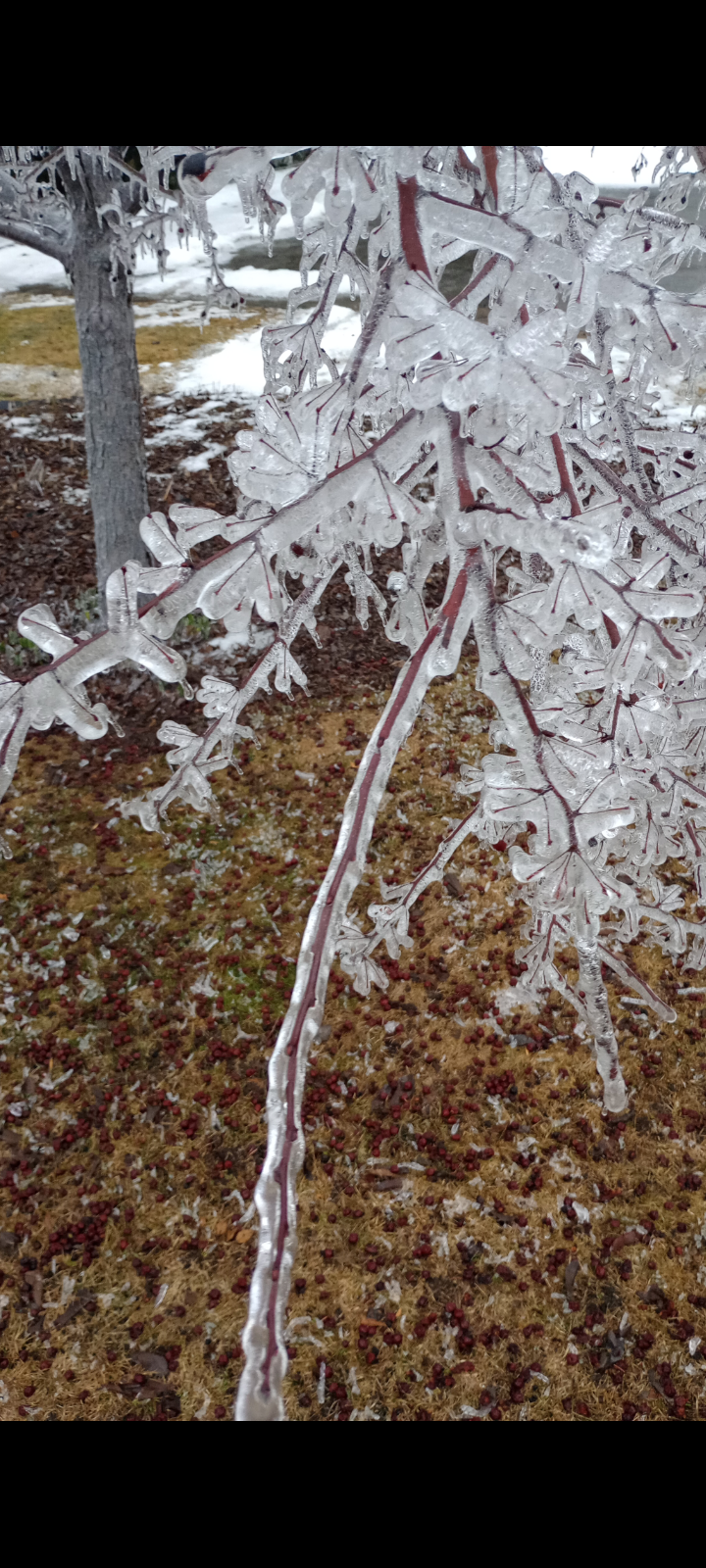
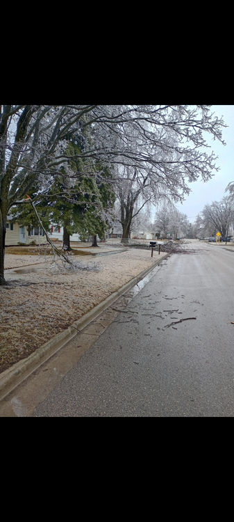
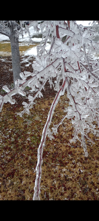
As nice of a surprise as it was fot folks in NW Illinois and Southern WI, this was definitely a once-in-a-lifetime blizzard for many areas on Northern MI / WI... Some areas along the noth shore of Lake Michigan are well over 2 feet and might been push 3 feet, virtually all synoptic too...
-
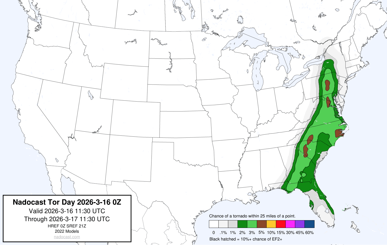
 SPC just issued a new MD for 60% tornado watch issuance for a lot of us. https://www.spc.noaa.gov/products/md/md0269.html
 -
NAM has 100kt at 850 over ORH tonight. Obviously we’re a little inverted, but if we could get spots pushing 60/60 we’d mix a lot more down from H9.
-
Central PA Spring 2026 Discussion/Obs Thread
Yardstickgozinya replied to Voyager's topic in Upstate New York/Pennsylvania
I don't give those channels the time of day anymore but when I did watch them Andy seemed very professional.,Ryan has completely rewrote the book on weather hype and fear mongering. Intelligent guy for that guess. -
I’ll sell that depiction and move the front north.
-
There’s kinda a separate northern element to that part of the line going into Culpeper, I think that misses most of NoVA to the northwest
-
 If you love clouds, you will love the current satellite loop: https://www.star.nesdis.noaa.gov/GOES/sector_band.php?sat=G16§or=ne&band=GEOCOLOR&length=12
- 402 replies
-
- 2
-
-
- severe
- thunderstorms
- (and 1 more)
-
I think this year it's worse here. Here was a year ago.
-
 643 ACUS11 KWNS 161404 SWOMCD SPC MCD 161403 MDZ000-VAZ000-DCZ000-WVZ000-161630- Mesoscale Discussion 0269 NWS Storm Prediction Center Norman OK 0903 AM CDT Mon Mar 16 2026 Areas affected...Central Virginia into Maryland Concerning...Severe potential...Watch possible Valid 161403Z - 161630Z Probability of Watch Issuance...60 percent SUMMARY...The severe weather threat will increase through the morning. DISCUSSION...Low-level moisture advection and cooling mid-level temperatures will continue to destabilize Virginia into Maryland this morning. Limited capping evident on the RNK and IAD 12Z RAOBs has resulted in scattered warm sector development ahead of the primary squall line. These messy-mode storms will continue to limit heating, but may have some severe threat as above mentioned destabilization continues within a strong wind profile. Low-level shear, already strong at 12Z, will continue to strengthen through the day. Therefore, any stronger/deeper updrafts could have some tornado threat late this morning into the early afternoon. The primary threat still appears to be the wind/embedded tornado threat later this afternoon as the secondary mid-level jet streak ejects east of the Appalachians and wind fields strengthen rapidly. However, even this threat is contingent on the evolution of these morning storms. A tornado watch will likely be needed at some point, potentially by later this morning if the morning storms start to show more organization/structure. ..Bentley/Thompson.. 03/16/2026 ATTN...WFO...PHI...AKQ...LWX...RNK...
- 402 replies
-
- 1
-
-
- severe
- thunderstorms
- (and 1 more)
-
I mean just stating that the stuff moving in a couple hours isn’t exactly ideal for getting severe. Early storms will limit what we can see.