All Activity
- Past hour
-

Outta gas and Outta Time: Early March Winter Storm finale
high risk replied to Ji's topic in Mid Atlantic
Moderate snow in downtown Silver Spring -

Outta gas and Outta Time: Early March Winter Storm finale
midatlanticweather replied to Ji's topic in Mid Atlantic
Snowing well out here in Purcellville! White ground. Roads are fine. 29.2 degrees -

Outta gas and Outta Time: Early March Winter Storm finale
Terpeast replied to Ji's topic in Mid Atlantic
Now it is coming down heavy, big fatties! -

Outta gas and Outta Time: Early March Winter Storm finale
bncho replied to Ji's topic in Mid Atlantic
Thinking it might be a beautiful bus ride home this afternoon. -
Snywx is just under 52", a 6-7" difference in annual totals is common between his location and mine. My elevation is only around 400' and being in the Wallkill River valley has its own impacts. What will always sting me a bit about this winter is only getting 6.6" of snow in February.
-

Outta gas and Outta Time: Early March Winter Storm finale
WxUSAF replied to Ji's topic in Mid Atlantic
Liking the radar for MBY in a couple hours… -

Outta gas and Outta Time: Early March Winter Storm finale
SnowenOutThere replied to Ji's topic in Mid Atlantic
Think this might be your storm for payback after my backyard got the band last Sunday. Hoping it can slink just 5 miles south -
FYI, the February 24th temperature range at DCA has been confirmed as 27 to 40 degrees: https://www.weather.gov/wrh/Climate?wfo=lwx
-

Outta gas and Outta Time: Early March Winter Storm finale
pazzo83 replied to Ji's topic in Mid Atlantic
light snow in upper NW DC -
Outta gas and Outta Time: Early March Winter Storm finale
bncho replied to Ji's topic in Mid Atlantic
Happy March, everyone. Happy March. -

Outta gas and Outta Time: Early March Winter Storm finale
NorthArlington101 replied to Ji's topic in Mid Atlantic
Trying to will that band southward a bit. Gonna be close. -

Outta gas and Outta Time: Early March Winter Storm finale
scope1 replied to Ji's topic in Mid Atlantic
Light flurries just started -

Outta gas and Outta Time: Early March Winter Storm finale
clskinsfan replied to Ji's topic in Mid Atlantic
It is ripping snow here. Already close to a half inch. Best snow of the year. -

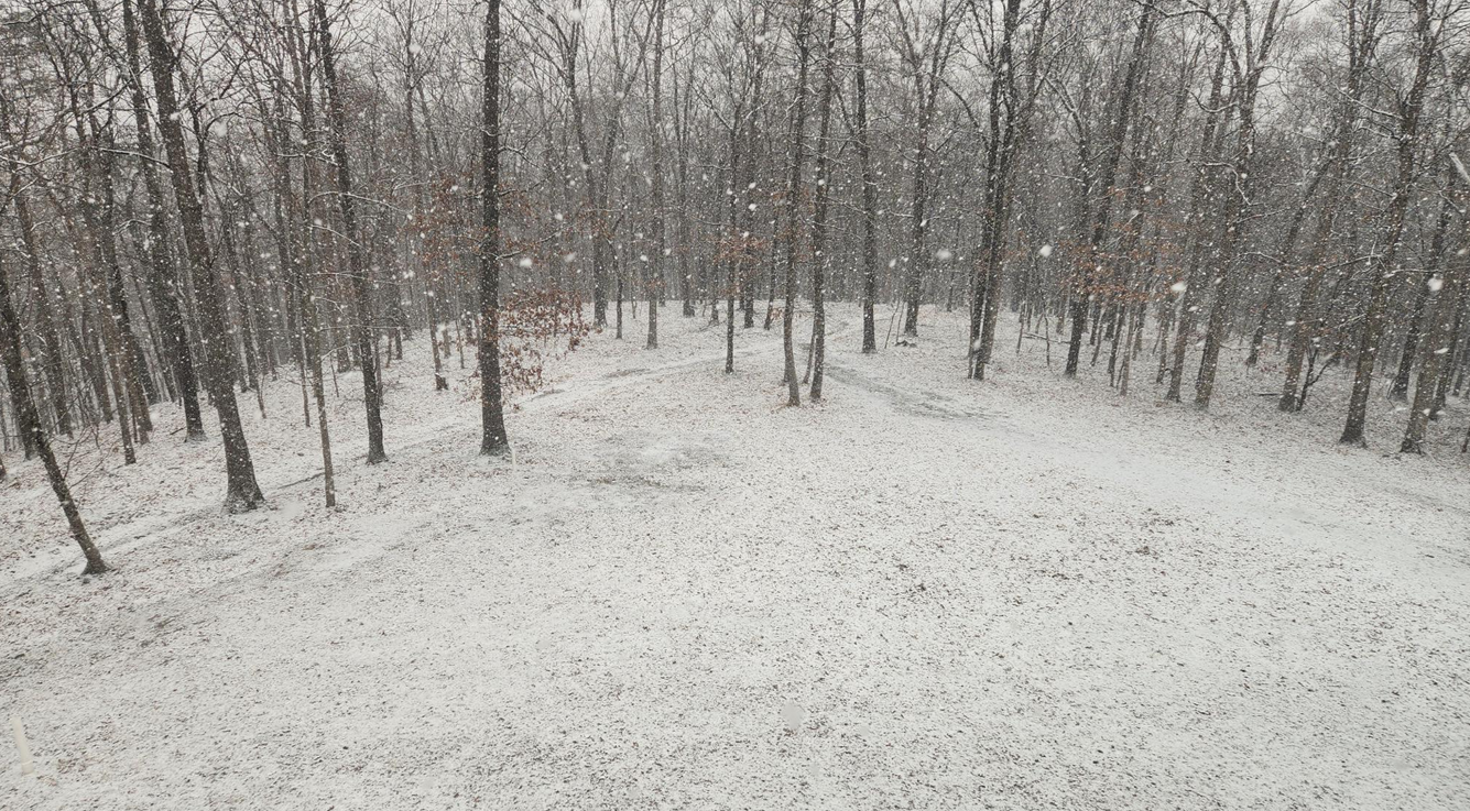
Outta gas and Outta Time: Early March Winter Storm finale
MountainGeek replied to Ji's topic in Mid Atlantic

-
Outta gas and Outta Time: Early March Winter Storm finale
Terpeast replied to Ji's topic in Mid Atlantic
Now below freezing at 31.8, mulch and car tops caving. Grass getting dusted too -
Late February/Early March 2026 Mid-Long Range
MountainGeek replied to WxUSAF's topic in Mid Atlantic
I'm liking this new version of Randy that returned from Houston. We should start a pool to send you to TX in Dec every year - lead us to the promised land! -
11/30/2025: T (A mix of rain/sleet from the 4am hour through about 9am. Intensity got up to light/moderate intensity at times. Temps: low/mid 30s 12/02/2025: T (Probably had a brief period of sleet w/ rain sometime between 4:30am and 5am when precip started before quickly changing to a cold rain that became moderate at times during the morning.) 12/05-06/2025: 1.4" (Flurries/very light snow starting in the 4am hour intensifying to light snow between 6am and 10am (light/moderate at times). Flurries to very light snow showers continuing through the rest of the morning ending during the 12pm hour. ETA: Another few bursts of sometimes moderate snow with big aggregates between 10:30pm and around midnight or so dropping an additional 0.2".) 12/11/2025: T (A few flakes in the air during the morning on a northwesterly surface wind.) 12/14/2025: 0.9" (Mixed rain/snow starting after midnight on the 14th, changing over to snow sometime during the 3am hour and lasting through about 6:30am. Snow was moderate at times between 4am and 5:45am. It was graupelly in consistency.) 12/26/2025: T (A mix of light rain/sleet between 10:30am and 12pm. It was briefly freezing rain/sleet as temps fell to 31F during the precip.) 1/01/2026: 0.1" (A squall of heavy snow blew through between 5:18am and 5:35am with visibilities dropping to <= 1/4 mile briefly between 5:21am and 5:25am. Note: could have been 0.2" but the wind 25-30mph gusts made it difficult to tell.) 1/11/2026: T (A few wet flakes with a dying snow/graupel squall around 1:30-1:45pm.) 1/17/2026: 0.4" (Flakes started falling around 8:45am. At 8:48am intensity rapidly jumped from flurries to moderate+ within 15 seconds. Between 9-9:05am the snow was fairly heavy at times. Snow tapered off to flurries by 9:15am. There was a snow/graupel mix that briefly got up to light/moderate intensity around 10am. Snow/graupel tapered off by 10:30am as the last flakes concluded.) 1/18/2026: T (Off and on light rain, probably mixed in with mangled flakes predawn (1:30am-6:30am). An afternoon round of flurries between 4 and 5pm.) 1/24-25/2026: 8.0" (Flurries starting in the 11pm hour on the 24th intensifying into a light snowfall after midnight. Snow becoming moderate at times through the predawn hours. Some moderate+ rates in the 6am hour, then light/moderate through 7:30am when sleet mixes in. Back and forth between sleet and snow/sleet mix through 8:10am when sleet takes over for good. Sleet was moderate at times with snow grains mixed in throughout the morning. Waves of heavy sleet moved through during the afternoon (mainly between 1:30pm and 4pm). Sleet continued in light/moderate intensity afterwards until 5:30pm when it became light. Light sleet continued until precip wrapped up around 7pm. Snow grains were mixed in w/ the sleet (especially before 3pm.)) 2/06/2026: 0.3" (Flurries starting after midday becoming a period of light snow between 2:30pm and 4:30pm. Snow tapering off to flurries afterwards and ending by 5:20pm.) 2/07/2026: T ( Flurries/light snow showers associated with a strong cold front that moved through from NW to SE in the 2am hour.) 2/22/2026: 2.6" (Snow starts mixing in with rain around 2pm. More mixes in until it’s a moderate wet snow by 4pm. Snow becomes moderately heavy during the 5pm hour. Snow tapered off to light intensity during the 6 and 7pm hours. Became moderate again with the western snow band by 8pm w/ increasingly gusty winds. Snow lightened up during the 9pm hour and stopped with the exception of a few flurries throughout the night by 10pm.) Snow totals as of March 2nd, 2026: 13.7"
-
Outta gas and Outta Time: Early March Winter Storm finale
Terpeast replied to Ji's topic in Mid Atlantic
Snow coming down nicely -

Outta gas and Outta Time: Early March Winter Storm finale
Warm Nose replied to Ji's topic in Mid Atlantic
Some pretty nice rates -
I’m just stoked I won’t have to run in the dark after work.
-

Outta gas and Outta Time: Early March Winter Storm finale
feloniousq replied to Ji's topic in Mid Atlantic
A few mangled flakes starting in Reston Town Center. -
Outta gas and Outta Time: Early March Winter Storm finale
MountainGeek replied to Ji's topic in Mid Atlantic
still nice mod snow with big flakes, ground caving except for pavement -

Outta gas and Outta Time: Early March Winter Storm finale
Scuddz replied to Ji's topic in Mid Atlantic
Flurries @ HQ in Silver Spring. Looks heavier looking south. -

Outta gas and Outta Time: Early March Winter Storm finale
EastCoast NPZ replied to Ji's topic in Mid Atlantic
Snow has stopped here outside of a few flurries. Had about 10 minutes of moderate to heavy snow. -

Outta gas and Outta Time: Early March Winter Storm finale
MLynnWx replied to Ji's topic in Mid Atlantic
31 and fluffy flakes in Purcellville