All Activity
- Past hour
-

Feb 10-11 Mid Week Minor Event - Ride the hot hand?
WinterWolf replied to HoarfrostHubb's topic in New England
Yes..hope so. I’d like to pick up a couple more inches. Let’s pad the stats. Closing in on climo. -
 Average highs might be too warm but what is the mean 850 and wet bulb temp? Again why do you act like we need a cold regime to snow. We have needed that recently but historically we got so many snowstorms in marginal thermal regimes if we get a good storm track. Do you know how many Baltimore snows were 45 the day before and after it snowed. We need those to return. Because cold regimes are often dry! A big part of our snow climo was from snowstorms in marginal temp regimes not cold ones. One of the reasons we are stuck in the worst snow drought EVER is that for the last 10 years or only snows when it’s cold. We need to get snow when the pattern isn’t perfect or Baltimore is going to continue to average half of what it’s long term 140 year average actually is.
 -
Huh?
-

Feb 10-11 Mid Week Minor Event - Ride the hot hand?
Kitz Craver replied to HoarfrostHubb's topic in New England
Lol, loud. -
Feb 10-11 Mid Week Minor Event - Ride the hot hand?
WinterWolf replied to HoarfrostHubb's topic in New England
All that meant was that it was going with the flow..which has been cold. I didn’t say it was right. I said it’s following the tenor. The model isn’t impressive. I didn’t hump it when it showed the blizzard the other day for next Sunday. It’s just another model. Period. -

Feb 10-11 Mid Week Minor Event - Ride the hot hand?
The 4 Seasons replied to HoarfrostHubb's topic in New England
Time for an IP ban. (kidding! i noticed that IP drop down you have) -

February 2026 Medium/ Long Range Discussion: 150K Salary Needed to Post
CAPE replied to Weather Will's topic in Mid Atlantic
Yeah it isn't going to snow down there in this upcoming pattern lol. Barely any chance up in our area. If they get precip its gonna be rain. The cold airmass is long gone. Good for them tho.. we be droughting. -
"Could be"....The typical way to make a forecast leaving yourself an out if it fails, which would never happen, of course, since MJO 20-30 day forecasts are always accurate. I suspect you've got to pay those people if you want a real forecast.
-

Feb 10-11 Mid Week Minor Event - Ride the hot hand?
dendrite replied to HoarfrostHubb's topic in New England
Anyway I’m just busting you in the dead zone. Let’s juice this system up more at 00z -
Feb 10-11 Mid Week Minor Event - Ride the hot hand?
dendrite replied to HoarfrostHubb's topic in New England
-

Feb 10-11 Mid Week Minor Event - Ride the hot hand?
kdxken replied to HoarfrostHubb's topic in New England
I feel the 18z is the most accurate. -
 Seems like mother nature is doing her best to pad the snow stats of central and southern VA, but even she can fail too with rain getting in the way.
 -
It's been a really rough season for the Warm Kitty. Too much snow in Billerica this season, cut him a little slack
-
Feb 10-11 Mid Week Minor Event - Ride the hot hand?
WinterWolf replied to HoarfrostHubb's topic in New England
Absolutely not. We all know the tenor. So the implication is not even close to true. Where was the warm run? I don’t have anymore respect for that model…it’s(The Op) slowly but surely becoming more atrocious. If it(the Op) shows cold…or warm whatever. EPS is still good, but that’s a different story. -
Yeah, I like these events that go SW flow ahead of them and then NW flow behind them.... Usually works out decently for the mountains, especially if the low level flow is SSE to begin. I could see a widespread 3-6" from the Adirondacks across BTV and into VT... or maybe 2-5" instead for the lower elevations under 1,500ft and 4-7" above that? Agree with BTV that the GFS is overdoing it and likely the NAM too. More like 0.20 to locally 0.5" in the mtns for QPF instead of that big area of 0.33-0.75"?
-
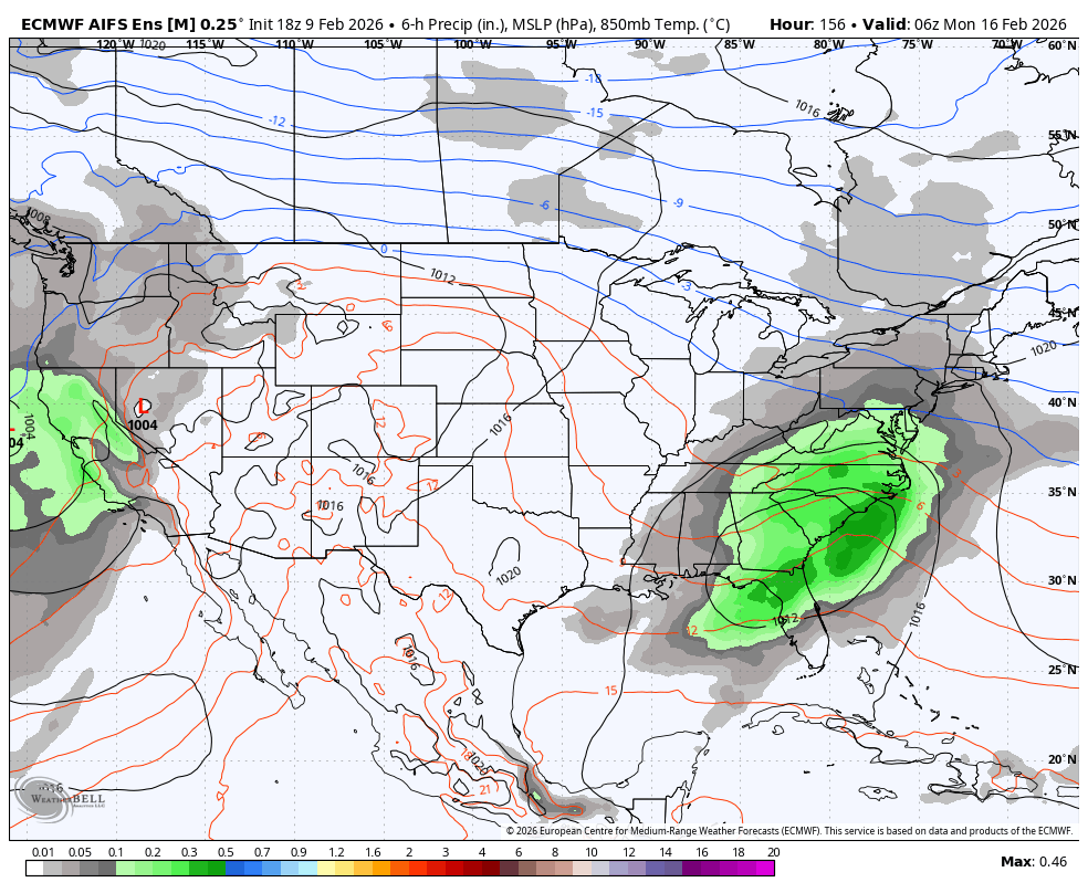
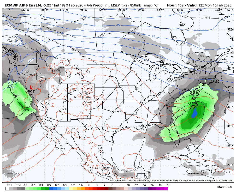
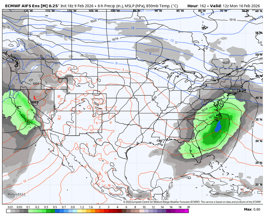
 18z AI EPS main issue is lack of good precip getting near most of the region.
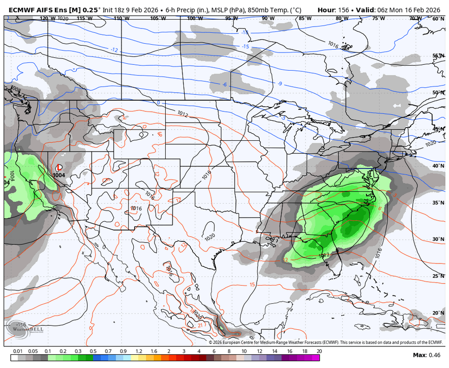


-
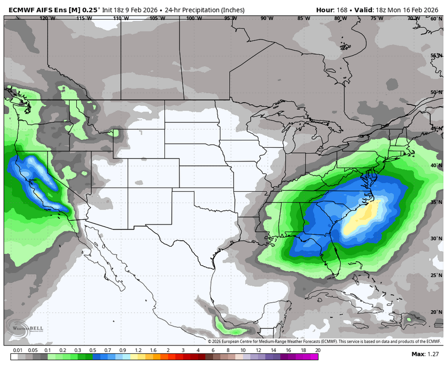
The lower snow totals on the 18z AI EPS are mostly due to a south & east track cluster and lower precipitation totals that held down snow amounts on most members. It basically followed the Op AI Euro this run.
-
Yes, ha, that 3km NAM stuff is useless over the peaks and terrain. I read something once that it's confusing rime icing parameters for actual precipitation but I can't quite wrap my head around it. Because it doesn't *always* do it... there's definitely some variable, like the terrain hits the cloud deck and all the sudden it goes bananas for precip. The only way to really read what its saying is to look at adjacent areas to the mountains. When it gets that super sharp gradient of like 0.2" in Underhill or Stowe and like 1.5"+ over the peak in like 6-12 hours, lol, it's like ok NAM, stop it with the ridgelines. The HRRR seems much better with the terrain around these parts... just the right amount of enhancement... wish we could get whatever precipitation calculation that uses into the 3KM NAM.
-
There’s never a time stamp on his pictures when they’re posted like that.
-

Feb 10-11 Mid Week Minor Event - Ride the hot hand?
SouthCoastMA replied to HoarfrostHubb's topic in New England
It will probably nail a future cutter though -
Pick your model. If one picks Feb 8th ext GEFS like you did (2/9 ext GEFS not out yet), it looks mild. But if one picks the Euro Weeklies, which is a superior model to the GEFS, it isn’t as it’s a mix of AN, NN, and BN. Of course none of them are reliable that far out. But I much prefer the ext Euro over ext GEFS.
-
Feb 10-11 Mid Week Minor Event - Ride the hot hand?
dendrite replied to HoarfrostHubb's topic in New England
Cold run…tenor Warm run…glue -
360 hr GFS is OG .
-
One would think
-
 Kind of exhausted tracking the last two weeks; get something showing up inside 5 days and I will get back on the saddle...