All Activity
- Past hour
-
With better upper air conditions than this one has. Shear and dry air are making a beeline right into this one. Will it have enough time to weaken a lot is one question but it’s almost certain this one weakens coming in.
-
If recon verifies a major before the 10:00AM update will NHC issue a special statement? .
-
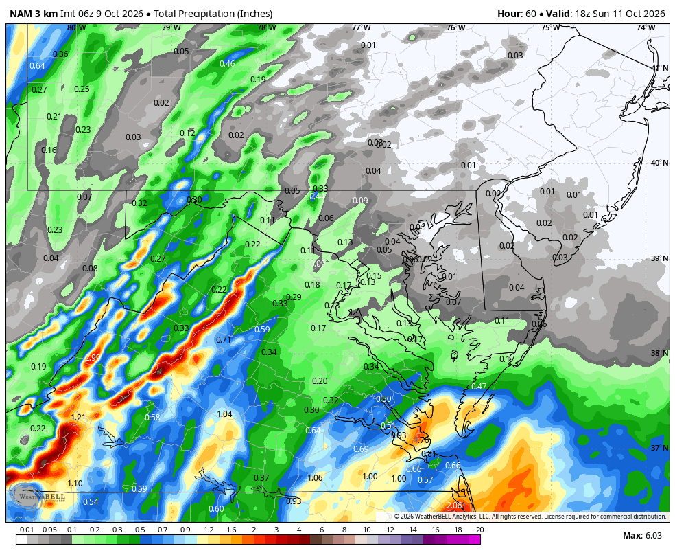
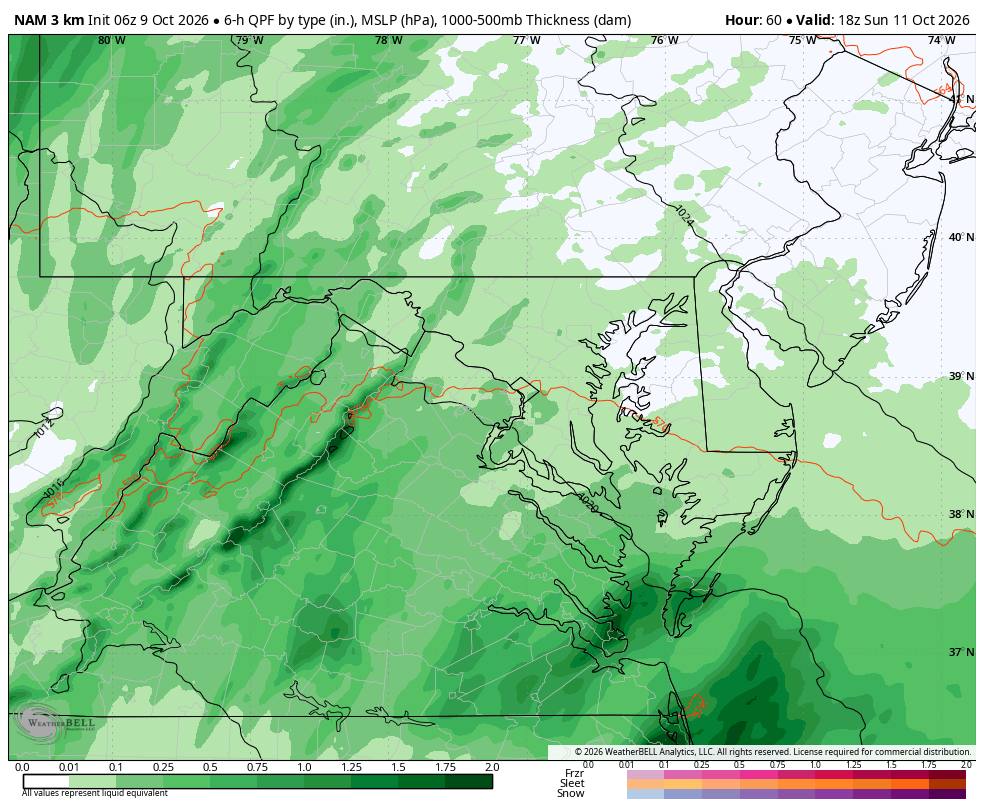
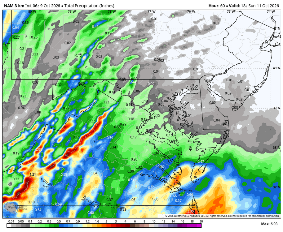
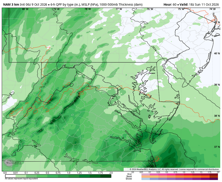
True, but WB 3K NAM is slower than EURO...more to come at hr 60.
-
Like I said to you a few days ago, always hedge east when a poleward moving tropical entity is interacting with a mid latitude system....going with the bots was a tremendously easy call. That said, there are no absolutes, so I get the conflicting thoughts by some.
-
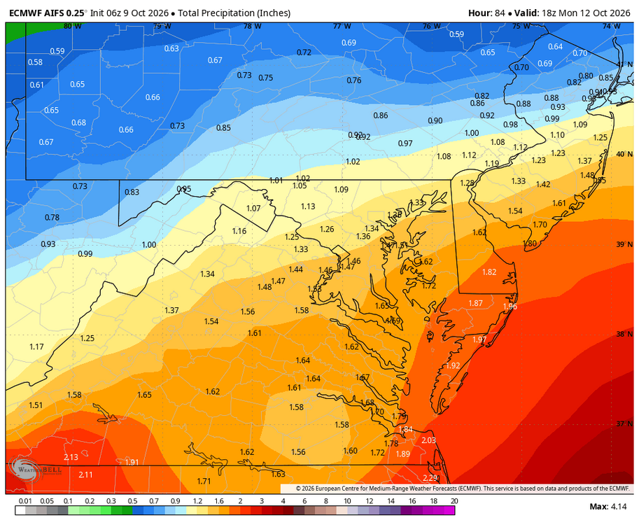
Models keep trending up with rain for us as the storm is slightly east of forecast track each cycle.
-
Recency bias.
-
What a win for GDM weathernextv3. It’s getting scary how good it is.
-

2026-2027 Record-breaking El Nino
40/70 Benchmark replied to Stormchaserchuck1's topic in Weather Forecasting and Discussion
Yes, this is what I was getting at....I understand that the baseline warming elevates that critical threshold for convection, but the warming across the eastern Pacific was lagging the west Pacific, so these recent potent El Nino events are part of a concerted effort to neutralize that...especially this latter, record surge. It's a battle, so the expression of warm ENSO has been masked to an extent, which is what @ensonerd1233e343was driving at. The antecedent warm west/cool east stratification and the record warm ENSO push are two competing forces, the latter attempting to restore a prior baseline in the midst of rapid GW. You're right...no one knows for sure how this will all work out, and I appreciate the different perspectives. -
Now show the nam3k lol
-
if you want to play that game then harvey andrew michael and a bunch of other storms did intensify
-
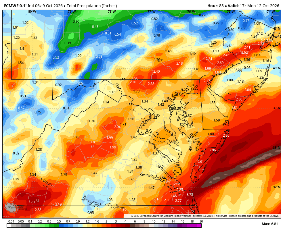
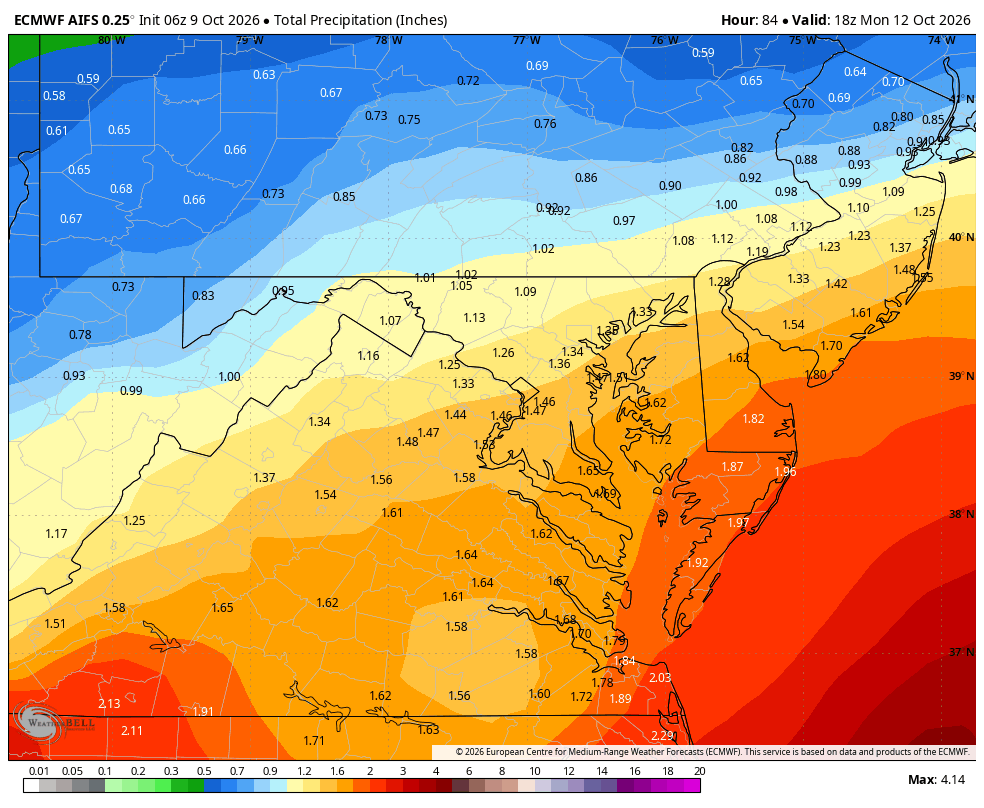
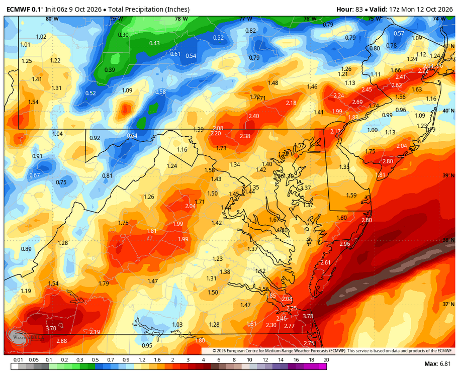
Euro caved and came north with the heavy rain Sunday night
-
Think they are awaiting recon but that is almost undeniably a major at the moment. I’d venture to guess recon emphatically concludes the same
-
You better be prepared to suit up tomorrow night!
-
Opal in 1995, Dennis in 2005, and the list goes on.
-
WB 6Z EURO and AI
-
Remains Cat 2 at the 8am intermediate advisory. A bit surprising to be honest. Pressure down to 958mb
-
-
Yep, people seem to only remember the ones that intensified upon landfall. But Idalia in 2023 weakened right before landfall, Delta in 2020 did too, and of course Katrina weakened big time before landfall.
-
On the cusp of a major--the only one of the season--which would be a huge coup for my peak season forecast.
-
Marginal D3 SPC outlook right now but with a 5% tor risk. Good chance there's an upgrade as we get closer if the track holds.
-
The rotator cuff was ok! A torn bicep and labrum, but that’s so much better.
-
i respectfully disagree with you. the 3 games i am aware of closest to the storm's impacts are Georgia/Alabama in Tuscaloosa (storm will be effectively over by kickoff), Georgia Tech/Duke in Atlanta (breezy and rainy, but no big deal in the whole scheme of things) and Vanderbilt/Ole Miss in Nashville (similar to Atlanta, with probably less overall impact, and less tornado threat). i do agree with you that this could come in like Opal... in the sense that the pressure might rise 25 millibars prior to landfall off its peak.
-

Central PA Autumn 2026
Mount Joy Snowman replied to canderson's topic in Upstate New York/Pennsylvania
Low of 45. Heading up to Happy Valley this afternoon! -
Low of 42 in Marysville. Agreed, lower than what I expected.
-