All Activity
- Past hour
-
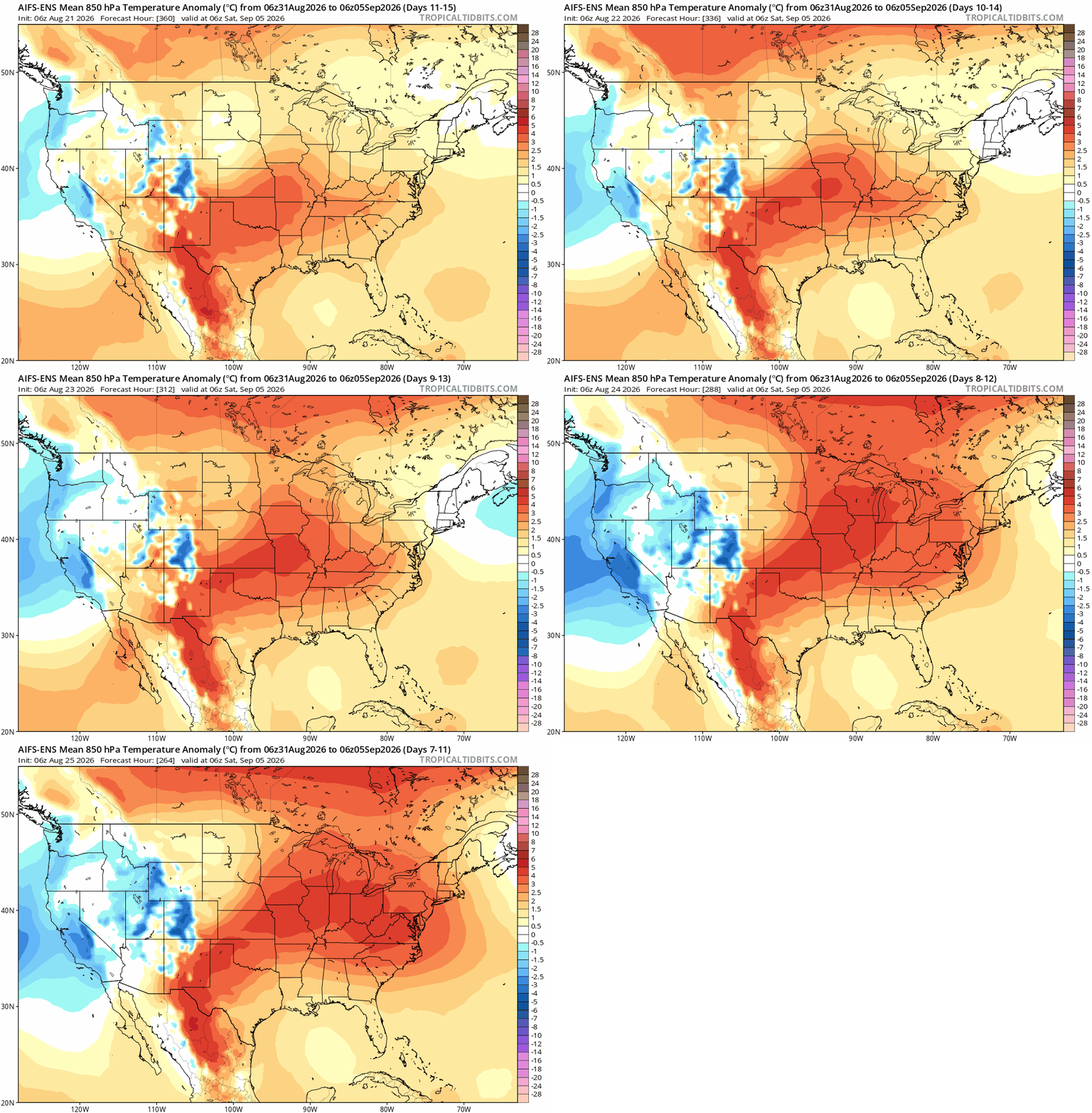
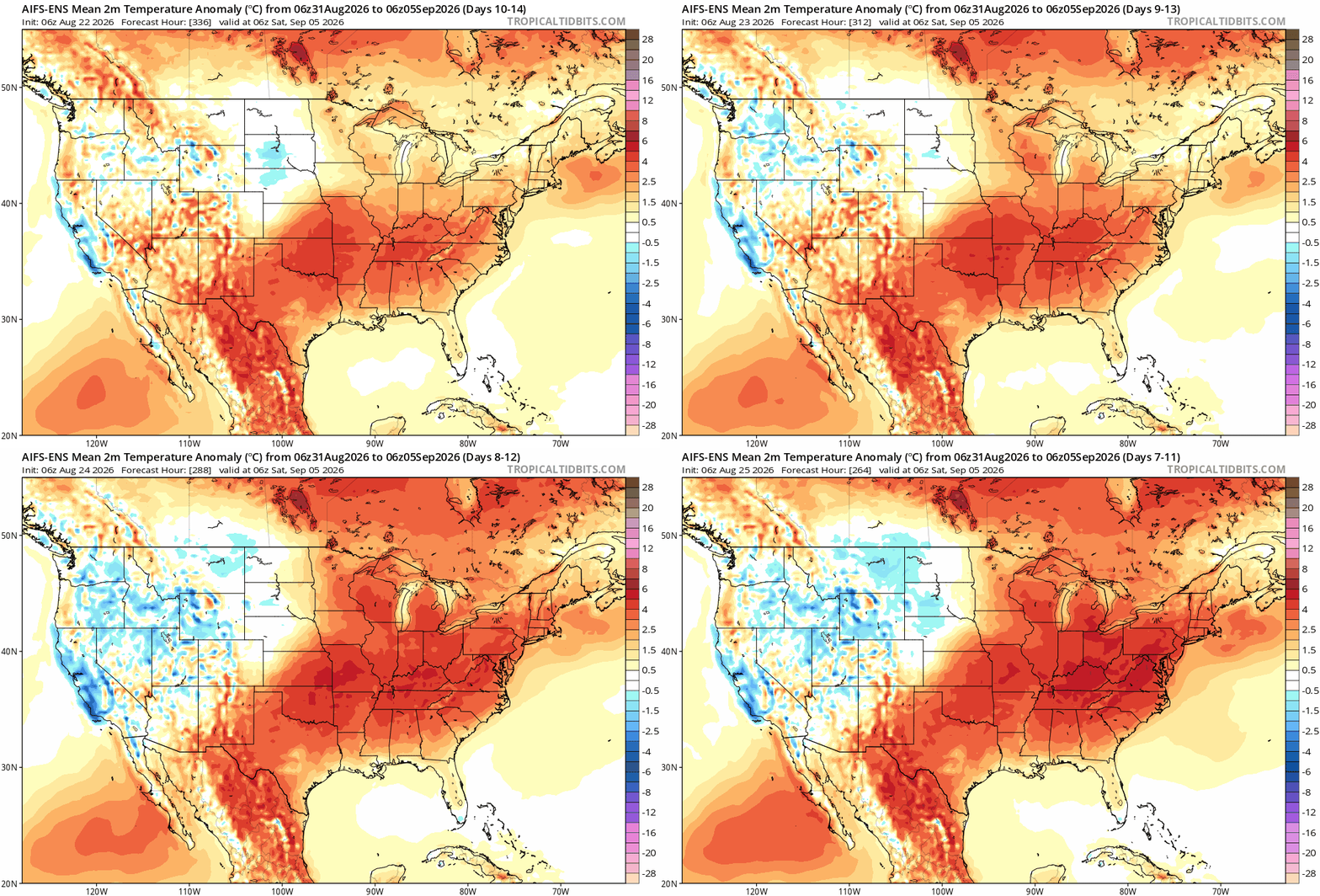
Aug 30 - Sep 7 period trending warm - hot ' er we'll see the ridge position key for pushing a late season heatwave and matching 3 summer months early hot starts.
-

Augdewst 2026: Summer's Last Stand
dendrite replied to Prismshine Productions's topic in New England
It’s definitely trending warmer though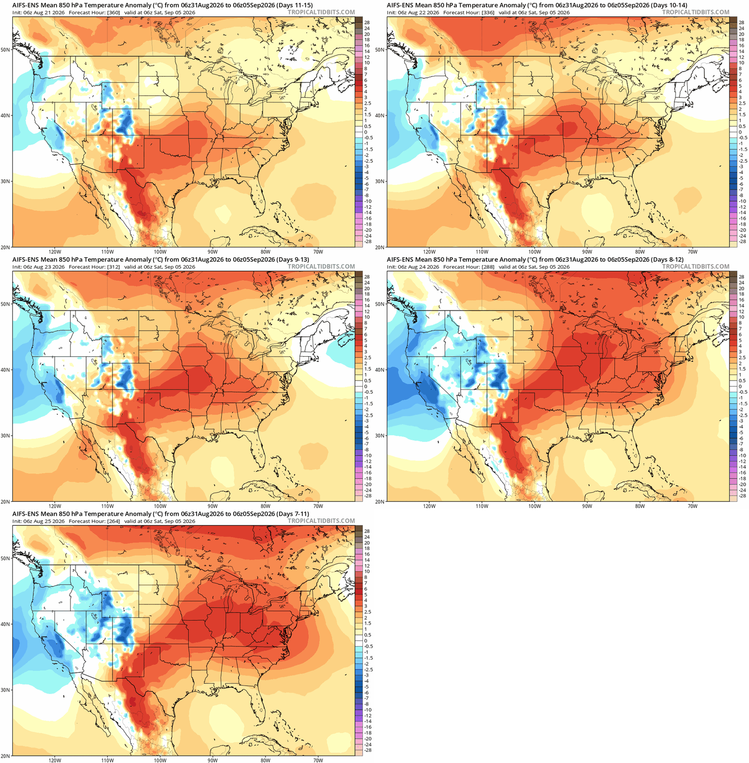
-

E PA/NJ/DE Summer 2026 Obs/Discussion
BBasile replied to PhiEaglesfan712's topic in Philadelphia Region
Got down to 57F this morning. That was nice. -
Augdewst 2026: Summer's Last Stand
dendrite replied to Prismshine Productions's topic in New England
That’s the EPS AI Ens -
ECMWF hints at this, though I think this is exaggerated....likely closer to the coast than this. That is a resolution issue...like when the GFS places the CF near ORH a few days out from a storm.
-
Augdewst 2026: Summer's Last Stand
dendrite replied to Prismshine Productions's topic in New England
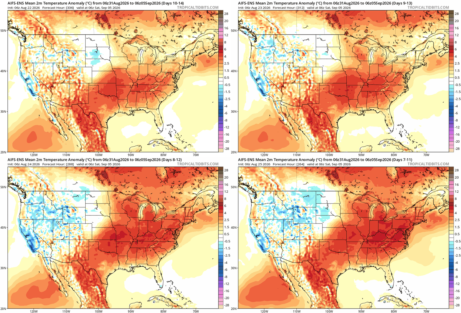
More 6z maps -

2026-2027 Record-breaking El Nino
Typhoon Tip replied to Stormchaserchuck1's topic in Weather Forecasting and Discussion
heh... ENSO correlations for 300 years due too - but, I'd be remiss if I didn't mention that until the gradient locks in and the jet(s) configures accordingly ...etc. -
Augdewst 2026: Summer's Last Stand
Typhoon Tip replied to Prismshine Productions's topic in New England
Is this the GFS AI ...or ? -

2026-2027 Record-breaking El Nino
40/70 Benchmark replied to Stormchaserchuck1's topic in Weather Forecasting and Discussion
Roundy's stuff favors W Canada. -
Great graphic from the NWS showing how Bridgeport was significantly ahead of the other major sites for summer rainfall this year.
-

Augdewst 2026: Summer's Last Stand
weatherwiz replied to Prismshine Productions's topic in New England
Let's get a Labor Day '98 redux but even more widespread -
Augdewst 2026: Summer's Last Stand
weatherwiz replied to Prismshine Productions's topic in New England
yeah it sucks how relatively short in duration we get enjoyable weather. I mean 50's and 60's aren't bad but it's just so much more enjoyable to sit outside with shorts, plus when its into the 80's you can at least do water activities/beach. January though I don't mind...you're in prime winter/snow season so you just hope you can rack up winter events. The month I really despise is March. By the time March rolls around I am ready for consistent 70's. But March...and April can be dreadful and it feels like better weather will never come lol. -

Augdewst 2026: Summer's Last Stand
forkyfork replied to Prismshine Productions's topic in New England
-
warming trend continued on the overnight models
-

Augdewst 2026: Summer's Last Stand
Snowedin replied to Prismshine Productions's topic in New England
The summer season goes by way too fast, especially in this cut off corner of paradise. Why can’t we blow through the god awful month of January at the same relative pace as July? -
The soil temperatures in the top ~12" will vary based on the coverage and thickness of the vegetation currently present. For our stations we aim for a natural ground cover or "meadow like". If your ground is mowed short, or especially if it is bare, it will fluctuate more than our stations indicate. Soil moisture will also vary based on your exact soil makeup. But as long as it isn't straight clay or sand, it should be proportional.
-
 http://mexisafepharm.com/# pharmacy in mexico city
 -
lol don’t expect 02-03. I was just using that as an example.
- Today
-

2026-2027 Record-breaking El Nino
BlizzardWx replied to Stormchaserchuck1's topic in Weather Forecasting and Discussion
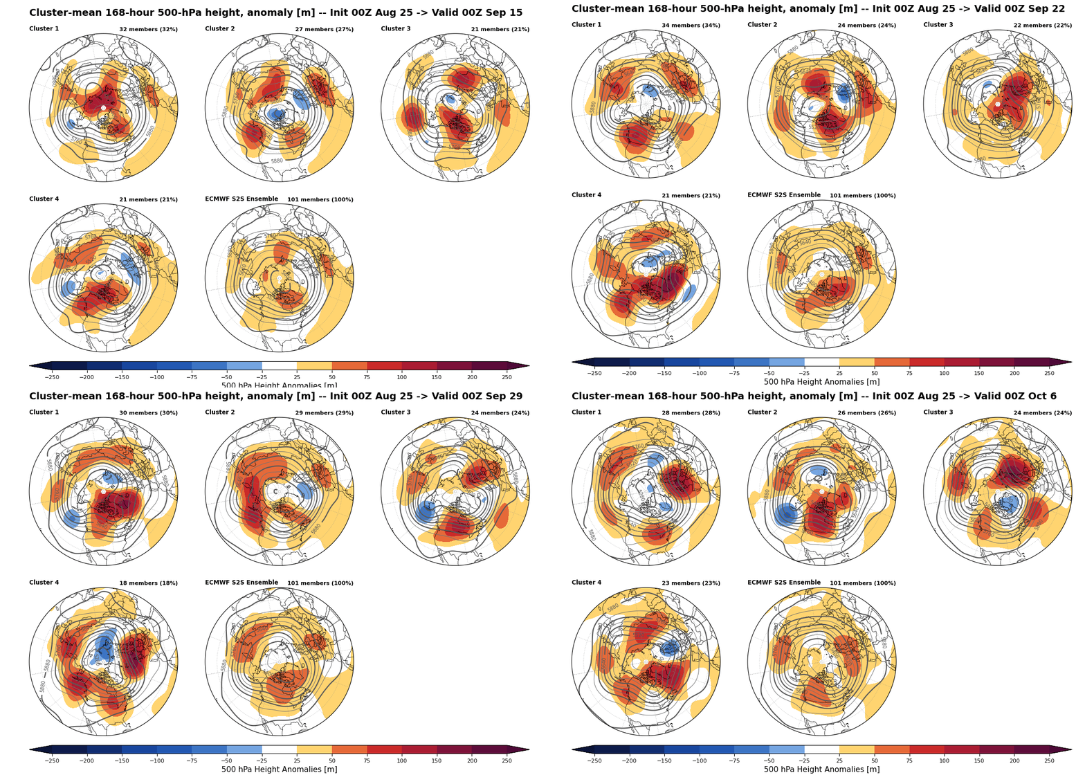
ECMWF clusters week 3-6 seem to net hint at a move towards +PNA ridging in western Canada but there is a solid second group keeping ridging going somewhere in south-central Canada or north-central USA as we head into fall.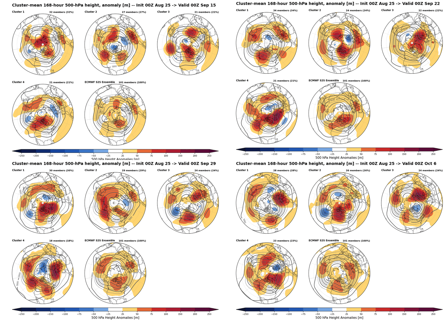
-
talk dirty to me
-

2026-2027 Record-breaking El Nino
soadforecasterx replied to Stormchaserchuck1's topic in Weather Forecasting and Discussion
So does this mean that this El Nino may not be as record breaking as it once looked? -
You definitely could. Adding @wxmeddlerin case he's got some other discussion points.
-
(002).thumb.png.6e3d9d46bca5fe41aab7a74871dd8af8.png)
Central PA Summer 2026 Discussion/Obs Thread
ChescoWx replied to Voyager's topic in Upstate New York/Pennsylvania
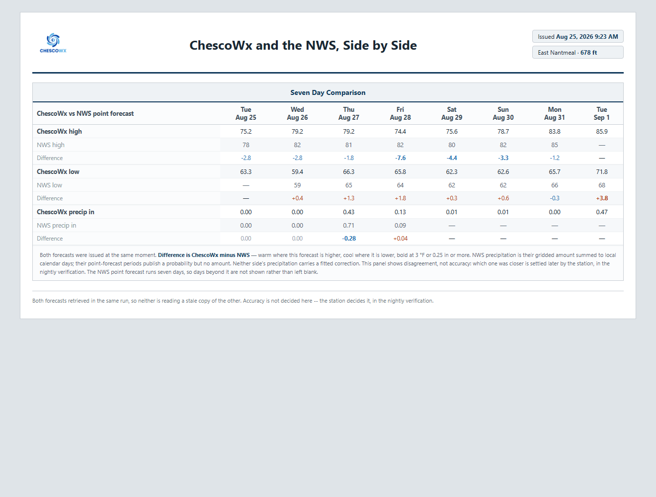
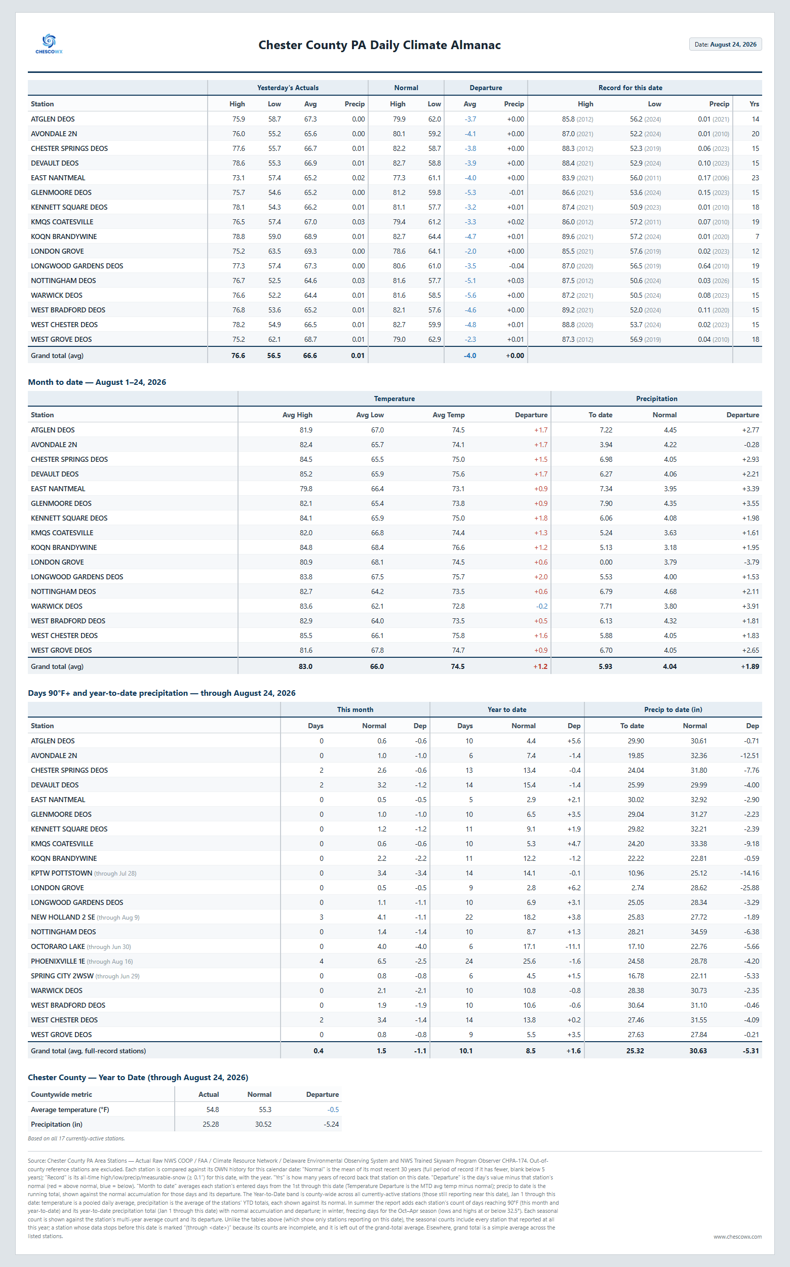
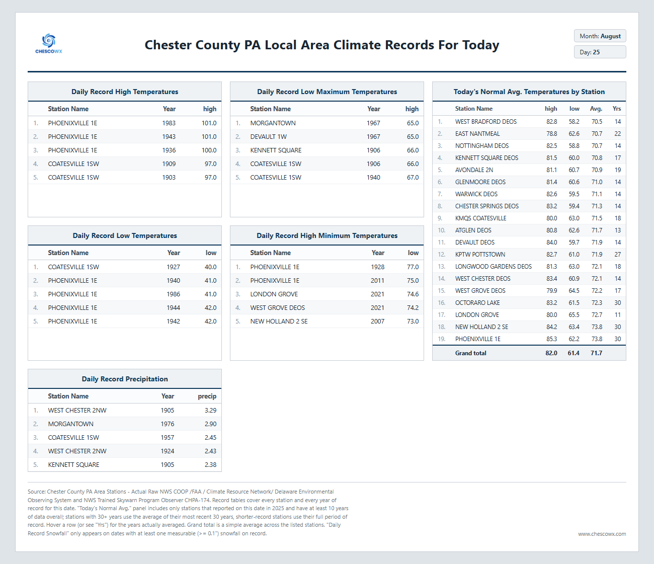
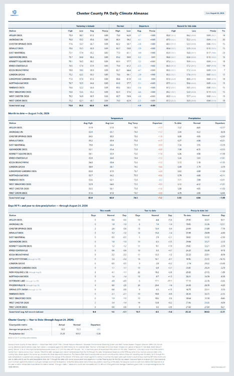
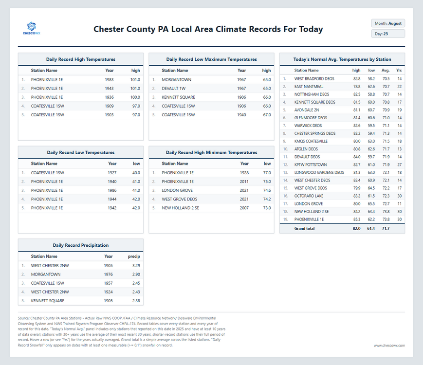
Widespread low to mid 50's across the county this morning with the lowest the 51.2 at Warwick. Another beautiful day on tap today with highs per our ChescoWx Model in the mid 70's with the NWS seeing upper 70's. The NWS sees 80's starting tomorrow through the next week while ChescoWx keeps East Nantmeal just shy of 80’s both tomorrow and Thursday before falling back to the mid 70's both Friday and Saturday. Rain chances to increase by Thursday before we clear out on Friday.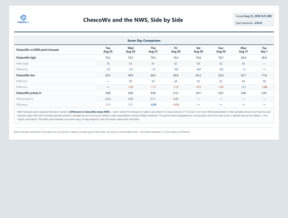
-
E PA/NJ/DE Summer 2026 Obs/Discussion
ChescoWx replied to PhiEaglesfan712's topic in Philadelphia Region
Widespread low to mid 50's across the county this morning with the lowest the 51.2 at Warwick. Another beautiful day on tap today with highs per our ChescoWx Model in the mid 70's with the NWS seeing upper 70's. The NWS sees 80's starting tomorrow through the next week while ChescoWx keeps East Nantmeal just shy of 80’s both tomorrow and Thursday before falling back to the mid 70's both Friday and Saturday. Rain chances to increase by Thursday before we clear out on Friday.
-
Hope much of this breaks up a bit otherwise those sunny forecasts will again miss a partly - variable cloudy afternoon