All Activity
- Past hour
-

SE Area of Interest--0% two day, 20% five day odds
BarryStantonGBP replied to WxWatcher007's topic in Tropical Headquarters
Hi! 3. Off the Southeastern United States: An area of low pressure could form in a couple of days a few hundred miles southeast of the Carolinas. Some gradual development of this system is possible by midweek as the system drifts to the northwest. * Formation chance through 48 hours...low...near 0 percent. * Formation chance through 7 days...low...20 percent. -
Tropical Overview 8/3 Things have been quiet for most of the season despite three named storms so far. ACE is well below normal, but at this point in the season ACE doesn't really mean much. We have approximately 90% of the season to go, and the peak of the season, which begins around August 20, is right around the corner. There are several factors that have contributed to the quiet start. In recent high activity/hyperactive years, we've seen activity in the tropical Atlantic before climatology makes the region favorable. Think Beryl of last year. That was not the case this year, as a hostile atmospheric pattern, stability, and lower sea surface temperature anomalies (SSTAs) have left the tropical Atlantic devoid of activity, even in the face of historically low Saharan Air Layer intrusions (SAL) during its usual annual peak. Meanwhile, the PAC has been hot. And continues to be so as a favorable phase of the MJO passes through the region. Before more favorable atmospheric conditions move into the Atlantic we are already seeing homebrew starting to percolate off the East Coast. With a favorable MJO in the coming weeks, the window will begin to crack open in the Atlantic. At this time I am tracking three distinct possibilities. (As I wrote this the NHC designated area two as a lemon and area three as an orange) 1. Invest 95L Off the Southeast Coast The first area of interest is already likely in the early TC genesis stage. A current non-tropical low is trying to detach from a frontal boundary off the southeast coast, and is looking more and more like it's trying to become tropical with persistent convection firing now near an apparent center of circulation. This is a very common way to get TC genesis in the homebrew region this time of year. This looks well on its way to developing before conditions become more hostile early in the week. It is not a threat to land, as these frontal system TCs tend to follow the weakness in the trough out to sea. It's interesting, but not overwhelmingly so. 2. "Follow up" Development off Southeast Coast Now this one is much more interesting, and has been for a while now. Yesterday most probably sat up as the happy hour GFS showed a strong system attempt to develop in the wake of 95L off the same frontal boundary, this time getting shunted back into the US. Well, although that run of the GFS was way too aggressive, the signal for some sort of follow up development has been on the guidance for a few days now. It's not terribly hard to see why, as the environment looks at least marginally favorable for some development. Vorticity First--again, the frontal boundary is usually good for getting some vorticity spin up. So if something is far enough off the coast there should be some sort of spin that develops in the coming days. Both models pick up on this in the medium range. This is not enough for TC genesis. Which leads to the second favorable factor. Instability While the tropical Atlantic has been incredibly stable so far this season... There has been no such issue off the East Coast...in fact, instability has been extremely high. What that tells me is that anything that does have spin and can develop an area of low pressure will have a chance to generate convection, which will only help with TC genesis odds as long as the system isn't hugging land the entire time. SSTa Not much analysis needed here. I expect the the southwest Atlantic to be a hotbed of activity this season because that's where the heat is. Any low is going to have a shot with enough time and space to become tropical in this SSTa regime. Shear The key inhibitor here is shear. Often times with these frontal boundary systems near the coast you have shear and drier air that is lurking. That comes with the territory with the frontal boundary. Here it is unclear how favorable a shear environment this potential system will find, but guidance is hinting at a window of lower shear later this week taking hold. What makes this particularly interesting is the steering pattern. While the outcome is different in terms of where the area of vorticity goes, the pattern evolution is the same. In the wake of 95L a ridge builds in and traps whatever could develop along the coast. That's something to legitimately watch. Maybe not closely, yet, but at least with a casual eye. 3. Central Atlantic Wave This final area is highlighted as a lemon by the NHC, but the wave hasn't yet left the coast of Africa. This is an area that should benefit from the coming MJO change, and it already has a few things going for it. First, as I mentioned earlier, SAL is at historic lows. Now, that doesn't mean that SAL isn't out in the Atlantic, because it is, but look at the coast of Africa. When this wave comes off, it will likely be in a pocket where there is very little SAL. It will be fighting stability in that part of the basin along with lesser SST anomalies, but that can be manageable with a vigorous enough wave. Timing and location are everything, and this one is still TBD on both. With the steering pattern likely changing with a ridge taking over, if this is able to get trapped under the ridge it will likely be moving into the most favorable conditions for a tropical wave yet this season. To be sure, I'm not calling for a US threat or anything at this time, but the NHC has a large geographical zone for development for a reason. There is higher than usual uncertainty on where this could develop. This may be our first reasonably strong system of the year for two reasons. First, it is running into the aforementioned warm SW Atlantic. OHC is primed for a system ready to take advantage of it. Second, and potentially far more concerning, is the ensemble guidance that wants to totally wipe out unfavorable shear. This is a fairly stunning retreat of shear by the 00z EPS. So while I'm not necessarily expecting a super burst of activity, we now have plenty to track in advance of the start of peak season, with two areas that are worth watching...
-
 Weak sauce compared to late June through July.
 -
AND THE AOI BLEW UP MORE LMAO 2. Central Tropical Atlantic: A tropical wave is forecast to move off the west coast of Africa by late Monday. Thereafter, some gradual development of the wave is possible, and a tropical depression could form late this week while it moves generally west-northwestward across the central tropical Atlantic. * Formation chance through 48 hours...low...near 0 percent. * Formation chance through 7 days...medium...40 percent.
-
1. Western Atlantic (AL95): Showers and thunderstorms have increased in association with a non-tropical area of low pressure located a few hundred miles east of the North Carolina coast. While satellite wind data show that the low is now producing gale-force winds, the system remains attached to a frontal boundary. However, environmental conditions are conducive for this system to acquire additional tropical characteristics, and a tropical storm is likely to form by Monday well east of the North Carolina coast. LMAOOOOOOOOOOOOOOOO. For additional information, including gale warnings, please see High Seas Forecasts issued by the National Weather Service. * Formation chance through 48 hours...high...70 percent. * Formation chance through 7 days...high...70 percent.
-
 Doubtful locally except for EWR where it's almost always likely and some points well north and west. I would think Central Park 87, LGA 85, EWR 91. WX/PT
 -
Only on Coc k days with N flows.. ACATT would rather have that and be forced to stay inside due to bad air quality, respiratory failures, wheezing etc , than have humid dews where they can get outside and breathe, be active and healthy. Definitely odd
-
Yeah. They seem to love nesting in old New England homes with wide open wall cavities. Haha. But they will still nest in the ground and some the biggest nest's I've seen have been in the ground. It looks like @kdxkenhit a nest of Eastern YJ because their is no way he would be taking that picture if he hit the german ones. Haha
-
JV models hinting at something as well
.thumb.png.bccf4649060b1f769d1f4be84f0a74b8.png)
-
I’m not making this up right, the number of days with smoke has climbed exponentially over last 5 years right? I remember as a kid in the 90s how big of a deal it was the one day we had smoke. Now it’s like twice a week.
-
 Ok, so normally we wouldn't have threads for current low probability systems, but I guess we're changing that this year. This comes from my bigger overview, which highlights this area of interest. I've been quietly watching for days, and now it's worth discussion. This area of potential has been much more interesting than 95L, and has been for a while now for the reasons below. Yesterday most probably sat up as the happy hour GFS showed a strong system attempt to develop in the wake of 95L off the same frontal boundary, this time getting shunted back into the US. Well, although that run of the GFS was way too aggressive, the signal for some sort of follow up development has been on the guidance for a few days now. It's not terribly hard to see why, as the environment looks at least marginally favorable for some development. Vorticity First--the frontal boundary is usually good for getting some vorticity spin up. This fits with climatology. So if something is far enough off the coast there should be some sort of spin that develops in the coming days. Both models pick up on this in the medium range. This is not enough for TC genesis. Which leads to the second favorable factor. Instability While the tropical Atlantic has been incredibly stable so far this season... There has been no such issue off the East Coast...in fact, instability has been extremely high. What that tells me is that anything that does have spin and can develop an area of low pressure will have a chance to generate convection, which will only help with TC genesis odds as long as the system isn't hugging land the entire time. SSTa Not much analysis needed here. I expect the the southwest Atlantic to be a hotbed of activity this season because that's where the heat is. Any low is going to have a shot with enough time and space to become tropical in this SSTa regime. Shear The key inhibitor here is shear. Often times with these frontal boundary systems near the coast you have shear and drier air that is lurking. That comes with the territory with the frontal boundary. Here it is unclear how favorable a shear environment this potential system will find, but guidance is hinting at a window of lower shear later this week taking hold. What makes this particularly interesting is the steering pattern. While the outcome is different in terms of where the area of vorticity goes, the pattern evolution is the same. In the wake of 95L a ridge builds in and traps whatever could develop along the coast. That's something to legitimately watch. Maybe not closely, yet, but at least with a casual eye.
- 1 reply
-
- 1
-

-
let all that fresh smoke in
-
I'm going to partially disagree with a some things that have been said. Firstly, I think the onshore flow around the relatively cool HP is mostly this week. Then from what I'm looking at there is a fairly brief spell of warmer/hotter weather later in week #2 pending no significant tropical activity up our way. GFS thinks there will be some. Then it appears a fresh Canadian air mass drops southeast bringing possibly a spell of well below normal temperatures by sometime during week #3. After that I speculate purely based on the pattern that we may see one last or the second to last spell of heat as the ridge builds around on the return flow of that air mass probably not long duration but we'll see. All in all, it looks like an average to slightly above average August temperature-wise. WX/PT
-
 We see triple digit heat mid august I say. The worst of it is NOT over just cause we're having a little break from the extreme heat/humidity first week of august. Many people are jumping the gun on second half of summer.
 -
Smoke haze generally sucks, but silver lining in reducing the UV index, while we bone dry for at least another week here
-
3 hrs ago we smoke
-
You meant where there’s Coc k , there’s smoke, Dews don’t bring smoke
-
I had read somewhere that the german ones are more likely to nest in walls and the native eastern ones more likely underground.
- Today
-
My friend Keith said his friend at NWS said it was most humid July since 1933. I’m don’t know how that’s measured and recorded but that’s the info I got
-

2025 Spring/Summer Mountain Thread
Met1985 replied to Maggie Valley Steve's topic in Southeastern States
The magic of cold air damming: Three days ago, Asheville's low temp was 71 degrees, which tied a record for the warmest low temp for 7/31. Yesterday, Asheville's high temp was 71 degrees, which set a new record for the coolest high temp for 8/2. -
Dew point just briefly dipped to 49 at Dulles. Riddance of Hell Heat is wonderful Don’t spend the entire day with too much body heat. Damn sweat would not evaporate and nearly boiled
-

E PA/NJ/DE Summer 2025 Obs/Discussion
The Iceman replied to Hurricane Agnes's topic in Philadelphia Region
Yeah drought guy will be making an appearance by next weekend. Long range pattern looking dry barring any tropical systems. This week should be beautiful. -
That is absolutely wild. Only .11” over here!
-
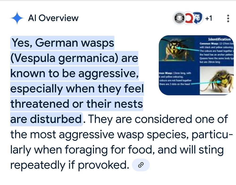
Maybe you guys dont have them up north...yet. I'm referring to these... https://en.wikipedia.org/wiki/Vespula_germanica They are the most aggressive wasps out there. I work with people from Mexico, Peru, Ecuador, etc. They claim afrancinzed bees are tame compared to them...


.png.82a0f6f30ab8ab12233b0b4baac21cc8.png)