All Activity
- Past hour
-

Spooky Season (October Disco Thread)
Torch Tiger replied to Prismshine Productions's topic in New England
You'll see it. -

Spooky Season (October Disco Thread)
Damage In Tolland replied to Prismshine Productions's topic in New England
2nd -
Spooky Season (October Disco Thread)
Torch Tiger replied to Prismshine Productions's topic in New England
I saw snow on my b-day in 2009, random 10-15/16 snow. Only time I can recall -
Spooky Season (October Disco Thread)
Torch Tiger replied to Prismshine Productions's topic in New England
what day -

The return of the elusive Nor'easter. Drought buster or bust?
87storms replied to dailylurker's topic in Mid Atlantic
Terrible start, legendary finish. -
Spooky Season (October Disco Thread)
Damage In Tolland replied to Prismshine Productions's topic in New England
I think this year for the first time in 25+ years offers at least a low chance of snow on or near my bday . The pattern of aligned right shows the opportunity.It’s been an elusive chase for 52 years. Time is running out.. -

Spooky Season (October Disco Thread)
MJO812 replied to Prismshine Productions's topic in New England

-
DT called this ^
-
Luckily this is hour a million so it probably won't happen
-
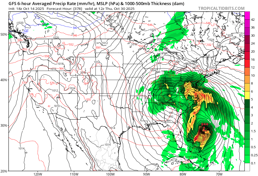
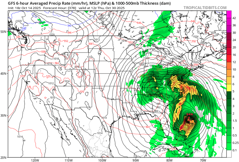
Sandy 2.0

-
Spooky Season (October Disco Thread)
Torch Tiger replied to Prismshine Productions's topic in New England
Yeah I've been looking, it's still a very coarse signal out of the Carib. I don't care if it impacts here, but let's see some impacts! -
That map isnt even close over this way. Might have been an inch or so. Consider the source.
-

Spooky Season (October Disco Thread)
ineedsnow replied to Prismshine Productions's topic in New England
Far out but I think either way there's going to be a big end of the month storm.. lots of fun on the ensembles for that time period. -
Spooky Season (October Disco Thread)
Torch Tiger replied to Prismshine Productions's topic in New England
that's my darling setup! Just a bit weak with 942mb and too far south. Looks late-season 1938ish though! -
Spooky Season (October Disco Thread)
Torch Tiger replied to Prismshine Productions's topic in New England
Yes!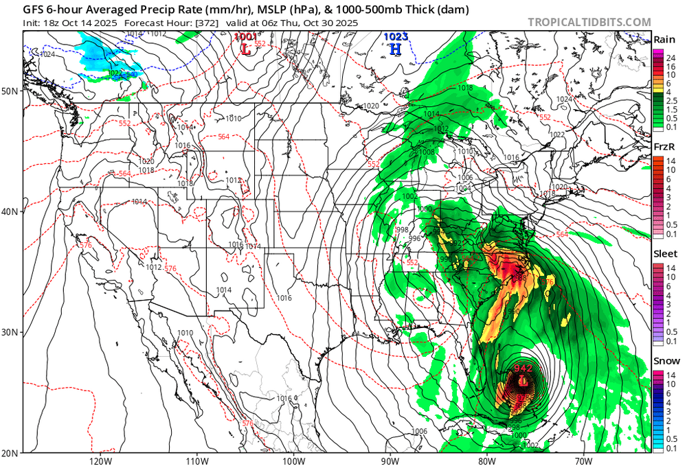
-
5 days later, has that misery look outside of a VERY cold anedecent airmass
-
6.60"..just persistent steady rain
-
 I've seen references in news clipping from the NJ coast, 4th or 5th worst tidal level since 2000... that's pretty serious in the past 25 years.
 -

October Medium/Long Range Discussion
Stormchaserchuck1 replied to Eskimo Joe's topic in Mid Atlantic
Have to love this +PNA/-NAO.. it's a colder pattern if it were later in the year. And a corresponding trough in the Mid Atlantic a few days later.. the ensemble mean is nothing like the OP -

Central PA Fall Discussions and Obs
Blizzard of 93 replied to ChescoWx's topic in Upstate New York/Pennsylvania
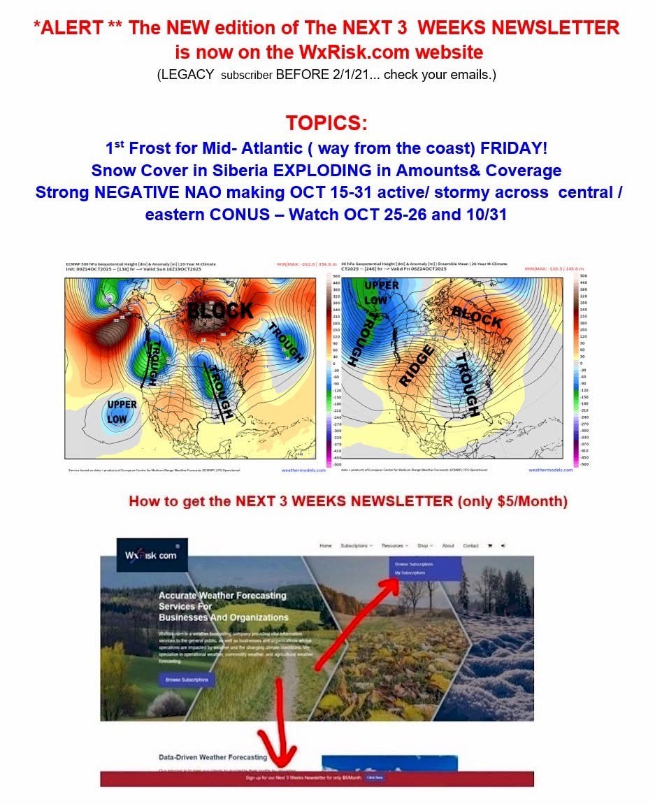
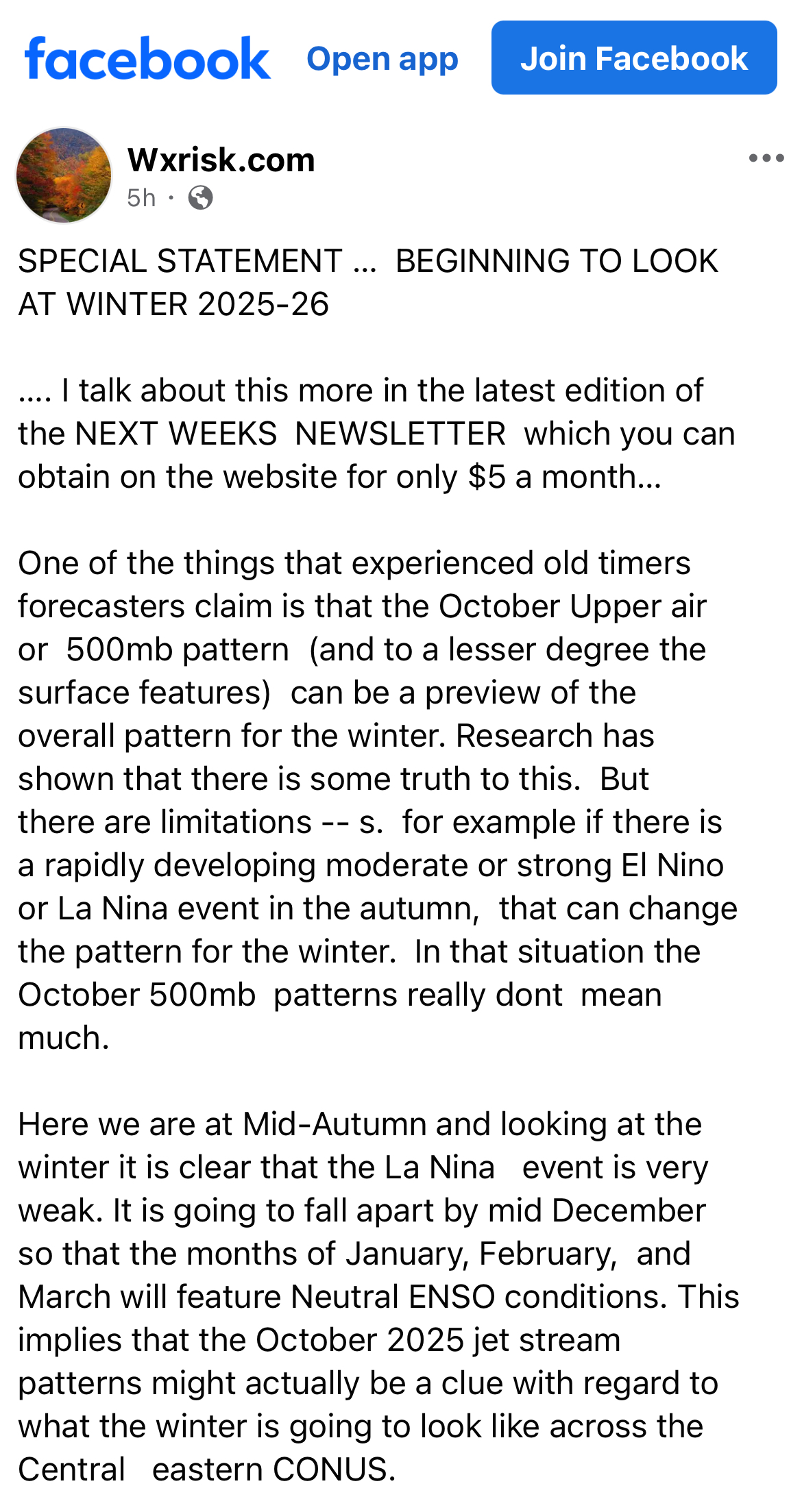
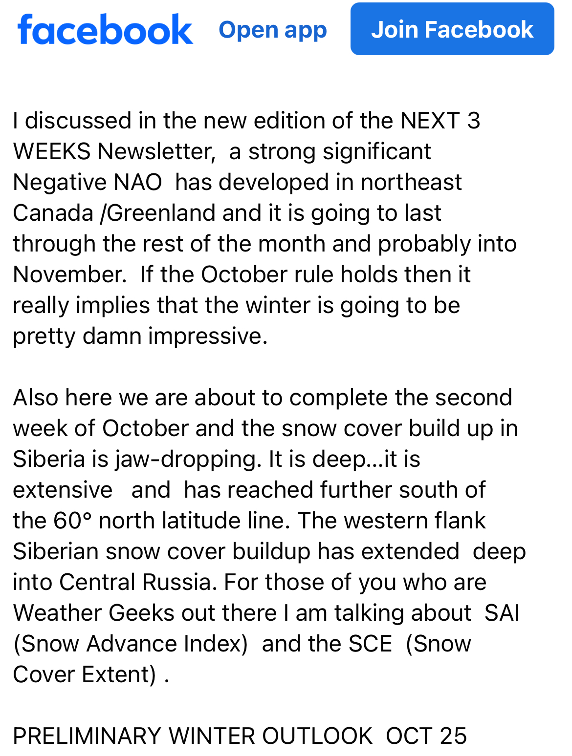
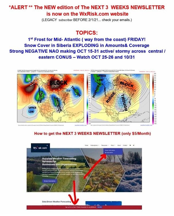
More from DT on the next few weeks & Siberia comments…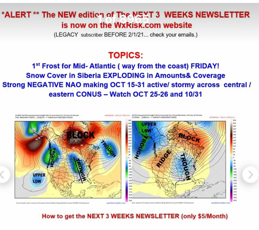
-
Central PA Fall Discussions and Obs
Blizzard of 93 replied to ChescoWx's topic in Upstate New York/Pennsylvania
Our friend DT is starting to look towards this upcoming Winter…

-

Spooky Season (October Disco Thread)
dendrite replied to Prismshine Productions's topic in New England
There was a lot of low level E flow before and during that first wave of precip. I assume you’d have to be well into Jan to overcome that? A lot of the precip yesterday would’ve been low level stuff too…maybe saved by some salt nuclei? Of course there may have been a stronger high if it was winter as well. So I guess it’s all a moot point. -
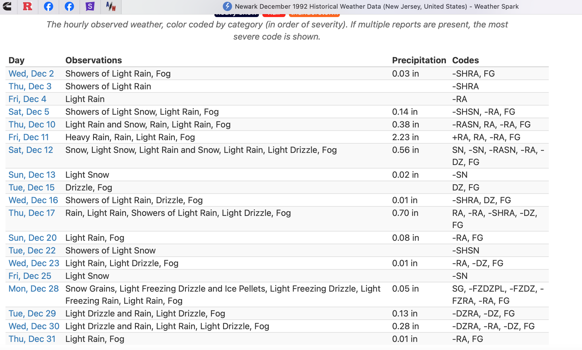
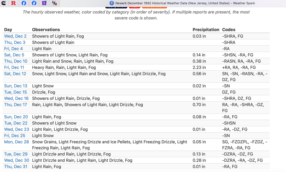
Hi... I'm not going into details since time and my age 75 have lost a little of the edge. From Northeast Snowstorms V2 Kocin and Uccellini. Dec 10-12 1992 was huge... heavy snow most of the interior higher northeast and New England. I was up in Marblehead MA. Powerful there. Mar 11-13 was the Eastern USA Superstorm Coast problems with most of the snow interior I95 westward. Also in Marblehead. The Newark Climate Data for Dec 1992 below describes what happened at Newark Airport... Inland colder and snowier. Coast winds, seas and tides were enormous Dec 10-12 while a snowstorm raged interior. Hope this helps
-
Also featured the worst standing wave of subsidence in RI I have ever seen. Cory nearly did himself in.
-
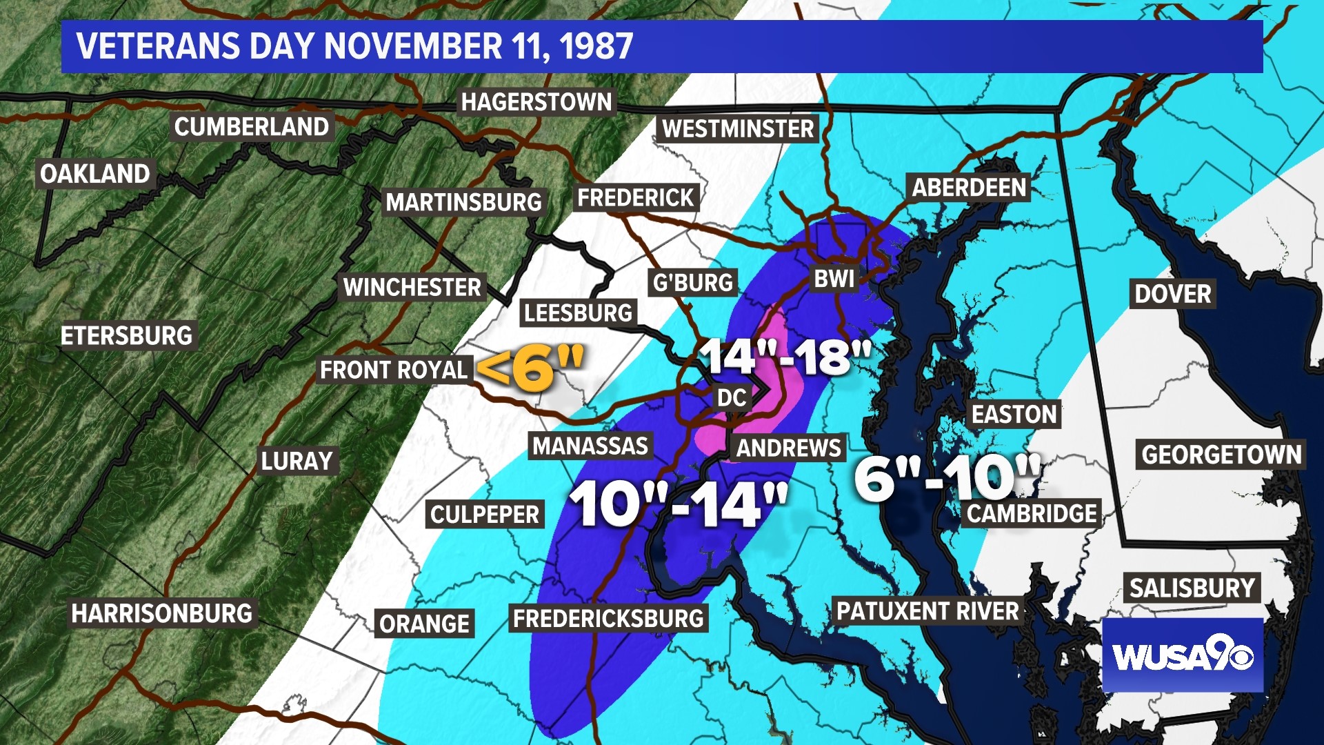
I have fond memories of Veterans Day 1987. I start my tracking around this time. Rare, but it can snow. I was at Univ. of MD in the bullseye.