All Activity
- Past hour
-
Trying to enjoy this last snow until Nov ‘27
-
Lol, +SN now.
-
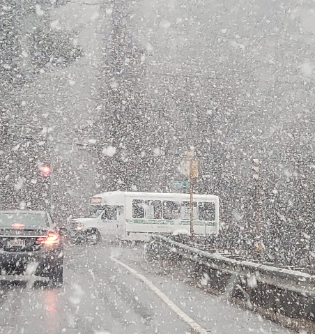
Driving to work over the Berkshires was horrible. Some towns have packed it in with the sand and salt. If only my car was powered by expletives!
-
29.8° SN Poundtown now
-
Yes, chances for Super El Nino are increasing. The last one was 15/16. If this holds, it could be a hot and dry summer in the south. Very concerning...
-
Now is when I appreciate living right next to the bay. Should moderate the temps down here a bit.
-
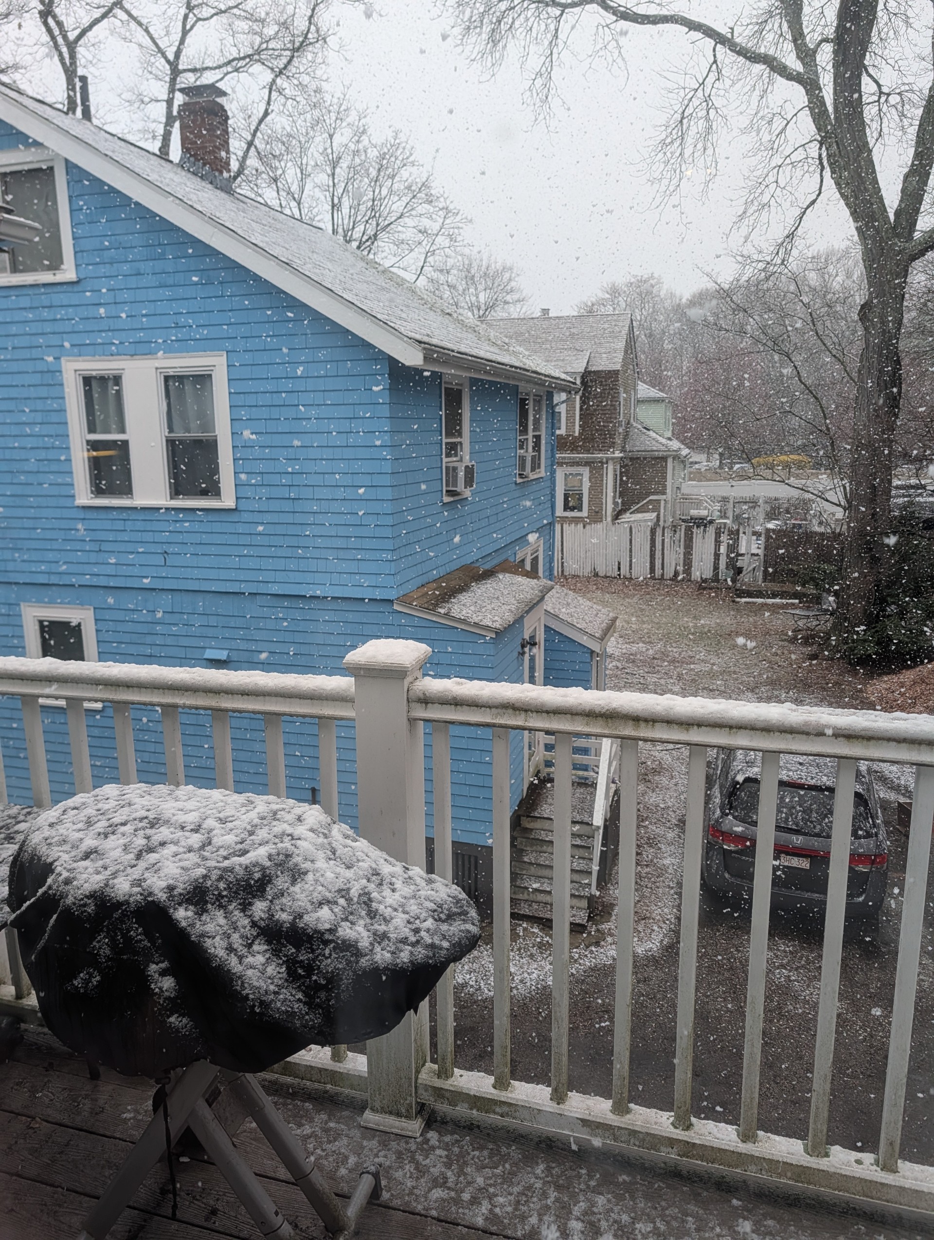
Not bad for 4/7..

-
Was snowing to beat the band in southborough. Coated everything.
-
1.5, even if not strong, is still notable. In the last 77 years, we've only had 10 events that cleared 1.5 on both the ONI and RONI (only 4 of these, in bold, cleared 2.0 on both - the threshold for super): 1957-58 1965-66 1972-73 1982-83 1986-88 (this was a double year el nino, which unlike the others, peaked in the summer of 1987) 1991-92 1997-98 2009-10 2015-16 2023-24
-
30.5° -SN Decent dendritic aggregates
-
Sheeh... I want to say it's 1/4S+ in this burst. Just pouring dendrites.
-
Not enjoying this 79725774645__97044C0A-00DE-458F-B690-F596D6828E3A.MOV
-
Another burst of moderate with graupel mixed in. Pavement coated up again. Probably finish with about 1.25” 31° Over performer.
-
The modeling looks like the key 3.4 region rises to just under +1.5 toward this next Xmas. Makes sense I suppose ... El Nino is Spanish for "Christ child" and is given to the name of the phenomenon for a reason; the canonical time of year for it to occur. Anyway, 1.5 is not super this or even very strong that. Where is this extremeness coming from ?
-
stopped for a bit but started back up.. we rip.. everything whitened up
-
Of course 5 minutes later it starts pouring cat paws and that gets a few white spots to show up.
-
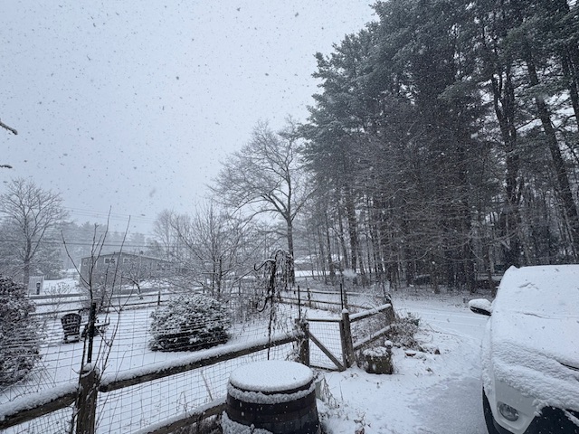
Sun was out, but now getting another good burst. Exactly 1” on the car when I drove the kiddo to school.
-
I think the worst outcome is 36F snow like I had earlier. I’ll take an April blizzard.
-
Still snowing in the heavier bursts, but not quite hard enough get a coating on anything.
-
Actually, it's now a freeze warning from midnight on for the DC metro. (Other warnings up for the rest, freeze watch up for Thursday AM for the outer suburbs) URGENT - WEATHER MESSAGE National Weather Service Baltimore MD/Washington DC 213 AM EDT Tue Apr 7 2026 DCZ001-MDZ013-014-016-VAZ054-057-071415- /O.NEW.KLWX.FZ.W.0001.260408T0400Z-260408T1300Z/ District of Columbia-Prince Georges-Anne Arundel-Charles- Arlington/Falls Church/Alexandria-King George- 213 AM EDT Tue Apr 7 2026 ...FREEZE WARNING IN EFFECT FROM MIDNIGHT TONIGHT TO 9 AM EDT WEDNESDAY... * WHAT...Sub-freezing temperatures as low as 31 expected. * WHERE...The District of Columbia. In Maryland, Anne Arundel, Prince Georges, and Charles Counties. In Virginia, King George County, and Arlington/Falls Church/Alexandria. * WHEN...From midnight tonight to 9 AM EDT Wednesday. * IMPACTS...Frost and freeze conditions could kill crops, other sensitive vegetation and possibly damage unprotected outdoor plumbing.
-
could be worse ... 44 years ago today, NYC-BOS were in the later stages of an April blizzard.
-
Yes.
- Today
-
It snowed and some things were white
-
Radar estimates over 2 inches of QPF fell in south-central IA overnight. Likely overestimated due to bright banding, but some big amounts may have happened in a narrow corridor if the snow wasn't too mixy with rain.
-
Only 0.09 inch here. It is so very dry… .

.thumb.png.4150b06c63a21f61052e47a612bf1818.png)