All Activity
- Past hour
-
This has been a huge bust IMBY. Before this last round I had only had 0.31 inch of rainfall storm total. That’s a far cry from the inch-plus in the forecast. Ouch.
-

2026-2027 Strong/Super El Nino
Stormchaserchuck1 replied to Stormchaserchuck1's topic in Weather Forecasting and Discussion
For 1 month. December, Feb, March, and April were all -PNA You believe global warming is a main driver of dominant patterns? I think we have more of a background -ENSO/-PDO state so it may not be like some of the classic Strong Nino's but I don't see the relevance in "new global temperature 3 years apart" aside from general warming. -

Central PA Spring 2026 Discussion/Obs Thread
Blizzard of 93 replied to Voyager's topic in Upstate New York/Pennsylvania
Next rain concern is Saturday. There is a softball tournament scheduled in northern Perry County. Anyone have any thoughts on the timing & amount of rain at this time? -
It's my biggest fear. I'll take anything other than alpha gal
-
0.20” overnight 0.48” total
-
Central PA Spring 2026 Discussion/Obs Thread
Blizzard of 93 replied to Voyager's topic in Upstate New York/Pennsylvania
.29 of rain yesterday in Marysville. The rain yesterday ended early enough for the softball field to drain. They got the game in & my daughter’s team played well and got the win. -
Cold n wet this morning. Looks sun will be breaking out soonish though.
-
Put every chemical known to man down and kill em all.
-
Perfect!
-
Sat morning looks wet after 10a or so in CT.
-
Uconn grad is Sunday?
-
Let’s see how much they can screw up this possible Andes hantavirus too.
-

2026-2027 Strong/Super El Nino
bluewave replied to Stormchaserchuck1's topic in Weather Forecasting and Discussion
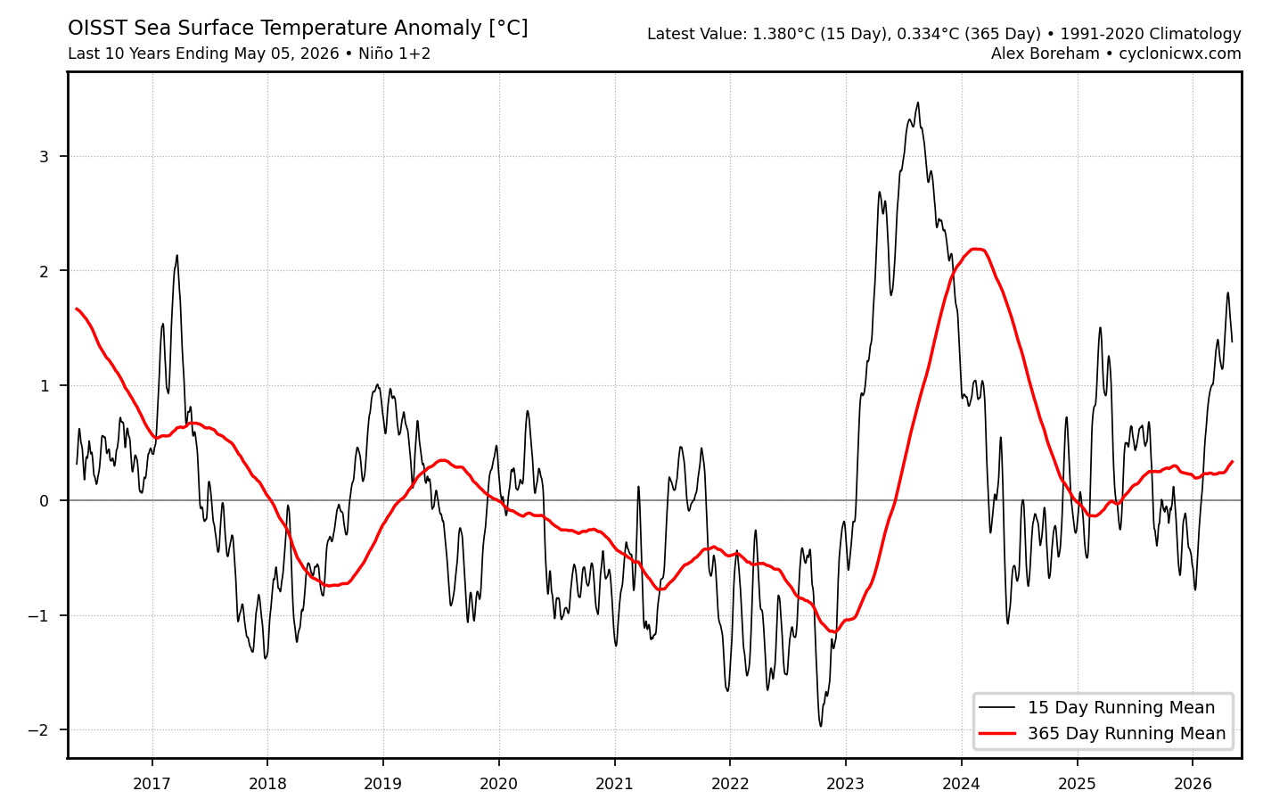
The 365 day running mean never really went into La Niña in Nino 1+2 following the +2.1 ONI event in 2023-2024. Remember we were talking about the anomalous WWBs and warming there last winter during the La Niña which had the record +PNA for a La Niña which was more Nino-like. Seems like the unusual WWBs in EPAC during March 2023 with the rapid warming may be part of a different type of ENSO cycle than we have seen before. So this allowed only 3 years to go by before the El Niño emerged again on track for the shortest return period between two consecutive 2.1 or greater ONI events. We also had the record warming in early 2023 ahead of the usual El Niño lag which wasn’t present. I know most here are focused on next winter. But we don’t have any analogs for such big global temperature jumps only 3 years apart. It’s a big unknown how the details will unfold in regard to weather extremes. Since 2015-2016 happened 18 years after the last big rise in 1997-1998. The record increase in 2023-2024 was only an 8 year gap. Now we are talking only 3 years.
-
0.39 inches here... .27 coming overnight last night
-
"We needed this" - Everyone. Good to see a forecasted rain event come to fruition.
-
If so, they broke the rule this week............ 100% and 90% for 36 hours resulted in .01"
-
0.32” from the event. Not bad
-
Last May began very dry then turned quite wet and stayed wet until early August when rain stopped. El Nino suggests a possible reversal this year. I expect exceptional drought labeling later this morning.
-
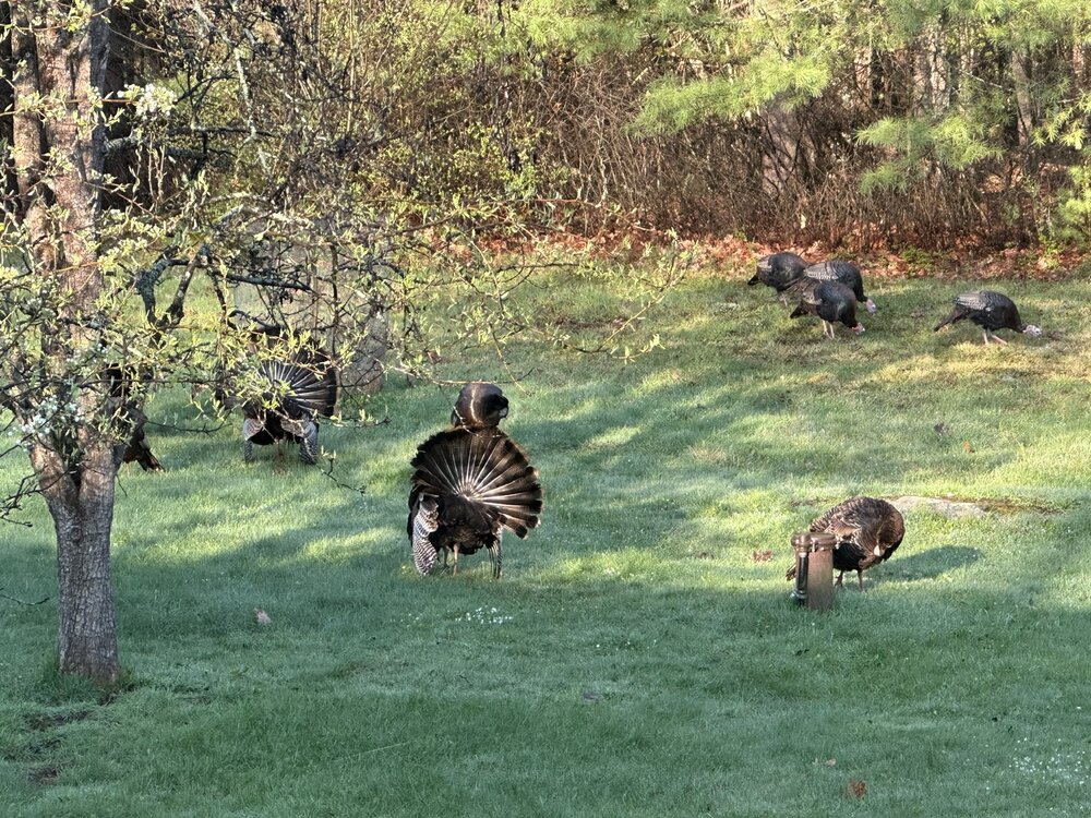
They’re everywhere. You’d think the turkeys would eat some of those f’ers.
-
Had some thunderstorms overnight on the Cape too.
-
Agree. Just swallow a shot shotgun.
-
Alpha gal syndrome escaping the islands and getting statewide is a real concern. Imagine being allergic to meat and dairy you may as well take me out behind the barn and put me out of my misery. .
-
Isn't there a rule at NWS to be very, very conservative when predicting rain during a drought?
-
Frost/freeze threat here Sat Am
-
Hrrr ftw