
All Activity
- Past hour
-
Damn cold spot in the triangle. Thats awesome
-
Strong Nor'Easter/Hybrid Storm Late September 2026
Northof78 replied to Rjay's topic in New York City Metro
Yup, all models in very good agreement from roughly 10PM tonight in far eastern areas through 3PM tommorow in south western areas the intense rain/wind associated with the storm center, would be really awesome to see if eye structure holds as it approaches land to see if can get some great pictures -

October Comes Early: Late September Multi-Hazard Hybrid Storm
WxWatcher007 replied to WxWatcher007's topic in New England
Ryan covers it, but I'll just add that the little burst of convection right at the center is interesting. This is a pretty good system with a good bit of thunderstorm activity over CT today. It'd be cool go get convection that could wrap around the center but that might be asking too much. -

Strong Nor'Easter/Hybrid Storm Late September 2026
steve5728 replied to Rjay's topic in New York City Metro
When does it get bad again over Queens? After sunset,? Thanks. -

October Comes Early: Late September Multi-Hazard Hybrid Storm
SJonesWX replied to WxWatcher007's topic in New England
Very little wind and less than 0.1” rain. staying safe -

Strong Nor'Easter/Hybrid Storm Late September 2026
nycsnow replied to Rjay's topic in New York City Metro
-
Strong Nor'Easter/Hybrid Storm Late September 2026
nycsnow replied to Rjay's topic in New York City Metro
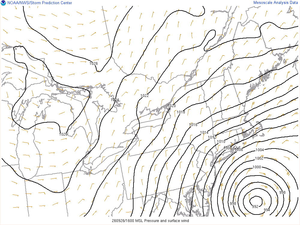
Short term models continue to show from 6z-12z a period of intense rain and winds 45-60mph -

October Comes Early: Late September Multi-Hazard Hybrid Storm
FXWX replied to WxWatcher007's topic in New England
Like 99% of social media folks they just love to bitch and moan with little or no basis, other than they would always do everything better than everyone else! You were spot on, as were most of the forecasts... -
 legit canadian pharmacy: п»їcanadian pharmacy - legitimate canadian pharmacy
 -
Got down to 43 this morning.
-

Strong Nor'Easter/Hybrid Storm Late September 2026
MANDA replied to Rjay's topic in New York City Metro
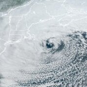
Highest wind gust I've seen so far along the Jersey coast is Harvey Cedars at 69 mph per NJWXNET. So far at least in my opinion things going as expected. Rainfall totals have always been the biggest wildcard with this event and at least so far they have been on the lower end of expectations I would say. Winds and coastal flooding about as expected so far but more to come. So far gusts to about 35 mph here, maybe a tad higher overnight. Rainfall so far .33". Twigs and small branches scattered across the yard. If you took away the map underlay what would you think? https://www.meteo.psu.edu/ewall/PSUGOES_OV/loop60v.html -
October Comes Early: Late September Multi-Hazard Hybrid Storm
bristolri_wx replied to WxWatcher007's topic in New England
I guess you are in a boring spot of this one. I’ve been getting 30-40 mph gusts for the last 24 hours here, which means it will be 60 hours total of gusts in this category before they subside. Rain has been meh. -

October Comes Early: Late September Multi-Hazard Hybrid Storm
Bostonseminole replied to WxWatcher007's topic in New England
This board never changes lol . -
Strongest hurricane of the season!
-

October Comes Early: Late September Multi-Hazard Hybrid Storm
TalcottWx replied to WxWatcher007's topic in New England
This. -
43 last night. Woke up with a shiver lol.
-

October Comes Early: Late September Multi-Hazard Hybrid Storm
Great Snow 1717 replied to WxWatcher007's topic in New England
On a scale of 1-10...it has been a 0 here.. -
October Comes Early: Late September Multi-Hazard Hybrid Storm
TalcottWx replied to WxWatcher007's topic in New England
Since Tuesday, the main show inland was overnight tonight. It's almost like some of us either struggle from reading comprehension -

E PA/NJ/DE Autumn 2026 Obs/Discussion
The Iceman replied to PhiEaglesfan712's topic in Philadelphia Region
.6” this morning looks like a lull in precipitation/spotty showers mostly this afternoon before maybe another slug of moisture overnight? Winds have also died down. -

Strong Nor'Easter/Hybrid Storm Late September 2026
SomeguyfromTakomaPark replied to Rjay's topic in New York City Metro
If u showed me that storm and I couldn’t see where it was I’d say cat 1 hurricane. Really nice presentation. -

October Comes Early: Late September Multi-Hazard Hybrid Storm
CT Rain replied to WxWatcher007's topic in New England
Becoming more of a warm seclusion. Has definitely had fronts for its life so far and is getting most of its energy through synoptic scale forcing with the digging trough. Not really a hybrid/subtropical storm but definitely a warm seclusion. -

October Comes Early: Late September Multi-Hazard Hybrid Storm
weatherwiz replied to WxWatcher007's topic in New England
I don't see this storm or have not seen this storm hyped by any local meteorologists out there. The key points of storm impacts were illustrated and highlighted well. How people decide to respond and actions taken is on them. In fact, I think you could even argue what measure people are taken is not in fact a bad thing but a mere positive. It illustrates increased awareness from the public, a greater trust from the public in forecasts, and people's ability to manage around inclement weather. I don't really see anything wrong with stores being "flooded" with people before a storm. I mean, in this day in age, who has the means to keep a fully stocked fridge and freezer? People are probably getting food and supplies "as needed". -
October Comes Early: Late September Multi-Hazard Hybrid Storm
TalcottWx replied to WxWatcher007's topic in New England
-

Strong Nor'Easter/Hybrid Storm Late September 2026
wthrmn654 replied to Rjay's topic in New York City Metro
So just was chatting with one of the Mets from Upton, I had asked how the forecasts were doing with regards to coastal flooding, over achieving , under achieving or pretty on point. He said they have been very much on point for majority of region. With regards to the next few high tide cycles though, this morning was likely highest, but the next 2 could rival the morning high tides on some areas. -

October Comes Early: Late September Multi-Hazard Hybrid Storm
kdxken replied to WxWatcher007's topic in New England
Get on the horn. He didn't include your observation.







