All Activity
- Past hour
-
Josh just posted from Okaloosa Island, FL: https://www.facebook.com/story.php?story_fbid=1515937730580171&id=iCyclone
-
It’s a CAT 2 now
-
So did Sandy but that got retired lol
-
The pressure did just rise 13mb between the last two recon passes. Not enough time for it to make a huge difference but it’s starting to weaken pretty quickly now.
-
The uglies looking Cat 3 Landfall ever.
-
It’s collapsing rapidly
-
It’s doing as modeled. Degrading quickly now.
-
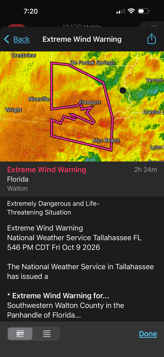
For the EWW issued in FL now. EWW is defined to expect winds *sustained* 115 mph (not gusts). Look at the plot attached. What are the chances of sustained winds this strong *anywhere* but the immediate coast, say within 5 mi? Due to friction, sustained winds drop off very, very quickly once inland. And for a hurricane that is right at the threshold of 115 mph for winds over *water*, you are going to be hard pressed to even see such sustained winds anywhere on land. It goes to show how warnings often are overdone and do not account for obvious factors, like how strong a hurricane is, how large or fasting-moving it is. or how far inland locations are. Objectively, getting winds 115 mph sustained more than a few miles inland at near ground level is practically unheard of more than a few miles inland. Exceptions would be Andrew, Michael and Camille, but Isaias is no where near any of them. You can't treat hurricane landfalls as one-size-fits-all. We have the skill, knowledge, and tech to fine-tune things better and narrow down warning areas these days. And it is not like people this area of the FL PH are not already warned the wazoo a hurricane is making landfall. That very fact has already resulted in major action and lock downs, so people are more than prepared. The word "hurricane" in itself prompts immense action.
-
i had the heat on in my place very chilly at night i suppose i could close the windows that might help..
-
it did not fall apart as some on this forum were suggesting as it makes landfall..
-
 generic semaglutide: semaoraldirect - rybelsus bottle
 -
2026-2027 Fall/Winter Mountain Thread
Buckethead replied to BlueRidgeFolklore's topic in Southeastern States
Gorgeous sunset tonight! Sent from my SM-S948U using Tapatalk -
Not minimizing this in any way but presentation on IR and radar is degrading as it comes in. Not going to make much difference though. At least it is not intensifying right up until landfall. Jet interaction, trof and vorticity interaction will maximize wind and maximize it well inland as well. There is little weather once that northern eye wall plows ashore, which it is doing right now. Not much on the other side of degrading eye. Looks like a two hour window of the worst of it for a given location along the coast. Official landfall should take place around 10pm +/- 30 minutes.
-

2026-2027 Record-breaking El Nino
40/70 Benchmark replied to Stormchaserchuck1's topic in Weather Forecasting and Discussion
I think it will become more even distributed...I do agree that the EURO is overdoing the westward shift, as all guidance has been. -
The storm was expected to max near 110mph and weaken near landfall. Is that changing?
-
Watching Reed Timmer channel. They are about to be in the eyewall.
-
Gonna be rough for the next 90 min or so. Good luck. Hope all goes well for you.
-
Just a rainstorm hurricane that the southeast needed.
-
No eye.
-
https://x.com/pappenheimwx/status/2108697812766441670/video/1?s=46
-
MAMMOTH ALERT !!!! ALEET ALEET! A potent cold front will slam into the Sierra Saturday possibly mixing with moisture from Rachel which could result in some wet snow Sunday into Monday in Mammoth and Palisades with some accumulating snow at elevations above 8000 feet. Uh-oh. What will super nino moisture do to the Sierra ski resorts at high elevations like 9000 feet this winter?
-
2026-2027 Record-breaking El Nino
40/70 Benchmark replied to Stormchaserchuck1's topic in Weather Forecasting and Discussion
I was not, nor do I deny CC. -
2026-2027 Record-breaking El Nino
40/70 Benchmark replied to Stormchaserchuck1's topic in Weather Forecasting and Discussion
I'm talking 3 months from now. -
City day cancelled sunday. Will try Monday. Took off
-
Worst conditions by far currently, winds high TS sustained with hf gusts, very intense as darkness comes in! .