All Activity
- Past hour
-
give me 60s through Novie, with spot 70s.
-
Sell. Save your time for Winter. Looks like an easy whiff to me
-
Full rundown of 12Z main global non-AI for the possible E coast storm next week excluding the not yet released Euro: The 12Z UKMET, after 3 full runs in a row with an E coast “tropical cyclone”, has no TC and not even an E coast storm as the non-tropical low forms well offshore (300 miles) and then moves out NE from there to just NW of Bermuda. 12z Icon is much further offshore than its 0Z with little E coast effect. 12Z GFS is a bit closer (similar to the 0Z) but like for the 0Z the low still is far enough out to have little effect on the E coast as it then moves out. OTOH, the 12Z CMC is its first run with effects on the E coast with it getting caught 300 miles SE of the Carolinas and then then coming back WSW to Jacksonville on 10/23. That’s now an extreme outlier pending that the 12Z Euro shows.
-
Full rundown of 12Z main global non-AI for the possible E coast storm next week excluding the not yet released Euro: The 12Z UKMET, after 3 full runs in a row with an E coast “tropical cyclone”, has no TC and not even an E coast storm as the non-tropical low forms well offshore (300 miles) and then moves out NE from there to just NW of Bermuda. 12z Icon is much further offshore than its 0Z with little E coast effect. 12Z GFS is a bit closer (similar to the 0Z) but like for the 0Z the low still is far enough out to have little effect on the E coast as it then moves out. OTOH, the 12Z CMC is its first run with effects on the E coast with it getting caught 300 miles SE of the Carolinas and then then coming back WSW to Jacksonville on 10/23. That’s now an extreme outlier pending that the 12Z Euro shows.
-
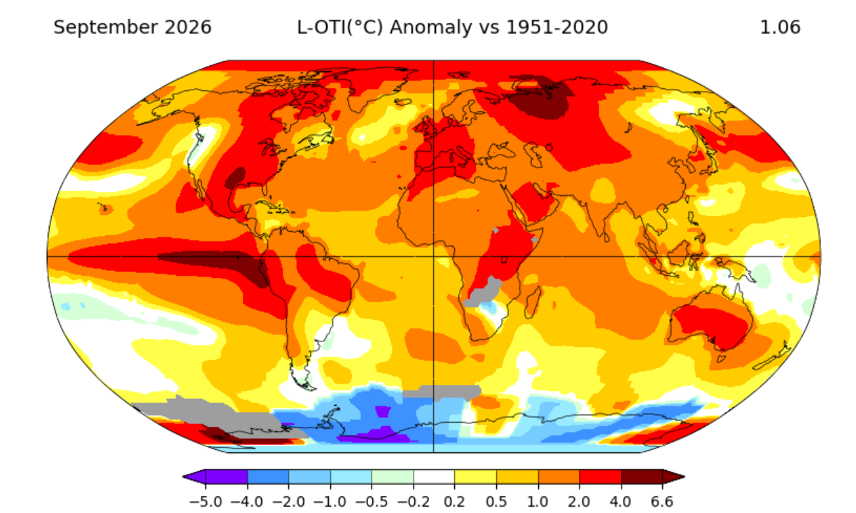
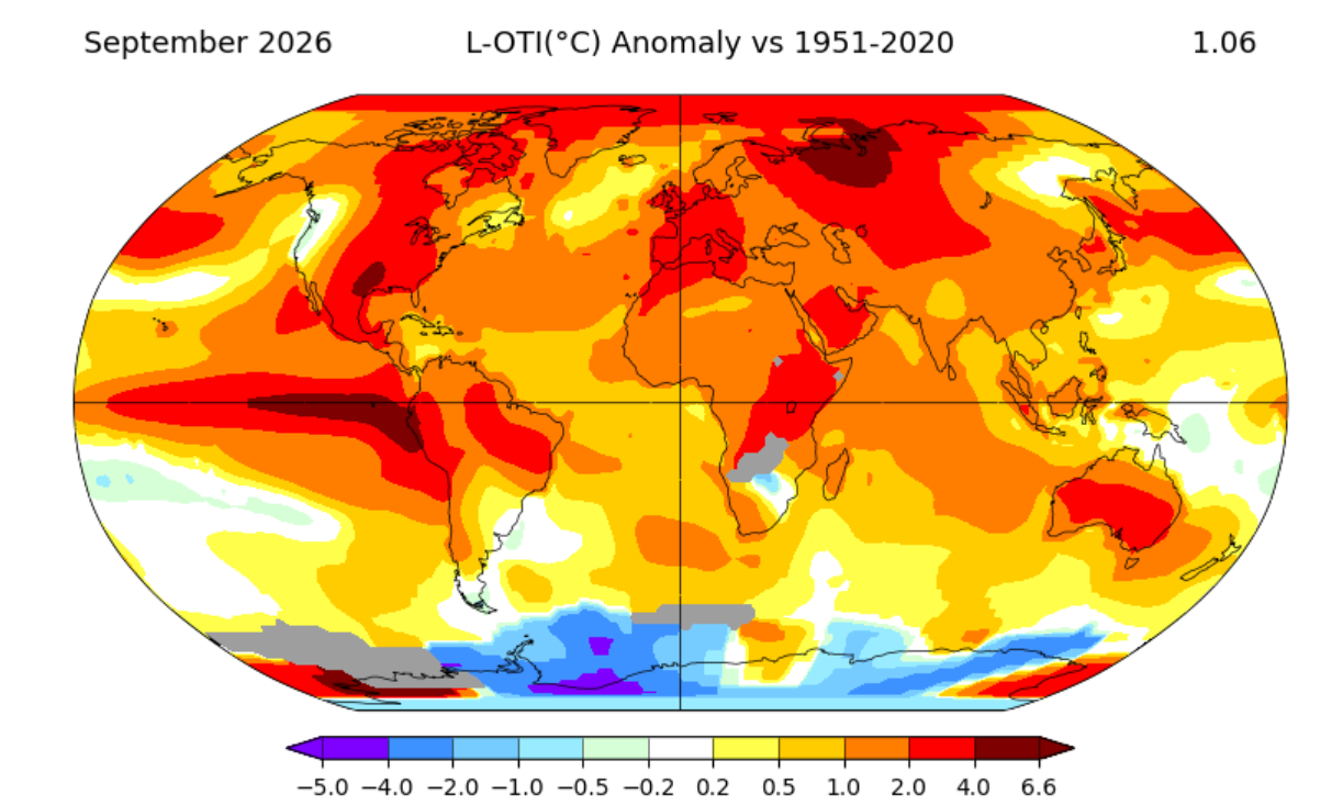
Kind of the theme since July-warm but not the warmest as that stays to our S and W
-
mm yeah thing is, it doesn't feel that way for us here in SNE .. maybe it's this 'blazing above normal' because the nights stay hot under cooler afternoon routine that's been going on since global warming began it seems ( ) - if that is the reason for that 'faux impression' my hunch is that we will be among the coolest relative to the whole, while still being above normal?
-
Seems like the early theme is in and out cold. The cold spell a week or so ago was basically one day
-
12z GEFS starting to pick up on it
-

2026-2027 Record-breaking El Nino
Winter Wizard replied to Stormchaserchuck1's topic in Weather Forecasting and Discussion
This image is textbook AI slop. The -PDO is depicted incorrectly and the QBO oscillates back and forth every year, there's nothing unusual about it. Not to mention the state outlines are distorted. No idea who this is, but IMO it doesn't reflect well on the business and any seasoned weather enthusiast can see right through it. -
Slightly off topic but looking at the drought monitor a significant chunk of the US could say the same thing.
-
generally agree but warm is an ez call imo
-
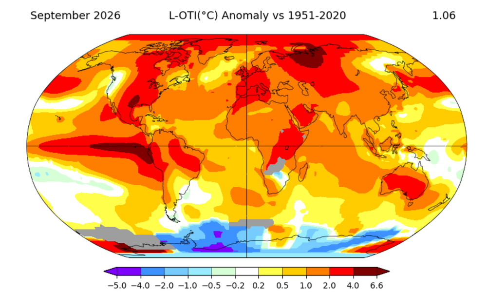
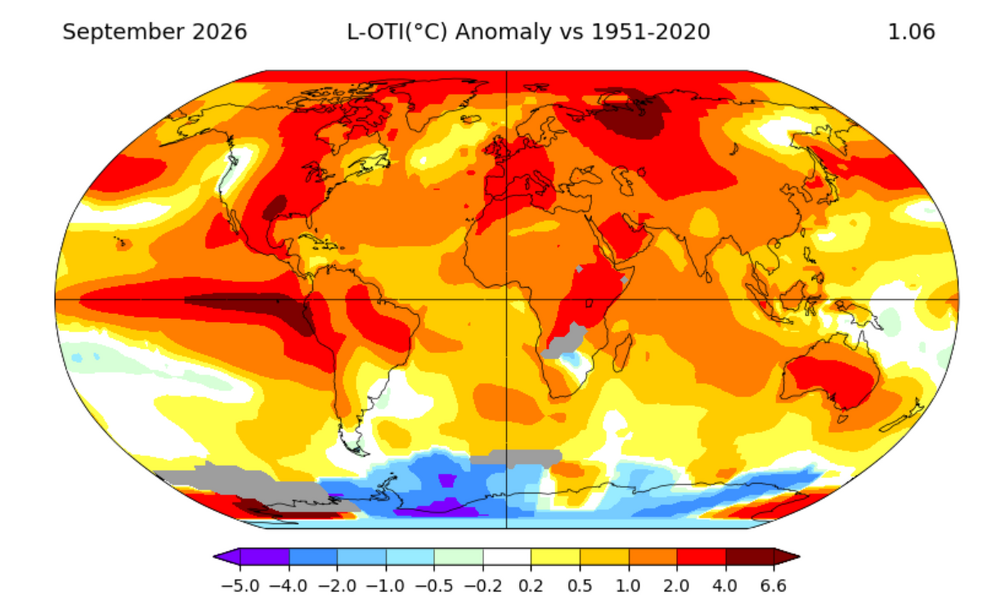
October will be another blowtorch. The whole CONUS is on fire
-
-
-
 http://mexgetrx.com/# mexico pharmacy order online free shipping
 -
Looks very mild overall for the entire US with the weekend chill sort of a blip in the warm pattern. The onshore flow and coastal low could blunt highs but should still be plenty warm.
-
Gfs and icon well west. Maybe time to track this?
-
.png.e16362594399afa030e204024362874c.png)
.png.149632c24c948ffcaa351c7959da96f2.png)
-
I would RUN with that look.
-
useless outlook, as all winter outlooks are.
- Today
-

Winter 2026-2027 Speculation
Prismshine Productions replied to 40/70 Benchmark's topic in New England
So the Euro actually is around avg for the important part but lose ground in April to show the negative anomaly Sent from my SM-S176V using Tapatalk -
-

E PA/NJ/DE Autumn 2026 Obs/Discussion
JTA66 replied to PhiEaglesfan712's topic in Philadelphia Region
lol...don't look to me Mike. I'm just a weenie, not a trained met. I think it was Oct 2015. Woke up to beautiful blue skies that morning. There was a chance of severe storms later in the day, but it just didn't feel like a "severe day". Sure enough, I (central Montco) was under a tornado warning that afternoon. Hence my "we'll see". -
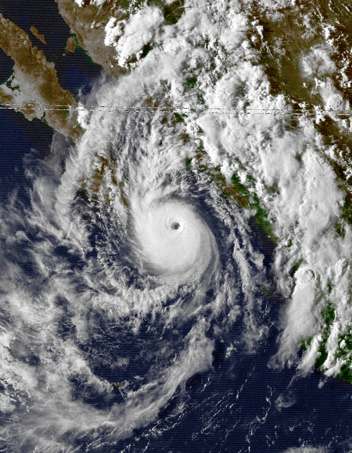
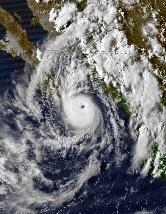
It had a 34 kt radii the other day as a HU down to 30 nm. That's on par for the smallest 34 kt radii HUs in the Atlantic. 2004-2024 avg R34 35 nm or less Jeanne 28 nm 9/16/04 Humberto 26 nm 9/13/07 Michael 35 nm 9/5/12 Lee 30 nm 9/24/17 Beryl 25 nm 7/6/18 Isaac 30 nm 9/10/18 Oscar 35 nm 10/19/24 Only hurricane that comes to mind nearly as small in the EPAC is Kiko from Aug 1989 with a ~45 nm R34, and it was in the same area as Simon (VIS image attached). On Oct 10 at 15z, Simon's R34 was as large as 110 nm in one quadrant. The storm has gained about 6 degrees of latitude since it genesis. So how does a long-lived, intense TC that gained reasonable latitude shrink so much? I read that it proximity to the Mexico coast and the downslope from high elevation just inland was a factor, but many TCs parallel close to the Pacific Mexico coast, and we do not see this kind of reduction in size. Why was Simon different here? Normally, TCs grow in size w/ time from ERCs and latitude gain.
-
Not here. We grow with wind up . Whole cold shot basically went poof