All Activity
- Past hour
-

2026-2027 Super El Nino
GaWx replied to Stormchaserchuck1's topic in Weather Forecasting and Discussion
Unfortunately, TAO doesn’t have buoy data for 160W. It has them at 170W and 155W. For July of 2015, TAO does confirm that 30C didn’t make it as far E as 155W. But it did make it to 170W at 2N and 2S though not to 5S: 2N: avg ~30.0C https://www.pmel.noaa.gov/cache-tao/sy1/deliv/data3551221/sst2n170w_dy.ascii 2S: avg ~30.2C https://www.pmel.noaa.gov/cache-tao/sy1/deliv/data3551221/sst2s170w_dy.ascii But it was <30C (~29.8C) at 5S: https://www.pmel.noaa.gov/cache-tao/sy1/deliv/data3551221/sst5s170w_dy.ascii ———————————— How does July 2026 compare to July 2015 at 170W? 2026 at 2N: avg ~30.35C or ~0.35C warmer than 2015 https://www.pmel.noaa.gov/cache-tao/sb1/deliv/data2259457/sst2n170w_dy.ascii 2026 at 2S: avg ~30.60C or ~0.45C warmer than 2015 https://www.pmel.noaa.gov/cache-tao/sb1/deliv/data2259457/sst2s170w_dy.ascii 2026 at 5S: N/A..so can’t compare ——————— Summary: TAO confirms that 2026 is currently notably warmer (~0.4C) than 2015 in July at 170W. But of course the globe has also warmed notably since 2015. -

2026-2027 Super El Nino
michsnowfreak replied to Stormchaserchuck1's topic in Weather Forecasting and Discussion
1997-98 had a cold November with multiple snowfalls. It was definitely a front loaded winter. -
 We lived in Gardiner from late October 1985 thru mid-May 1998. August 1988 compared to averages for our 13 Augusts had 3 levels: 1-13: 74° nearly 8° AN 14-18: 65° average 19-31: 59° 3.5° BN Modest temps compared to the real hot spots (instrument was within some pines), but impressive averages.
 -
 Has anyone seen these before? They’re incredibly tiny orange big/insect…whatever. Sitting outside and feeling random spots of itchiness and I’ll see a super small orange looking thing and I’m guessing they bite or something because I’ll have a tiny red bite mark. No clue where they are coming from or what they are. They’re like those tiny red bugs that leave a blood dot but these are orange and even smaller.
 -
 Yeah. As I’ve gotten older, I yearn for more of these days.
 -

2026-2027 Super El Nino
40/70 Benchmark replied to Stormchaserchuck1's topic in Weather Forecasting and Discussion
Exactly. -
 https://mexicotoppharmacy.icu/# best mexican pharmacy online
 -
2026-2027 Super El Nino
40/70 Benchmark replied to Stormchaserchuck1's topic in Weather Forecasting and Discussion
Very feasible....I don't debate that. -

2026-2027 Super El Nino
snowman19 replied to Stormchaserchuck1's topic in Weather Forecasting and Discussion
-
https://mexicotoppharmacy.icu/# best mexican pharmacy online
-
2026-2027 Super El Nino
40/70 Benchmark replied to Stormchaserchuck1's topic in Weather Forecasting and Discussion
I think it would be warmer if El Niño DIDN'T take over entirely. Anyway, all I said was El Niño still has work to do....I never even implied that there is no chance that it will not take over the hemisphere entirely this fall. -

2026-2027 Super El Nino
mitchnick replied to Stormchaserchuck1's topic in Weather Forecasting and Discussion
Irrelevant then. Wrong forum anyway. -
 Going by too fast.
 -
The bay/river boundary pushing across ffx county is desperately trying to get a storm going up over Reston. Have watched it grow for the past 10 minutes.
- Today
-

2026-2027 Super El Nino
TheClimateChanger replied to Stormchaserchuck1's topic in Weather Forecasting and Discussion
It says hottest month "on record" - official NOAA/NCEI records date to 1895. -
Beautiful day today. Sun feels strong. Hard to believe MET summer is just about 1/2 over.
-
2026-2027 Super El Nino
mitchnick replied to Stormchaserchuck1's topic in Weather Forecasting and Discussion
Except the United States just celebrated 250 years and your graph only goes back to 1900, soooo.... -
Why not both.gif
-
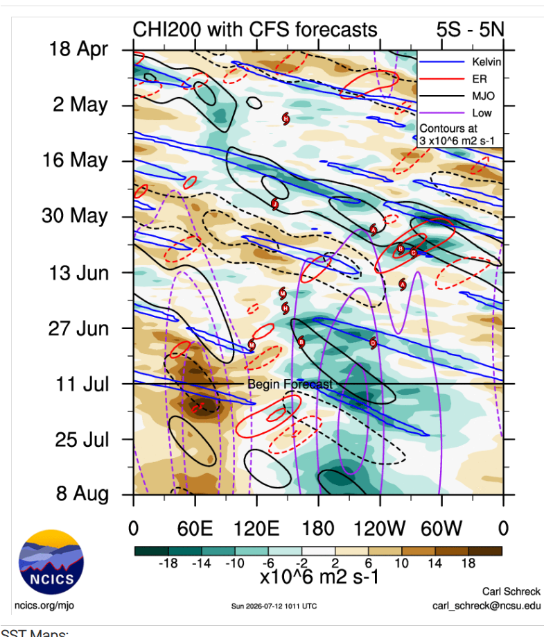
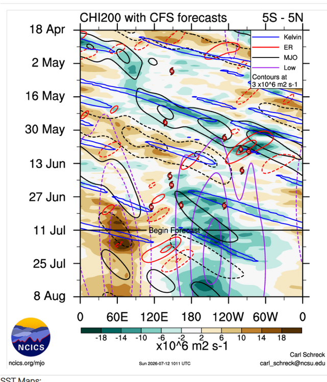
DWKW the next couple weeks could possibly expand or even rise those SST anoms from +8C IN the east
-
You say the same thing every year. Never happens.
-
.23 so far for today and .74 for the event here. Not as much as you guys, but still beneficial.
-
I hit 100.9 at home at 2:24PM today and then 101.1 at 2:35PM, which are the hottest I’ve seen on my thermometer so far this summer! The good news though is that I’ve already heard thunder and prospects for a much cooler late afternoon than the prior 3 days are very high due to outflow boundaries from nearby thunderstorms at the least, and probably also actual rainfall. It has already dropped to back quite a bit with 96.9 as of 2:51PM due to increased clouds and popups nearby.
-
2026-2027 Super El Nino
TheClimateChanger replied to Stormchaserchuck1's topic in Weather Forecasting and Discussion
I made this nifty graph to track the ongoing push for what could become the hottest month on record for the contiguous United States. Through July 10, PRISM had the national temperature anomaly at roughly +2.12°F relative to 1991–2020. Based on observed temperatures and the current NBM forecast, my provisional estimate rises to around +2.60°F through July 21. Obviously, that figure remains subject to change as observations come in and forecasts evolve. The historical significance would be difficult to overstate. July 1936 still holds the national record at +2.38°F and represents the oldest surviving warm-month temperature record in U.S. weather history. July 2012 came extraordinarily close at +2.34°F, but fell just short. So this is not merely a run at another monthly record. It is a serious challenge to one of the most famous and durable benchmarks in the American climate record—one that has stood for 90 years. -

2026-2027 Super El Nino
jaxjagman replied to Stormchaserchuck1's topic in Weather Forecasting and Discussion
We had a -PDO in the strong NINO of 57-58,we just had some good North Atlantic blocking,it was quite cold in the TnValley,maybe Global warming is a player now which seems possible,but that was quite unusual when you see waterways in Mid Tn freeze up in J/F,it that happens agin who knows -

Spring 2026 Pattern Discussion Thread
Carvers Gap replied to Carvers Gap's topic in Tennessee Valley
Kind of rainy, cool, very humid day here at TRI. We used to get these a lot. Nice to see them every once in a while. Heavy rains have fallen in the foothills near Greeneville as others have noted.- 350 replies
-
- 1
-

-
- severe
- mountain snow
- (and 1 more)