All Activity
- Past hour
-

The Return of the 12/5 Snowstorm
midatlanticweather replied to SnowenOutThere's topic in Mid Atlantic
Any chance for high ratios? LOL! Get every bit out of it we can squeeze! -
Bumped up again, now 65% chance at 4", a 38% chance at 6" and a 10% chance at 8". NWS bumped forecast to 3-6 total.
-

December 2025 Short/Medium Range Forecast Thread
nrgjeff replied to John1122's topic in Tennessee Valley
This system will probably do more than Monday night Tennessee north of I-40. Not everywhere, but more places esp northeast Tenn. More I mean snow. Fortunately the ice looks trace again. Regrettably I don't have time to write more. Good luck up there! -
He got banned over some nonsense in that moronic OT thread. So ludicrous. Supposed adults acting like children.
-
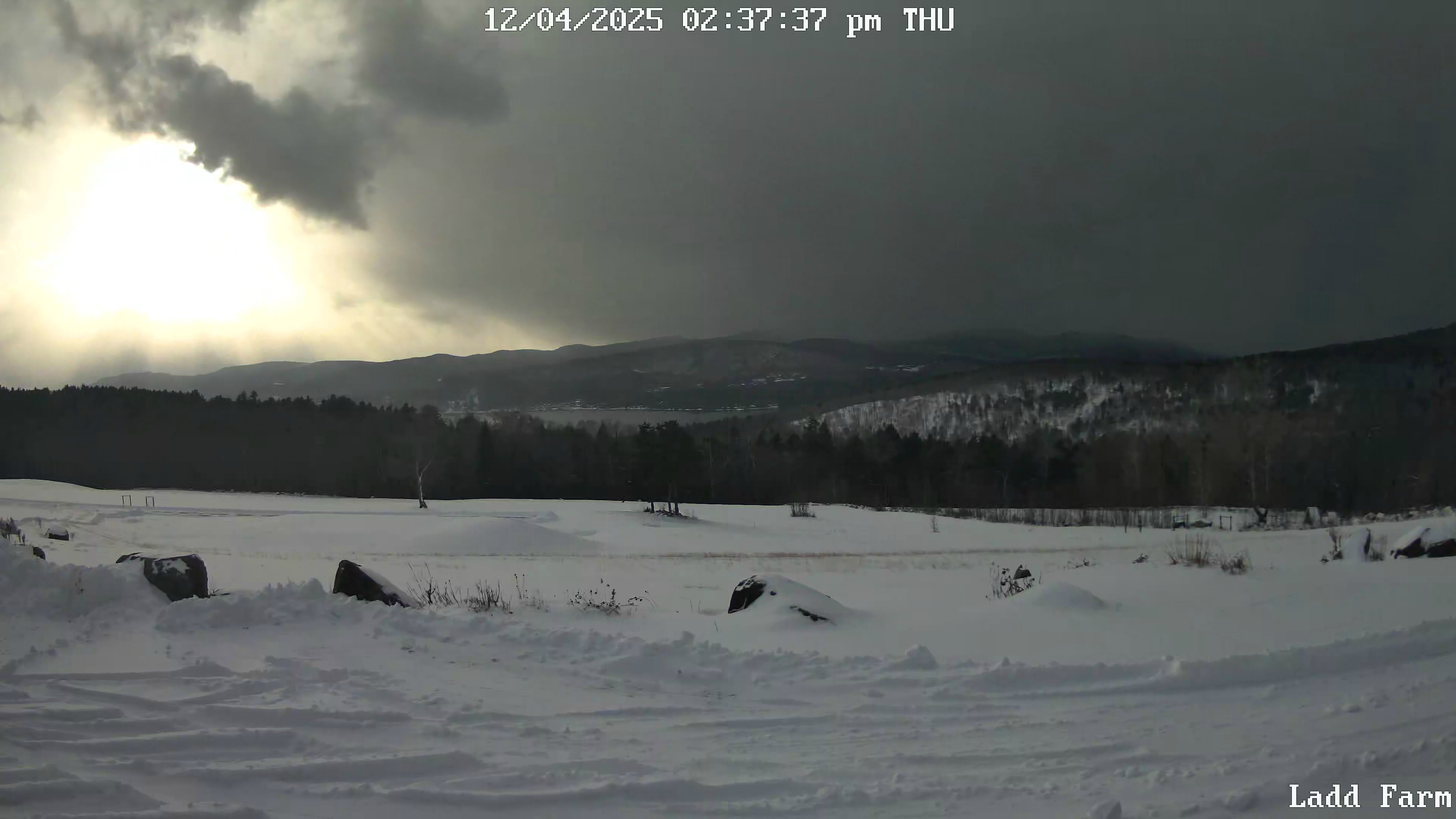
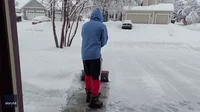
Extreme snow squall in progress. Captured this image from my neighbor's webcam. Right now vis is 1/16th of a mile. When I can't see the other side of my pasture we know that heavy rates are happening.

-
I did not know he was deliberately away what happened?
-

December 2025 regional war/obs/disco thread
weatherwiz replied to Torch Tiger's topic in New England
yeah has a nice little axis of precipitation from E CT on east -

December 2025 regional war/obs/disco thread
Kitz Craver replied to Torch Tiger's topic in New England
Norlun? -
Here too. Happy Holiday season to you guys and the kids!
-
December 2025 Short/Medium Range Forecast Thread
Scottie16 replied to John1122's topic in Tennessee Valley
Was supposed to warm up to 47 imby. Currently sitting at 41.6. . -
I am currently playing this game in the background
-
We want MATT back. @stormtrackerright the injustice. It's a travesty he isn't here tracking snow with us. We want him back.
-
Maybe I’ll get some sympathy flurries
-
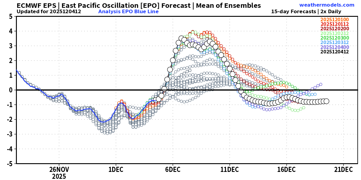
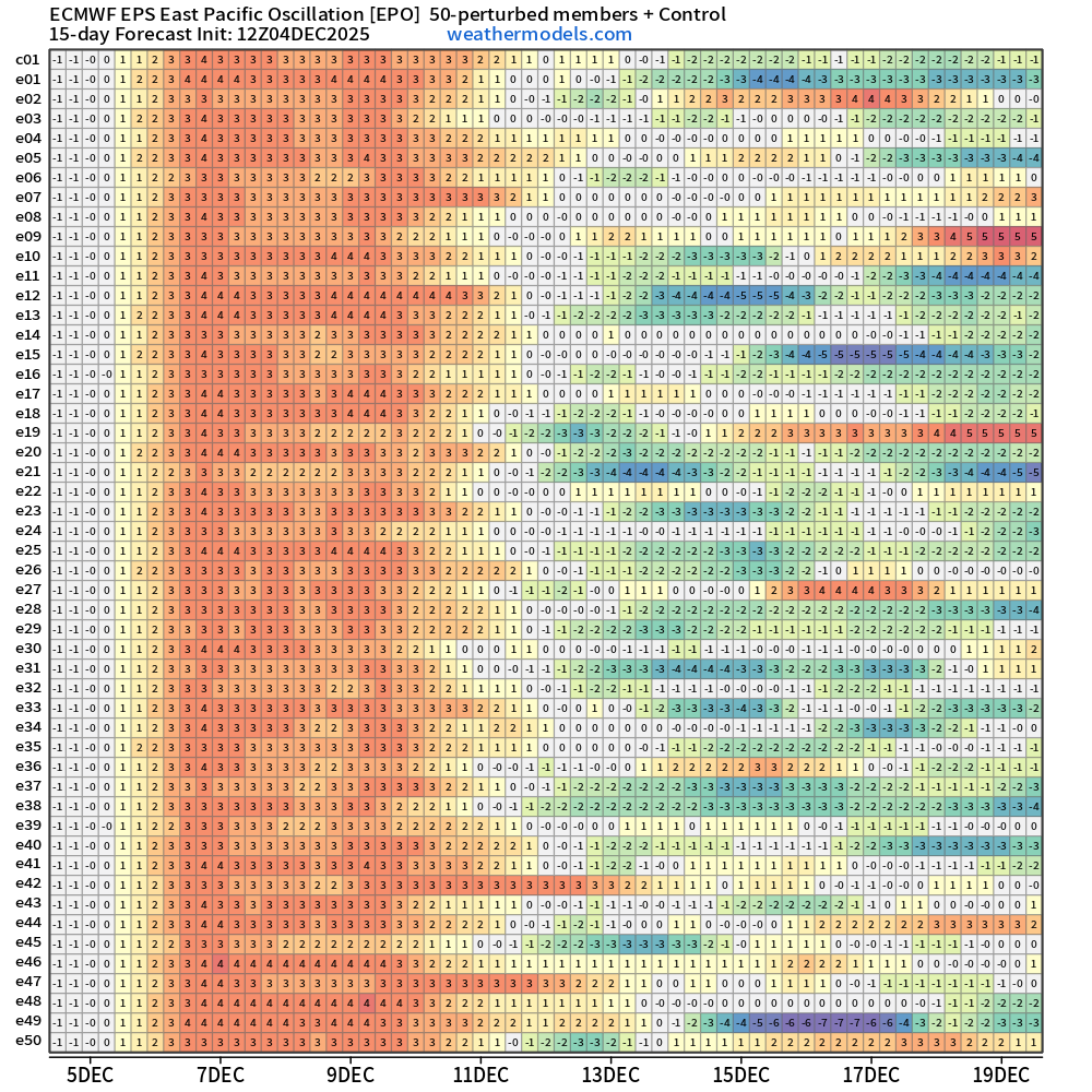
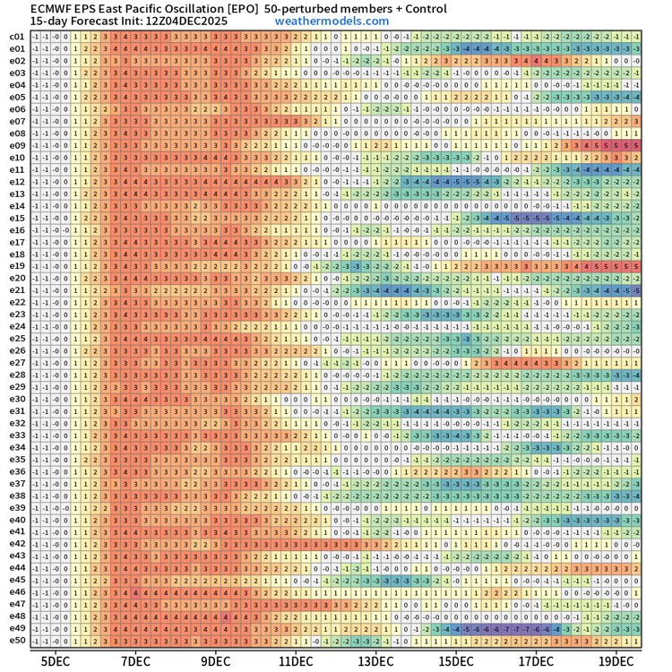
I agree that the -WPO will remain the most dominant influence on the cold through mid-Dec. However, there are increasing indications that in the 10-15 day period (Dec 13 and beyond), the center of the most anomalous ridging will shift significantly NE from the Kamchatka Peninsula/western Bering Sea to the Bering Strait, with the eastern extent of positive anomalous also shifting notably eastward into AK and even parts of the Northwest Territories. Combined with the increased negative anomalies north/NE of Hawaii and below normal heights over the NE US, that suggests a -EPO. This more eastward position of the ridging could theoretically allow the most anomalous cold air to be directed toward the NE US beyond Dec 15, though the lack of ridging over Greenland and the relatively northward position of the polar vortex indicated by the guidance e.g. north of Hudson Bay (I am mainly speaking about EPS and GEPS) would counteract this.
.gif.a7b5443c643c60e78590fb210957cf8c.gif)

-
Jesus the front must be coming through here. It’s like whiteout conditions
-
trust me when I say that you didn't miss much. about 5 mins of snow, nothing crazy, with 0.000000000000 accumulating
-
I don’t think the precip gets out of here as early as 9-11am. Probably lingers through mid afternoon
-
10:1 18z NAM Kuchera for fun
-
Agreed! I wasn't even really ready to get in to storm tracking mode and I find it hard hard to believe we'll see any accumulation. But it looks like it's coming.
-
Maybe add an extra hundredth lol... but this is the QPF from 18z NAM
-
-
Still light snow around at hr 24
-
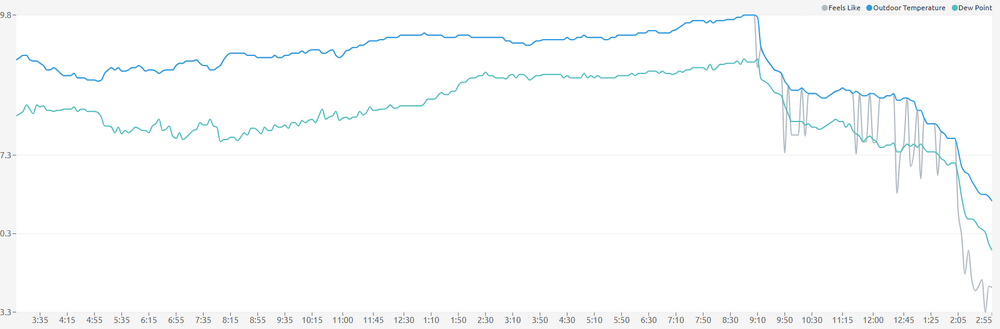
From 30° at 9:00 am to 13° now
-
Damn right, you can feel it
-
3k pretty nice as well. Looking good for an 1"