All Activity
- Past hour
-

October Comes Early: Late September Multi-Hazard Hybrid Storm
kdxken replied to WxWatcher007's topic in New England
While you're sifting through data please verify or debunk the 50 kt gust at Logan. -

Strong Nor'Easter/Hybrid Storm Late September 2026
TriPol replied to Rjay's topic in New York City Metro
From what I'm seeing, the storm is going to move due north and dissipate over central new york. -

October Comes Early: Late September Multi-Hazard Hybrid Storm
dendrite replied to WxWatcher007's topic in New England
I’m disappointed to see Kevin’s station still online this morning. Inversions are a biatch. -

Strong Nor'Easter/Hybrid Storm Late September 2026
GaWx replied to Rjay's topic in New York City Metro
Suffolk power outages have increased to the highest I’ve seen there for this storm at 3.2% or 20.6K: https://poweroutage.us/area/county/830 —————— Also: due to visibility Due to WEATHER / LOW VISIBILITY, there is a Traffic Management Program in effect for traffic arriving La Guardia Airport, New York, NY (LGA). This is causing some arriving flights to be delayed an average of 51 minutes. To see if you may be affected, select your departure airport and check "Delays by Destination". Delays by Destination: Due to WEATHER / LOW VISIBILITY, departure traffic destined to La Guardia Airport, New York, NY (LGA) is currently experiencing delays averaging 51 minutes. -
-
October Comes Early: Late September Multi-Hazard Hybrid Storm
dendrite replied to WxWatcher007's topic in New England
He’s getting served divorce papers as I type this -

Strong Nor'Easter/Hybrid Storm Late September 2026
SnoSki14 replied to Rjay's topic in New York City Metro
Models really adamant on a lot more rain later as storm moves SW of us. -
October Comes Early: Late September Multi-Hazard Hybrid Storm
dendrite replied to WxWatcher007's topic in New England
When I said “weenie” Wellfleet site I didn’t mean it was wrong or incorrectly sited. Just that it’s in a perfect elevated spot to maximize wind. They’re the peak wind in a lot of events. The one on Block Island is on a bluff too (Mohegan Bluffs) but I’m not aware of any elevation there near 150ft. Maybe there is and I’ll eat my hat. -

2026-2027 Fall/Winter Mountain Thread
Met1985 replied to BlueRidgeFolklore's topic in Southeastern States
First 30s of the season! Got down to 39 degrees! -
2026-2027 Record-breaking El Nino
GaWx replied to Stormchaserchuck1's topic in Weather Forecasting and Discussion
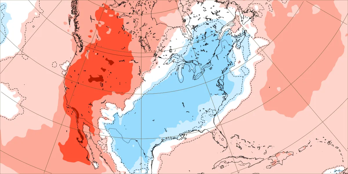
Oct 5-11 has been similarly cool/warm in the E/W 1/2 of the U.S. for 4 runs: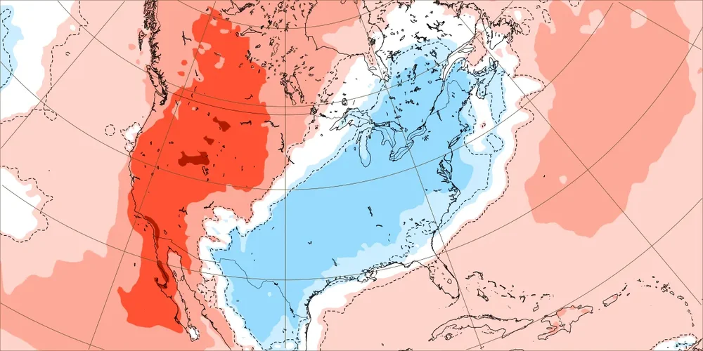
-

October Comes Early: Late September Multi-Hazard Hybrid Storm
SouthCoastMA replied to WxWatcher007's topic in New England
he's getting slammed -

2026-2027 Record-breaking El Nino
LakePaste25 replied to Stormchaserchuck1's topic in Weather Forecasting and Discussion
Everything is playing out like I envisioned with this record breaking event. We will be relying on that convection moving west after December. Hopefully we can squeeze in a lake effect event in November. -
October Comes Early: Late September Multi-Hazard Hybrid Storm
kdxken replied to WxWatcher007's topic in New England
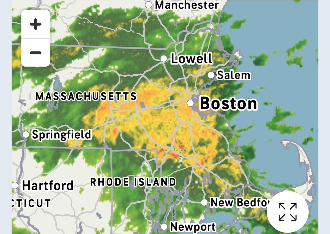
Western suburbs of Boston making up for lost time.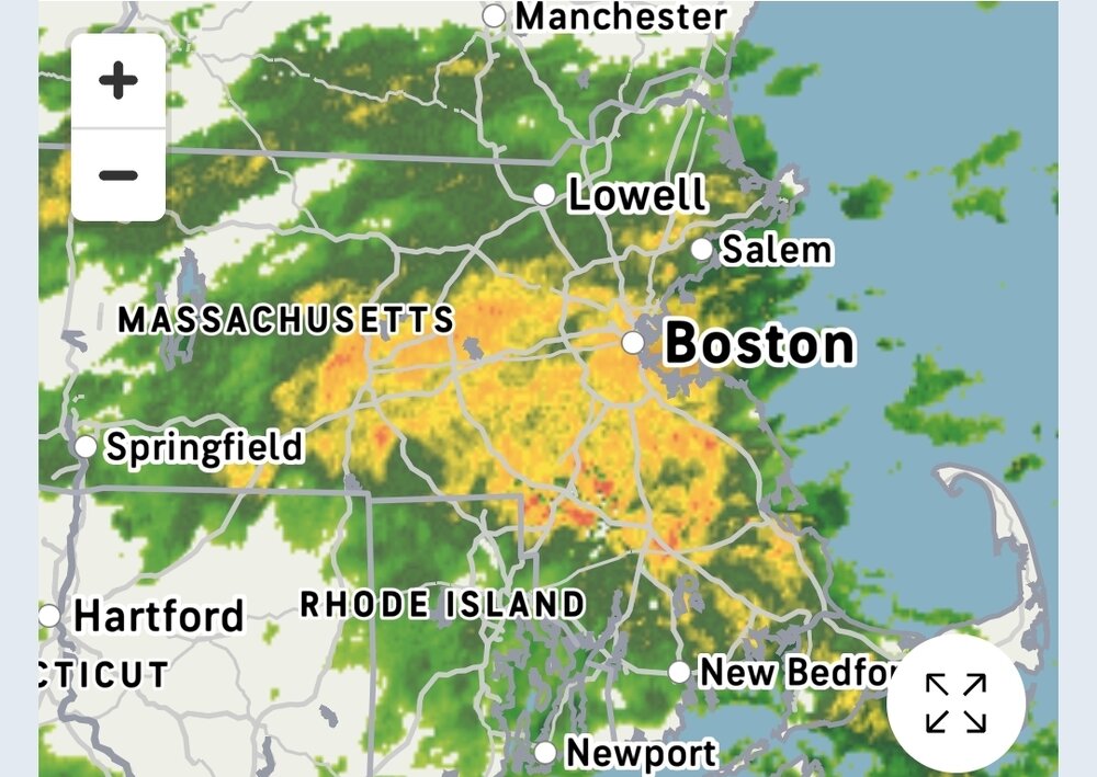
-

Strong Nor'Easter/Hybrid Storm Late September 2026
qg_omega replied to Rjay's topic in New York City Metro
not even a wind gust above 40 here, didn’t even get many leaves off the trees in the yard. In terms of Nor’easters this doesn’t even make the top 10 doesn’t even really make the list -
October Comes Early: Late September Multi-Hazard Hybrid Storm
kdxken replied to WxWatcher007's topic in New England
Waiting for Tblizz to come on and post that he's nearing an inch. -
October Comes Early: Late September Multi-Hazard Hybrid Storm
qg_omega replied to WxWatcher007's topic in New England
Euro 925 winds overnight for Long Island and CT didn’t really occur…. Lower atmosphere was very stable and cold or the storm was weaker than expected. Overall down here outside Saturday morning high tide right in the usual spots this was a below average Nor’easter. -

Strong Nor'Easter/Hybrid Storm Late September 2026
MJO812 replied to Rjay's topic in New York City Metro
Cloudy -
.thumb.jpg.aec747d13df1d95d5fed34574f74d4fd.jpg)
October Comes Early: Late September Multi-Hazard Hybrid Storm
Vinny Findley replied to WxWatcher007's topic in New England
3.78" in Cranston. 1.2" of that this morning just before day break in an hour. -
October Comes Early: Late September Multi-Hazard Hybrid Storm
kdxken replied to WxWatcher007's topic in New England
For the entire storm? -

Strong Nor'Easter/Hybrid Storm Late September 2026
EasternLI replied to Rjay's topic in New York City Metro
Yeah surprised winds weren't higher than that overnight. Not complaining -
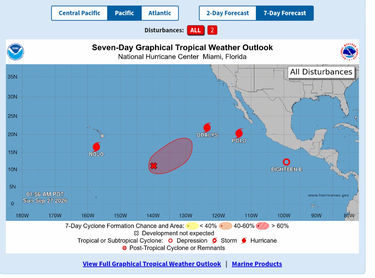
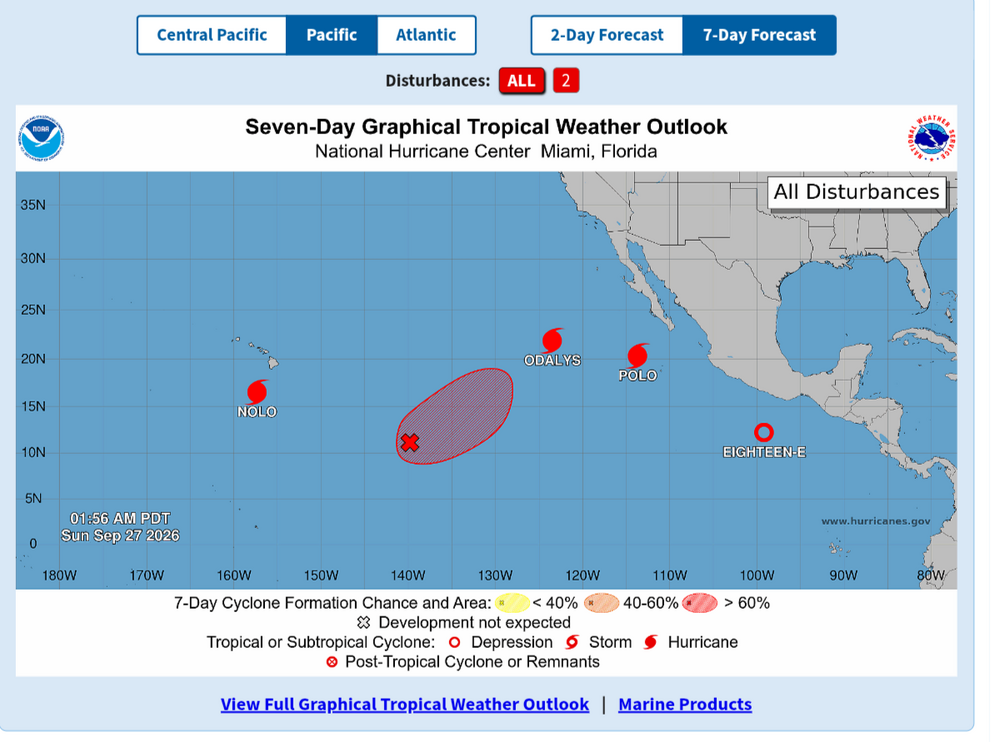
Classic rainy fall morning here in the tropical lowlands. Looks like a rainy day DC and east.
-
October Comes Early: Late September Multi-Hazard Hybrid Storm
SouthCoastMA replied to WxWatcher007's topic in New England
yeah Bourne/Wareham and to the west gotta be between 5-6". Just hit 4" here. -

Strong Nor'Easter/Hybrid Storm Late September 2026
Intensewind002 replied to Rjay's topic in New York City Metro
Winds were stronger last night, but this is the strongest they've been during part 2 of the storm (well around 6 am its dying down a bit now). Haven't seen any gusts that justified the hww overnight -
.thumb.jpg.6a4895b2a43f87359e4e7d04a6fa0d14.jpg)
Central PA Autumn 2026
Yardstickgozinya replied to canderson's topic in Upstate New York/Pennsylvania
Apparently, we've already experienced the worst of the winds in our area according to the discussion. The aviation forecast doesn't seem to agree with that idea I expected a little more in the wind department, but i'm not complaining.. Not sure if anyone caught the sunset last night ,but for my pov, it was quite beautiful. It wasn't the most vibrant, but It was very Mackereled and marbled with textures ,soft pinks and blues. I couldn't help but to think of the great Bob Ross. Area Forecast Discussion National Weather Service State College PA 440 AM EDT Sun Sep 27 2026 .WHAT HAS CHANGED... * No more wind advisory threat. * Bumped PoPs up over the western half of the CWA today. * Lowered dewpoints (again) today. && .KEY MESSAGES... 1) Nor`easter filling as it sits along the NJ coast. 2) Tranquil conditions expected for the first half of next week with a slight warming trend emerging across the region. && .DISCUSSION... KEY MESSAGE 1: Nor`easter filling as it sits along the NJ coast. The nor-easter center is just off NJ and will circulate back to the shoreline before sliding to the east and north later tonight and Monday. It is already starting to fill and will do so very slowly today and as it moves away. The wind and gusts will start to decrease a bit through the daylight hours, and will do so even more tonight. The loosening pressure gradient will mean that the threat for nearing wind advisory criteria over any of our counties is all but over. We did knock a couple degs off the dewpoints for today as the NBM has been consistently too high over the past 2-3 days. Despite this, the bands of rain should go farther to the west than Sat - so we bumped the PoPs to categorical for most of the CWA east of route 219. The rain may not quite reach the ground in the western layer of zones, but some hit the ground locally despite the lower-than-forecast dewpoints on Sat. Cool air is locked in, and maxes will be only 55-65F - coolest NE. QPF is looking heaviest just about where it was on Saturday - the Lower Susq. Someone might pick up another inch, but most likely not. Even so, the FFG is high enough to not have flooding even be a thought. Conditions will improve tonight and Monday morning. By noon Monday, there should only be isolated --SHRA over the NE and the wind will not be notable. Temps rise slightly from Sun, but will still be cooler than normal. ----------------------------------------------------------- KEY MESSAGE 2: Tranquil conditions expected for the first half of next week with a slight warming trend emerging across the region. Dry conditions will continue into Thursday as the front anticipated to be arriving late Wed/night will be delayed for a day or so. It will pick up some moisture from the remnants of Polo. But, that precip probably stays to our W until Thursday. All model guidance trends towards a warming trend in this timeframe, with above-average temperatures prevailing area wide for the balance of the week. Someone may hit 80F before Friday. Details on timing and intensity of rainfall are not easy to pin down at this range and with the upcoming pattern. So, we`ll just make a gradual increase in PoPs Fri-Sat-Sun. && .AVIATION /08Z SUNDAY THROUGH THURSDAY/... It appears that dry conditions will prevail overnight for most, with the bulk of model guidance keeping ceilings above VFR. The main concern for the rest of tonight will be LLWS at eastern TAF sites as surface winds decrease to less than 10 knots while winds at 2000 feet remain around 40 knots. Rainfall appears to be more widespread after 15Z with the the nor`easter closer to the NJ Coast. This will bring a higher potential for lower ceilings and visibilities across much of the region. Ceilings and visibility should deteriorate throughout the day, with IFR conditions possible at nearly every airfield by 00Z Monday. Any showers will be quite efficient and therefore could result in visibilities dropping below 3 statute miles (categorical IFR). There remains some uncertainty with how quickly ceilings will lower, but the combination of reduced visibility when showers are most numerous and lowering ceilings after showers weaken/dissipate give confidence in a lengthy period of restrictions Sunday afternoon through the overnight hours. The location of the Nor`easter will also lead to wind gusts exceeding 20-25kts across all of central Pennsylvania on Sunday; slightly stronger gusts are likely at KMDT and KLNS (up to 35kts possible). -

October Comes Early: Late September Multi-Hazard Hybrid Storm
moneypitmike replied to WxWatcher007's topic in New England
Yes. I simply add the daily totalas. I think there's (or used to be) a way you could put in a range. Just as easy to add the days though.