All Activity
- Past hour
-
I think seasonal snowfall is bound to decline as the 20 year period from 2000-2020 benefitted from the increased moisture from CC, while still being cold enough to snow. We're no longer reliably cold enough to snow anymore so we should expect the long term seasonal average in the city to go from 25" ish to maybe 15". At the same time we have been stuck in a particularly unlucky pattern since 18-19 as bluewave says.
-
I had that pleasure when I went to Iceland last November. Landing mere miles away from a volcano erupting was a literal dream come true. Sent from my SM-G970U1 using Tapatalk
-
Getting back to today if your area gets underneath one of these storms today you might be in a flash flood area because these storms aren't moving at all. They are just training over the same areas. TN is getting hammered currently because of this.
-
The big (24" x 90') red oak near the house still thinks it's August. Nearby white ash are almost bare, red maples near full color (even away from the swamps) while sugar maple is just beginning to color.
-
12Z Icon stays OTS from US
-

September 2025 OBS-Discussion centered NYC subforum
bluewave replied to wdrag's topic in New York City Metro
Several stations had a warmer departure than Newark did this month. HVN…+2.2 PHL….+2.1 FWN….+2.0 ISP…….+1.7 SMQ…..+1.4 MPO….+1.4 EWR…..+1.3 HPN…..+1.1 TTN…..+0.6 POU…..+0.5 NYC……+0.3 JFK……..0.0 LGA…….-0.4 BDR…….-0.5 -
Lucy’d with rain… We better get a true prolonged wet pattern after the Niña breaks…
-
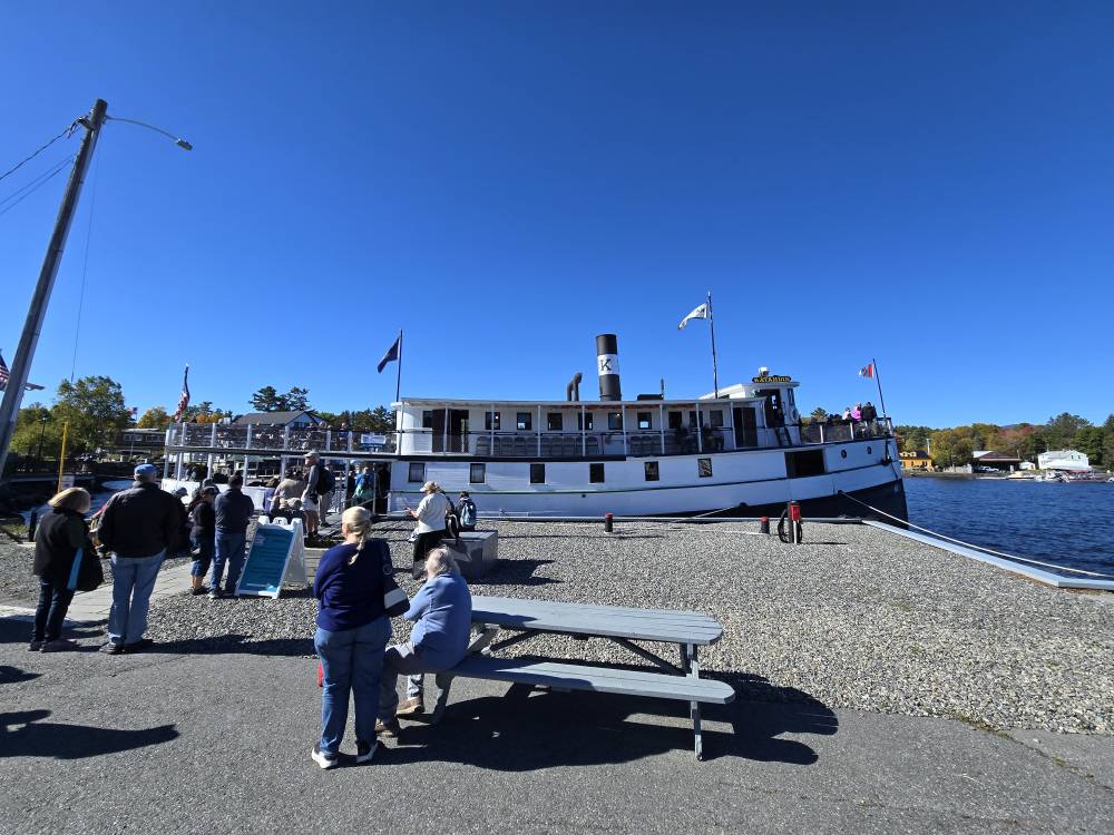
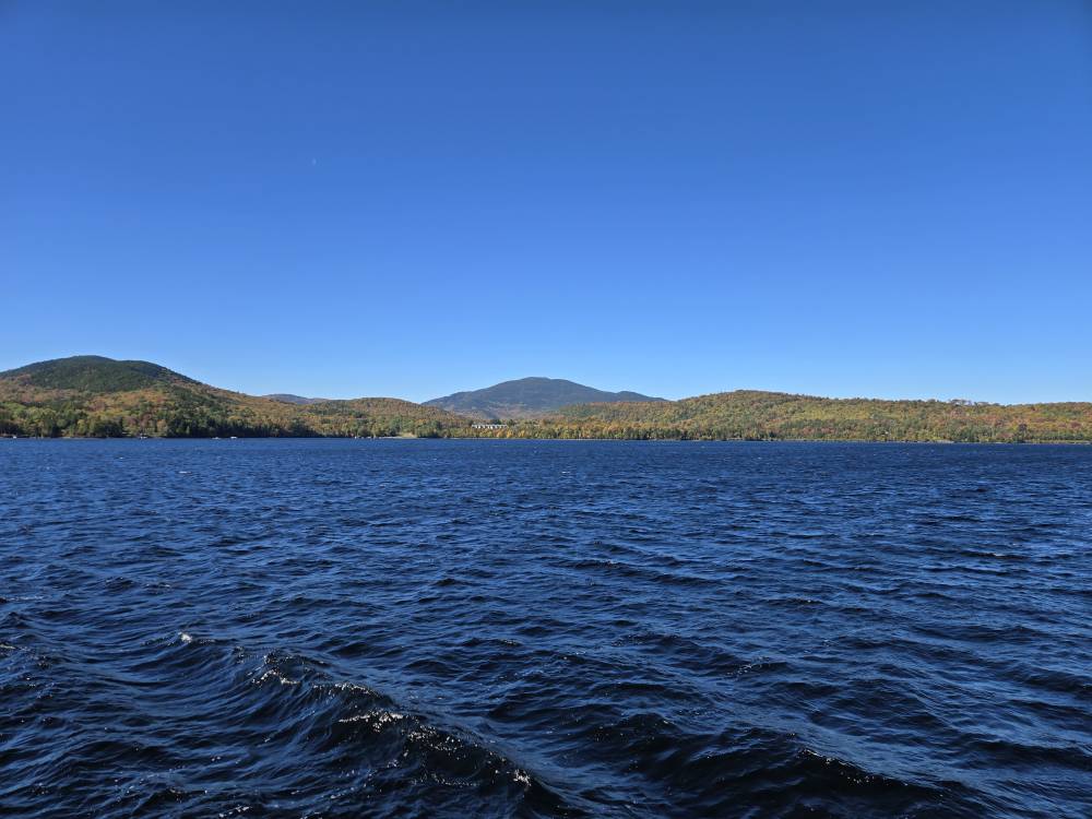
Out on the Katahdin on Moosehead. A bit brisk with NW wind but not a cloud in the sky. Sent from my SM-S921U using Tapatalk
-

2025-2026 ENSO
donsutherland1 replied to 40/70 Benchmark's topic in Weather Forecasting and Discussion
The New York City area can still see both big snowstorms and snowy winters and that will be the case for decades to come even if/as seasonal snowfall declines. -

September 2025 OBS-Discussion centered NYC subforum
anthonymm replied to wdrag's topic in New York City Metro
Yup even with 91-20 normals. I don't even understand how anyone can deny the reality at this point. -
2025-2026 ENSO
donsutherland1 replied to 40/70 Benchmark's topic in Weather Forecasting and Discussion
It has a very weak correlation. I don't think it's of much predictive value. It should also be noted that some more recent research suggests that it is lower September-October Siberian snow cover that translates into a weaker polar vortex during late winter and early spring while increased Siberian snow cover (September–October) leads to a stronger polar vortex in late winter and early spring. For example: The reduced snow cover benefits a deceleration of the circumpolar westerlies, the sea ice loss in the Barents-Kara Seas, the positive Pacific-North American pattern, and the negative Aleutian-Icelandic Low Seesaw pattern, which amplify the intensity of planetary waves propagating upward into the stratosphere. The enhanced planetary waves are characterized by the stratospheric dipole-like pattern during the preceding October and December and contribute to the continuous weakening of the polar vortex from January to March. https://www.sciencedirect.com/science/article/pii/S0169809524002898 -
Looks like he was on Little Moose Mt, and that area has a lot more spruce and fir than pine/hemlock, also very little oak. Beech tends to tarry in coloring (unless it's diseased) and some sugar maple turns significantly later than most of that species.
-
Mine produced a ton this year. Probably the most in the 9 years ive been here.
-
Very nasty bad luck over and over. Right on, if FL can score 9" KU's in this new climate regime it's OBVIOUSLY not over for the tristate.
-
Time will certainly tell, with regard to AI integration. Part of me is fearful that it will become "too good," eliminating the mystery and continuation of scientific analysis in forecasting. Maybe another thread for this topic. I'm fascinated by the current forecast evolution of this particular complex setup. This week will probably take the gold medal for most dynamic tropical forecast (regardless of land interaction,) in perhaps the past 2 seasons. Fujiwara is a thread the needle interaction with actual tropical core systems. Attempting to learn as much as I can over the next 72+ hours. This was worth the wait.
-

Central PA Summer 2025
Mount Joy Snowman replied to Voyager's topic in Upstate New York/Pennsylvania
What a beautiful day in Happy Valley. About to lose all service. Incredible scene up here. Go State! -
Honestly I think it’s totally useless but that’s just my opinion
-

September 2025 OBS-Discussion centered NYC subforum
the_other_guy replied to wdrag's topic in New York City Metro
Newark Airport…the warm cesspool of cement -
In defense of the ai models usage, it's better this year then last year from what memory remembers. . Idk how it has done with other storms, but with Erin the ai models track was so very much locked in from a very early start, from a rough aspect. As with this storm i saw the euro ai first to show a glancing blow to Carolinas then loops/meander off the coast... way before other non ai models started... Do they have more data at there resources versus conventional models? Not sure but there deft is some kinda difference, likely not obvious to the naked eye.
-

September 2025 OBS-Discussion centered NYC subforum
SACRUS replied to wdrag's topic in New York City Metro
77 / 60 but more clouds coming - race to 80 is on -
September 2025 OBS-Discussion centered NYC subforum
SACRUS replied to wdrag's topic in New York City Metro
Sep Dep's Through Sep 26th EWR: +1.3 NYC: +0.6 JFK: 0 even LGA" -.05 -

September 2025 OBS-Discussion centered NYC subforum
wdrag replied to wdrag's topic in New York City Metro
Saw the much less than modeled rainfall totals for this past week. Maybe we get more tonight and tomorrow which was in the original consideration. Still a bit dissatisfying totals -
Any TC rain hits? Any early season interior high terrain snow acc late in the month? Do we experience above normal rainfall for October?
-
Good morning Torch Tiger. I can understand the sentiment. As for Mr Epstein, I believe it’s best that he counts his blessings and keep sharing the photos. As always ….
-

September 2025 OBS-Discussion centered NYC subforum
LibertyBell replied to wdrag's topic in New York City Metro
Bob in 1991 came very close to making landfall at MTP and would have had more of an impact than Gloria did. Based on news reports at the time, I distinctly remember Gloria made landfall in Western Suffolk County, not near JFK airport. It didn't matter though because the eye was extremely large and covered all of us and there was no backside except for some gusty winds and partly cloudy skies.


