All Activity
- Past hour
-
3k gets the sleet line up to southern MA but big dump before that
-
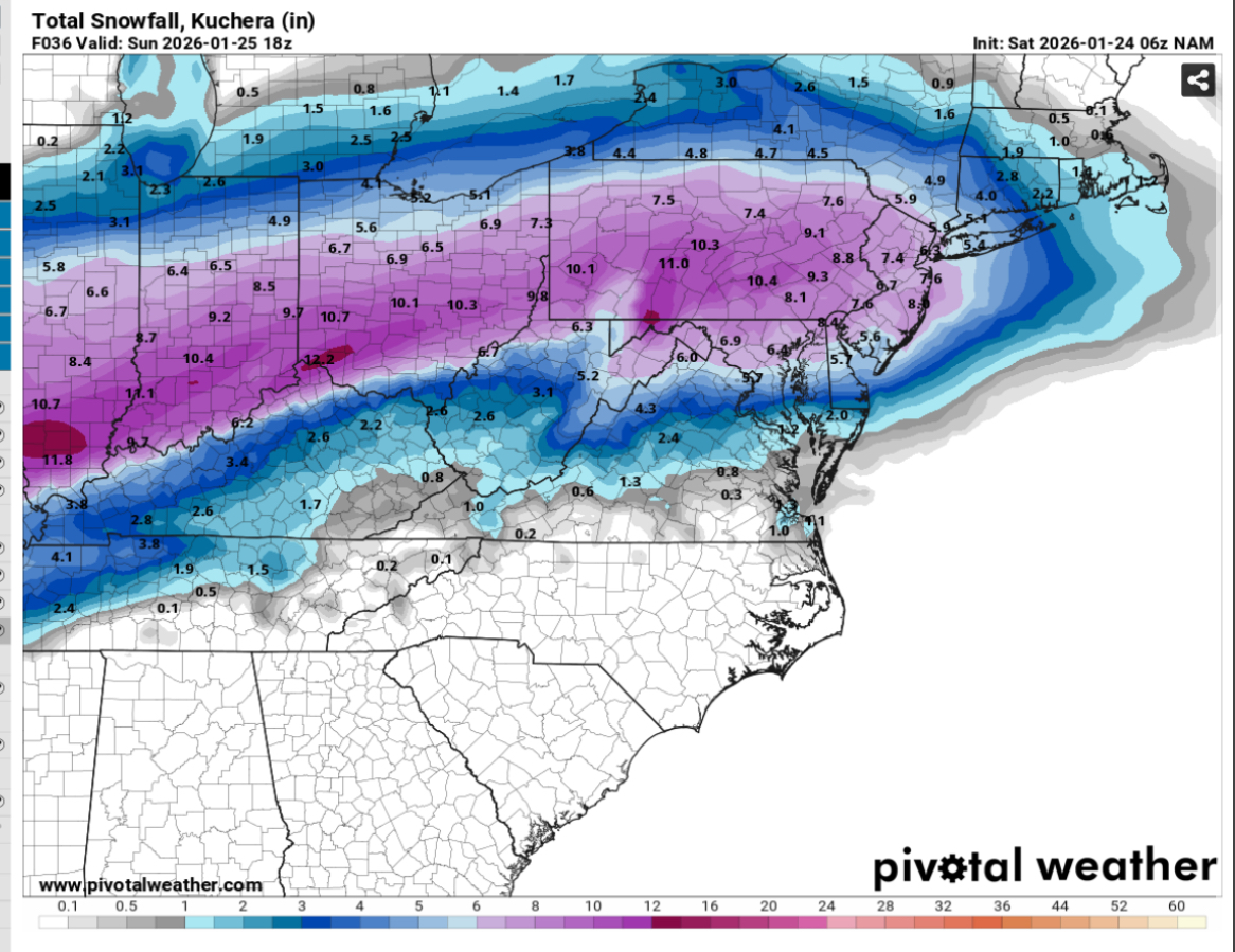
6z NAM Total qpf
-
thats how you get two feet in some areas
-
damn I wish I could lock this run in
-
Not sure what is and isn't virga on the radar, but Memphis webcams show a snow covered interstate. Jackson cams are inconclusive.
-
hr 60 still snowing should of waited for total qpf but will probably end up close
-

Texas 2026 Discussion/Observations
aggiegeog replied to Stx_Thunder's topic in Central/Western States
Very light but happy to see that the drizzle type activity here tonight is in the form of sleet. Hopefully that is the case in the morning. -
NAM increasing qpf again
-
They have the DGZ too warm for a lot of that
-

Central PA Winter 25/26 Discussion and Obs
Blizzard of 93 replied to MAG5035's topic in Upstate New York/Pennsylvania
Absolutely great to see this Euro run.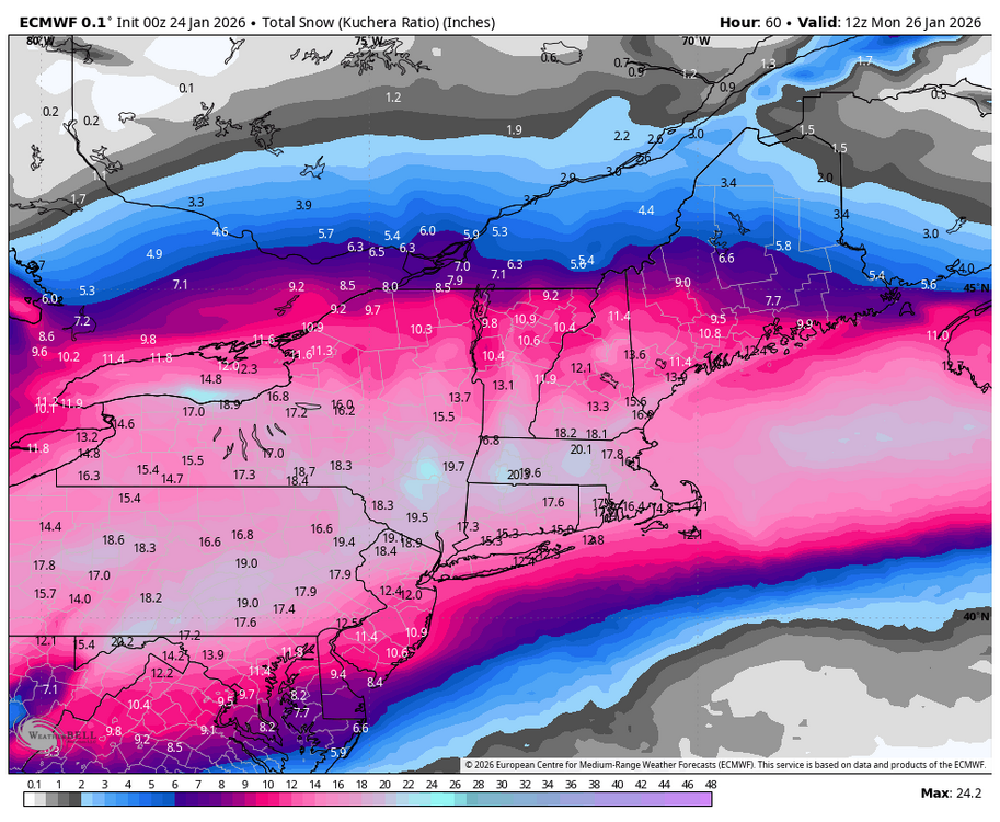
-

Possible Record Breaking Cold + Snow Sunday 1/25 - Tuesday 1/27
Snowlover11 replied to TriPol's topic in New York City Metro
6z NAM a tad bit colder for those directly on the edge. Noise at this point. -

Jan 24-26 Weekend Snow and Sleetfest Model Thread Part Tres
Weather Will replied to H2O's topic in Mid Atlantic
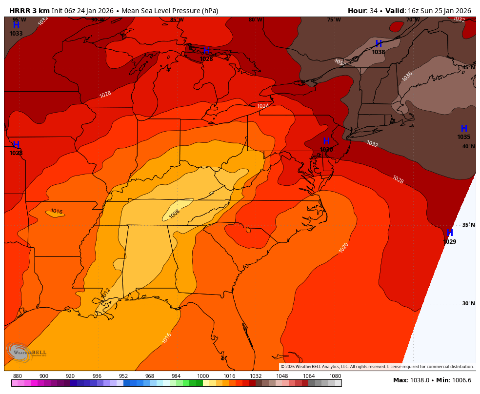
Pressure map sane time frame comparing WB 3K NAM to HRRR; not much difference.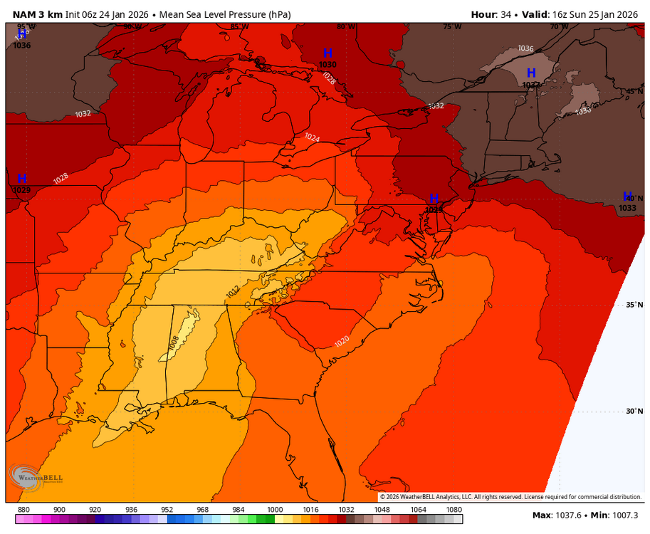

-

Possible Record Breaking Cold + Snow Sunday 1/25 - Tuesday 1/27
SnoSki14 replied to TriPol's topic in New York City Metro
6z Nam looks a lot better than 0z...much more in line with other models -
-
Jan 24-26 Weekend Snow and Sleetfest Model Thread Part Tres
Weather Will replied to H2O's topic in Mid Atlantic
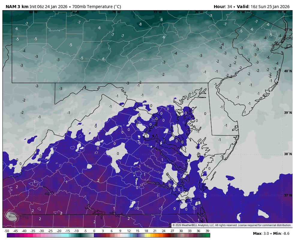
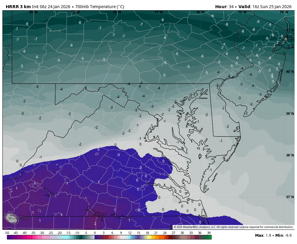
WB 3K NAM is warmer aloft than 6Z HRRR. For example, 11 am Sunday. We will see which model is wrong.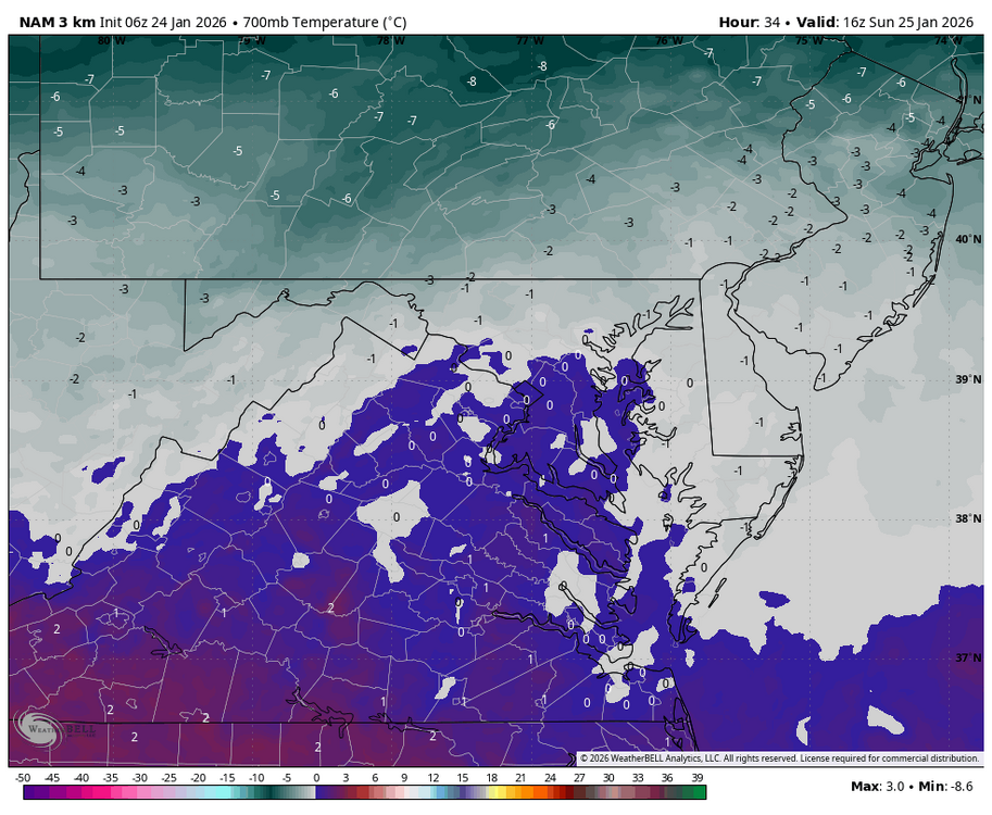

-
-

January 2026 regional war/obs/disco thread
TheSnowman replied to Baroclinic Zone's topic in New England
Yes, because it was the ONE YEAR I was home during this period of NAMM and the Grammys since they were cancelled for Covid. And WOULDN’T YOU KNOW IT…. A FAILED Disaster Storm happened. Of Course. FML. -

Jan 24-26 Weekend Snow and Sleetfest Model Thread Part Tres
TSSN+ replied to H2O's topic in Mid Atlantic
Not buying it -
Jan 24-26 Weekend Snow and Sleetfest Model Thread Part Tres
Weather Will replied to H2O's topic in Mid Atlantic
WB 3K NAM does not have the thump like HRRR. I think that is part of its problem or the reason it transitions to sleet faster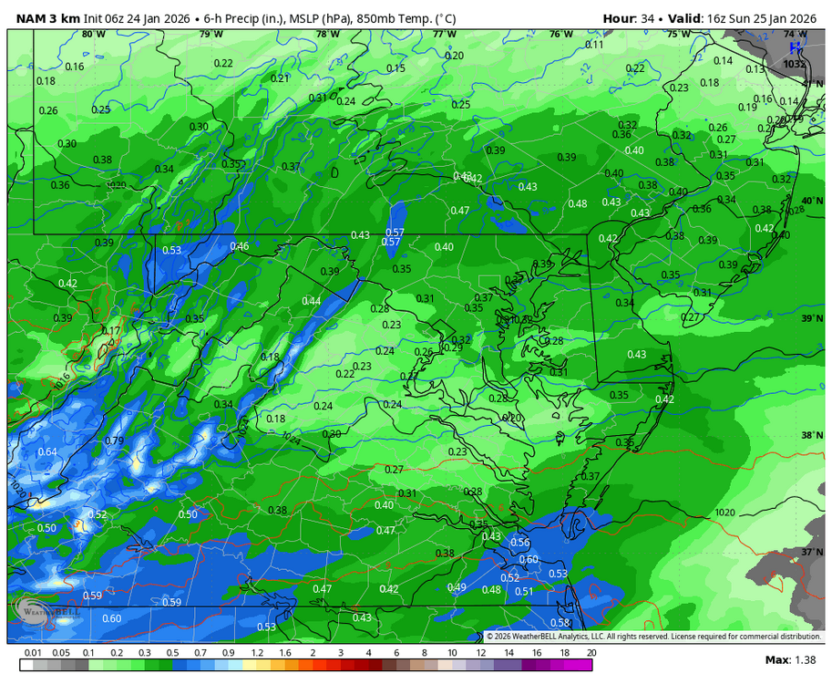
-
Jan 24-26 Weekend Snow and Sleetfest Model Thread Part Tres
TSSN+ replied to H2O's topic in Mid Atlantic
Yes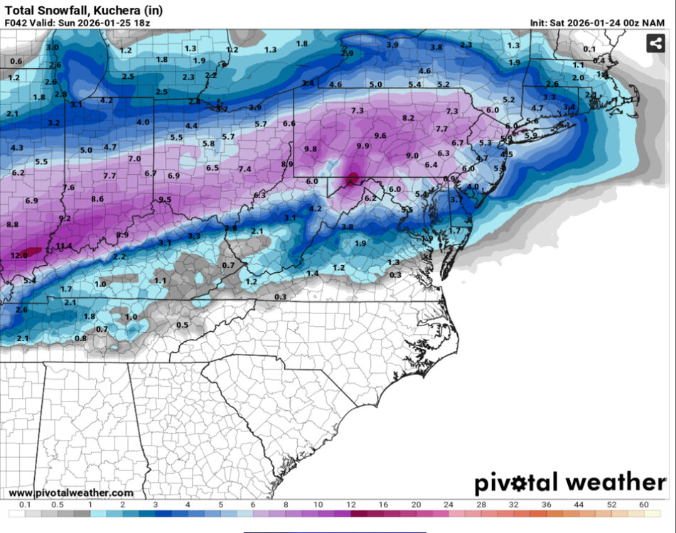

-
GRR is sitting at -16. Daily record is -20. All time is -24. There’s some -20s showing up in more rural areas nearby though. It seems like higher dewpoints are holding temperatures higher some places. It’s hard to get extreme lows here in West Michigan as normally westerly flow off the lake doesn’t diminish until the coldest core of 850 temps has passed. This is kind of a rare setup where the 850 cold pool is stalling directly overhead with light winds.
-

Jan 24-26 Weekend Snow and Sleetfest Model Thread Part Tres
Interstate replied to H2O's topic in Mid Atlantic
8.6/-6.6 -

Jan 24-26 Weekend Snow and Sleetfest Model Thread Part Tres
Maestrobjwa replied to H2O's topic in Mid Atlantic
A slight improvement, perhaps? -

Jan 24-26 Weekend Snow and Sleetfest Model Thread Part Tres
yoda replied to H2O's topic in Mid Atlantic
-
Wow TWC app radar is showing snow is currently just west of Nashville. And future shows it in knox around 8am. Not sure how accurate their future radar is.