All Activity
- Past hour
-
Hit 89 today. 89 this time of year actually feels great, especially with the lower humidity and cooler nights. Summer is back, a long with 2 more weeks of no rain for me. Dry as fuck...grass is brown, trees dropping leaves. Definitely drought conditions here.
-

2025 Atlantic Hurricane Season
RaleighNC replied to BarryStantonGBP's topic in Tropical Headquarters
Honest question - increasing SSTs would seem to make an AMO Inactive period more active than it otherwise would be, wouldn't it? -
-
I had snow last year on Christmas Eve
-
I got 2 storms in feb 2024 with 6"+
-
18 inches here Snow for 3 days
-
This is probably a dumb question. With area a little better, can that lead to more extent next season, or is there not really a correlation
-

September 2025 OBS-Discussion centered NYC subforum
FPizz replied to wdrag's topic in New York City Metro
Played 9 holes with my son. Perfect weather. -
-

September 2025 OBS-Discussion centered NYC subforum
donsutherland1 replied to wdrag's topic in New York City Metro
The weekend will see a continuation of partly sunny skies with highs mainly in the middle and upper 70s on Saturday. A few of the warmer spots could reach or exceed 80°. Sunday will be somewhat warmer with widespread highs in the lower 80s. Temperatures will top out in the upper 70s to perhaps lower 80s on Monday and Tuesday. September 1-15 remains on track to achieve a solid cool anomaly. Since 2000, there have been nine years that saw a cooler than normal first half of September. Two-thirds of those years went on to record a warmer than normal second half of September. Only two of those years (2017 and 2019) wound up with a monthly mean temperature of 70.0° or above. Overall, for two-thirds of those years, the cool start was sufficiently cool to produce a cooler than normal monthly anomaly. The last year that saw both a cooler than normal first half and second half of September was 2009. Prior to that, it was 2001. The last year to record a cooler than normal first half of September followed by a warmer than normal September was 2024. The latest guidance is continuing to evolve toward a very warm second half of September. As a result, it is plausible that the odds of a warmer than normal September could reach and then exceed 50% as early as tomorrow's guidance. The last September with a cooler than normal first half and a warm overall monthly anomaly was September 2019. The ENSO Region 1+2 anomaly was -0.3°C and the Region 3.4 anomaly was -0.4°C for the week centered around August 27. For the past six weeks, the ENSO Region 1+2 anomaly has averaged +0.33°C and the ENSO Region 3.4 anomaly has averaged -0.32°C. La Niña conditions will likely develop during mid- or late-autumn. The SOI was -1.48 today. The preliminary Arctic Oscillation (AO) was +0.382 today. Based on sensitivity analysis applied to the latest guidance, there is an implied near 51% probability that New York City will have a cooler than normal September (1991-2020 normal). September will likely finish with a mean temperature near 69.1° (0.1° below normal). Supplemental Information: The projected mean would be 1.1° above the 1981-2010 normal monthly value. -
September 2025 OBS-Discussion centered NYC subforum
wdrag replied to wdrag's topic in New York City Metro
Thank you... may take as well as well as Bluewave. We've got so many classifications of things... we've lost simplicity of when to amp interest. Folks certainly cant keep up with all the changes... Farmers are interested for sure as this did seem to stunt corn in late summer. Otherwise, I view this summer as having been sort of dull... not much SVR and very limited tropical with heat dominating JJ first week of Aug. - Today
-

September 2025 OBS-Discussion centered NYC subforum
Roger Smith replied to wdrag's topic in New York City Metro
Frederic went on to drop 4-6 inches of rain in upstate NY and east-central Ontario. I remember the month of Sep 1979 (in Ontario) as being almost bone dry apart from the one day of heavy rain and strong NE winds from then TS Frederic. Then Sep 1989 had a lot more action before Hugo followed a similar track through the Lake Ontario region and dropped similar amounts of rain (landfall in that case was of course SC). -
The last true DC-PHL-NYC-BOS corridor KU snowstorms were back in February, 2021. It shutdown at the end of that month, never to be heard from again
-
Sort of, def major for sure
-
Funny because only 5 miles SE of there 2 winters ago I got 6.5” of snow
-
I’m dying. Heeeerrrrreee’s Davy!!
-
25th straight top 10 day in a row
-
crazy nice out
-
putting in that
-
Today's best forecast goes to AccuWeather for my zone calling for increasing clouds in the afternoon versus the national weather service with totally sunny conditions. Clouds have moved in currently in the from Trenton to Philly to Wilmington, Delaware. Moving from Northeast to Southwest.
-
75/50 Lawn mowed. Prep for open house tomorrow. Awesome GSD day.
-
hey guys about 90 days until we snow
-

Occasional Thoughts on Climate Change
donsutherland1 replied to donsutherland1's topic in Climate Change
The literature is still mixed on the magnitude of its impact. Hopefully, the literature showing more than a minimal impact will ultimately be vindicated. If not, there will be the issue of whether one or more unidentified factors drove the spike. In turn, that would raise questions about whether there are things that are being missed in the climate models, factors that could potentially lead to higher sensitivity. Already, the "hot models" hypothesis has largely been settled. Those models likely have the better handle on climate sensitivity, as their cloud physics have better matched the developments that have now been observed and their scenarios are closer to the paleoclimate data for some past warming events that saw greater climate sensitivity. -
Lantern flies. Scroll up to see a video post from @astarck.
-
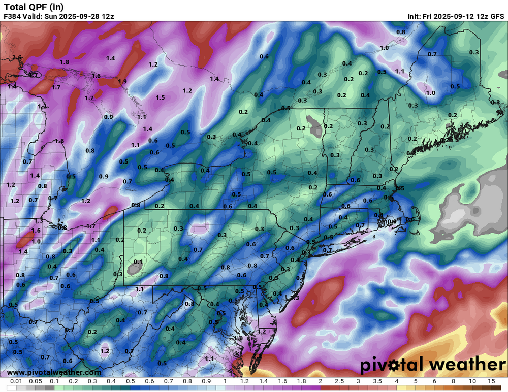
Totally different from the Euro for NNE.


