All Activity
- Past hour
-
my record low is 24. lol
-

2026-2027 Record-breaking El Nino
MJO812 replied to Stormchaserchuck1's topic in Weather Forecasting and Discussion
Pretty snowy overall on the weeklies for alot of the country going into December. Even some snow up here. -
The remainder of this week and weekend will see highs mainly in the lower 60s. Dry conditions are likely through the weekend into at least early next week. Temperatures will continue to top out in the upper 50s and lower 50s through the middle of next week. The ENSO Region 1+2 anomaly was +5.2°C and the Region 3.4 anomaly was +3.3°C for the week centered around October 7. For the past six weeks, the ENSO Region 1+2 anomaly has averaged +4.98°C and the ENSO Region 3.4 anomaly has averaged +3.12°C. ENSO Region 3.4 ties the all-time record set in the prior week. The ongoing strong El Niño, will continue to strengthen through the mid-fall. The SOI was -33.65 today. The preliminary Arctic Oscillation (AO) was +0.869 today. Based on sensitivity analysis applied to the latest guidance, there is an implied near 75% probability that New York City will have a warmer than normal October (1991-2020 normal). October will likely finish with a mean temperature near 58.9° (1.0° above normal). Supplemental Information: The projected mean would be 2.0° above the 1981-2010 normal monthly value.
-
Yes. But I saw some other stuff that suggests the early warming increases chances for later warming events. But we don't want to put all our eggs in the "stratosphere basket" by any means. Best for it to just enhance our chances than to be the sole/direct cause as they often don't workout so well as most know.
-
Isn’t there a lag time of a few weeks from when the SSW peaks to when it potentially impacts our region?
-

Mountain West Discussion
gallopinggertie replied to mayjawintastawm's topic in Central/Western States
There was another one today for an even larger area! Yesterday Flagstaff had a tornado warning and the airport reported squalls with a gust of 72 mph. -
70/33 split for me Thinking 20s either Saturday or Sunday morning
-
If there is a storm on a weekend I just may.
-
been an active summer and early fall-we were due.
-
Record low for CON yesterday is 10°
-
 http://dermatretdirect.com/# where to buy accutane online safely
-
a bit cooler than desired, hoping to finish the patching and painting on the antique Honda this weekend
- Today
-
wow, a cool airmass in late october
-
these climate model seasonal snow maps are a joke. what a waste of space and resources
-
The whole prostate massage to 10mb right now looks to be just that. It appears nobody is expecting anything significant from it.
-
Dude is click bait
-
https://levocarepharma.shop/# synthroid 25mcg price
-
The weather flatlined.
-
Head to Canaan valley this winter lol
-
fyp
-
It better snow, that’s all I got to say lol
-
Depends on snowpack. I rarely get much frozen ground here. Mostly areas where I clear snow.
-
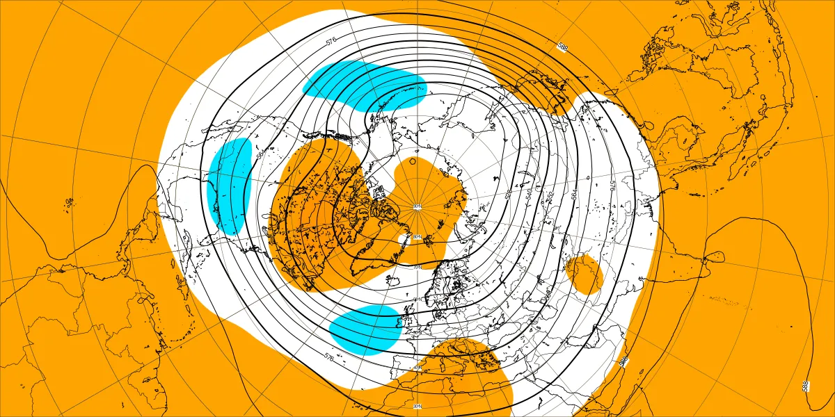
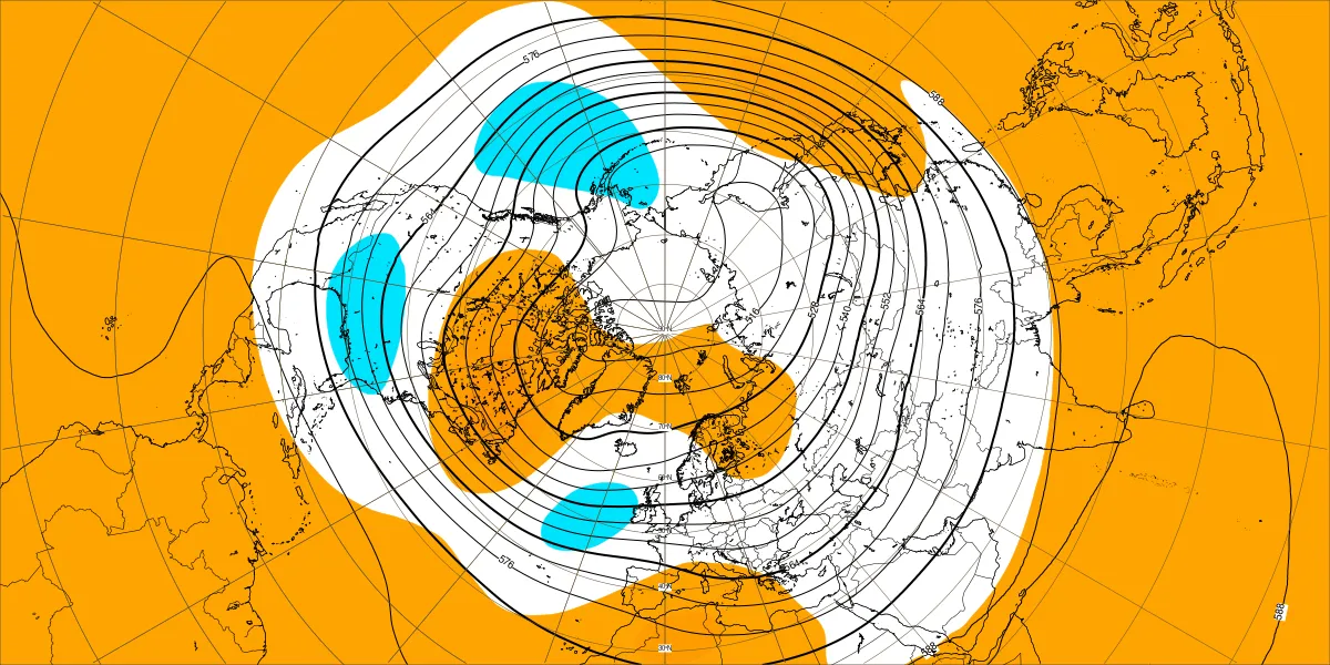
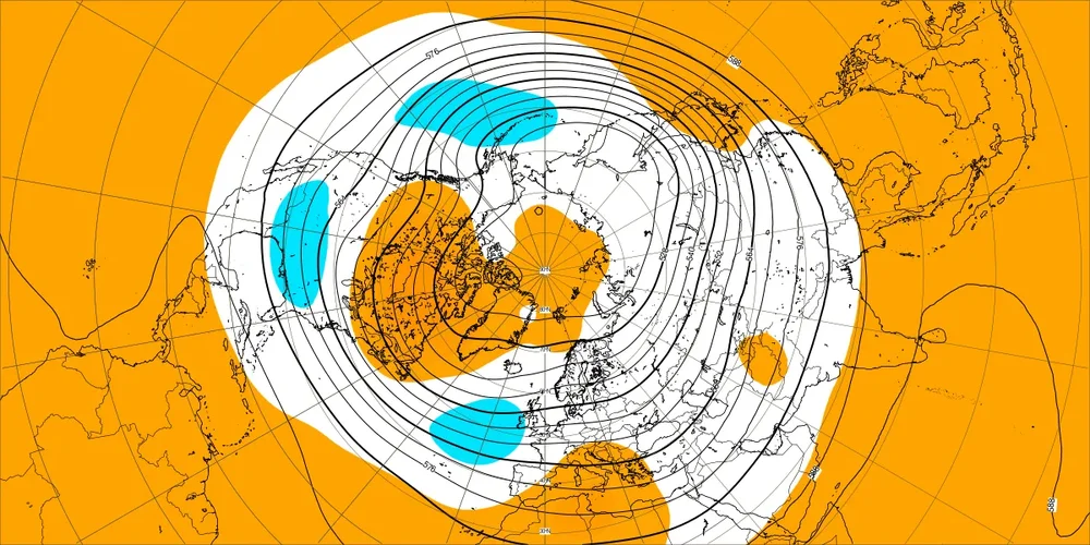
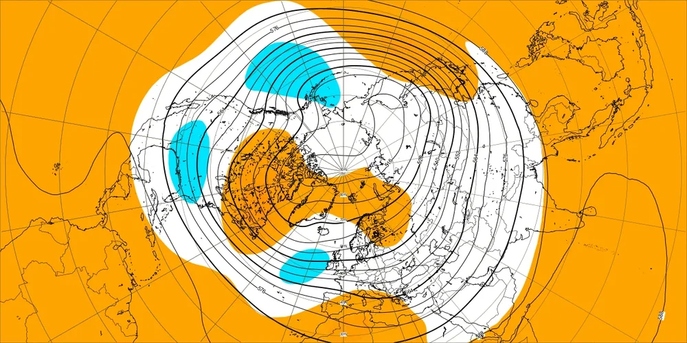
Last 2 weeks of today's weeklies lining up with seasonal with the trough in/near the GOA and a distinct SE trough, very similar to the Euro seasonal I posted a couple of weeks ago.
-
Drove over falls this afternoon and it is as low as it looked this summer. Crazy to see it this low again.
-
This is proged for the first few days of November, not that it makes a huge difference probably.