All Activity
- Past hour
-
UKIE is a bomb but much much warmer. It solves the precip problem but thermals are sketchy all the way to I-85. Given recent days of modeling I’ll take the look especially a juiced up solution
-
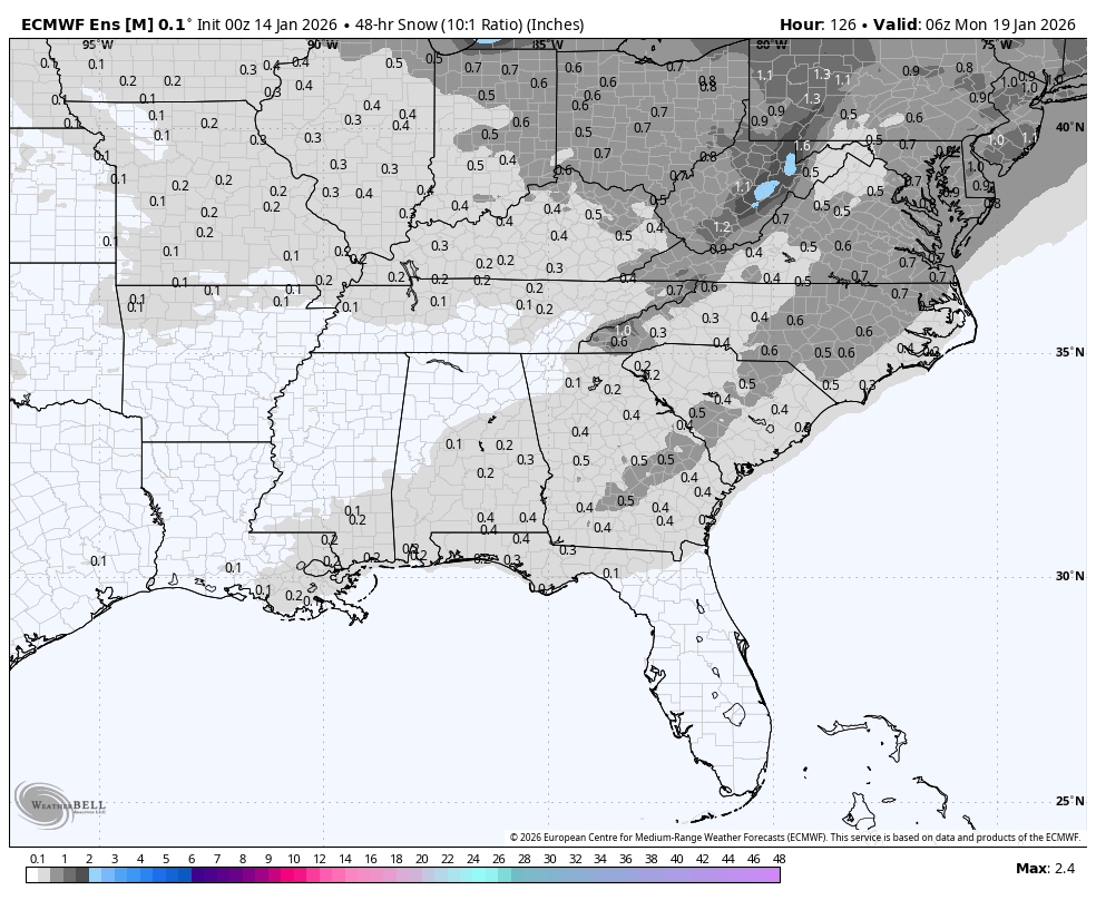
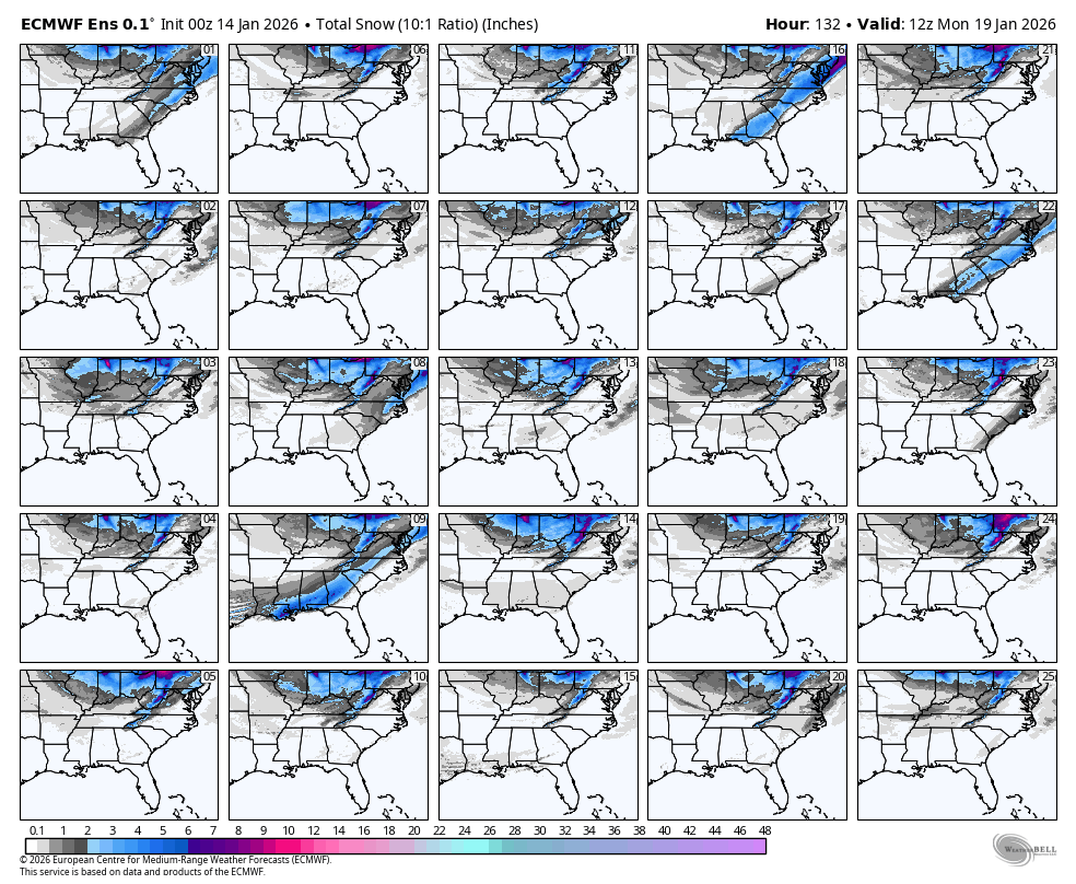
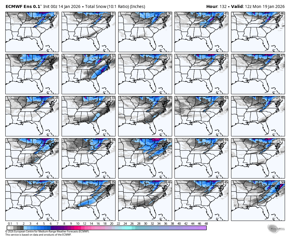
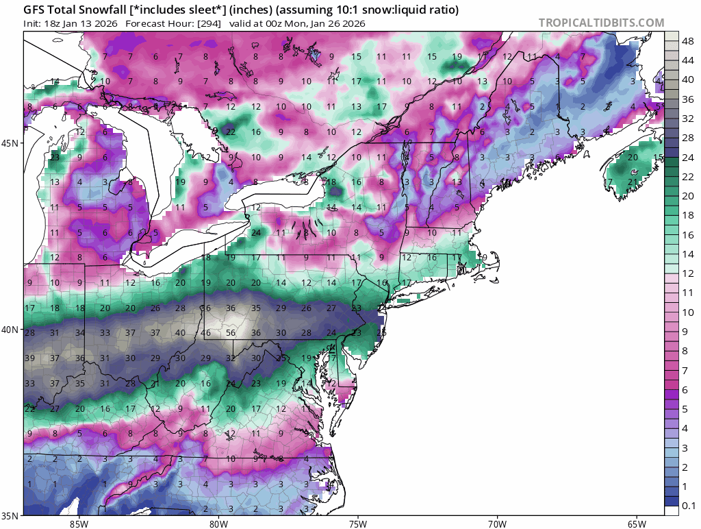
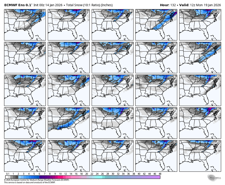
0Z Euro is sticking with the coastal regions of SE for heaviest but extends to RDU: 0Z EPS mean has sig. increase: RDU near the max with 0.6”: I count 18 with something in my area and ~25 in RDU out of 50:

-
Could @GaWx score two years straight??? For all the work put in here, you deserve it. You have to be at least somewhat excited with both the GFS and Euro onboard for SE GA and a GEFS snow mean of around an inch not far away which in itself is crazy that far south
-

Winter 2025-26 Medium/Long Range Discussion
wegoweather replied to michsnowfreak's topic in Lakes/Ohio Valley
I can already hear the CBus people talking about how they got cheated out of 57 inches of snow. -
GFS, EURO, UKIE all onboard for Sunday. GEFS is honestly a thing of beauty at this range. CMC is too flat and too warm. I think right now if you’re east of I-85 you’re solidly in the game on Sunday. While north trends will occur and we’re seeing that it will be interesting to see how far north it can go given this is mostly NS energy rather than a big phase with southern stream. That being said, you have to like where the triangle is at this juncture. Epic trends across the best modeling overnight
-
Winter is turning into a snoozefest. Even fantasy range is wearing granny underwear. What the hell is going on
-
Wide awake here in Danville sadly. Sleep is at a premium with this dang herniated disc and multiple pinched nerves, so I’m watching this closely. Been a hot minute since down here in Va that we got more than a dusting. .
-
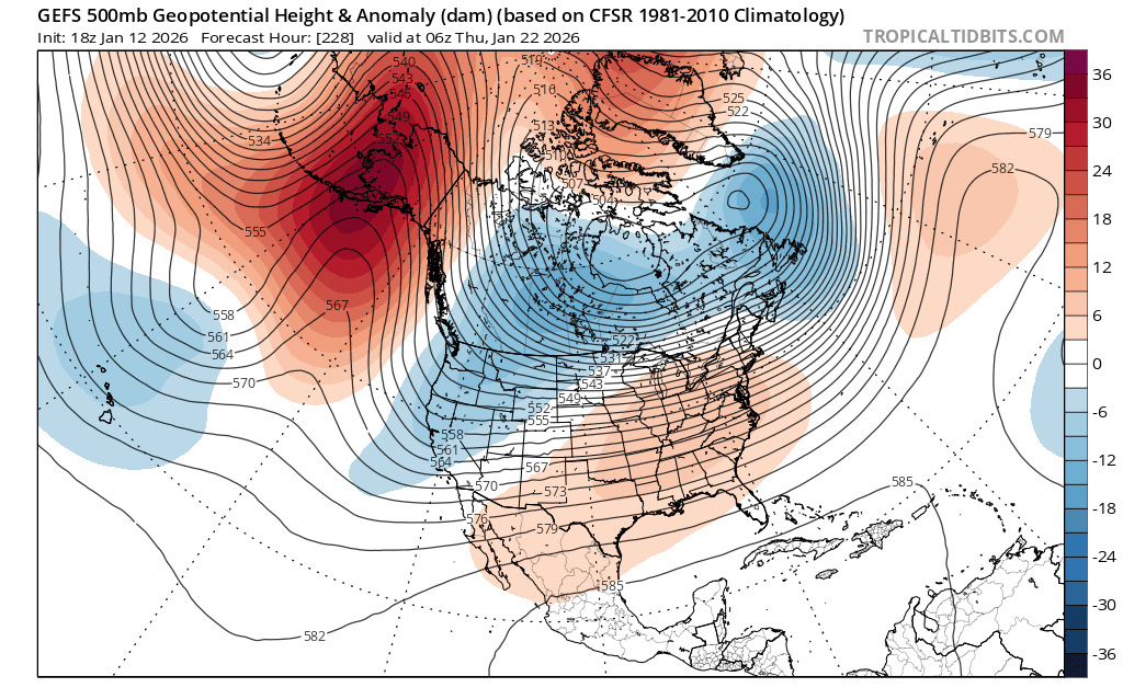
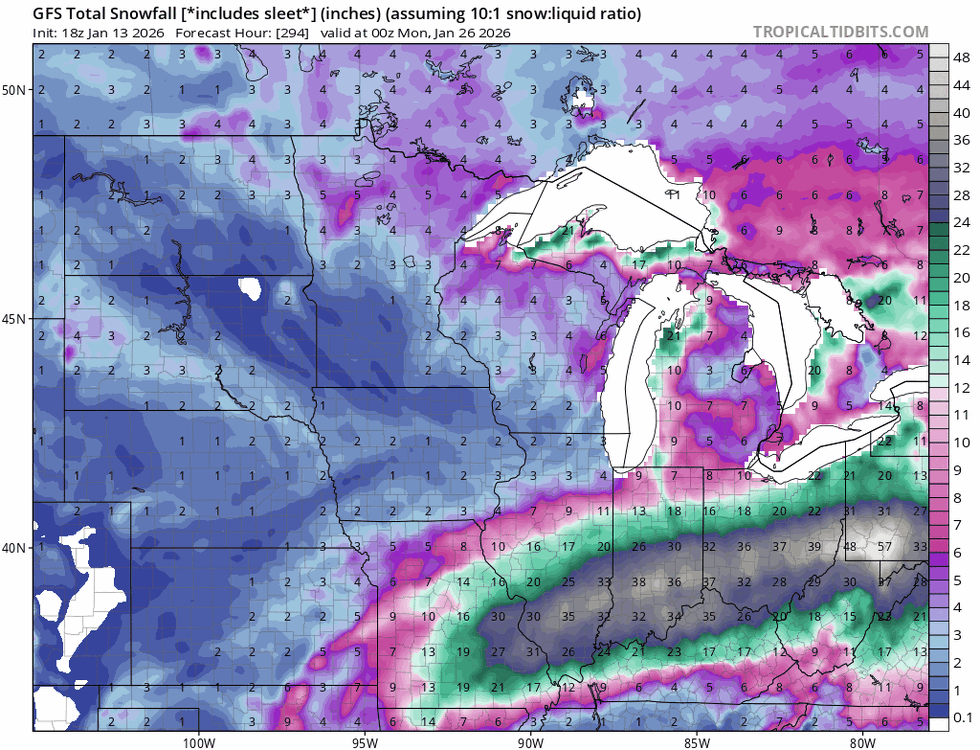
The Jan 25 event is still in the GEFS mean. In fact it's stronger this run than last. It's a major QPF signal for 11 days out and has been for several runs. Obviously a tiny model change at initialization will propagate across the entire globe over 11 days to result in huge differences at the regional/synoptic scale.
- Today
-
Tick tick?
-

Winter 2025-26 Medium/Long Range Discussion
Rjay replied to michsnowfreak's topic in Lakes/Ohio Valley

-
@NorthArlington101 storm is a cutter on the Euro
-
Actually, with the typical NW trend, which is in reality an unwinding of too far SE biases, you’re very much in this one. I think due to this and backed by climo, you have a better chance than us peeps way down in the Deep South of getting some of this. One never knows since every case is different, which makes forecasting discussions so interesting. Why is it so quiet in here? It’s not quiet at the other place. I guess most everyone here is sleeping? Or is almost everyone over there?
-
Winter 2025-26 Medium/Long Range Discussion
Rjay replied to michsnowfreak's topic in Lakes/Ohio Valley
-
Mmmk. Live by the sword, die by the sword. If you want to count on AGW driving monthly anomalies, you also have to account for when a Feb 2021 happens. FWIW, I think a top 5 warmest January in the U.S. is highly unlikely. Just looking at the blocking in AK.
-


-
If I were in Raleigh up to Virginia Beach, I would be getting excited
-
I am not from the SNE or NNE, I live in south Texas now, for cryin out loud but I love this site so much! I'll be soaking it in a lot. Incredible, outright brobdingnagian effort! Man, someone needs to do this for the Mid Atlantic, but I am just too damn OLD.
-
Oh the classic hold back energy out west and I thought that was only a Euro thing.
-
Driving home from Statesville to Beech tomorrow afternoon. Could be an interesting drive coming into Boone and onward to Banner Elk. We will see.
-
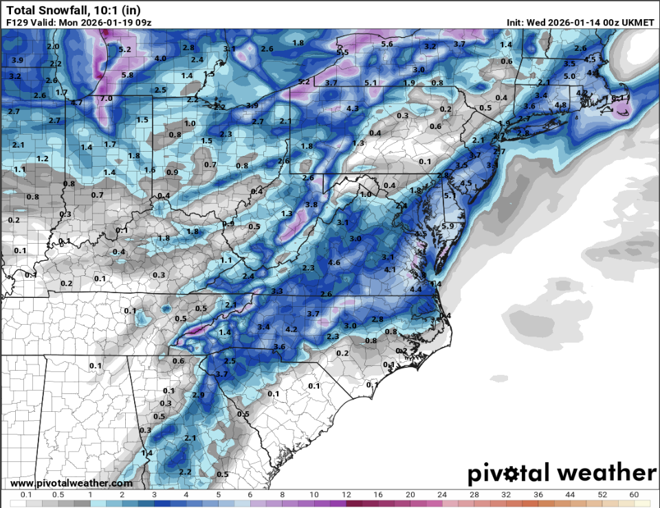
ECM-AI is west of 18z with the SLP and sharper with the trof. It's a scraper now. Very consistent trends across guidance. That's a solid improvement. 18z was well offshore and barely had a discernible coastal SLP. 0z forms a low and tracks it east of the benchmark.
-
Happening all winter
-
Will the sun angle be a problem with this storm? LOL
-
@CAPE gets buried. 1-3" for the cities, he gets 4-6"
-

2025-2026 ENSO
brooklynwx99 replied to 40/70 Benchmark's topic in Weather Forecasting and Discussion
who could have possibly seen this coming
-
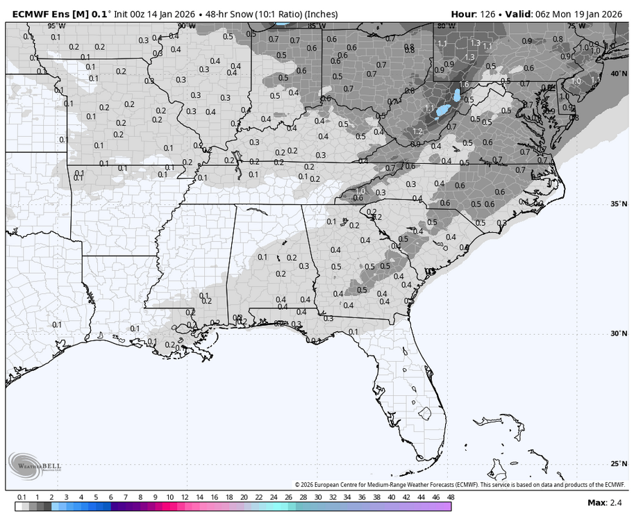
I agree the 1-3" characterization is better. But the event is not quite over for I-95 by 120hrs on the UK. But only a few hundredths of QPF after.