All Activity
- Past hour
-
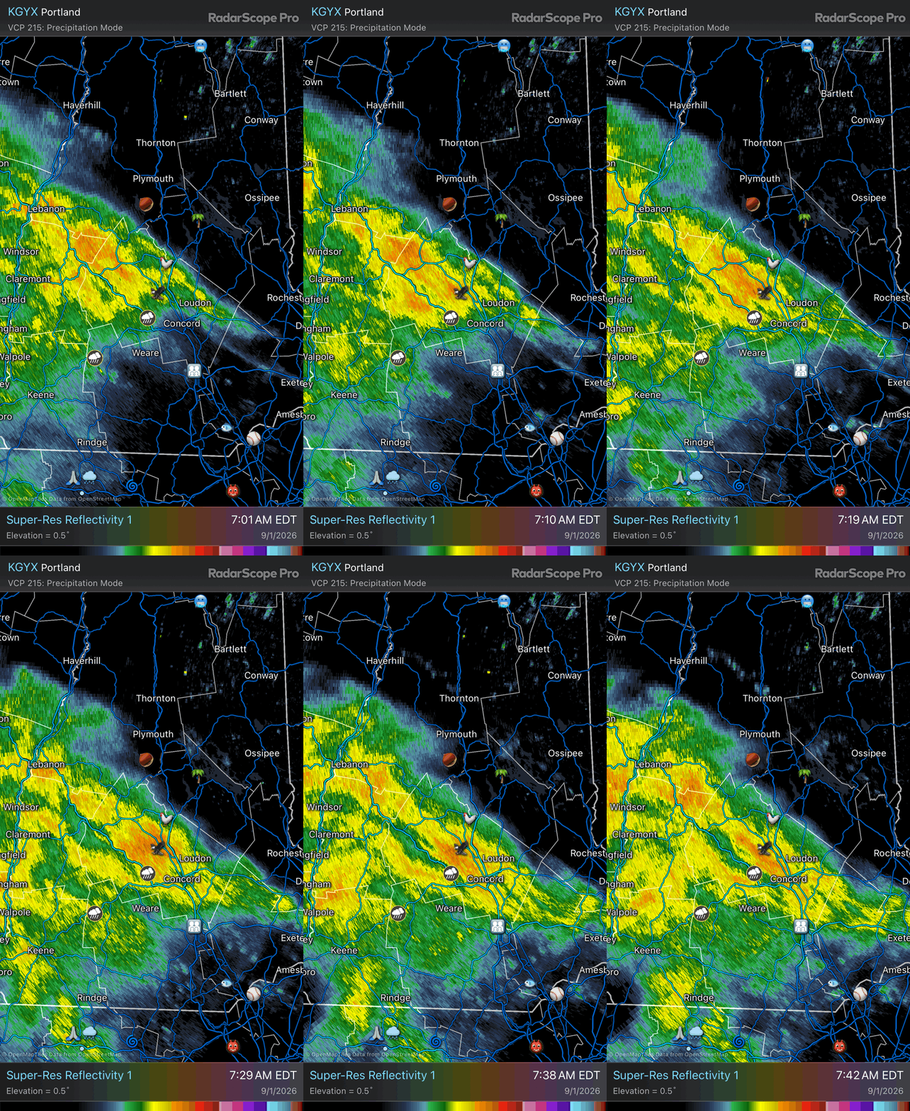
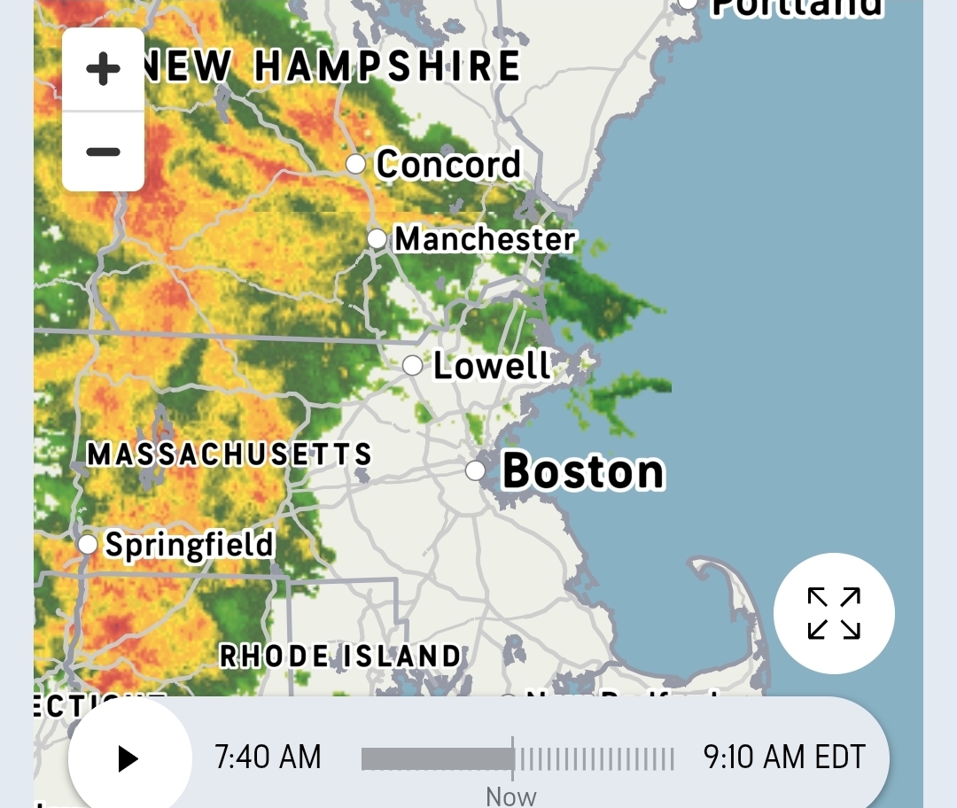
It's a pretty disheveled-looking core on satellite and radar this morning. It just doesn't have time to do much.
-

Septorcher 2026 Discussion - Endless Summer
jlauderdal replied to Damage In Tolland's topic in New England
Juste went over the 1 inch mark in the bucket with heavy rain -

Monday, August 31 - Thursday, September 3, 2026 Convective Episodes
CoastalWx replied to weatherwiz's topic in New England
You need to adapt to a warming world. I have. -

2026-2027 Record-breaking El Nino
MJO812 replied to Stormchaserchuck1's topic in Weather Forecasting and Discussion
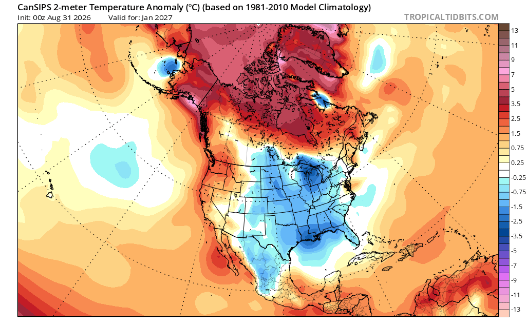
How much longer are people going to dismissals what this is showing ? We are getting closer. Maybe this winter will not be as bad as people think. -
Septorcher 2026 Discussion - Endless Summer
CoastalWx replied to Damage In Tolland's topic in New England
-
 You are indoors for most of the winter lol
 -
Monday, August 31 - Thursday, September 3, 2026 Convective Episodes
CoastalWx replied to weatherwiz's topic in New England
Thursday could be interesting, but as usual too many variables to nail down. -
Monday, August 31 - Thursday, September 3, 2026 Convective Episodes
CoastalWx replied to weatherwiz's topic in New England
I love winter, but it’s slowly slipping away. No need to retire to FL, FL will come to us now. -

Septorcher 2026 Discussion - Endless Summer
Damage In Tolland replied to Damage In Tolland's topic in New England
-
You are not a winter guy lol....don't worry you'll enjoy your retirement years in FLA....
-

2026-2027 Record-breaking El Nino
OSUmetstud replied to Stormchaserchuck1's topic in Weather Forecasting and Discussion
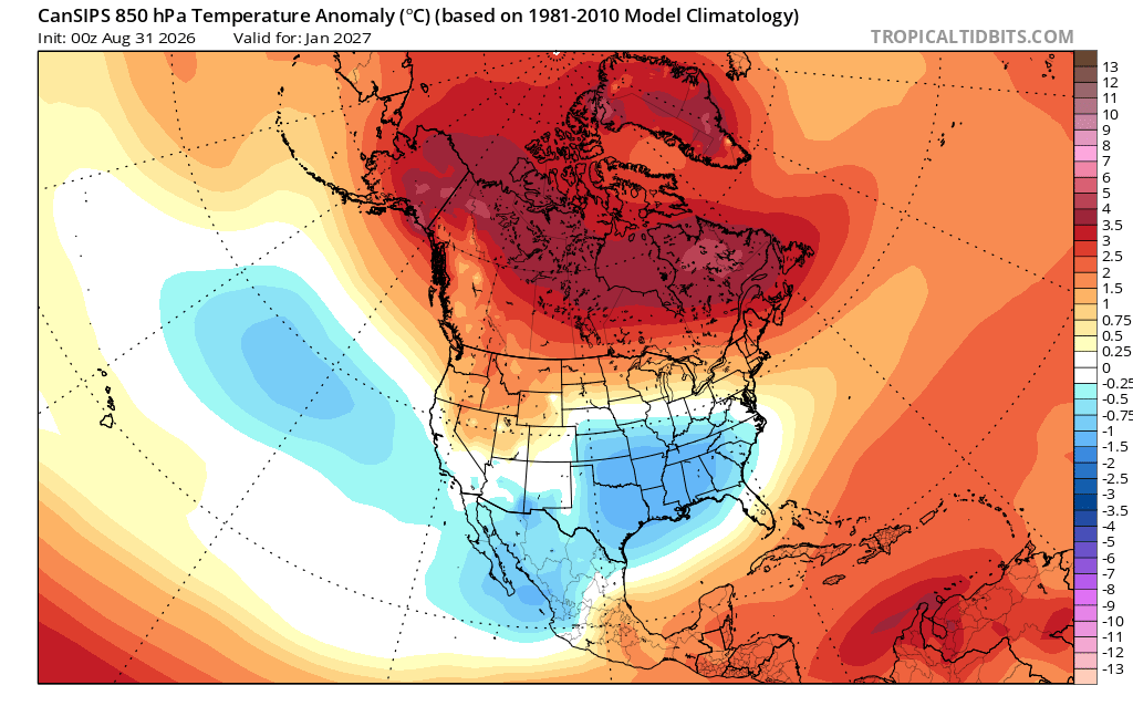
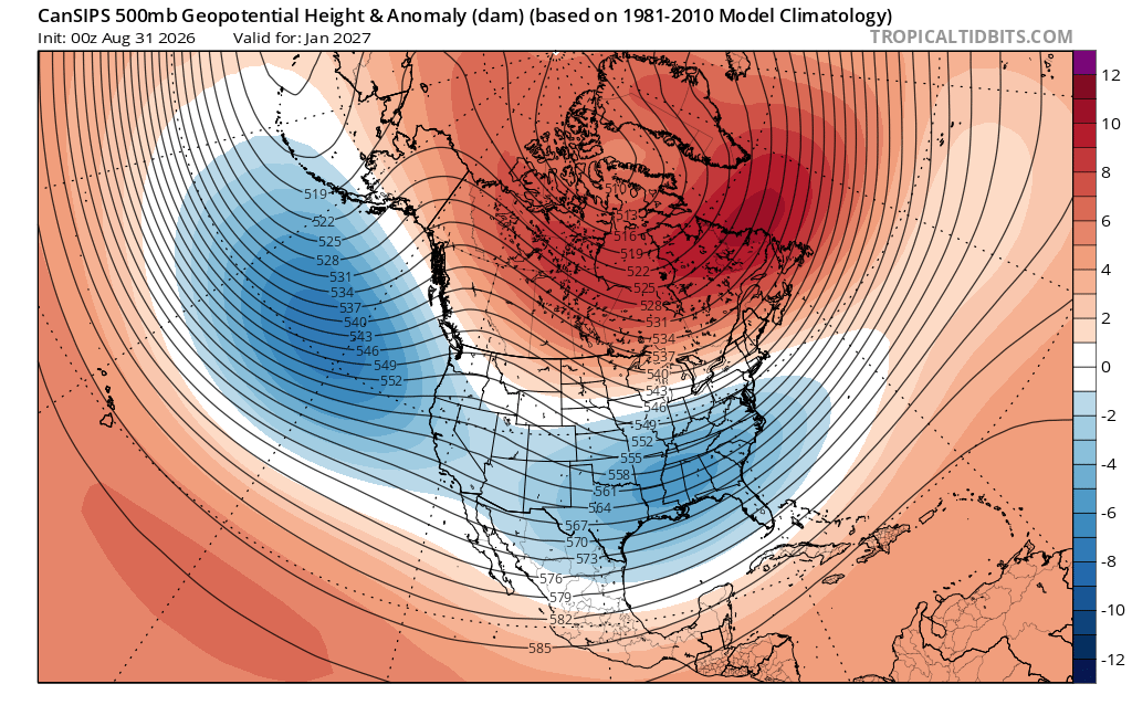
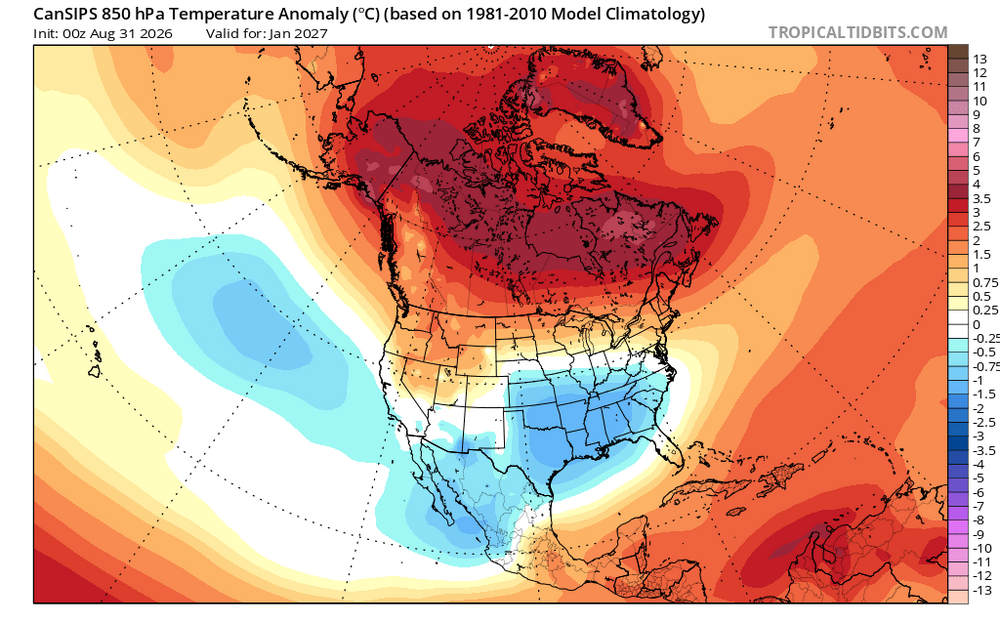
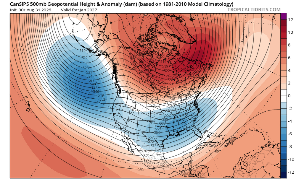
There's far too much disconnect with the 2m temp and 850mb temp on the CANSIPS over the Great Lakes. Maybe some sort of model issue?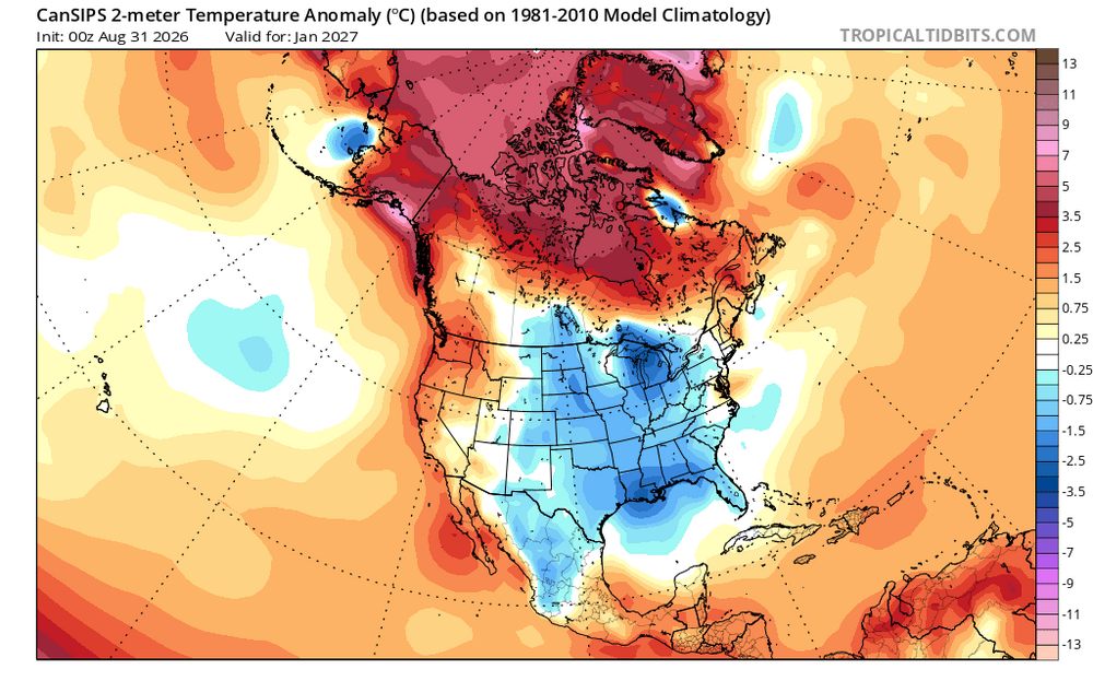
-
SPC has nothing in SNE for Thursday. Meanwhile BOX goes wild in AFD for pike south
-

Septorcher 2026 Discussion - Endless Summer
Brian5671 replied to Damage In Tolland's topic in New England
Alot of un airconditioned schools still as well. Never good for learning. -

Septorcher 2026 Discussion - Endless Summer
dendrite replied to Damage In Tolland's topic in New England
57.6° -RA 0.02” An infuriating graze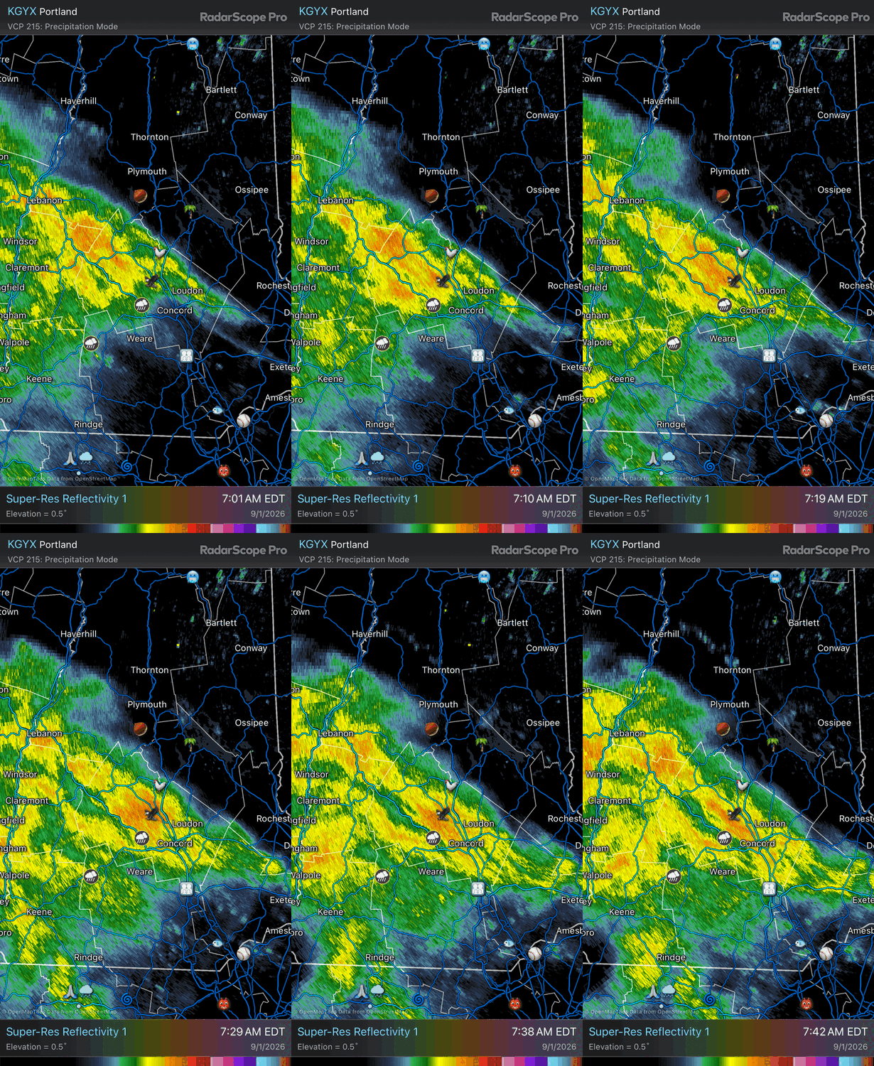
-

Septorcher 2026 Discussion - Endless Summer
kdxken replied to Damage In Tolland's topic in New England
Rain incoming.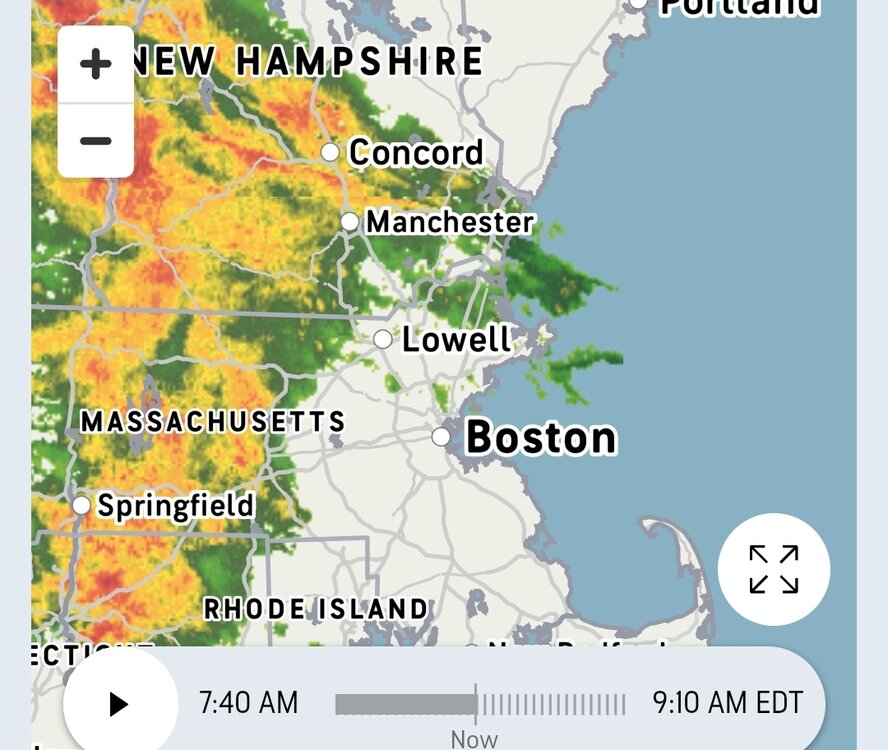
-
Monday, August 31 - Thursday, September 3, 2026 Convective Episodes
CoastalWx replied to weatherwiz's topic in New England
I wish I could start summer over. -
Can’t say I’ve ever seen a hurricane watch for a 35 kt system roughly 50 miles from landfall
-
I've felt for some time that BOX has been struggling and this goes to my point... Definitely a sign of fall approaching, with robust northern stream Friday yielding a baroclinic 998 mb maritime low late Fri/Sat. This will yield a cool, brisk NE flow into the SNE over the weekend. Highs likely remaining in the 70s and overnight lows in the 50s. It will feel even cooler over southeast MA, including Cape Cod and the Islands, with northeast winds 15-25 mph. Cool cyclonic flow aloft will yield diurnal clouds each day and possibly a spot shower. Otherwise, dry weather prevails. Possibly warmer and less wind for Memorial Day Monday, as high amplitude trough moves offshore and 1025 mb high settles over SNE. Memorial Day Monday????
-

2026-2027 Record-breaking El Nino
40/70 Benchmark replied to Stormchaserchuck1's topic in Weather Forecasting and Discussion
I would be careful with the CANSIPS...it's still evolving this El Nino too much towards the Modoki end of the spectrum. It's in error in that respect. Raindance just pointed that out, as did I in my blog last week. -
It does look better, but sat and radar show it filling in primarily in its outer bands, the inner core is not solid rain w/ dry slots present, and the center ring is not closed off. The blob nature of the developing convection is not a sign of imminent RI IMHO. 88D winds from LCH 4-5k ft show winds no higher than 50 mph, so even though I bet the pressure is now 998-1000 mb, the winds have not responded much yet.
-
2026-2027 Record-breaking El Nino
40/70 Benchmark replied to Stormchaserchuck1's topic in Weather Forecasting and Discussion
-
Monday, August 31 - Thursday, September 3, 2026 Convective Episodes
CoastalWx replied to weatherwiz's topic in New England
Danbury S and W -
SPC discusses potential/conditional need for CIG1 and higher probabilities for D2 depending on timing and such.
- 2,266 replies
-
- 2
-

-
- severe
- thunderstorms
- (and 7 more)
-
2026-2027 Record-breaking El Nino
40/70 Benchmark replied to Stormchaserchuck1's topic in Weather Forecasting and Discussion
No surprise with an El Nino this powerful...no way it's going to be a -EPO in the seasonal mean. -
2026-2027 Record-breaking El Nino
40/70 Benchmark replied to Stormchaserchuck1's topic in Weather Forecasting and Discussion
I been noticing that, too, which isn't a shock since we all know that the Modoki look that it and the JMA have been selling is overcooked.