All Activity
- Past hour
-

October Comes Early: Late September Multi-Hazard Hybrid Storm
Snowedin replied to WxWatcher007's topic in New England
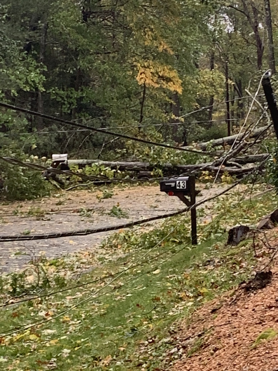
Out of boredom just dug up this shot from the October blowdown back in 2021. I think this is the one that produced a few 90 mph gusts and the damage was insane here. Even kev would’ve been in shock as we were boxed in for a solid week with trees and lines down everywhere. It was friggin wild man.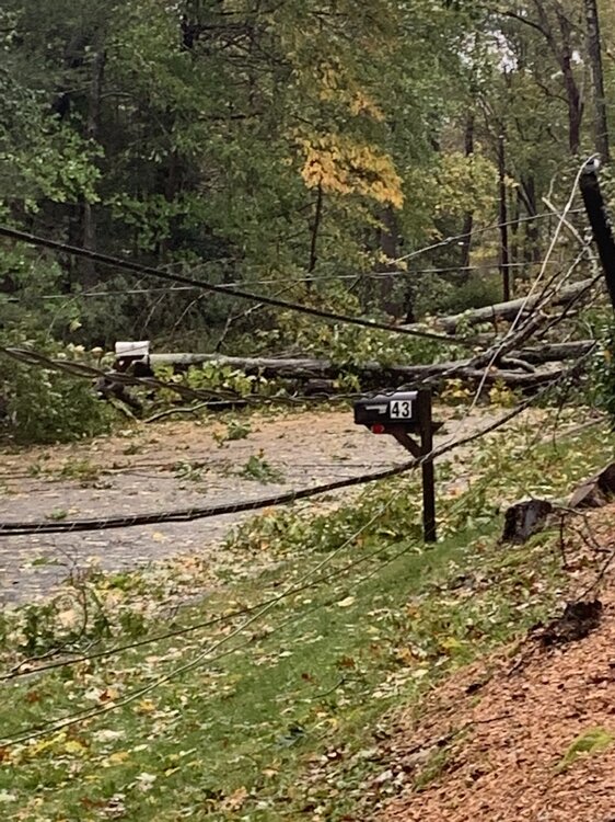
-

October Comes Early: Late September Multi-Hazard Hybrid Storm
Sey-Mour Snow replied to WxWatcher007's topic in New England
Oh wow congrats on retirement!!! -

Strong Nor'Easter/Hybrid Storm Late September 2026
winterwx21 replied to Rjay's topic in New York City Metro
0.70" here so far. -
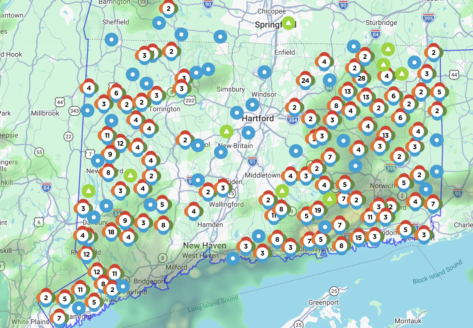
 That’s up to almost 30k . Wait till tonight
 -

October Comes Early: Late September Multi-Hazard Hybrid Storm
Great Snow 1717 replied to WxWatcher007's topic in New England
We would be witnessing the mother of all meltdowns.. -

October Comes Early: Late September Multi-Hazard Hybrid Storm
WinterWolf replied to WxWatcher007's topic in New England
ahh John, wish you were still doing my town. Disappointed to hear you’re not going to be advising my district. But congratulations on scaling back. -
Do they still have a football team?
-

Strong Nor'Easter/Hybrid Storm Late September 2026
nycsnow replied to Rjay's topic in New York City Metro
Radar starting to look better off shore, clear uptick in winds to when you’re under a band -

October Comes Early: Late September Multi-Hazard Hybrid Storm
FXWX replied to WxWatcher007's topic in New England
Lol... Which mean almost all of them (115) since I've retired that part of my business! Going to be fun winter mornings for me this year... Still lots of forecasting, but no schools... -

Strong Nor'Easter/Hybrid Storm Late September 2026
guinness77 replied to Rjay's topic in New York City Metro
Got about an hour and 10min of the ol footy in in Sayville just now. Caught a good pocket of dryness/mist before it opened up about 9:45. Pretty gusty, and actually chilly, car said it was 56 degrees when I got back into it, but a nice run before eating and drinking tonight lol -

October Comes Early: Late September Multi-Hazard Hybrid Storm
CT Rain replied to WxWatcher007's topic in New England
Eversource up to 20k out in CT. The distribution is pretty cool with nothing at all in t he valley.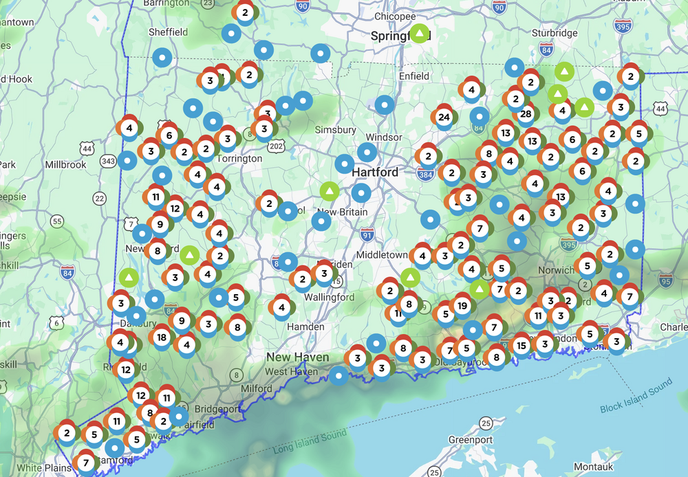
-
CLT got down to 47 this morning. The average first date for a low in the 40s for Charlotte is September 30th, so this is on schedule.
-

October Comes Early: Late September Multi-Hazard Hybrid Storm
weatherwiz replied to WxWatcher007's topic in New England
Outside of the coast inland areas don't get another pulse of a stronger LLJ until tonight. At that point its just a matter of how well we're mixing. But this seems to be going about par thus far. -

Strong Nor'Easter/Hybrid Storm Late September 2026
Rjay replied to Rjay's topic in New York City Metro
About an inch of rain. Peak wind gust 55 mph. Coastal flooding a little less than expected. I'm not sold on any stronger winds later but probably another short period of 50ish mph. -
October Comes Early: Late September Multi-Hazard Hybrid Storm
Snowedin replied to WxWatcher007's topic in New England
Easy there brother. We've become used to it from nearly every coastal storm that just happens to graze by us to the one nearly five years ago that brought total destruction to our neighborhood. And we’ve become just as used to our town forgetting our neighborhood even exists on the map. -
Great discussion from Hammer on this tempest beast https://x.com/ryanhanrahan/status/2103842123522990288?s=46
-

E PA/NJ/DE Autumn 2026 Obs/Discussion
PhiEaglesfan712 replied to PhiEaglesfan712's topic in Philadelphia Region
I'm surprised they haven't called a ground stop yet at PHL. I know they did so for Sandy. Does anyone remember if there was one for the Blizzard of 1993? -

October Comes Early: Late September Multi-Hazard Hybrid Storm
moneypitmike replied to WxWatcher007's topic in New England
Looks impressive. Feels meh. -

Strong Nor'Easter/Hybrid Storm Late September 2026
Prue11 replied to Rjay's topic in New York City Metro
Winds are strong here but I wouldn’t say it’s anything unusual from a Nor’easter system. The long duration is what’s causing the most damage -
October Comes Early: Late September Multi-Hazard Hybrid Storm
wx_observer replied to WxWatcher007's topic in New England
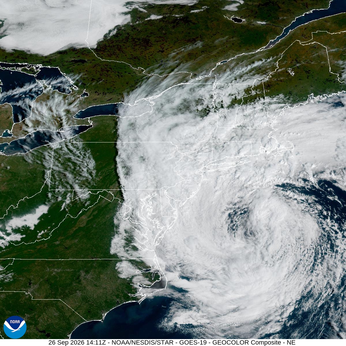
Pretty robust looking storm, despite all the underwhelmed naysayers...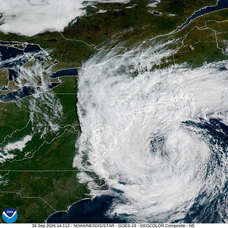
-

October Comes Early: Late September Multi-Hazard Hybrid Storm
CTWeatherFreak replied to WxWatcher007's topic in New England
I know its not tropical, but the clouds appear to be wrapping around what could be termed an 'eye like feature', or so it seems -

E PA/NJ/DE Autumn 2026 Obs/Discussion
BBasile replied to PhiEaglesfan712's topic in Philadelphia Region
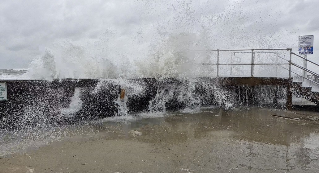
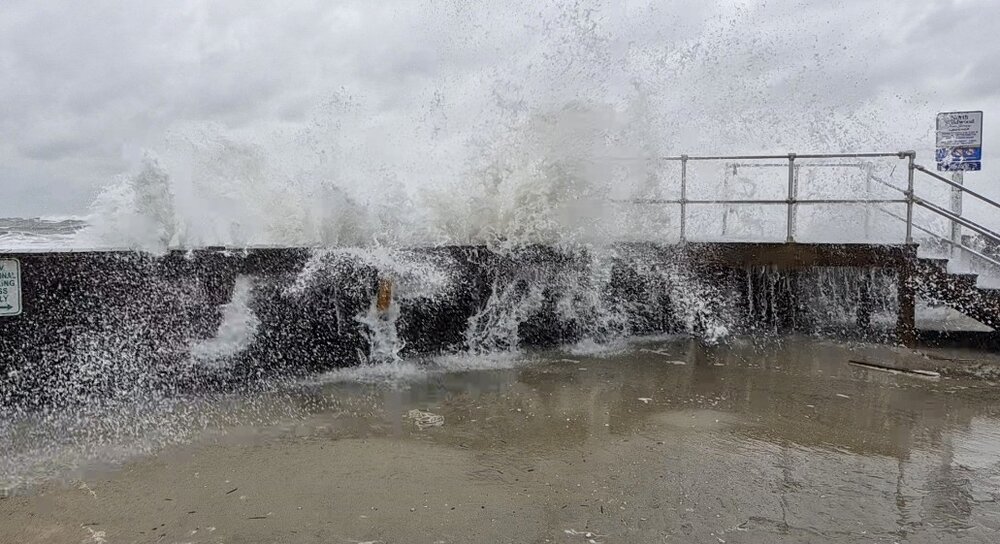
The ocean is angry..thumb.jpg.2e49dbf4edb647a3331cbc8bde2e0718.jpg)
-

October Comes Early: Late September Multi-Hazard Hybrid Storm
WxWatcher007 replied to WxWatcher007's topic in New England
Down to 986mb as of 12z analysis. Looks like it shed the cold front, but still has the warm frontal boundary so obviously not subtropical. -
That 51 at KSAV is the earliest that cold since 1999!
-
Strong Nor'Easter/Hybrid Storm Late September 2026
nycsnow replied to Rjay's topic in New York City Metro
A lot of high res models have strongest winds tonight into 12z ish tomorrow





.jpg.038e58d624d12f5d0b583523c8a95f8f.jpg)