All Activity
- Past hour
-
Yup.
-
Looking at satellite loops of the tropical Atlantic it looks like June 6th convection-wise not September 6th.
-

Septorcher 2026 Discussion - Endless Summer
40/70 Benchmark replied to Damage In Tolland's topic in New England
WINTER WINTER WINTER WINTER WINTER WINTER WINTER -
I think you mean era, but yeah. I am sure he is happy to be a part of...this. lol.
-

Septorcher 2026 Discussion - Endless Summer
mob1 replied to Damage In Tolland's topic in New England
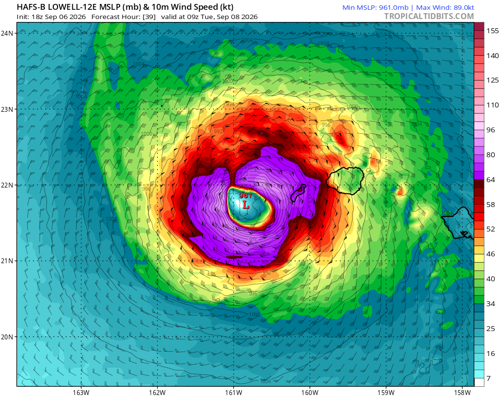
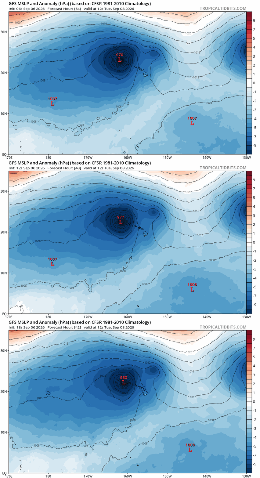
Some hurricane models now have it close enough for sustained hurricane winds.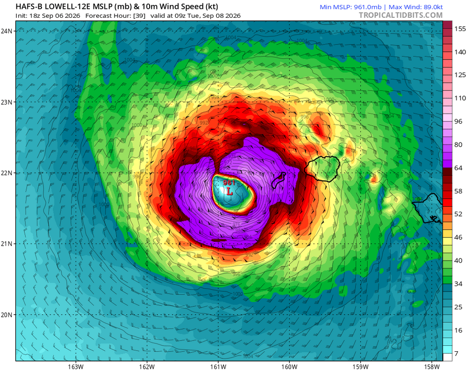
-
Glorious 75 out. Had dinner on the deck.
-
.thumb.jpg.6a4895b2a43f87359e4e7d04a6fa0d14.jpg)
Central PA Summer 2026 Discussion/Obs Thread
Yardstickgozinya replied to Voyager's topic in Upstate New York/Pennsylvania
There's no longer mention of any ring of fire pattern in the local forecast discussion, but they do mention gusty winds ramping up on wednesday and lasting into thursday afternoon along with increasing chances for thunderstorms. At this point in time, it looks that timing will keep severe limited according to the nws. -
 tamoxifen rash pictures: NolvaCare :: tamoxifen hot flashes
 -
https://cytocarepharma.shop/# cytotec abortion pill
-
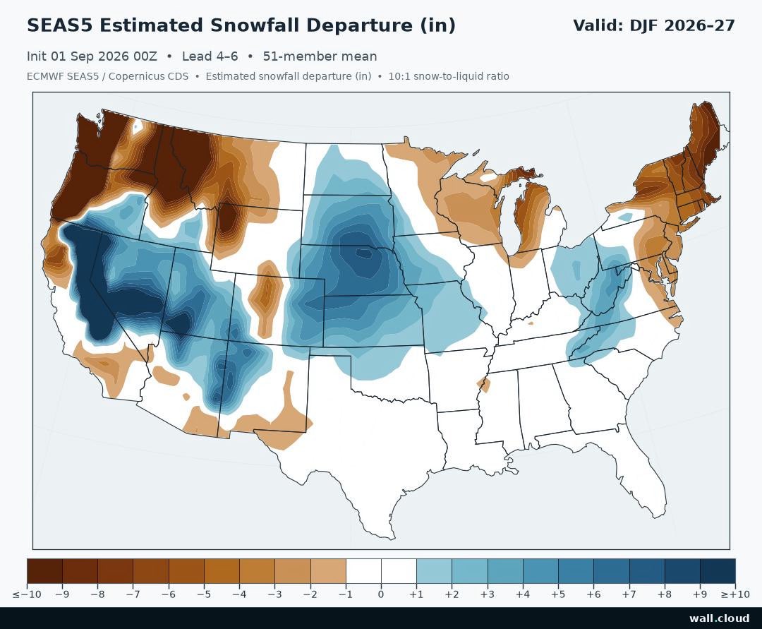
1. This very strong El Niño has a good chance to start helping out you and other SE dry areas by Nov and hopefully would then continue on/off through March as climo suggests. 2. I ended up getting very little from the late afternoon thunderstorms. It was only ~0.02”.
-
Might as well circle my house and add D4 on next drought monitor. We’ll have to wait 10 more months for another AN month of rain I guess
-
They haven't won in the Luis Roberts JR era yet
- Today
-
I'll be in CO this week and 18z GFS says when I get home its 75 with a dew 45
-

Occasional Thoughts on Climate Change
donsutherland1 replied to donsutherland1's topic in Climate Change
I may be referring to a different article. I was citing a ClimateBrink piece by Zeke Hausfather, which didn't mention bias correction. https://www.theclimatebrink.com/p/what-we-can-and-cannot-say-about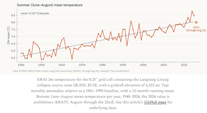
-
The graph says the temperatures were estimated with ERA re-analysis bias corrected to 5200 feet using regional high elevation weather stations.
-
The southern tier of NC continues to do well; a nice long-lasting MCC plowed from well west of Charlotte to Brunswick County.
-

Septorcher 2026 Discussion - Endless Summer
ineedsnow replied to Damage In Tolland's topic in New England
Pretty big shift east today.. maybe Hawaii has some fun after all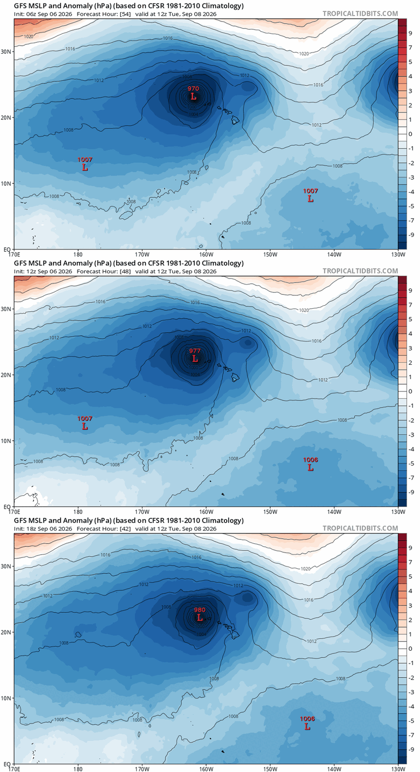
-
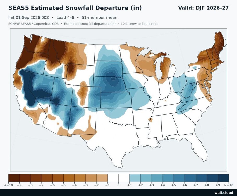
-AO is key for cold down here(minus a -EPO), but in a Nino the Aleutian/NE Pac trough position/strength can mitigate the tendency to deliver colder air southward if the flow of Pac air into Canada is overwhelming.
-
Septorcher 2026 Discussion - Endless Summer
ineedsnow replied to Damage In Tolland's topic in New England
Beautiful outside right now -
Anyway, time to start worrying about the Raven's unsteady kicker, and who the hell is going to play the Center position.
-
That Cowser game saving/walk off robbing catch though!!! To get them to 500!!! The turning point!!! Haven't won since
-

Septorcher 2026 Discussion - Endless Summer
jm1220 replied to Damage In Tolland's topic in New England
In Boston by the seaport today and now it’s raining on me. Eff this place. -
-

Septorcher 2026 Discussion - Endless Summer
Typhoon Tip replied to Damage In Tolland's topic in New England
Yet KFIT was 57 on the low ( +6 ), and 73 on the high (-1 ), for a net diurnal +2.5 (any rounding trickery notwithstanding) The Thornburgh effect - ...we'll see what happens before midnight for the low T but ... heh, see how CC works class ? you're only programmed to think this is below normal