All Activity
- Past hour
-

2026-2027 Super El Nino
LakePaste25 replied to Stormchaserchuck1's topic in Weather Forecasting and Discussion
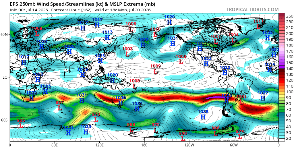
yeah there’s a solid mid latitude response happening in Chile. Nice mid latitude cell off the coast, extended pac/STJ and they’re getting blasted with rain and mountain snow. That’s what’s convincing me right now.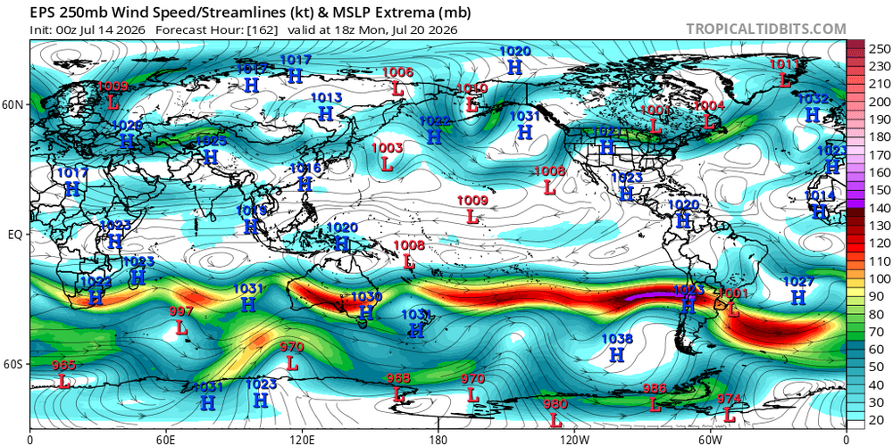
-
 Cloudy and some smoke around.. sun is trying to come out but cant.. maybe only upper 80s here today?
 -
It's coming x sunset season
-
 This kind of event has so much potential in New England for main reason that you rotate the entire flow pattern and create something more akin to what happens in the Midwest. Around here you typically have much more stable air to the southeast, the complete opposite of central CONUS severe weather. Northwest flow allows stable air to be in the right top quadrant relative to the storms. Check out the line of cumulus marking the surface based instability. Also the forecast for theta-e later today. That marks the warm front, and storm motion is parallel to this. So this is the exact orientation you need for long tracked supercellular storms.
 -

Central PA Summer 2026 Discussion/Obs Thread
Voyager replied to Voyager's topic in Upstate New York/Pennsylvania
Starting to notice the smoke in the Tamaqua area today already. -
 Also, we had putrid lapse rates that day. A ton of shear, but not a lot of instability. You know what that means in SNE.
 -

2026-2027 Super El Nino
brooklynwx99 replied to Stormchaserchuck1's topic in Weather Forecasting and Discussion
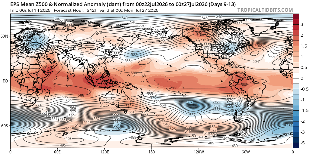
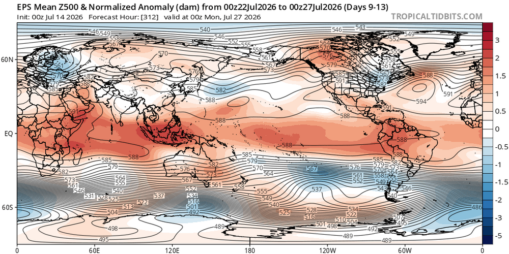
my thinking as of now is that the El Nino will take a foothold on the pattern as we head into autumn, but we will see. as you know, coupling is always pretty weak in the summer -

2026-2027 Super El Nino
bluewave replied to Stormchaserchuck1's topic in Weather Forecasting and Discussion
Getting very close in Nino 1+2 now to 1997 with 2026 leading in all other areas. https://www.cpc.ncep.noaa.gov/data/indices/ …….Nino1+2 Nino3 Nino34 Nino4 Week SST SSTA SST SSTA SST SSTA SST SSTA 08JUL2026 25.5 3.4 28.3 2.3 29.4 2.0 30.0 1.2 08JUL2015 24.7 2.5 27.8 1.8 28.7 1.3 29.8 1.0 09JUL1997 25.6 3.5 27.7 1.7 28.6 1.3 29.3 0.5 -
KInd of a bust with MDT risk IIRC.
-
That was a pike SUP that nailed BOS and Revere. I don't think there was much anywhere else.
-
 Long time since I’ve seen that much lightning in eastern Canada
 -
Not 100% sure but I think that happened within a mile of where I live now
-
 Those nice echoes shrank to only sprinkles when they arrived here, a common phenomenon since late last month. However, clouds thru late morning mean the sun has a lot of work to do if we're to reach the forecast 93.
 -
 Yeah it's fascinating on satellite. Now that the MCS is diurnally in decay and it's anvil is evaporating, it's exposing where the smoke is... You wonder if it will offset CAPE production for your convection later on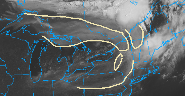
-
Heating up quick today gonna hit 90 by 11ish
-
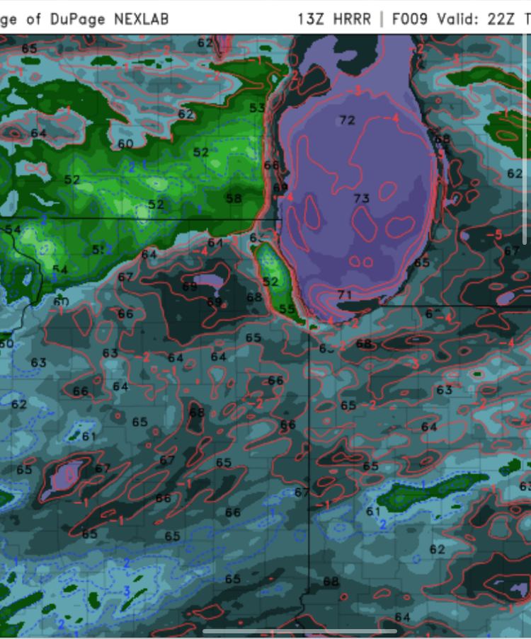
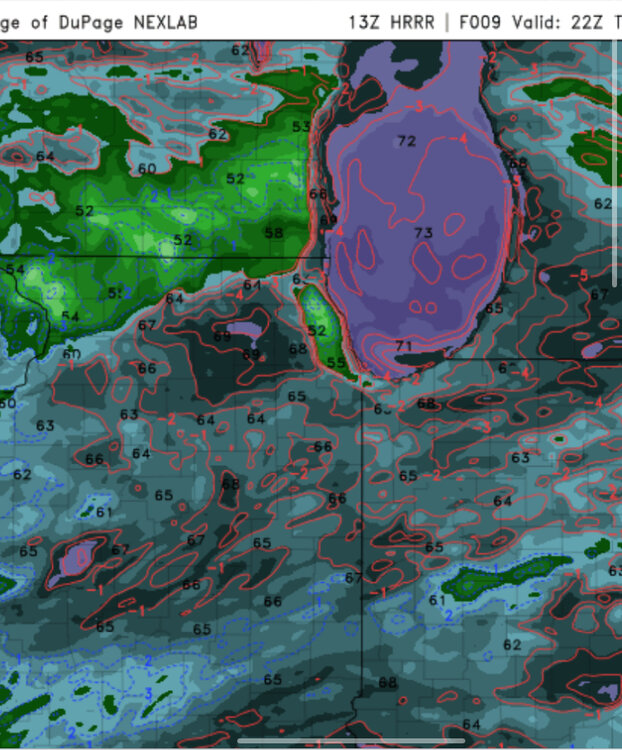
Wouldn’t surprise me if ORD or somewhere nearby briefly touches 100 today or tomorrow early afternoon. Models showing some nice dew point mixing during peak heating time today and tomorrow.
-
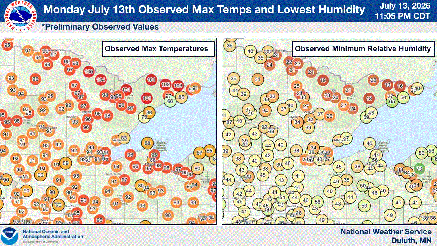
Yesterday's heat.
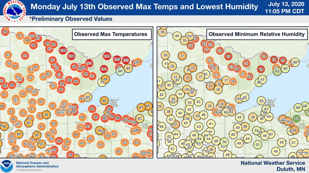
-
That kind of behavior gets you on neighborhood watch lists.
-
 I was sitting in the McDonalds parking lot across from BDL when the tornado warning went out and was hoping something would drop
 -
Watch out for wildfire smoke today. https://x.com/troydweather/status/2076968763023294948 Canadian wildfire smoke heads into the upper Midwest and Northeast today! Look for hazy skies today from the smoke but a better chance it reaches the surface tomorrow night.
-
 It is eerie out. BTV says sun breaks out late and we make a run at 90°.
 -
Two long tracked supercells that produced swaths of wind damage. Sadly for some, no tornadoes.
-
One of those two weekend days had a big microbust in CT and the other was up near Boston
-
Tornadoes no but I think that was the day of the big microburst or macroburst near Boston...either this day or the next.
-
 Did it produce?