All Activity
- Past hour
-

September 2025 OBS-Discussion centered NYC subforum
psv88 replied to wdrag's topic in New York City Metro
Thanks -

September 2025 OBS-Discussion centered NYC subforum
Sundog replied to wdrag's topic in New York City Metro
That's a serious cutoff just to our south, looks like a snowmap -
It’s chutes and ladders ya jackass!
-
You also don’t live in N CT. You live in the west Central Valley BDL to TOL had 7-8” in July alone
-
Heavy Rainers
-

September 2025 OBS-Discussion centered NYC subforum
Brian5671 replied to wdrag's topic in New York City Metro
Looks like it wraps up Friday AM/Midday -
September 2025 OBS-Discussion centered NYC subforum
psv88 replied to wdrag's topic in New York City Metro
What time do we dry out on Saturday -
Running about +8F for departure today. TORCH!
-
I beg to differ... We are not above normal for rainfall in northern CT ( maybe a localized area ). I looked up the departure from normal for Hartford, CT and there was a 2.17" deficit for the two months period of June and July. Bradley was very similar. So, you may need to look again.
-
September 2025 OBS-Discussion centered NYC subforum
Brian5671 replied to wdrag's topic in New York City Metro
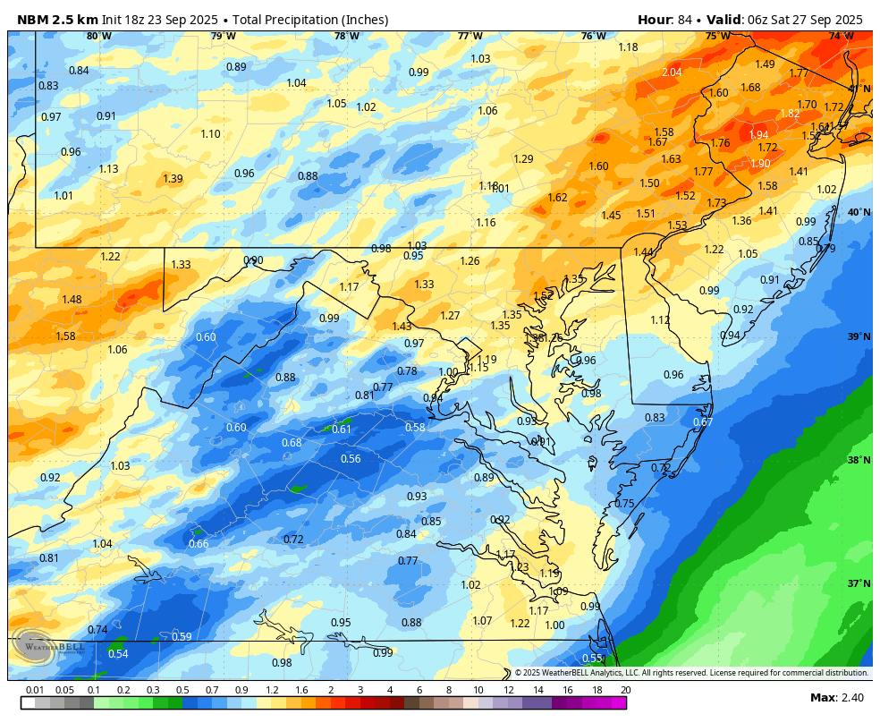
18z RGEM (and 3K NAM) are drenchers for Thursday into Friday -
Maybe a few spinups late Thu/night? warm front rips through, PWATs high and soundings actually have some directional and speed shear to differing degrees. LI sound tor?
-
BOS currently at -1.8F MTD. That should get lessened the next few days ORH at -0.1F.
-
Yeah, a few showers Thursday/Friday? Sick
-
what?
-
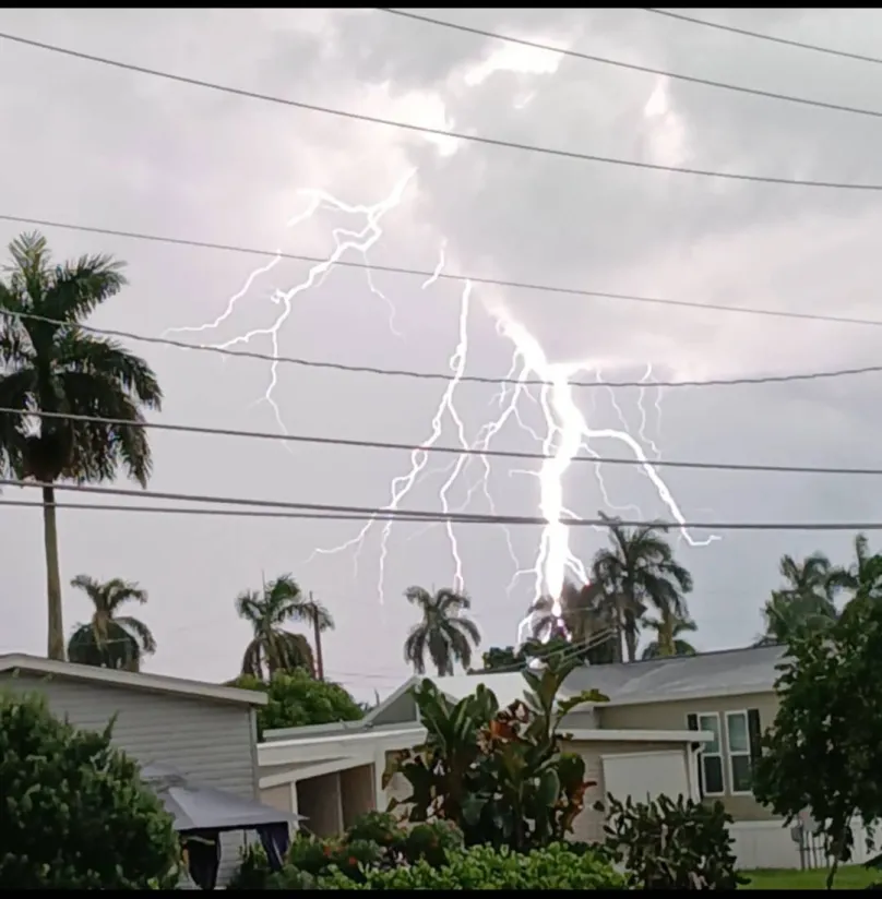
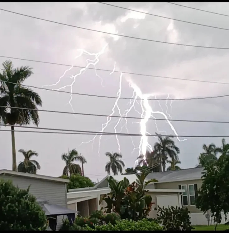
Big time electrical storm this afternoon.
-
What happened to cause the walk back? Seems to happen a lot these days.
-
I need that at home once watching these storms Sent from my SM-G970U1 using Tapatalk
-
54 and no clouds here today. Tomorrow looks identical. No rain at home. Our house cleaner said every plant we have looks dead so that’s cool.
-
And it looks like stuff coming in from York might add to your total.
-

Central PA Summer 2025
Mount Joy Snowman replied to Voyager's topic in Upstate New York/Pennsylvania
I’ve got ~1.5” here already. Insane. -
@Jns2183
-
But Thursday !
-
0.06” Up to 1.05” for Aug/Sep
-
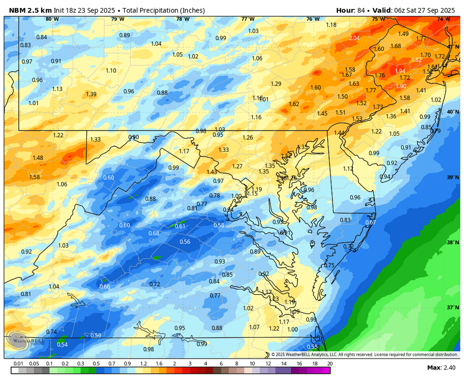
Over the last two days total model precipitation forecasts have decreased for the work week. Looks like Th. May be the wettest day. I will still be happy if I get what the WB 18Z NBM is putting out through Friday (which includes what we are getting this afternoon),
-

September 2025 OBS-Discussion centered NYC subforum
bluewave replied to wdrag's topic in New York City Metro
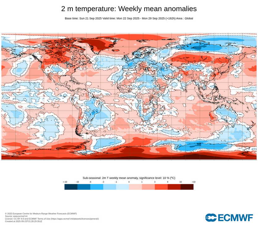
Yeah, looks like all the real cold is limited to Siberia.