All Activity
- Past hour
-
 National Weather Service Baltimore MD/Washington DC 216 PM EDT Mon Mar 16 2026 The National Weather Service in Sterling Virginia has issued a * Severe Thunderstorm Warning for... Northwestern St. Marys County in southern Maryland... Southwestern Prince Georges County in central Maryland... Charles County in southern Maryland... Southeastern Stafford County in northern Virginia... King George County in central Virginia... Southeastern Fairfax County in northern Virginia... East central Spotsylvania County in central Virginia... * Until 300 PM EDT. * At 216 PM EDT, a severe thunderstorm was located near Potomac Creek, moving northeast at 45 mph.
 -
 Was windy and rainy for 45s. Good thing I got let out at 2pm
 -
 BRING IT ON
 -
 0.4" earlier today and 0.3" from that line that just came through. I'll take it!
 -
 Columbia is about to get wrecked by a wall of water.
 -
I assume this

-
I think the tornado threat in eastern NC has been mitigated as well given the sloppy storm mode on radar right now
-
High standing water on I-70 and I-495 being reported by WTOP.
-
 On the bus home from the office, and it’s absolutely pouring on 395 in Arlington.
 -
Freaking awesome bro! That's pretty amazing for down there.
-
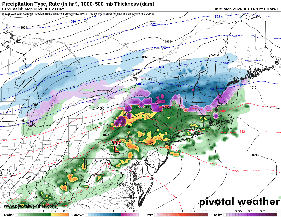
 The latest HRRR (still rolling out now) still has a substantial forced line for later on - with a weird bend/kink in the line modeled right near the DC metro area. Wind gust product looks decent as well. Regardless of how stable we are - that line later will probably still pack a "punch" even if it's the sudden 50mph sub-severe variety.
- 666 replies
-
- 1
-

-
- severe
- thunderstorms
- (and 1 more)
-
 Line is trying to form a bit of a hook in southern hoco along 29.
 -
 Impossible! It's a "bust"! Must be AI...lol. Folks are funny
 -
 Yep. Cloverly too.
 -
Temp down to 47 degrees here at work now.
-
 The storm coming into Charles County looks to be intensifying, and has some rotation.
 -
 Brief light rain for 5 minutes and now sunshine through a light cloud layer in Georgetown, DC
 -
It's funny as you're saying that there's pictures of tornadoes being put on here lol. Receipts
-
For what?
-
lock it in!!!
-
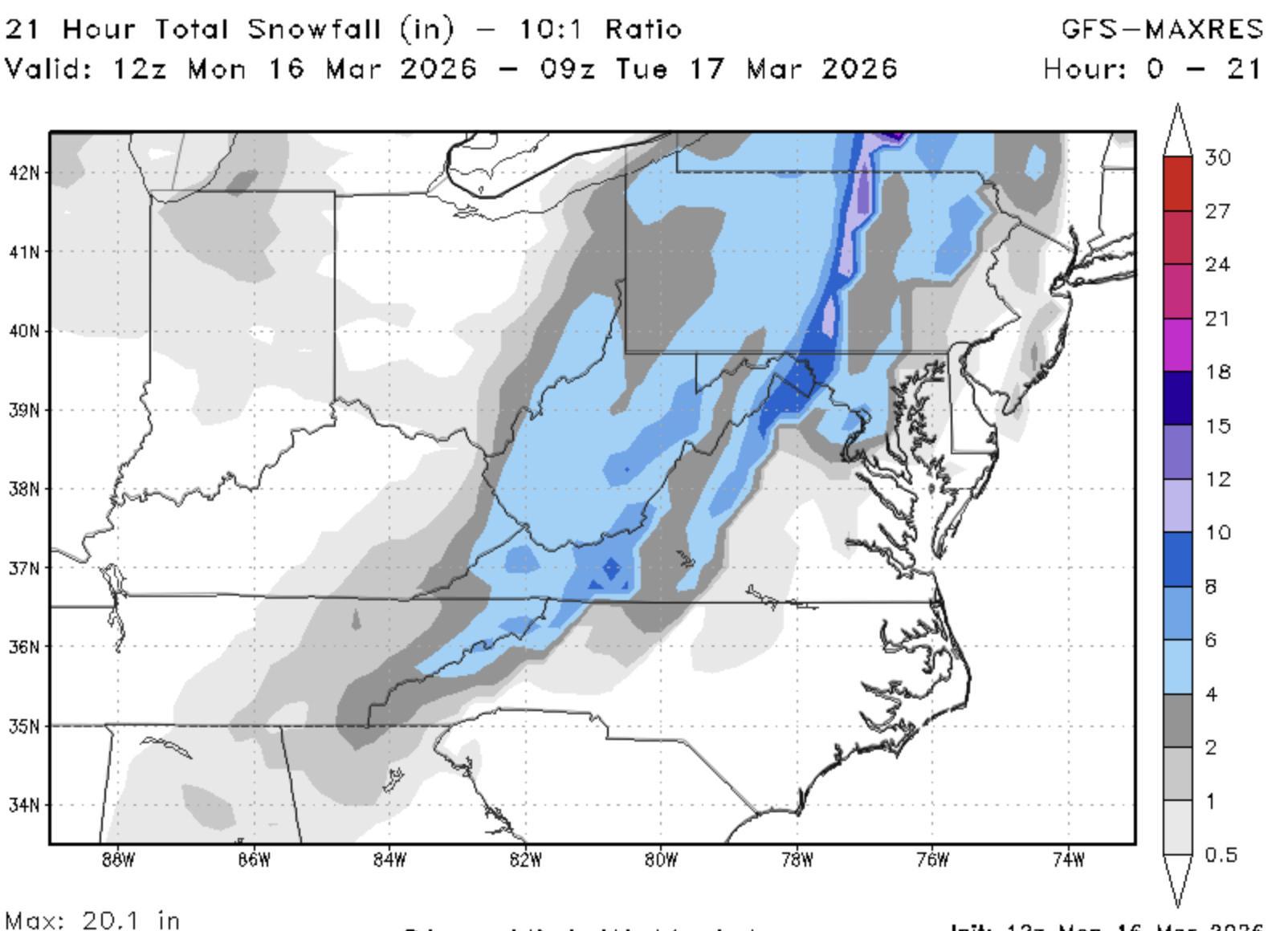
 lets go back to what we do best. Track digital snow and fight!
- 666 replies
-
- 1
-

-
- severe
- thunderstorms
- (and 1 more)
-
Decent wall of rain and a bit of a wind gust just now in Colesville, MD as it hit.
- 666 replies
-
- 1
-
-
- severe
- thunderstorms
- (and 1 more)
-
definitely suspect - but very little wind at the surface (that is passing right over me).