All Activity
- Past hour
-
Was that the valentines day sleet bomb? Maybe im thinking 2007 that concrete was on the ground for weeks
-
New day… gfs is still on our side. Lets lock in. .
-

January 25/26 Jimbo Back Surgery Storm
WinstonSalemArlington replied to Jimbo!'s topic in Southeastern States
This is gold-star, Academy education here. Thank you. -
6z was even cold. If this verified we could see rivers freeze up
-
.
-
2014 is exactly what came to mind @WxUSAF when I saw some of the 0z suite. One of the best WAA thumps we’ve had of the last 25 years.
-
Seeing the overnight runs I am ready to head to the cliff. What an absolute disaster in terms of the changes. To see our shot at a big one vaporize is hard.
-
Down to 5.7 now
-

January 2026 regional war/obs/disco thread
Kitz Craver replied to Baroclinic Zone's topic in New England
Awesome trends continue, let’s goooo!!!!!!! -
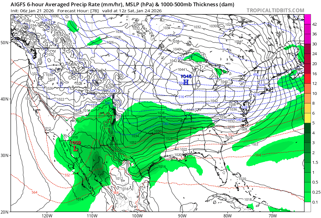
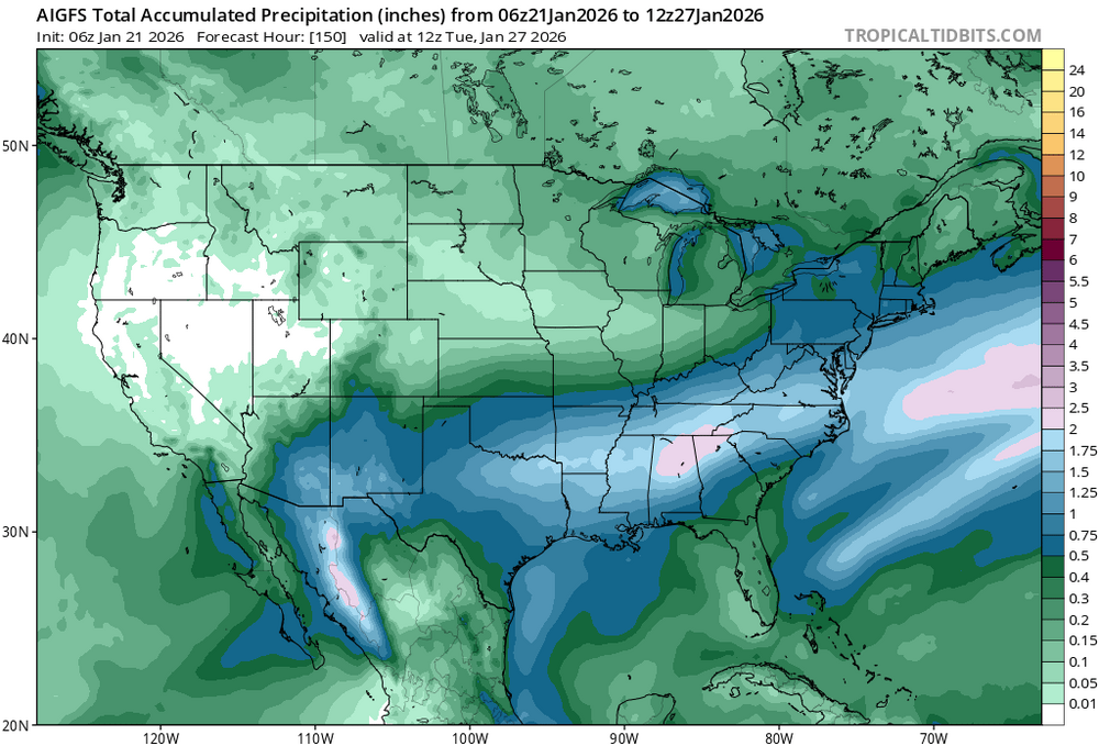
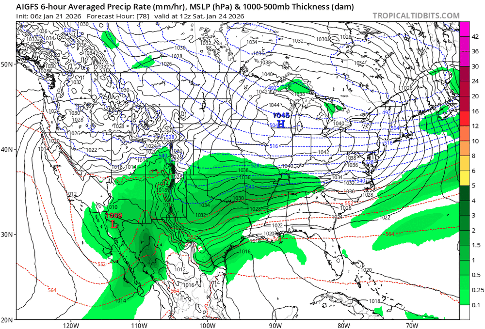
AI GFS qpf..
-
Good morning weenies. People have been mentioning Feb 2014 at times for this storm. I don’t remember the synoptic setup, but I remember that beatdown of a WAA thump. Maybe this is a colder version? 12” EPS mean is bonkers. Hitting NAM/RGEM range for storm start time with the 12z suite!
-
Today is the big test.
-
Just got down to 9 now in Kearny, not sure how accurate that is.
-

Winter 2025-26 Short Range Discussion
Baum replied to SchaumburgStormer's topic in Lakes/Ohio Valley
Ugly look for LOT again. And now I’ve got an Exteme Cold Watch…..who comes up with this shiat? -
Yup me too !!
-
High of 23 yesterday after a low of 6 Currently 9, after dipping to 4 earlier still have 2 or so of snow on the ground
-
January 2026 regional war/obs/disco thread
Kitz Craver replied to Baroclinic Zone's topic in New England
200 post update. I knew. -
Here's the 06z gfs AI model notice the 540 (mix) line stays just south of DC very nice run!!
-
This is 1960s cold.
-

January 25/26 Jimbo Back Surgery Storm
NorthHillsWx replied to Jimbo!'s topic in Southeastern States
We’re 3 days out so my initial forecast calls: Triangle- <1” SN, 2-3” IP, 25-.30” ZR Triad- 1” SN, 3-4” IP, .10-.25 ZR Foothills- 1-3” SN, 4-5” IP, TR-0.10” ZR Charlotte- TR-1/2” SN, 2-3” IP, .25-.30” ZR Upstate- TR SN, 2-3” IP, .25-.40” ZR ATL- TR-1/2” IP, 0.25-0.40” ZR (cold rain to finish) NC coastal plain- TR-1/2” SN, TR-2” IP, .25-.75” ZR Could see some isolated heavier amounts to 1” ZR if temps stay in 20’s). Switches to rain at coast and inland by a county or two limiting accumulation in those areas. SC low country-Midlands-NC Sandhills- TR-2” IP (more north and west), .25-1” ZR possibly a few higher totals in Sandhills to NW of Columbia. Switches to rain after light icing along the coast. Think worst ice runs from Greenville NC to Fayetteville to newberry SC to Greenwood SC and a county on either side of that line as first guess. Could extend further into GA as well especially Athens to Gainesville Praying a lot in NC and upstate get a sleet bomb -
Whatever it takes to get 20"+!
-

January 2026 regional war/obs/disco thread
Damage In Tolland replied to Baroclinic Zone's topic in New England
It’s mainly northern 2/3 of CT north with 1-2” -
I wasn't expecting it to feel like upstate NY this morning here in the lowlands. My point and click confused me for a second. I thought i had to set on Lacona NY when I looked at the long range forecast. Awesome period of deep winter incoming. 10
-
1 at home, 16 in the bronx.
-
Currently 9. Better get used to this cause looks to be this cold or colder for a while.