All Activity
- Past hour
-
The “I bring the mojo” Jan 30-Feb 1 potential winter storm
Aleksey replied to lilj4425's topic in Southeastern States
Starting to get a little nervous. HRRR keeps pushing back the onset. Was supposed to be between 7-8 this morning and now it’s showing not until around 10-11. Has the heaviest snow in the early afternoon now. . -

The “I bring the mojo” Jan 30-Feb 1 potential winter storm
Silver Meteor replied to lilj4425's topic in Southeastern States
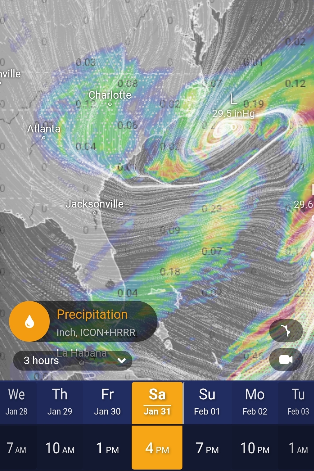
If you look at the Ventusky website you can see the surface Low is spinning far offshore, I mean it's way out there. And looking at Wilmington radar ... crimany, the good precip is - no surprise - sliding by well offshore too. Greenville, N.C. NWS office this early morning has cut 2" off our projected snow total. I fear it will get worse. https://radar.weather.gov/station/kltx/standard -

January 30th- Feb 1st ULL and coastal storm obs
neatlburbwthrguy replied to JoshM's topic in Southeastern States
Will this occur in north ga as well north & east of Atlanta? -
2 (winds haven't gone calm here) -6 at FOX (winds are calm)
-

January 30th- Feb 1st ULL and coastal storm obs
lilj4425 replied to JoshM's topic in Southeastern States
A meso-low will form as the ULL moves in and tilts. A heavy band of snow will form north of this meso-low from GSP up to CLT and down to CAE. Expect things to ramp up over the Upstate starting around sunrise. Anything before then is just a bonus. -

Jan 30th-February 1st 2026 Arctic Blast/ULL Snow OBS Thread.
Hurricaneguy replied to John1122's topic in Tennessee Valley
I also I cannot recall a time I've witnessed 12 straight hours of steady to heavy snowfall. -

Central PA Winter 25/26 Discussion and Obs
Voyager replied to MAG5035's topic in Upstate New York/Pennsylvania
Got down to -1 at 10:25 last night, but then rose back up to our current +5 degrees shortly thereafter. -

January 30th- Feb 1st ULL and coastal storm obs
gman replied to JoshM's topic in Southeastern States
Light snow in Greenville. Temp is 30. I am not impressed at all with the radar returns. I assume that will start filling in and expanding as the ULL moves in? -
Jan 30th-February 1st 2026 Arctic Blast/ULL Snow OBS Thread.
Hurricaneguy replied to John1122's topic in Tennessee Valley
If you believe the avg of the short res models there is a chance 6-8'' of snow will still fall over Greene Co before things wrap. I'm speechless -
January 30th- Feb 1st ULL and coastal storm obs
NCBlizzard replied to JoshM's topic in Southeastern States
Steady light snow in Belmont. Ground is whitening and cars are starting to be covered. Radar is filling in nicely as well. Some particularly heavier returns popping up over the Charlotte area and to the SW into the upstate. Surface temperature starting to drop as well, down to 28.5°. -

January 30th- Feb 1st ULL and coastal storm obs
CentralNC replied to JoshM's topic in Southeastern States
Light snow and 24 degrees. -

Jan 30th-February 1st 2026 Arctic Blast/ULL Snow OBS Thread.
WintryMixmaster replied to John1122's topic in Tennessee Valley
Some solid very fluffy snow falling here, a mixture of small snowflakes and larger nickel-sized ones blowing in the wind. Feels very Christmas-y! 2 inches on the ground -
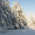
My hill down to the lake

-

Jan 30th-February 1st 2026 Arctic Blast/ULL Snow OBS Thread.
zbrown89 replied to John1122's topic in Tennessee Valley
Ty appreciate it . -
I’m sorry but did GSP use the word blizzard? I’m east of northeast Georgia and on the far west side of that triangle area. Ugh. Hoping the band forms a little further west than what the models show.
-
The “I bring the mojo” Jan 30-Feb 1 potential winter storm
Berlin1926 replied to lilj4425's topic in Southeastern States
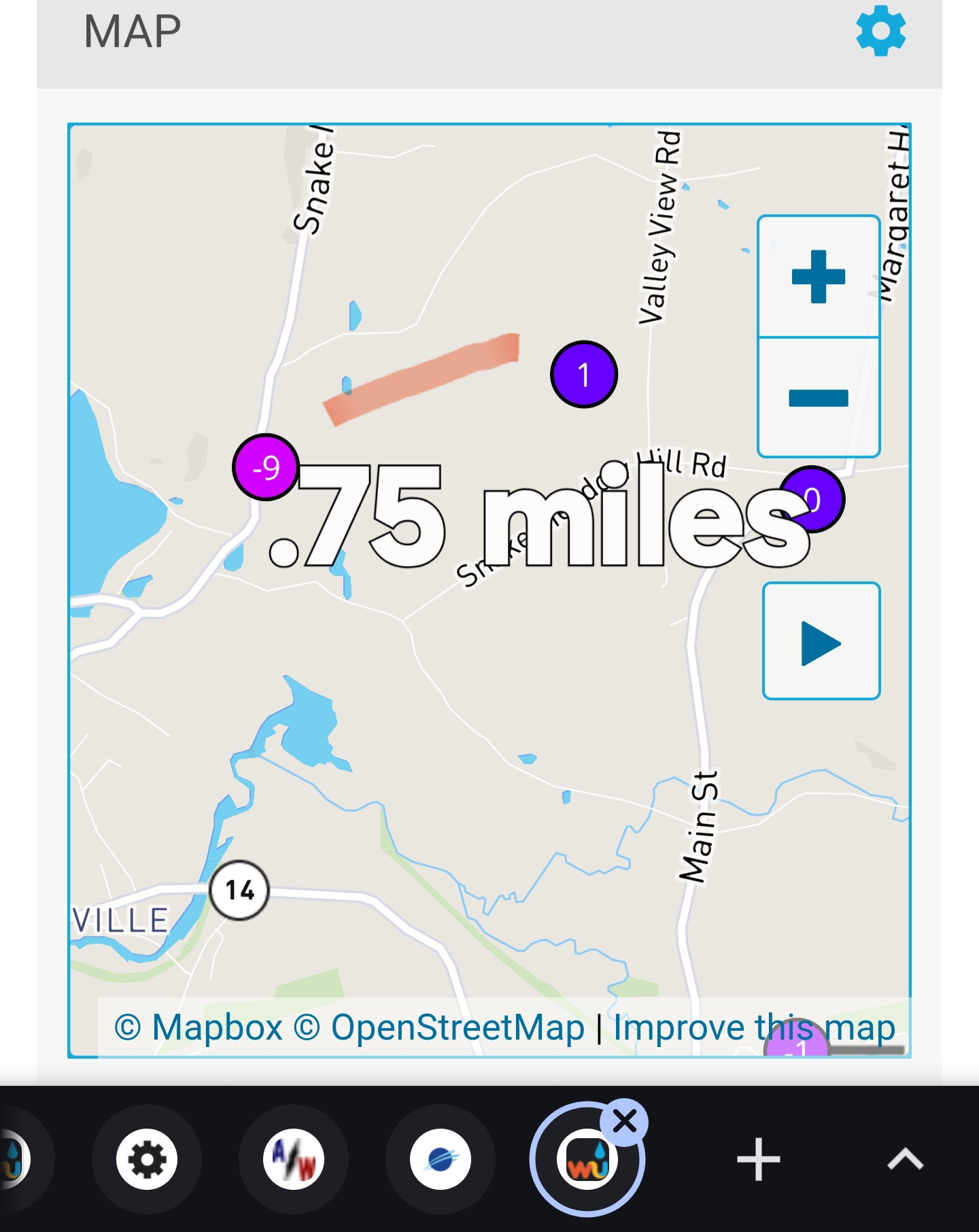
Cool tool. Here it is at 4p.
-

Jan 30th-February 1st 2026 Arctic Blast/ULL Snow OBS Thread.
Stovepipe replied to John1122's topic in Tennessee Valley
The super heavy dbz stuff looks to have wobbled over to west Knox, Loudon, and NW Blount. The overall blob is growing towards Madisonville and Tellico Plains. Oscillating between periods of peas with dimes and dimes with nickles here. Pretty dang good rates even when the radar shows relatively lower. -

January 30th- Feb 1st ULL and coastal storm obs
Jmoon replied to JoshM's topic in Southeastern States
Light snow here to. Starting to ramp up. -
It's on now brother!!!
-

Jan 30th-February 1st 2026 Arctic Blast/ULL Snow OBS Thread.
bearman replied to John1122's topic in Tennessee Valley
If you are wondering if there is really mixture there, no there is not. I am not sure how the tech is supposed to work and determine what is falling, but it is not real accurate. -
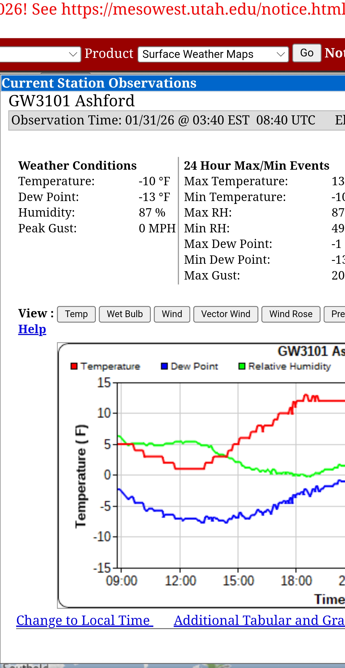
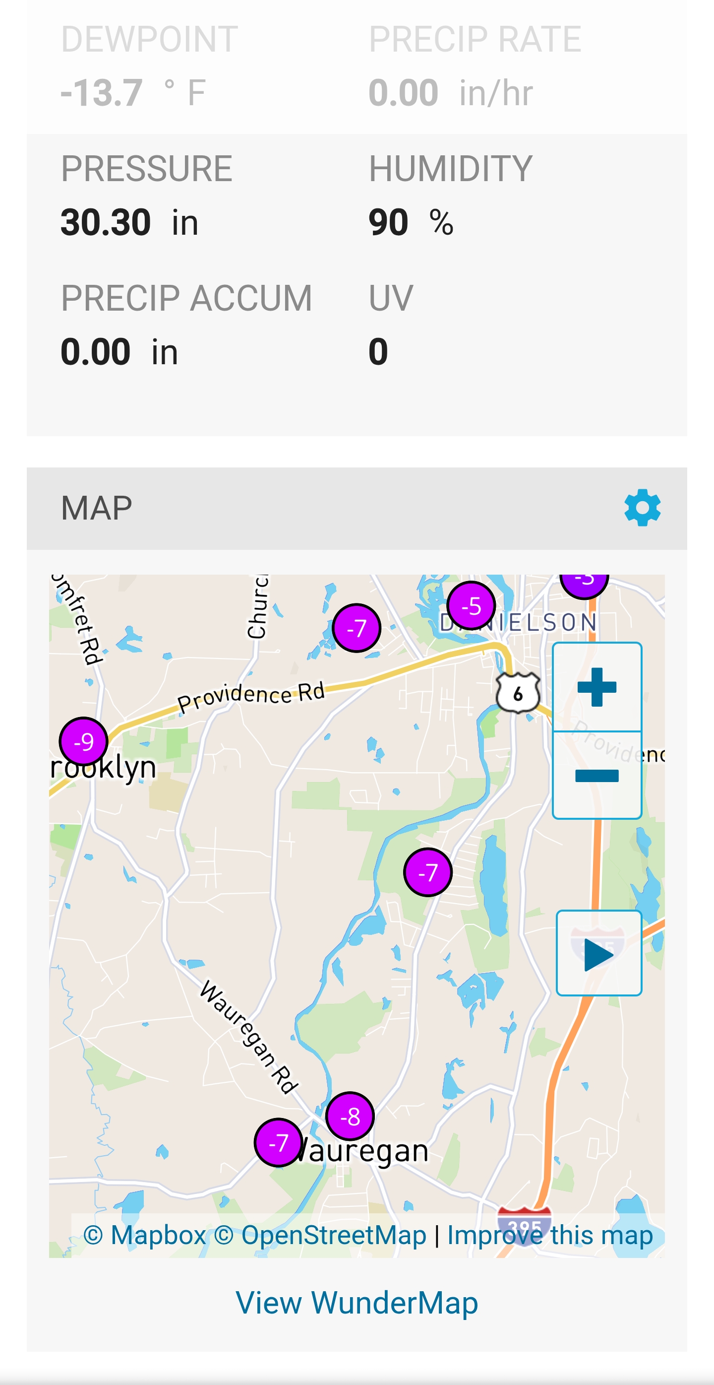
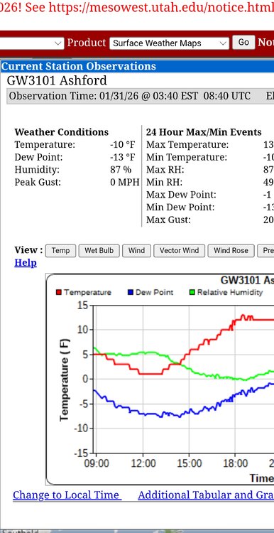
Man valley decoupled.Colder at IJD -8 Belchertown-8 Asford CT-11 than NNE
-
Area Forecast Discussion National Weather Service Greenville-Spartanburg SC 116 AM EST Sat Jan 31 2026 The CAMs continue to suggest banded structures in the simulated reflectivity though this might not be a strong case for mesoscale banding. If that were to develop, there could be sharp stripes and gradients of snowfall. Either way, there will probably be at least one axis of heavier precip/snow where the better frontogenesis sets up on the north side of the 850 mb low. What is interesting is how several guidance sources want to place the best snow potential somewhere out in that triangle area bounded by GSP/CLT/CAE later today. Guidance also has been consistent with a stripe of better snow potential somewhere in northeast GA, but confidence in placement will be elusive until/unless we see it start to materialize. Note that if we have banding, some places will get less than expected. However, the air mass should be cold enough...generally in the low/mid 20s outside the mtns...and the rates high enough...upwards of 1/2 to 1 inch per hour...that even lower accums will result in significant challenges to transportation as the snow easily sticks to roadways. There could also be some blowing snow concerns through the event that could result in brief near-blizzard conditions in some spots, particularly during the daylight hours.
-

Possible coastal storm centered on Feb 1 2026.
ineedsnow replied to Typhoon Tip's topic in New England
6z NAM gets the cape good again - Today
-

January 30th- Feb 1st ULL and coastal storm obs
JoshM replied to JoshM's topic in Southeastern States
Flurries flying, 28.8/15.6 -

January 30th- Feb 1st ULL and coastal storm obs
strongwxnc replied to JoshM's topic in Southeastern States
Lets go!