All Activity
- Past hour
-
that's a nice run
-
pretty snowy for NYC though. If it wasn’t a holiday it might be a good week to go
-
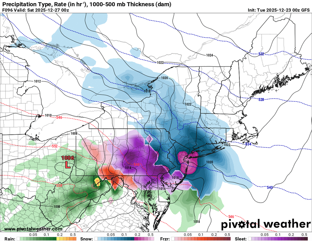
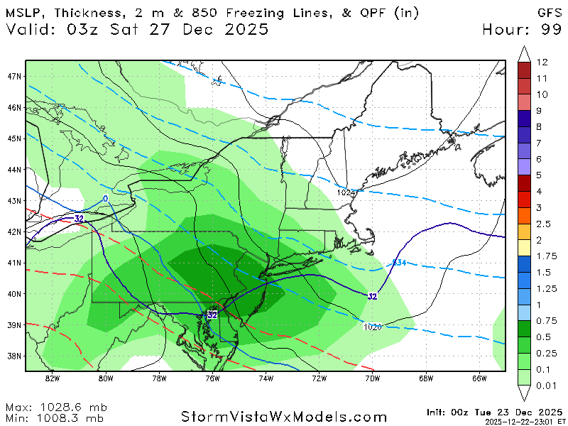
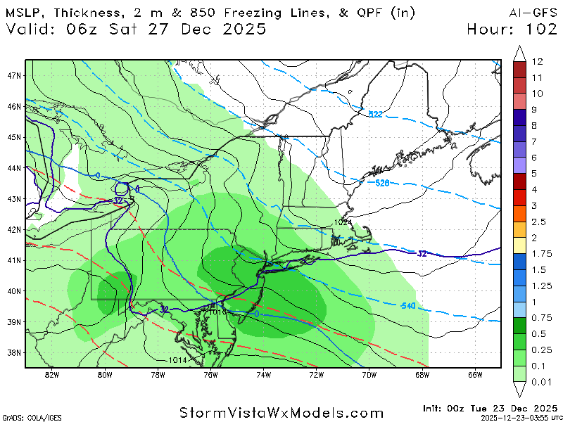
Gfs is what you want to see 5 days out. We want this thing to have wiggle room to come north. This is a weird storm though. Like some kind of atomic clipper.
-
Terrible run . No precip
-
Damn.
-
Not much margin for error since the cold side precipitation is unlikely to be extremely widespread. But run to run changes are decreasing in magnitude and most mid-range guidance appears to be converging on at least some wintry precip. locally. Obviously a fringing or ZR to rain are still possible but the envelope appears to be shrinking.
-
Gfs north
-

December 2025 regional war/obs/disco thread
TauntonBlizzard2013 replied to Torch Tiger's topic in New England
Congrats Philly on the gfs -
Wintry 5 days on the GFS! Might even squeeze in some flakes or ZR on Xmas day in the weak wave in between the Tue and Fri night events.
-
Did get little warmer than last run though.
-
Heavy precip from Philly to NYC
-
.thumb.png.4150b06c63a21f61052e47a612bf1818.png)
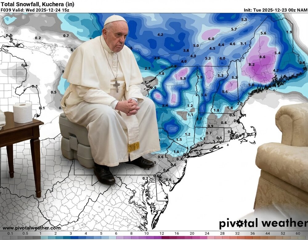
White Christmas Miracle? December 23-24th
HIPPYVALLEY replied to Baroclinic Zone's topic in New England
Definitely some dry air to fight through. Currently 23/16 at mi casa. Counting on that initial burst to drop an inch here. -
Gfs is nasty icy for northern tier
-
Both GFS and GFS-AI ticked slightly further north vs. 18z. Still snowy (some ice SW) for most areas. Kind of the sweet spot right now.
-

E PA/NJ/DE Winter 2025-26 Obs/Discussion
CoolHandMike replied to LVblizzard's topic in Philadelphia Region
Anybody seeing any actual flakes tonight, or is it all just virga? -

White Christmas Miracle? December 23-24th
JKEisMan replied to Baroclinic Zone's topic in New England
HREF. Still going up north.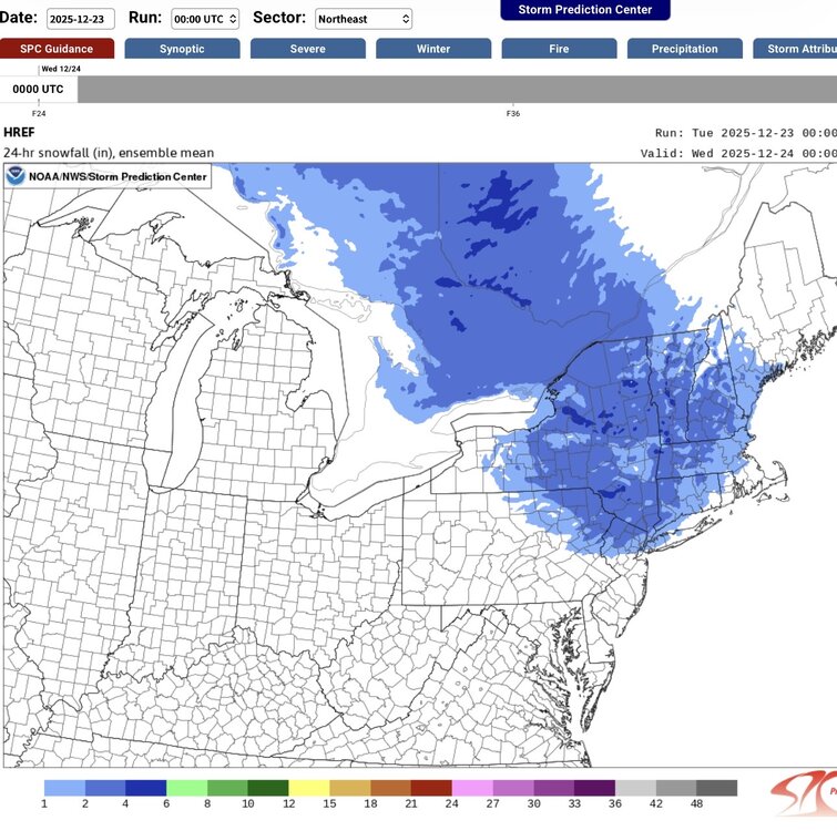
-
Gfs is a beauty
-
MECS? Anthony?
-
I just posted this in another thread but this one may be more appropriate… I’m looking to rent a cabin in the NC mountains for New Years Eve through the weekend - where’s the best chance for snow?
-
AI gfs
-
I’m looking to rent a cabin somewhere in the NC mountains for New Year’s Eve through the weekend… Where’s the best chance for snow? Or where’s the best place for me to ask this question? Lol
-
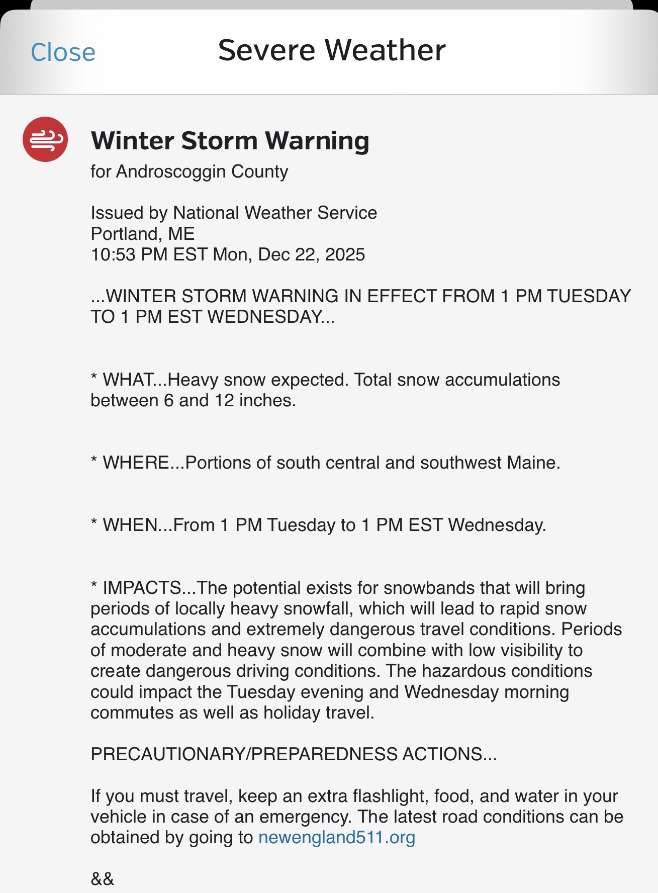
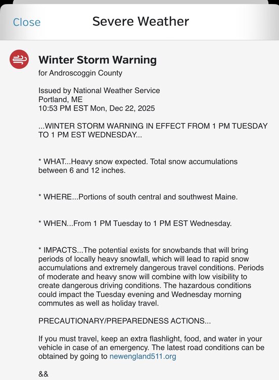
WSW hoisted
-
I haven’t seen any reports of overperforming coming out of PA where it’s currently snowing so I think the models might be onto something with the marginal temps and drier air
-

White Christmas Miracle? December 23-24th
bristolri_wx replied to Baroclinic Zone's topic in New England
-

White Christmas Miracle? December 23-24th
tunafish replied to Baroclinic Zone's topic in New England
IVT already showing up on radar over midcoast Maine??