All Activity
- Past hour
-
There is a 24 hour tele connector that exists because it’s statistically significant that’s all I’m gonna say I honestly don’t need the meteorology lesson
-
That cell is very disorganized, hopefully it doesn’t come back
-
That cell is probably about to cycle and put down another monster
-

E PA/NJ/DE Summer 2026 Obs/Discussion
RedSky replied to PhiEaglesfan712's topic in Philadelphia Region
18z goofus was well north with the monday chance -
just gonna leave this here, for now.

-
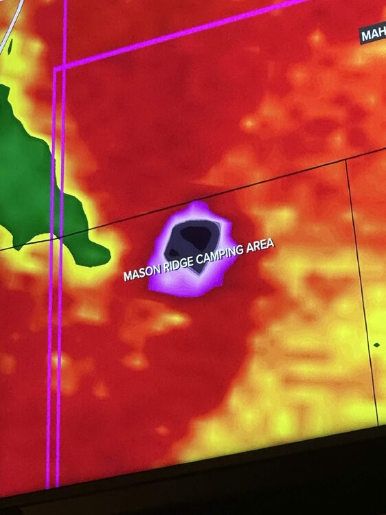
Is this thing throwing debris 5-10 miles away? Is that what's showing on radar?
-
Looks like it direct hit a campground
-

Central PA Summer 2026 Discussion/Obs Thread
Jns2183 replied to Voyager's topic in Upstate New York/Pennsylvania
Watching the Great outdoors I am one with the racoons Sent from my SM-S731U using Tapatalk
-
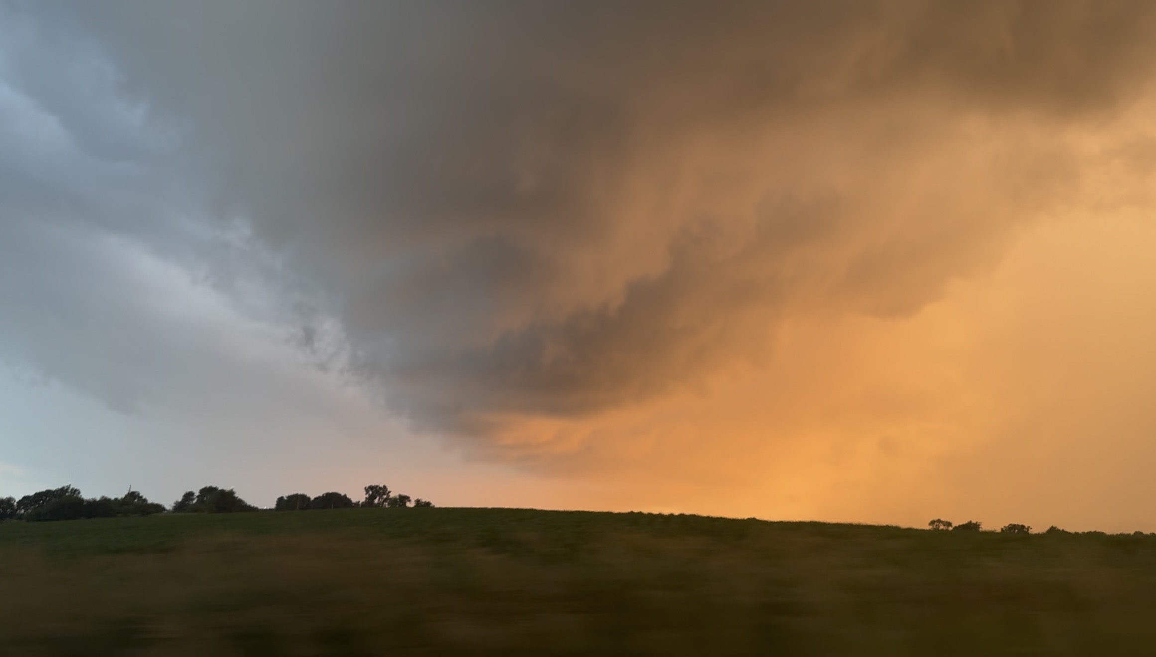
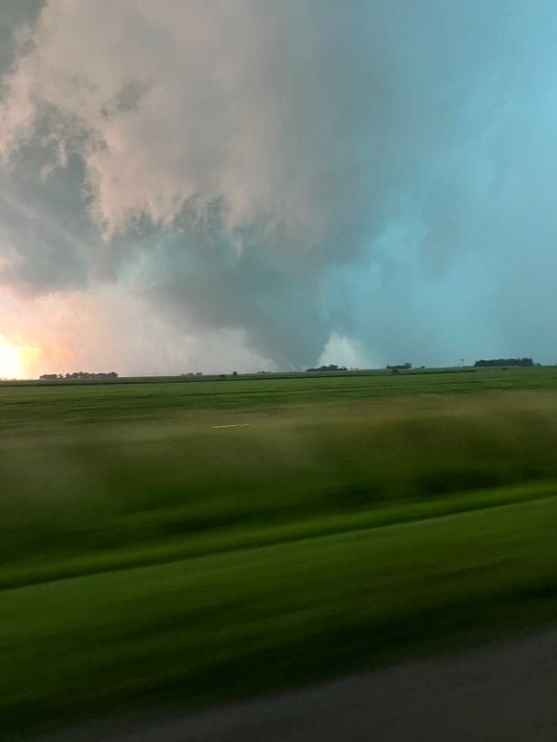
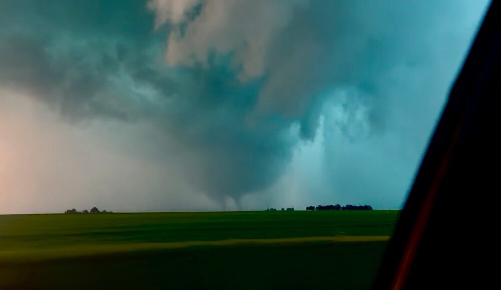
Still from video I took of the warned rotation in the notch in SE Rock County WI around a half hour ago, the greened up corn + the sunset made it majestic.

-
Spc discussion on it says the environment out ahead of it has fully recovered, this might be the storm of the event, definitely a violent tornado.
-
This is unreal
-
The amount of trees that thing has to be lifting is insane. Absolutely unreal debris ball.
-
Charleston IL spinner PT.

-
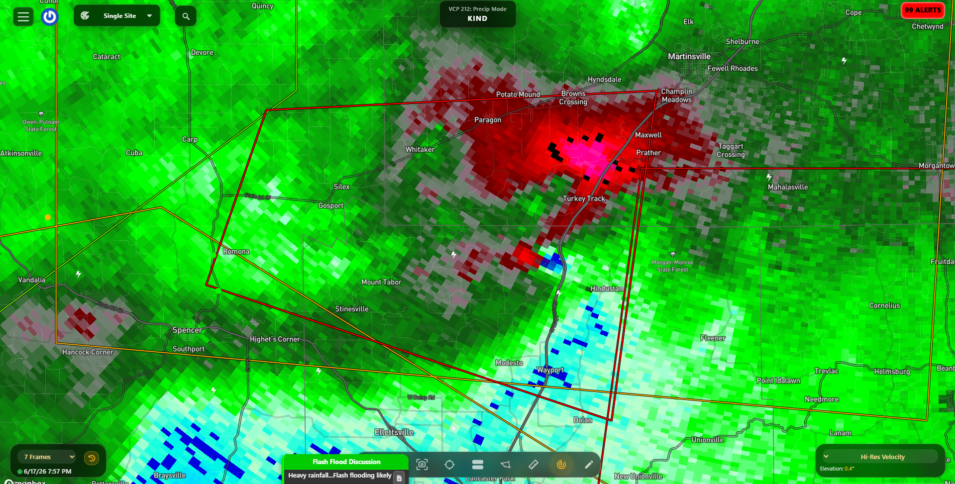
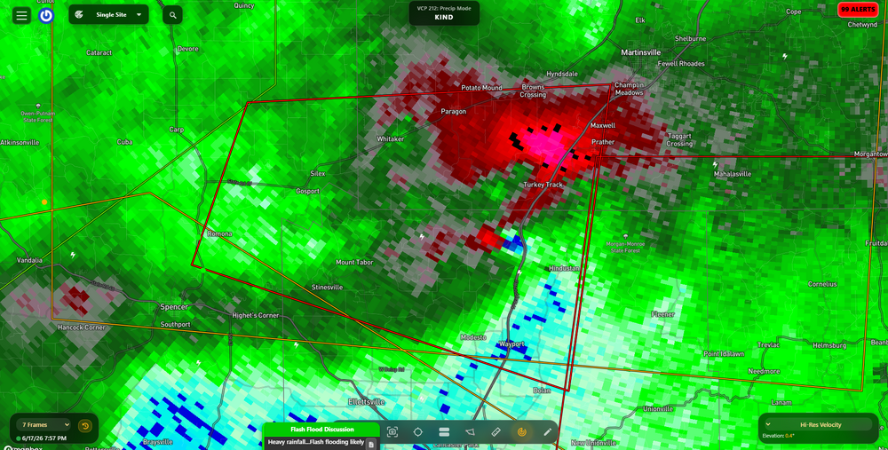
72 dBZ debris ball south of Indy, that is a mean tornado.
-
Wow that debris ball and growing
-
What the fuck
-
Monster debris ball and cc drop near Gosport IN
-
Yes, on the shore.
-
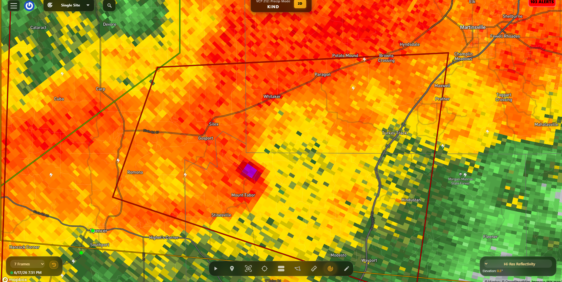
Pink debris ball on that cell near mount tabor

-
Bloomington IND college webcam for sickos like myself who love to watch frequent lightning. (time sensitive of course) https://cpf.iu.edu/weather-camera/index.html
-

-
-
Bingo. Without the MCS we probably have a Palm Sunday level outbreak
-

Late May/June 2026 Medium/Long Range
Stormchaserchuck1 replied to JenkinsJinkies's topic in Mid Atlantic
Nino 1+2 is +2.8c! July in strongly warm Nino 1+2 years August and September are near average historically, for most of the country. Maybe not enough examples. Let's see if we get a cool October. If the PDO doesn't shift to neutral by then, it counteracts this. -
Spinner paradise!

.thumb.jpg.5af6c8520bd26ab0d13e24b2747484e1.jpg)