All Activity
- Past hour
-
Nice washout of a day for my cousin-in-law's daughter's college graduation party. On a normal June day it would be a pool and backyard event, but I kind of doubt it today. Nothing worse than being relegated to the indoors (probably garage) on what should be a fun, outdoor event.
-
It looks like the stalled front will push further south today. Any heavier rain will probably be from DC and SW, then end up moving southeastward towards eastern VA. That HP to the NE looks a bit more robust on the latest runs. Probably plenty of drizzle and some scattered showers for places further N and E in our region.
-
New SST records set for the subtropical oceans.
-
Lol...the on-air bot said no The GFS and EURO indicate that upwards of 1000-2000 J/kg of instability is available on Thursday afternoon, which could lead to severe thunderstorms,
-
South and west and east…
-
Dogs teach us great lessons. Sorry about your friend, friend.
-
HRRR FTW 6z Euro yesterday FTL @Ginx snewx
-
Managed 0.33" as it weakened. Lucky to get that. Literally disintegrated just to my east.
-
Sea breezes and ocean views are the prime reason that so many people love living near the shore. Back in my old hometown places on the Boardwalk are going for almost 5 million dollars. It’s why so many people from NYC come out to Long Beach during the summer. Even the West End where houses used to sell for 50 thousand back in the 1970s is pushing almost 6 million to live on Reynolds Channel. When I grew up in those days Long Beach was more like Coney Island with arcades and an amusement park on the Boardwalk. Now it has become one of the most in demand Long Island real estate markets. https://www.realtor.com/realestateandhomes-detail/100-Boardwalk-Unit-1001_Long-Beach_NY_11561_M99207-31637?from=srp-list-card https://www.realtor.com/realestateandhomes-detail/853-W-Park-Ave_Long-Beach_NY_11561_M30048-76311?from=srp-list-card
-
Beautiful enjoy
-
-
-
Man euro has a nice MCS look at times. We pray.
- Today
-
Big cell formed yesterday like 3 miles to the east and moved away. Total for June so far just a quarter inch. Germantown is back!
-
@Eskimo Joeany details regarding the mesonet in Harney? This station is really close to the golf course I manage and will be a great asset for me. Thanks for any additional info.
-
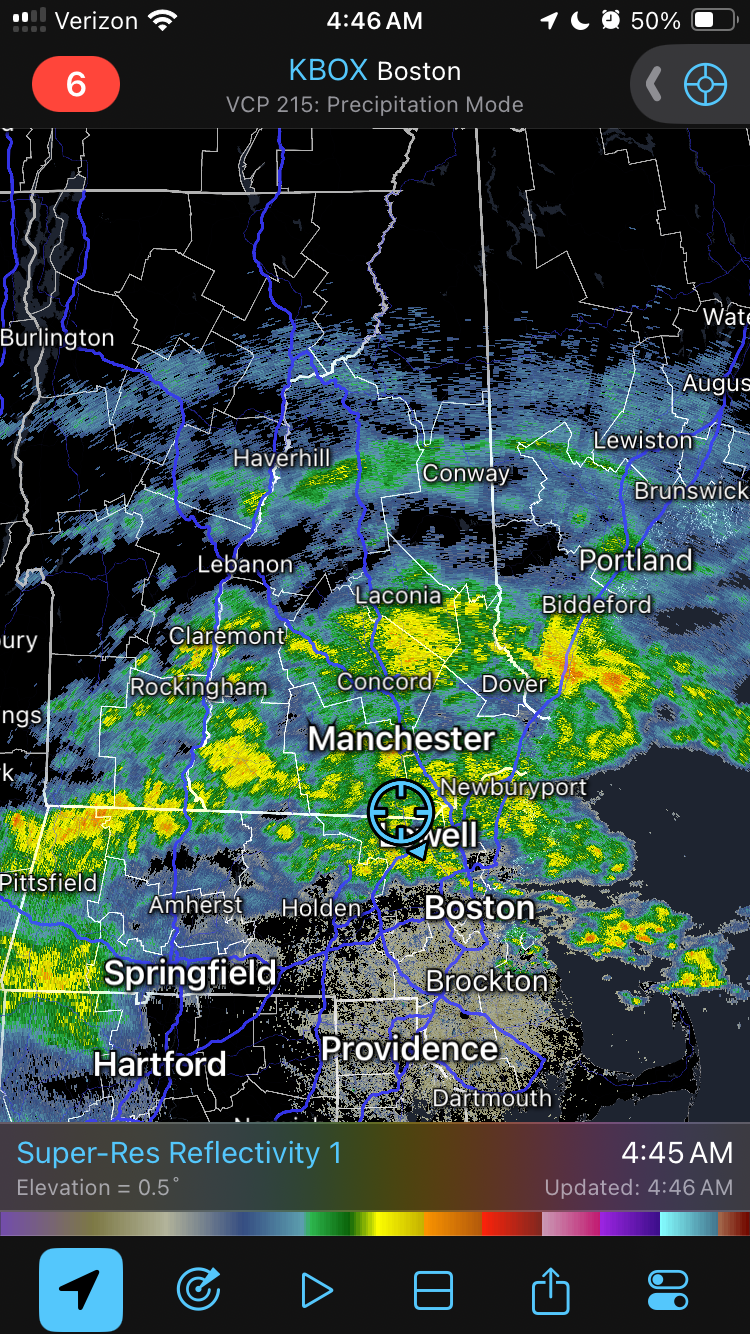
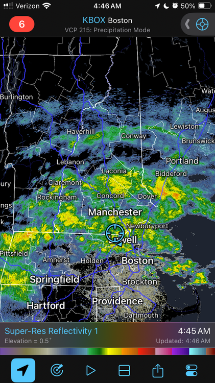
57° rain should be here soon. Hopefully it moves quickly.
-
Steined for once. Let’s clear this shit out.
-
How many apple martinis?
-
1200 dcape and 100/65 .. good wind threat. You were drunk
-
Columbia: Friday 6/13/25 0.09” — heaviest rains were to my south
-
0.18” here pretty pathetic for being under a flood warning
-
 Lekian4 joined the community
 -
Flood Watch National Weather Service State College PA 241 AM EDT Sat Jun 14 2025 PAZ010>012-017>019-045-046-049>053-142000- /O.NEW.KCTP.FA.A.0012.250614T0641Z-250614T2000Z/ /00000.0.ER.000000T0000Z.000000T0000Z.000000T0000Z.OO/ Elk-Cameron-Northern Clinton-Clearfield-Northern Centre-Southern Centre-Southern Clinton-Southern Lycoming-Union-Snyder-Montour- Northumberland-Columbia- Including the cities of Sunbury, Renovo, Ridgway, St. Marys, DuBois, Lewisburg, Bloomsburg, Philipsburg, Williamsport, Lock Haven, Clearfield, Berwick, Selinsgrove, Shamokin, Danville, State College, and Emporium 241 AM EDT Sat Jun 14 2025 ...FLOOD WATCH IN EFFECT THROUGH THIS AFTERNOON... * WHAT...Flash flooding caused by excessive rainfall is possible. * WHERE...A portion of central Pennsylvania, including the following areas, Cameron, Clearfield, Columbia, Elk, Montour, Northern Centre, Northern Clinton, Northumberland, Snyder, Southern Centre, Southern Clinton, Southern Lycoming and Union. * WHEN...Through this afternoon. * IMPACTS...Excessive runoff may result in flooding of rivers, creeks, streams, and other low-lying and flood-prone locations. Flooding may occur in poor drainage and urban areas. * ADDITIONAL DETAILS... - A several hour period of moderate to heavy rainfall and possible embedded thunderstorms this morning could produce widespread rainfall amounts of 1 to 2 inches in the Watch area with local amounts exceeding 3 inches. Rainfall rates of 1 to 2 inches per hour could produce flash flooding. - http://www.weather.gov/safety/flood PRECAUTIONARY/PREPAREDNESS ACTIONS... You should monitor later forecasts and be prepared to take action should Flash Flood Warnings be issued.
-
I'm at 0.00
-
Not even narrow. Is it too much to ask for a dry fucking Saturday morning? Where’s the Stein talked about?
-
Flood Watch National Weather Service Baltimore MD/Washington DC 212 AM EDT Sat Jun 14 2025 DCZ001-MDZ013-016>018-504-VAZ025>031-036>040-050-051-053>057-501-502- 505>508-526-527-141415- /O.NEW.KLWX.FA.A.0012.250614T1800Z-250615T0300Z/ /00000.0.ER.000000T0000Z.000000T0000Z.000000T0000Z.OO/ District of Columbia-Prince Georges-Charles-St. Marys-Calvert- Central and Southeast Montgomery-Augusta-Rockingham-Shenandoah- Frederick VA-Page-Warren-Clarke-Nelson-Albemarle-Greene-Madison- Rappahannock-Orange-Culpeper-Fairfax-Arlington/Falls Church/Alexandria-Stafford-Spotsylvania-King George-Northern Fauquier-Southern Fauquier-Western Loudoun-Eastern Loudoun- Northern Virginia Blue Ridge-Central Virginia Blue Ridge- Northwest Prince William-Central and Southeast Prince William/Manassas/Manassas Park- 212 AM EDT Sat Jun 14 2025 ...FLOOD WATCH IN EFFECT FROM 2 PM EDT THIS AFTERNOON THROUGH THIS EVENING... * WHAT...Flooding caused by excessive rainfall is possible. * WHERE...Portions of DC, including the following , District of Columbia, Maryland, including the following areas, Calvert, Central and Southeast Montgomery, Charles, Prince Georges and St. Marys, and Virginia, including the following areas, Albemarle, Arlington/Falls Church/Alexandria, Augusta, Central Virginia Blue Ridge, Central and Southeast Prince William/Manassas/Manassas Park, Clarke, Culpeper, Eastern Loudoun, Fairfax, Frederick VA, Greene, King George, Madison, Nelson, Northern Fauquier, Northern Virginia Blue Ridge, Northwest Prince William, Orange, Page, Rappahannock, Rockingham, Shenandoah, Southern Fauquier, Spotsylvania, Stafford, Warren and Western Loudoun. * WHEN...From 2 PM EDT this afternoon through this evening. * IMPACTS...Excessive runoff may result in flooding of rivers, creeks, streams, and other low-lying and flood-prone locations. Creeks and streams may rise out of their banks. Flooding may occur in poor drainage and urban areas. * ADDITIONAL DETAILS... - Showers and thunderstorms will increase in coverage through this afternoon and evening. Some thunderstorms will contain heavy rainfall, with rainfall amounts around 1 to 3 inches possible within an hour or two. Storms may also train over the same areas, causing the possibility for locally higher amounts around to 5 inches of rain within a few hours. Heavy rainfall in a short period of time combining with already saturated soils means that creeks and streams may rapidly rise out of their banks along with the potential for flash flooding in urban areas.