All Activity
- Past hour
-
 Actuellement, de nombreux internautes choisissent l'Ordre des MГ©decins pour la fiabilitГ©.
 -
Sunset alert, beautiful orange and pink sky!
-
Today's Highs (coolest of the next 7) PHL: 90 New Brnswck: 87 TEB: 85 LGA: 85 TTN: 85 EWR: 84 NYC: 84 ACY: 83 JFK: 83 ISP: 83 BLM: 81
-

2026-2027 Super El Nino
EasternLI replied to Stormchaserchuck1's topic in Weather Forecasting and Discussion
I think you're both right. The SST PDO is a reflection of a propensity of the atmosphere to favor that state. Whether that is positive or negative. There are also far longer term oscillations known, such as the IPO. Which can have a period of 40-60 years. I personally believe the IPO explains the long term negative period we have witnessed. There are also short term (+PDO) events within a long term -IPO, and vice versa. Although they are shorter lived than they otherwise would be when they oppose the IPO. With the + or - phase dominant over that entire period depending on the IPO. We are currently in a negative phase. We have been since the late 1990's. For one reason or another, the atmosphere has been predisposed towards -PDO thanks to that. I actually think this explains quite well a year like 23-24(-IPO). Where you can get an el nino with a -PDO. Or on the flip side, a year like 95-96(+IPO). Where you can get a la nina with a +PDO. The EOF of a +IPO is posted below followed by a few studies. Pay extra attention to the second one, as it relates to the North Pacific. Powerful enso events have the potential to flip the Pacific. As the la nina following 97-98 is attributed to beginning this current negative IPO phase. So we're closing in on 30 years now. In this context, I find an inbound record breaking el nino all the more interesting. There's a shot at flipping the longer term Pacific to something more like the following EOF. Instead of the opposite, which we've become accustomed to. The record wildfires in Australia several years ago also may have acted to extend this negative period beyond what it otherwise would have been. By driving the triple dip la nina of the 2020's. In fact it's been postulated that had those fires not happened. 2015-16 likely would have begun the transition to +IPO. The influence of the Interdecadal Pacific Oscillation on Temperature and Precipitation over the Globe https://link.springer.com/article/10.1007/s00382-015-2500-x "Since 1920, there are two warm (1924–1944 and 1977–1998) and two cold (1945–1976 and 1999–present) IPO phases, whose change is associated with abrupt shifts in North Pacific sea level pressure (SLP) and contrasting anomaly patterns in T and P and atmospheric circulation over the eastern and western Pacific." Statistical relationships between the Interdecadal Pacific Oscillation and El Niño–Southern Oscillation https://link.springer.com/article/10.1007/s00382-023-07035-8 " While the spatial SST patterns that represent the IPO and ENSO are similar, the IPO is meridionally broader in the central to eastern Pacific, which may be caused by a lagged relationship with low-frequency SST variability in the equatorial Pacific. In addition, North Pacific SST anomalies of opposite sign to the tropical Pacific SST anomalies is a unique feature of the IPO that cannot be explained by decadal ENSO variability. This suggests a clear IPO and ENSO relationship, but also independence in some of the IPO’s characteristics." The role of interannual ENSO events in decadal timescale transitions of the Interdecadal Pacific Oscillation https://link.springer.com/article/10.1007/s00382-021-05784-y "A long pre-industrial control run with CESM1 is analyzed to show that there is a greater chance of ENSO activity to contribute to an IPO transition when off-equatorial western Pacific Ocean heat content reaches either a maximum (for El Niño to contribute to a transition to positive IPO) or minimum (for La Niña to contribute to a transition to negative IPO) as seen in observations." 2019-2020 Australian bushfire smoke, multi-year La Niña, and implications for the Interdecadal Pacific Oscillation (IPO) https://www.nature.com/articles/s41612-025-01204-8 -

Augdewst 2026: Summer's Last Stand
Damage In Tolland replied to Prismshine Productions's topic in New England
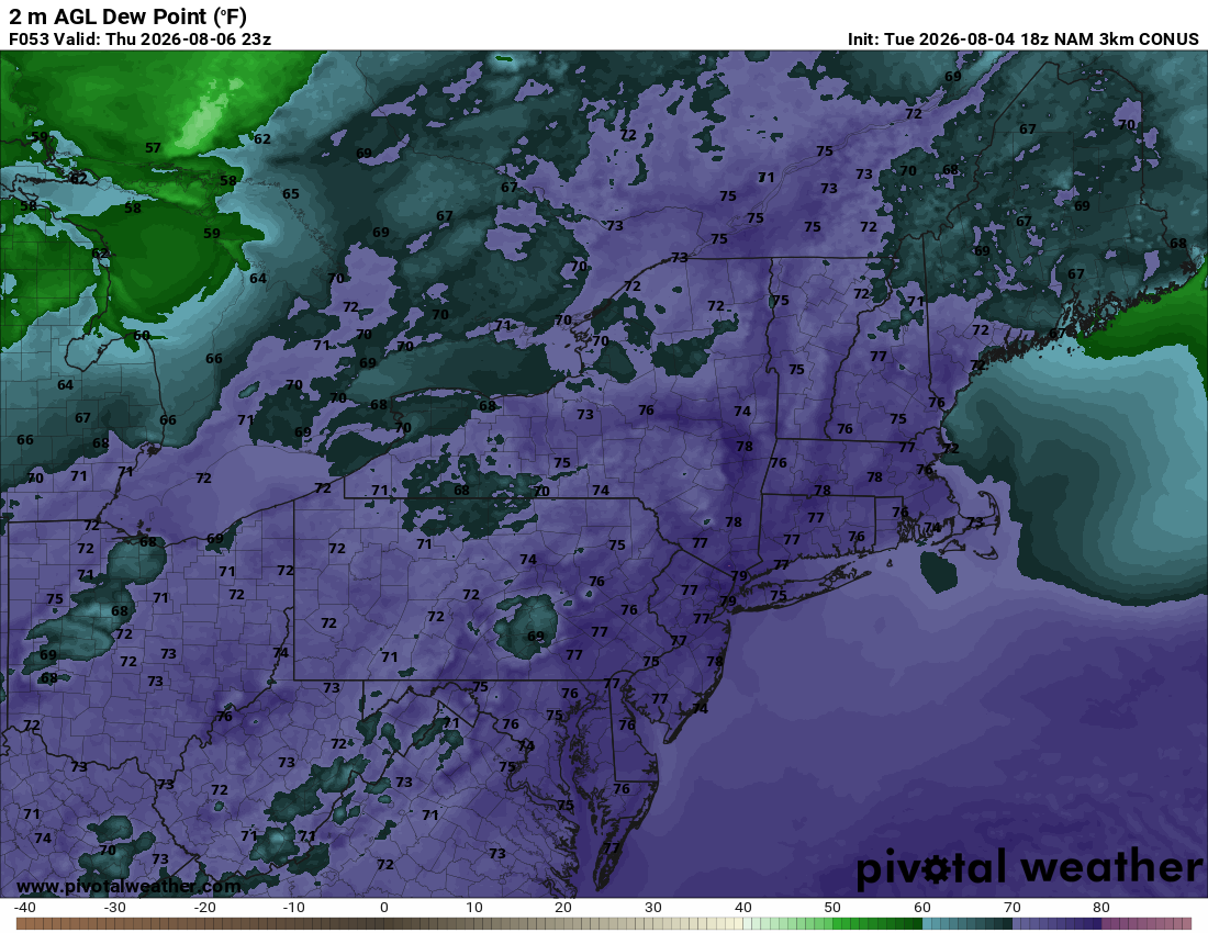
She’s choosing high dews I can tell Getting wet all by herself.. she’s choosing high dews I can tell . - Yesterday
-
Picked up .88" this evening. Pushing 17'' over the last 37 or 38 days.Only takes a couple tenths of rain to stand in the yard.
-

Augdewst 2026: Summer's Last Stand
CoastalWx replied to Prismshine Productions's topic in New England
When it moistens me, everything is sweaty Dripping off my boobies, Mmm the way you dew me. -
-
+1
-
safety standards for overseas shipments Mexi Meds Express https://maps.google.co.vi/url?sa=t&url=https://mexicorxnews.online click here for details [url=https://maps.google.je/url?sa=t&url=https://mexicorxnews.online]companies that ship internationally[/url] federal import policies
-

super el nino banter thread
JACKASS replied to forkyfork's topic in Weather Forecasting and Discussion
I just enjoy reading that anyone who posts warmer than normal temps and ( more importantly, less snow) for this coming winter are immediately chastised by the snow flakes. The meltdowns get more intense as the year progresses. -
Off topic but how about those Sawx? Durbin with a grand slam and then Duran goes back to back.
-
It's not my week. Sunday the axis of convection was too far west. Yesterday it was too far east. Today it was back west. Did manage 0.28" in three separate events today so not a total shut out. Things look hit or miss for the rest of the week.
-
En cas de besoin urgent, voir les offres ici s'avГЁre ГЄtre un choix solide.
-
Probably stays pretty cool under the bridge.
-
And you get to observe the weather
-
2026-2027 Super El Nino
BlizzardWx replied to Stormchaserchuck1's topic in Weather Forecasting and Discussion
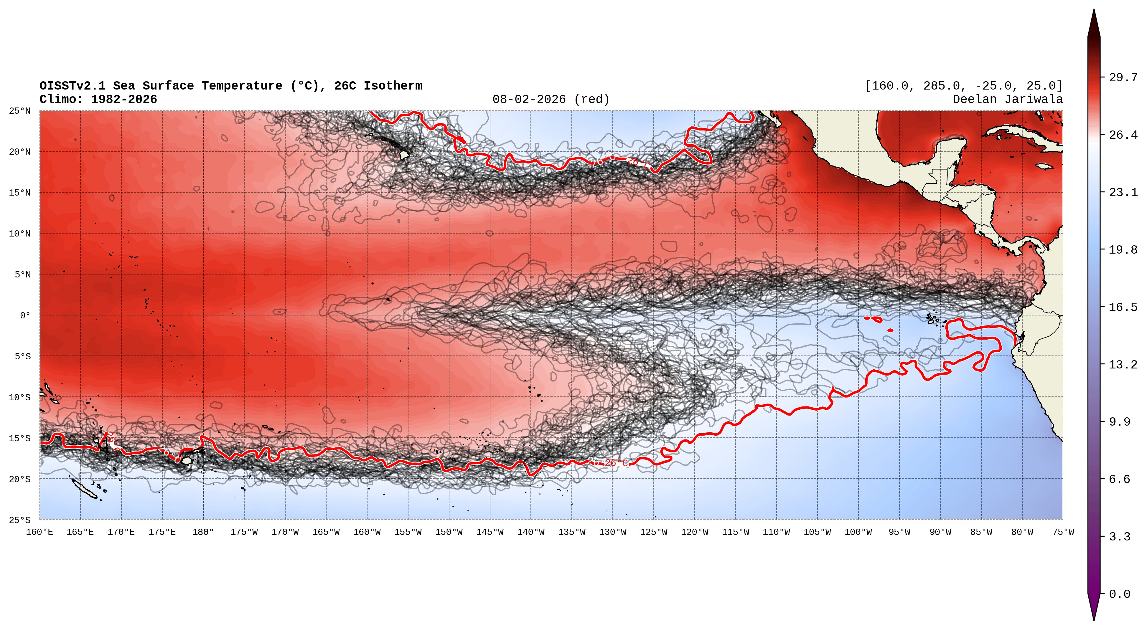
I thought this was an interesting plot I saw on X. Any thoughts on how far east actual convection will fire within the ENSO regions? Sure seems like it'll be further east than ever before. I was actually have a hard time getting a straight answer but at least for the Galapagos Island the average is highest at around 77F in Jan-Mar. If it were to maintain a ~5C anomaly that would be 86F. One would think that would be enough. Did that happen in 97? Just trying to contextualize all this.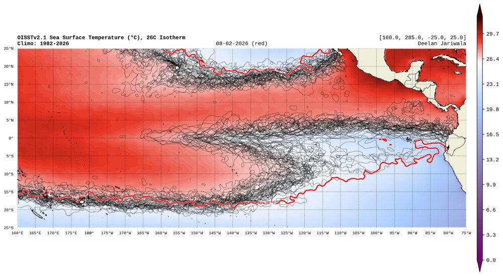
-
.thumb.gif.f92b16c631a1d15d405ed77b33f0710d.gif)
Augdewst 2026: Summer's Last Stand
Torch Tiger replied to Prismshine Productions's topic in New England
I don't mind extreme hhh but 90 with 70s dews is perfect summer -

2026-2027 Super El Nino
Stormchaserchuck1 replied to Stormchaserchuck1's topic in Weather Forecasting and Discussion
Did we break any records today with the 500mb trough over the Arctic? It got down to 5030dm I think. I know at the end of last Aug we set an all time N. Hemisphere record for Aug at something like 4980dm. -
 Dolphin is definitely winning in beauty points. Absolutely gorgeous expansive typhoon.
 -
Nice gig ya got going there. Pretty much stress free!!
-
Funny how the peeps that work without ac aren’t the ones pushing for extreme heat and humidity.
-

Augdewst 2026: Summer's Last Stand
dendrite replied to Prismshine Productions's topic in New England
Just a shy guy looking for some 2ply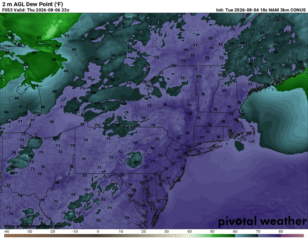
-
Hopefully the weather improves for y’all. That area floods for a rain shower so I can only imagine what its like this week.
-
Juicy out there, flood watch makes sense.