All Activity
- Past hour
-
If a picture is worth a thousand words there will still never be enough to describe these. Magnificent! As always …..
-

Augdewst 2026: Summer's Last Stand
Damage In Tolland replied to Prismshine Productions's topic in New England
TORCH!!!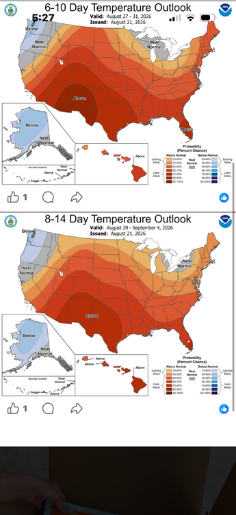
-

2026-2027 Record-breaking El Nino
rclab replied to Stormchaserchuck1's topic in Weather Forecasting and Discussion
When forky gets serious he is untouchable, weather wise. Other than that your point is well taken. Thank you, M, for the ‘factual trolling’ term. I’ve now found a descriptive synonym for political debates. As always …… -
It's all about the dynamics. Get the right dynamics and you can pop whoppers in a wedge. Not sure if this system is going to have the umph we need, but it is certainly more dynamic than anything we have seen this month.
-
ABSOLUTELY BEAUTIFUL!
-
That stuff out west is wild. However...this cloud covered showered cool air will do to it what it always does!
-
Just judging by upstream radar, things look good, but we know how upstream cells can vanish mysteriously once hitting the Raleigh shield.
-

2026-2027 Record-breaking El Nino
40/70 Benchmark replied to Stormchaserchuck1's topic in Weather Forecasting and Discussion
That is nuts....you just recreated my extra tropical Pacific composite. I hadn't even viewed that correlation map, either. Matches it 100%. -
 http://globalcarepharm.com/# cheapest ed pills
 -
First measurable rain since start of the month but just 0.02” lol
-
buying erectile dysfunction pills online: GlobalCare Pharm - online erectile dysfunction medication
-

2026 Severe Wx - General Thread
SchaumburgStormer replied to largetornado's topic in Lakes/Ohio Valley
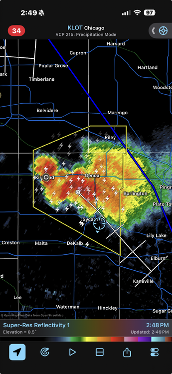
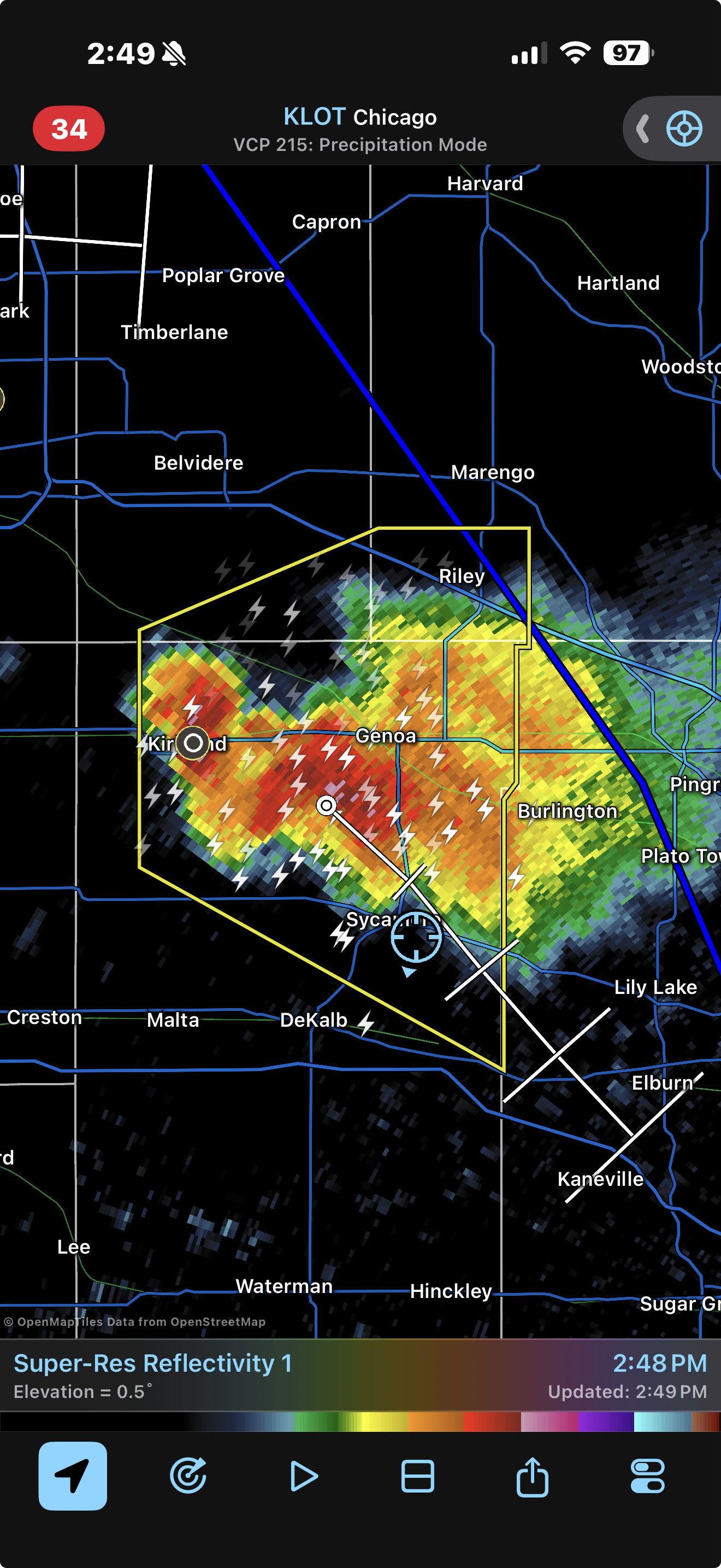
That was a fun way to kill an hour. Storm had a lot of low level rotation but it was broad. Needed just a little kick to tighten it up and it may have spun up a quick one. Passed just NE of me, so I got to watch the whole evolution on the deck. -
Getting a few anvil sprinkles here with the sun still out.
-
 I think a lot of attention is paid to the Pacific when ENSO may actually effect N. America directly If you look at the cold season correlation with Nino 1+2 there is actually a slightly higher max in N. America, north of the Great Lakes, than the NPH area in the N. Pacific It will be interesting to see what happens this Winter in this regard as the PDO/overall 500mb state of the Pacific is so different from El Nino atm.
 -
2026 Severe Wx - General Thread
SchaumburgStormer replied to largetornado's topic in Lakes/Ohio Valley
It’s trying to wrap up due east of me - Today
-
Wettest summer here was the Irene year of 2011 with 27.50", helped along with 21.55" in Aug. Also had 27" during the 30 day period from 8/5-9/5. Driest summer was 6.60" in 1999.
-
I wonder what the animals thought of yesterday's heavy rain.
-
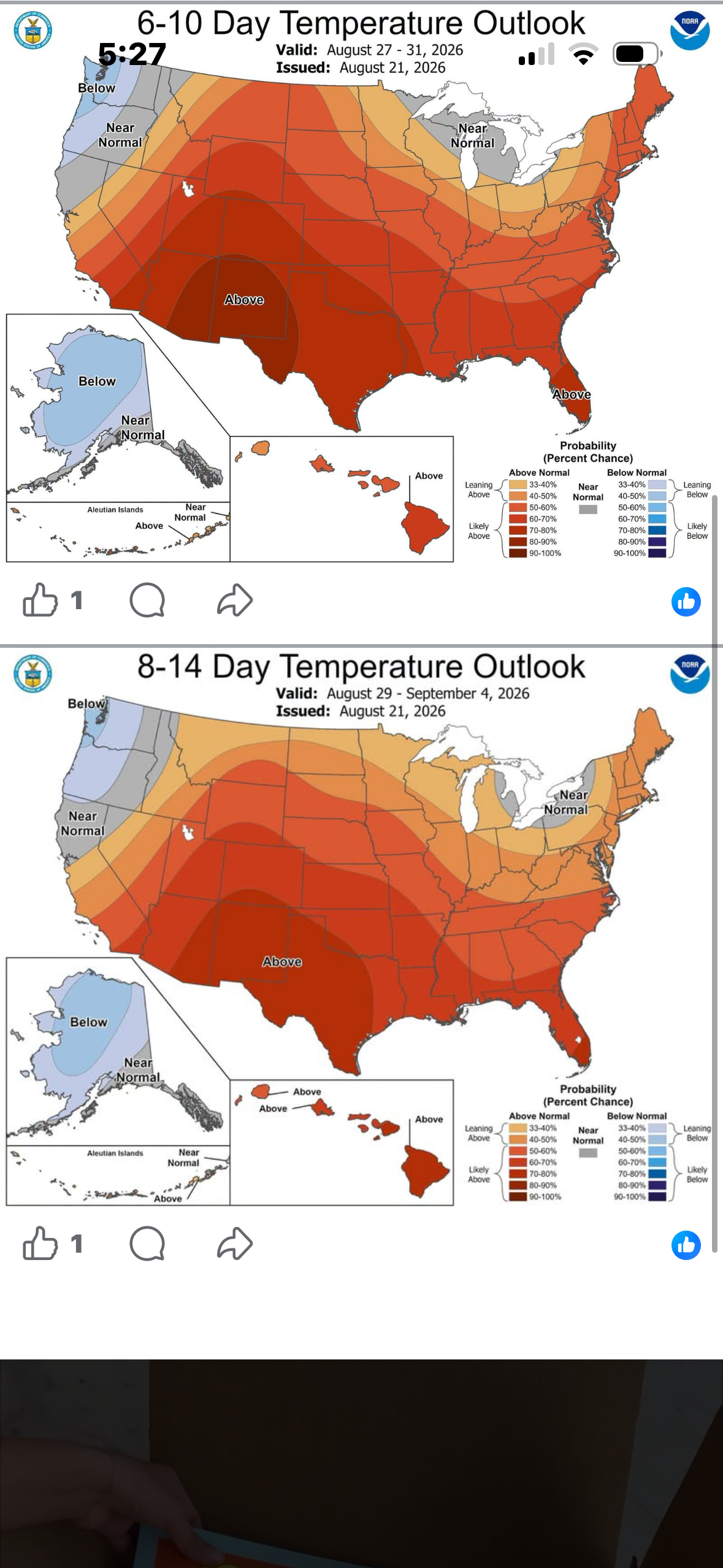
You are exactly right! West of the BR we have fallen into a God-awful pattern whereby feedback from previously existing conditions, foils the best and brightest of the models. The only hope we have is a +2.9 - 3.0 Nino breaking this pattern between Oct 1 and Dec. 31. Earlier today the Euro said, this will happen. The problem is that the Euro is not smart enough to fathom the feedback atmospherics of a serious Drought. Sorry Ji, "elite" is not perfect.
-

Augdewst 2026: Summer's Last Stand
weatherwiz replied to Prismshine Productions's topic in New England
Will be some nasty storms around Sunday if we can destabilize enough -
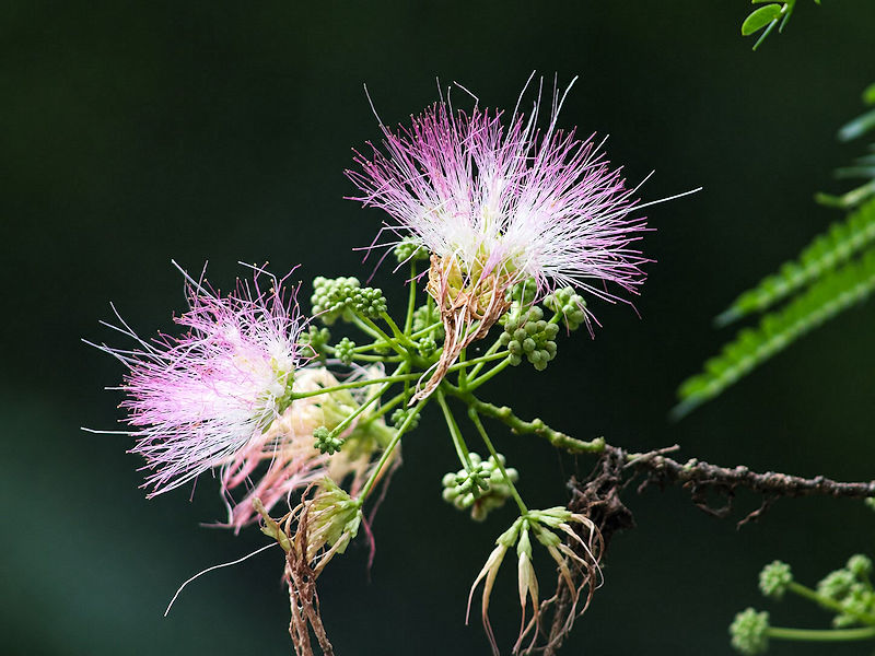
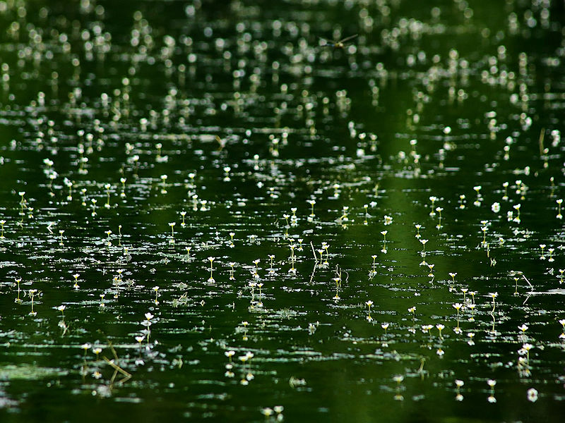
In the wake of yesterday's heavy rain, I went out to Queens to get some photos on a day off. Below are six photos from Alley Pond and Oakland Lake.




-
You know as well as I do that their forecasts underperform. I think they use mostly models, and you can actually utilize other methods (PDO, AMO, Summer N. Atlantic SSTAs, Summer arctic 500mb), to do better. As least that's how it's verified in the last 15 years. Keep in mind though that they did do really well in 15-16 and 23-24. Two of their best forecasts. but yeah, the possible fluctuation is pretty big. 18-19 was stock ENSO for a weaker Nino and it verified opposite. They had near average last Winter in the Rockies and some places were +10F for DJFM.
-

Augdewst 2026: Summer's Last Stand
Prismshine Productions replied to Prismshine Productions's topic in New England
Nascar at Loudon. Sent from my SM-S176V using Tapatalk -
Another arctic low at -400dm today. <5100dm! Since the Solar Max peak we have been getting this a lot May-Sept (24-26). A lot of the "patterns" seem consistent actually - warm start to Summer locally then near average or cooler ending. July-Aug being wettest months locally.
-

Augdewst 2026: Summer's Last Stand
tamarack replied to Prismshine Productions's topic in New England
GYX discussions seemed promising for the weekend but as is often the case, the forecast is "less than a tenth of an inch possible" (which usually verifies). Sandy River is down to 77 cfs, well below the 25% level. Median is 157. -
2026 Severe Wx - General Thread
SchaumburgStormer replied to largetornado's topic in Lakes/Ohio Valley
Narrator voice. It was not, in fact, his moment as the storm drifted just NE dropping .01” of rain