All Activity
- Past hour
-
Im getting tired of the mountains always breaking up snow storms but rain storms cross them fine
-
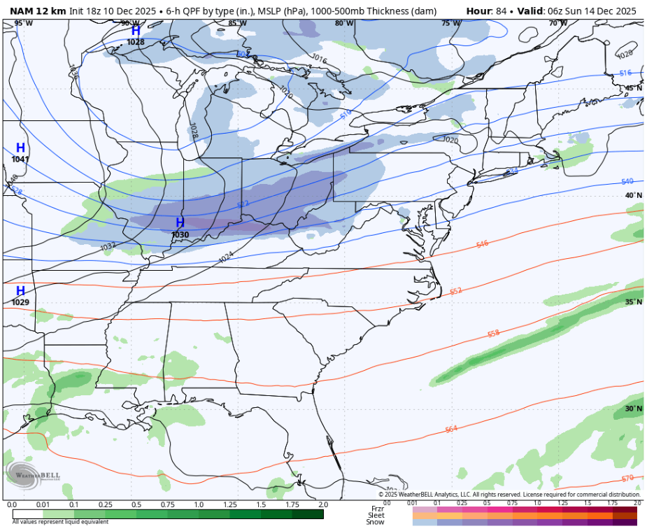
500 mb chart. Shows the expected location of the jet streams and disturbances within.
-
27.5° -SN 3/4”
-
The ratio of whatever fell IMBY is like 4:1. It’s 2.5” but it weighs the same as a dry 8”. Some plain old rain mixed in too.
-

Central PA Winter 25/26 Discussion and Obs
Mount Joy Snowman replied to MAG5035's topic in Upstate New York/Pennsylvania
It's snowing in Harrisburg as I get ready to walk to the train, wasn't expecting that this late in the day. Nice! -
Light to moderate snow falling. It’s a pretty scene here currently. Sticking to all surfaces. Globals and the NAM FTW on this one.
-

Central PA Winter 25/26 Discussion and Obs
Ruin replied to MAG5035's topic in Upstate New York/Pennsylvania
No snow all rain temps higher then forecast -
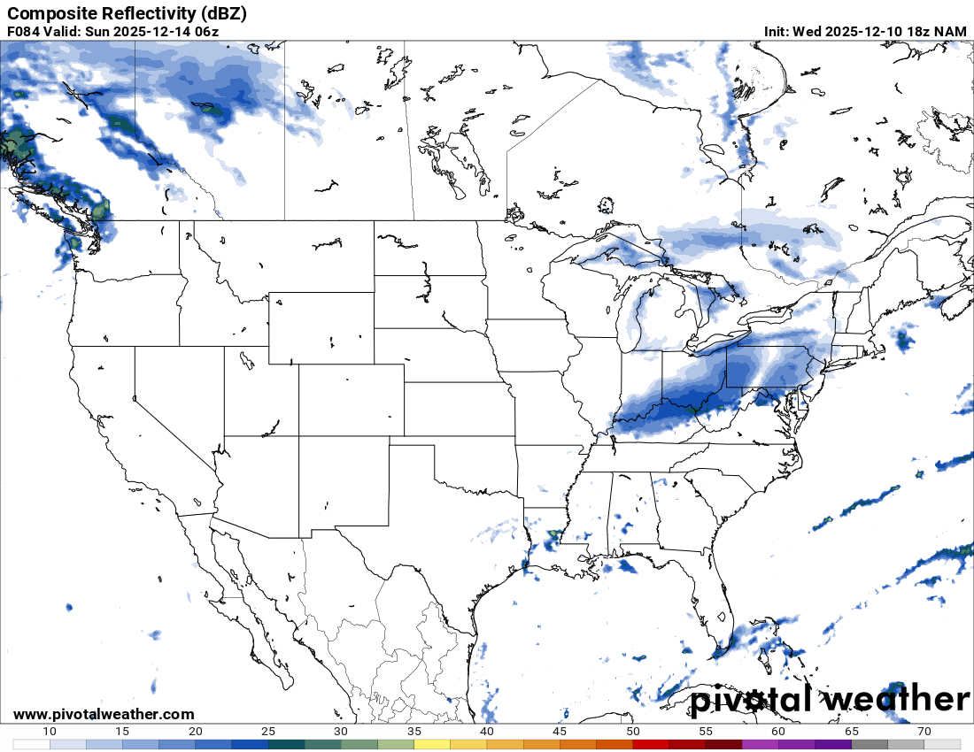
go to 18z nam for the composite. Right at 84 you see the explosion of snow in the east. that link defaults to 12z

-
That's the Composite Radar off Nam.
-
-
2.5” total. After 1:00 AM added water content without adding any more depth. Some 40 dbz silver dollar flakage, but it was mixed with rain too.
-
Ya that looks like the other models. Question is what does it do after that crosses the mountains.
-
.thumb.jpg.6a4895b2a43f87359e4e7d04a6fa0d14.jpg)
Central PA Winter 25/26 Discussion and Obs
Yardstickgozinya replied to MAG5035's topic in Upstate New York/Pennsylvania
And just like that it's raining. -

December 2025 regional war/obs/disco thread
mahk_webstah replied to Torch Tiger's topic in New England
Nothing in Concord, but up here in Boscawen snowing quite hard roads covered, and the temperatures down to 28. -

-

E PA/NJ/DE Winter 2025-26 Obs/Discussion
RedSky replied to LVblizzard's topic in Philadelphia Region
Significant amount of precipitation still to work through interesting -
And pursuant to the name of your account, central park under measures everything so I doubt this would get anywhere near 4”
-
Central PA Winter 25/26 Discussion and Obs
Yardstickgozinya replied to MAG5035's topic in Upstate New York/Pennsylvania
It's been all frozen here for about the last forty five minutes, still mainly sleet with some larger snowflakes mixing in at times. -
There has been some talk about a torch leading up to Christmas. The White Christmas fans would have loved Christmas 1969 in Augusta County. I recorded 12 inches of snow with a high of 24 and low of 14. Lets do it....................................
-
What am I looking at? lol
-

December 2025 Short/Medium Range Forecast Thread
Carvers Gap replied to John1122's topic in Tennessee Valley
I posted this on Nov 21st about the first and second weeks of November. Look at the second paragraph. That standing wave was replaced by a trough. Is that standing wave over the SE a feedback error on the EPS and Euro? -
https://www.pivotalweather.com/model.php?m=nam&p=refcmp&rh=2025121012&fh=84&r=conus&dpdt=&mc=&pwplus=1 @TSSN+
-
E PA/NJ/DE Winter 2025-26 Obs/Discussion
RedSky replied to LVblizzard's topic in Philadelphia Region
Eh it is now snowing 34F -

Winter 2025-26 Short Range Discussion
Radtechwxman replied to SchaumburgStormer's topic in Lakes/Ohio Valley
Live and die by hrrr. Usually dont give it any credibility till day of event Clippers are a nightmare to forecast. Seems like a lot of last second shifts with these. Also could be a relatively narrow corridor of frontogenic banding with areas outside getting more of a pixie dust snow. Definitely not spread the wealth. Sat has a little bit better coverage. -
This is most accurate. The ifs are: If temps keep increasing as they have been in a straight line If underlying background factors dont change like a Pacific affecting the jetstream If we continue to add people and or cement. That last factor in the NY area is huge and not talked about enough. I live in Westchester between 287 and Cross County so I’m not in the hinterlands. It is not unusual in the morning to leave my house and have Jfk be 10 to 15° warmer. It is fucked up. Royally fucked up. and that has been amplified in our new warmer climate. There was always a UHI effect, but it has gotten more extreme. The city cant stay cold and cant keep snowfall on the ground. And I’m not talking about Midtown Manhattan…this is going on in Queens. for all purposes, the LaGuardia Astoria Corona area is now the hottest part of the city. And that corresponds with a huge increase in large buildings and cementing that has taken place in that area and in Flushing over the last 20 years. I’m amazed that they’re building condos on that contaminated land next to the citi field. That should be a super fund site and will be a cancer cluster. You could smell it when you drive over it on the Van Wyck.