All Activity
- Past hour
-

November 2025 general discussions and probable topic derailings ...
alex replied to Typhoon Tip's topic in New England
Saw this guy yesterday on my deck. Didn’t seem very fat but on so cute
-
Is this just a wind threat or will there be rain associated with it?
-

November 2025 general discussions and probable topic derailings ...
weatherwiz replied to Typhoon Tip's topic in New England
I would not be shocked to see convective blossom towards the Cape tomorrow night -
That’s interesting, Chris! Regardless, this NYC snowfall rule before/after an SSW is tangential to the significant correlation of major SSW to several weeks of cold following a lag period in the E US as a whole.
-
Thread started for tomorrow night... might need pinning? Thank you very much. OBS for the wind event will go right into this thread...I'll probably adjust it for OBS in the headline at 6PM tomorrow.
-
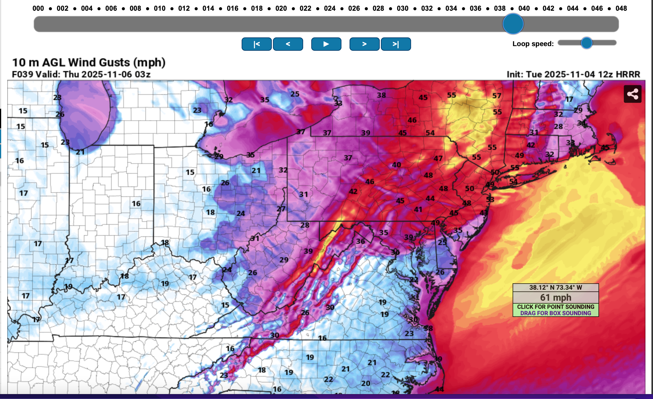
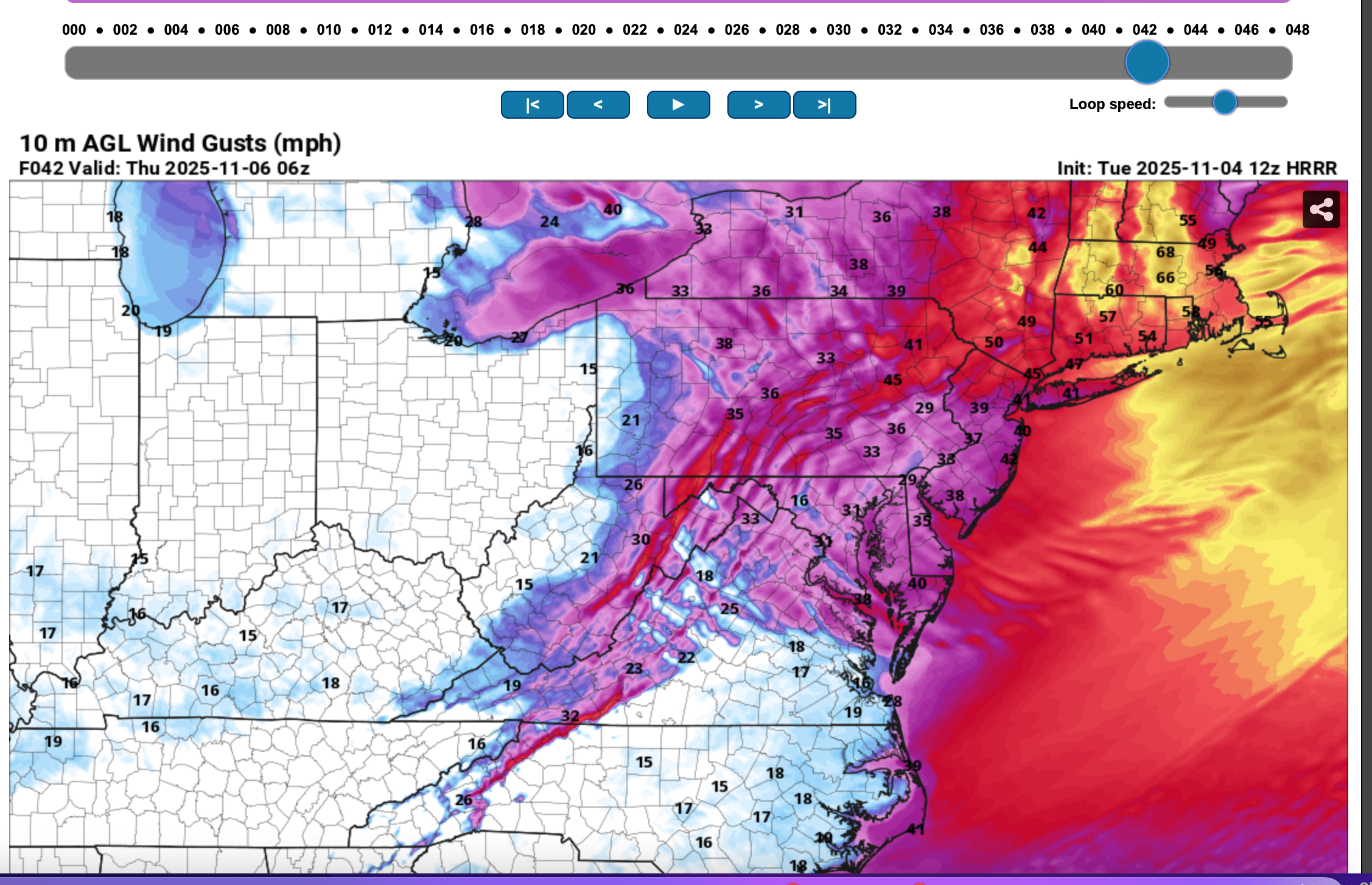
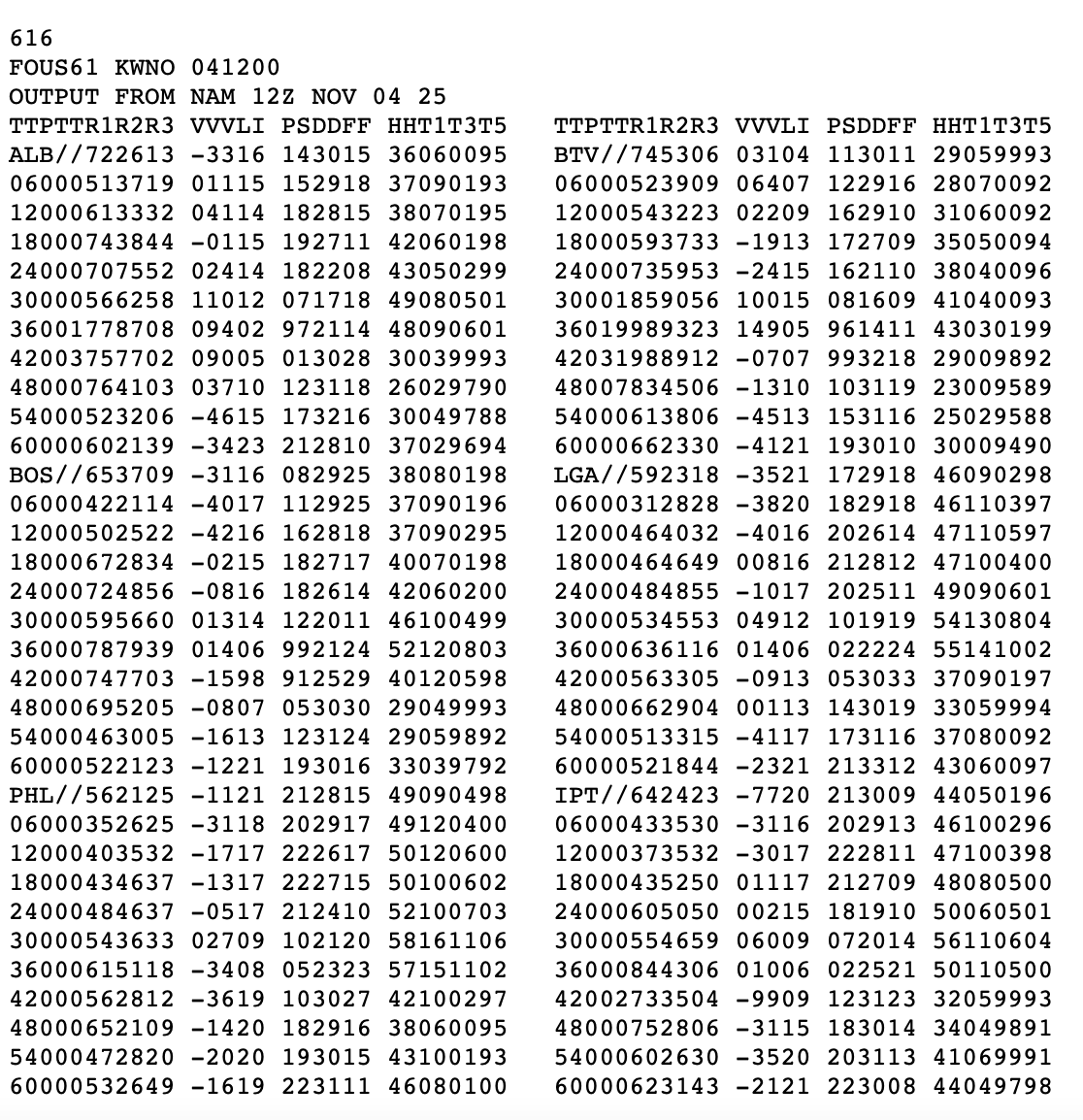
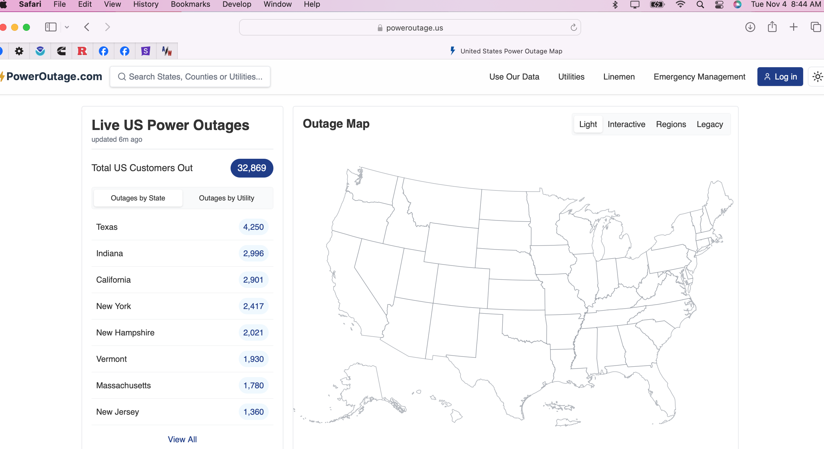
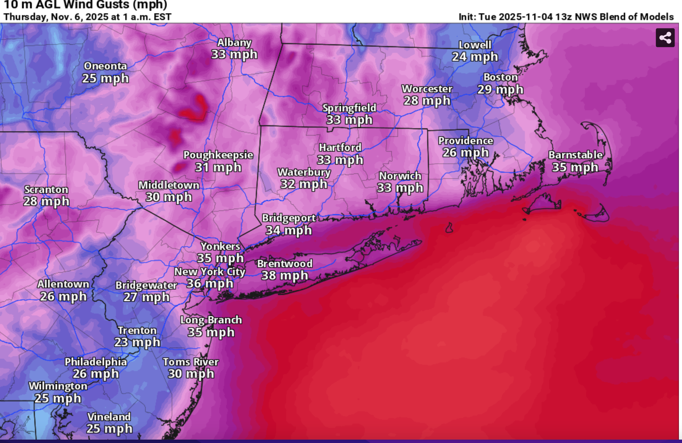
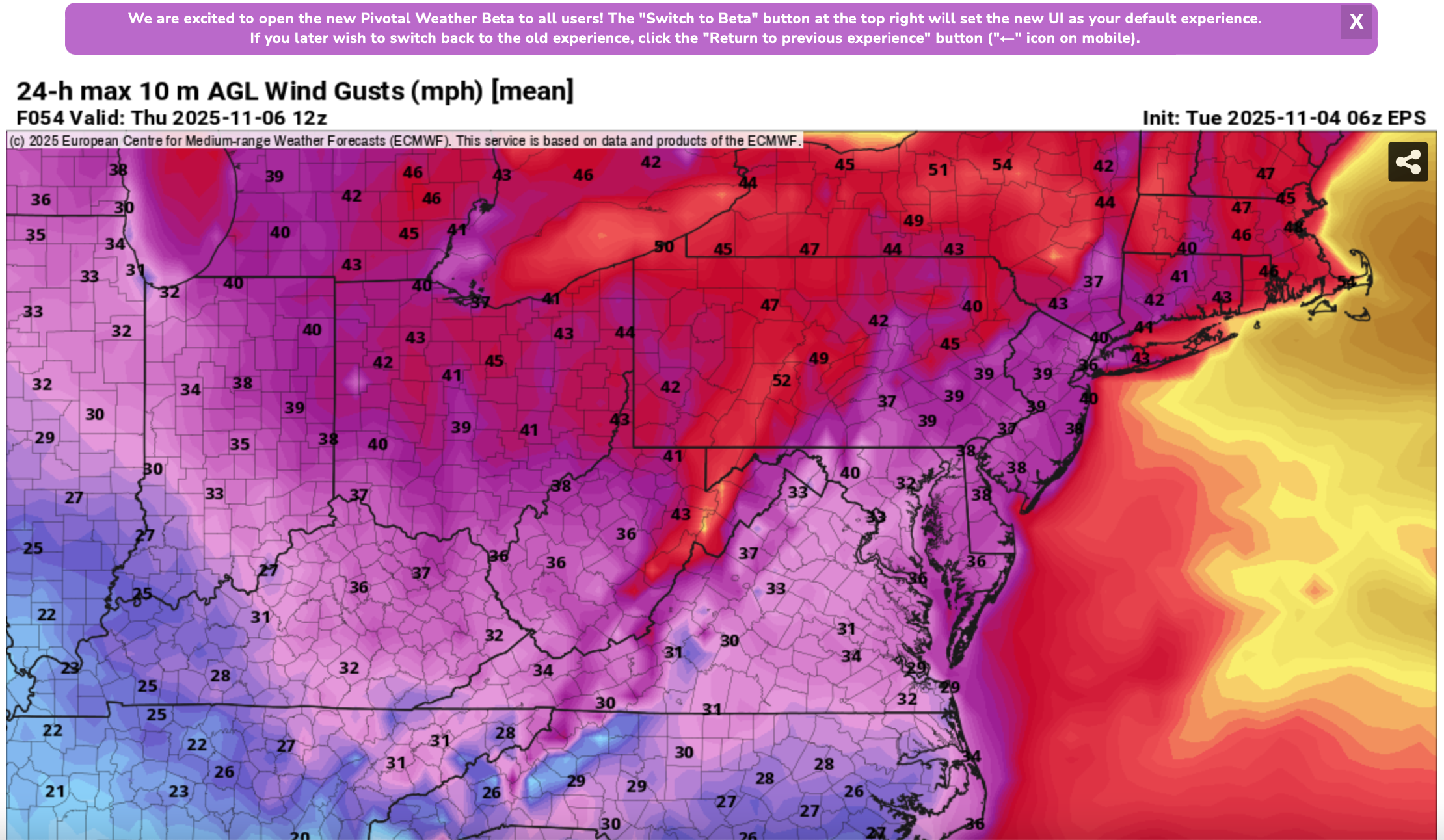
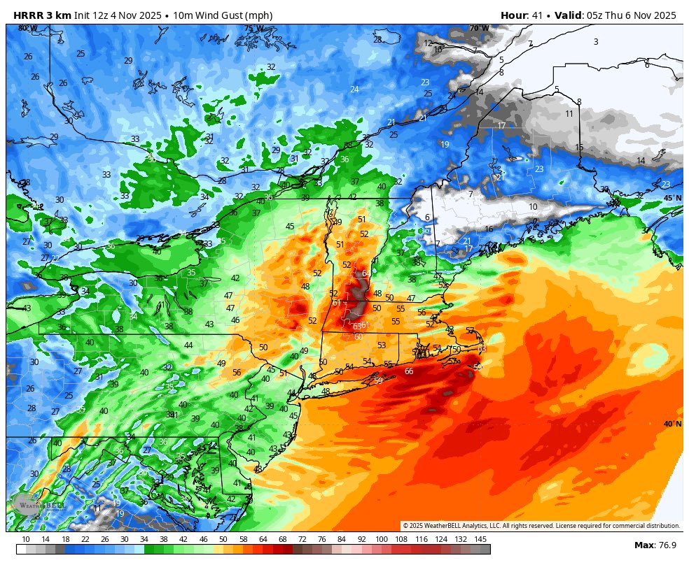
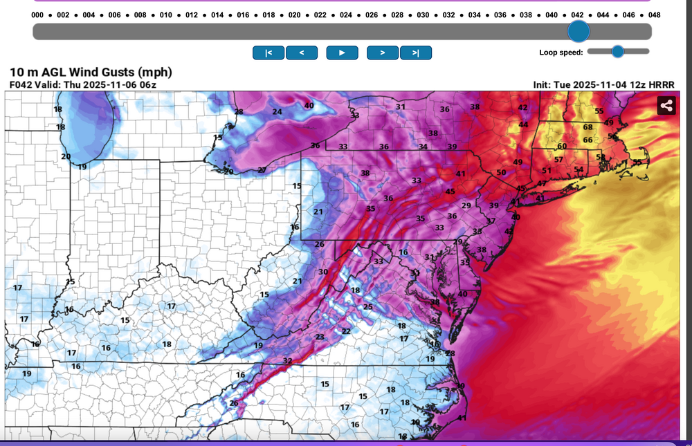
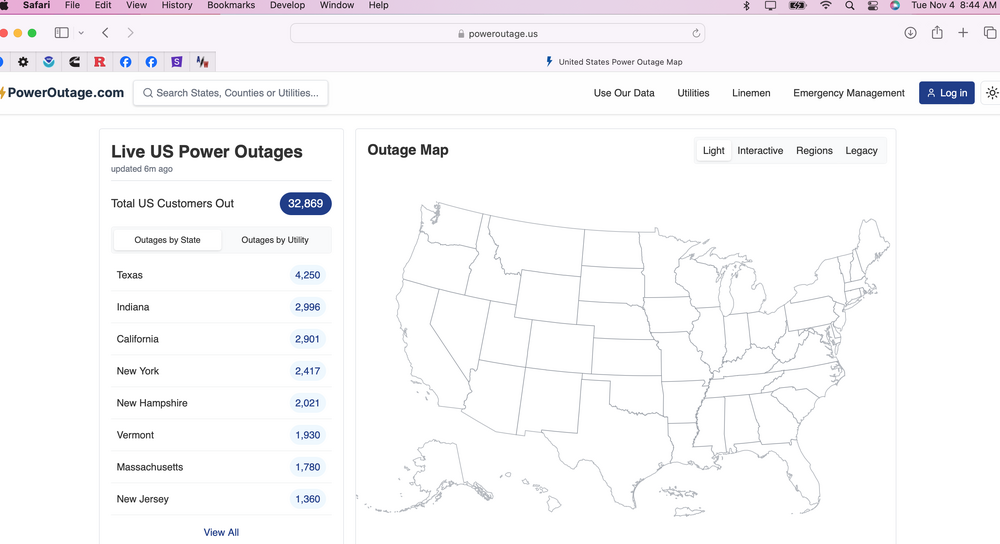
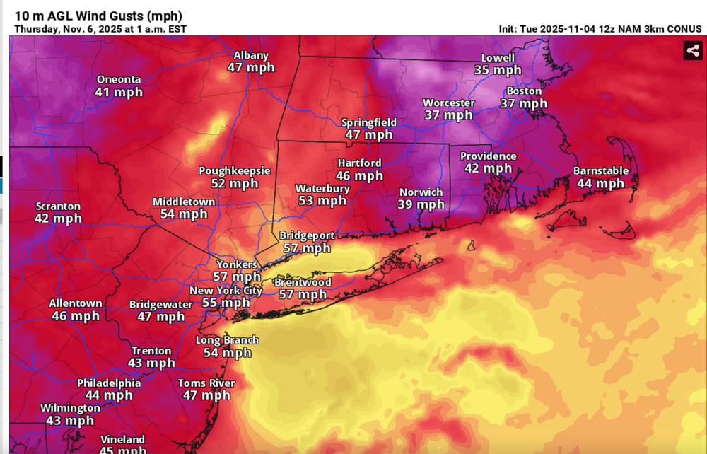
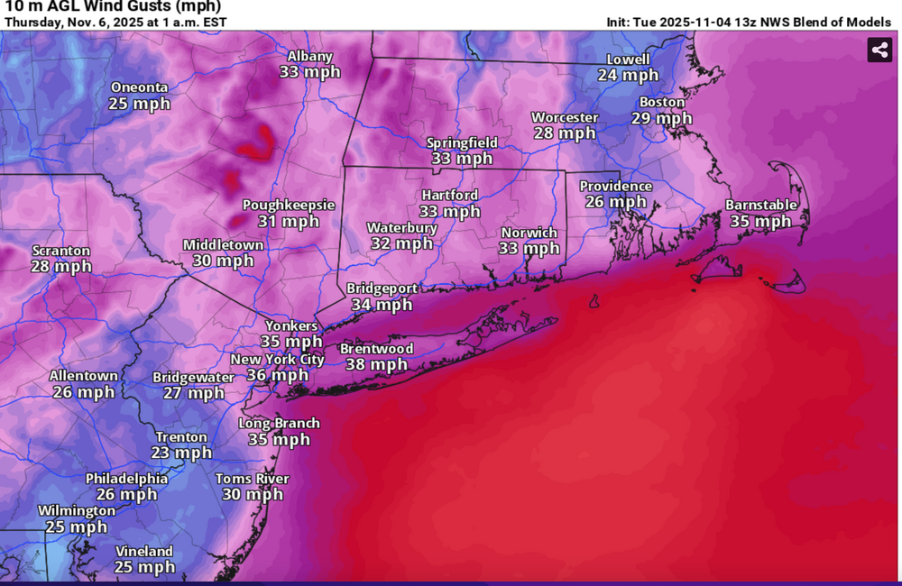
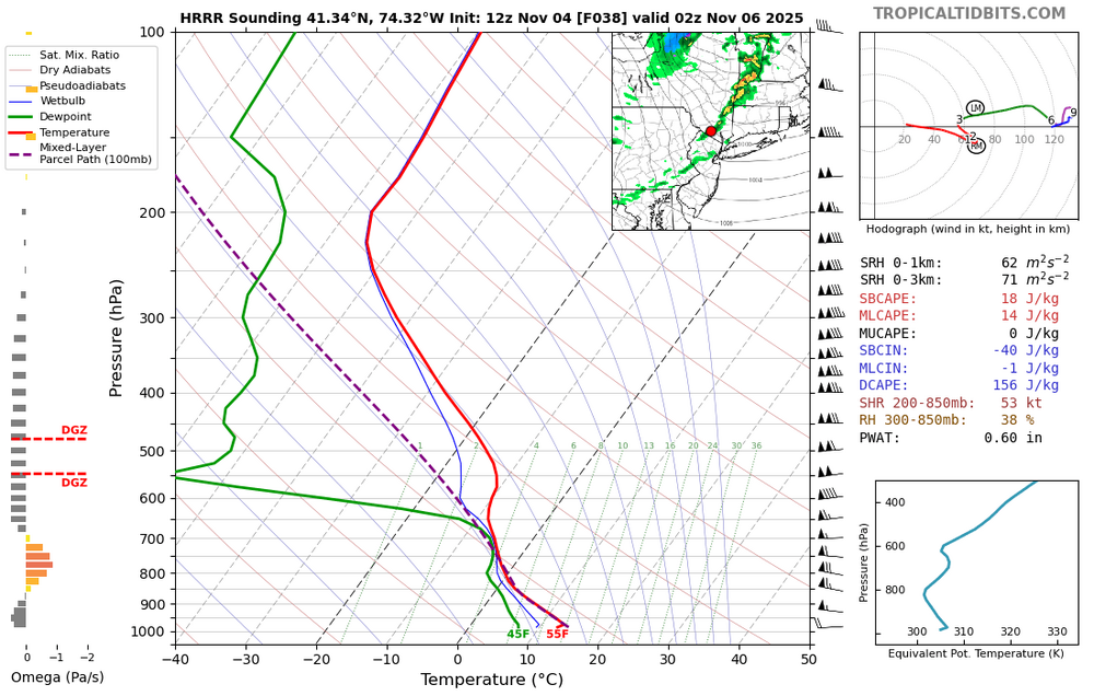
 Please follow whatever NWS OKX PHI ALY and BOX issues on the coming Wednesday night wind and tides. From our subforum standpoint have tagged wind damage for Wednesday night's brief but significant wind event associated with a 55-65KT 850 MB Cold Air Advection jet overhead. No guarantees, so the worst case 12z/4 HRRR and NAM suite max wind gusts should be 5 MPH too high but nevertheless, we should see more power outages than this morning (attached), and I expect at least a few night time -Thursday morning detours travel delays due to downed tree branches especially ridges and through NYS-CT. This will impact air travel for arrival departures Wednesday evening possibly into Thursday morning. Lapse rates look unstable for a few hours Wednesday evening up to at least 900MB, with strong subsidence drying in the wake of the Wednesday evening cold frontal passage adding to momentum transfer. A 12 hour 500MB HFC of over 150M amplifies in its east-southeast trek across NYS into New England Wednesday evening, briefly increasing the nw 850MB jet behind it to 65 kt or a bit higher. PA/NJ look to be on the southern fringe of the greatest impact which should be NYS and New England. It's an early call so no guarantees but I think its worth an eventual wind Watch or Advisory. I expect at least half the airports in the NYC metro area to hit at least 40 kt, possibly reaching 50 KT? Wind gust potential diminishes rapidly in our NYC subforum area by dawn Thursday. BLOWOUT Tide Thursday morning?: There is a chance that parts of the east facing coasts at just after midnight Thursday morning's LOW tide cycle will see a blow out tide less than -1.6' MLLW because of this brief period of wnw wind. Added HRRR max gusts at 10P/5 and 1A/6, the 12z/4 FOUS with my own personal trigger of 27KT BL wind as a threshold of wind event concerns, the 844AM today power outages with the relatively light sub 40KT gusts. Then I added the 3K NAM sampler max wind gusts, the more conservative Blend Of Models wind gust forecast and the the EPS marginal advisory wind gust modeled prediction. 1058A/4


-
November 2025 general discussions and probable topic derailings ...
weatherwiz replied to Typhoon Tip's topic in New England
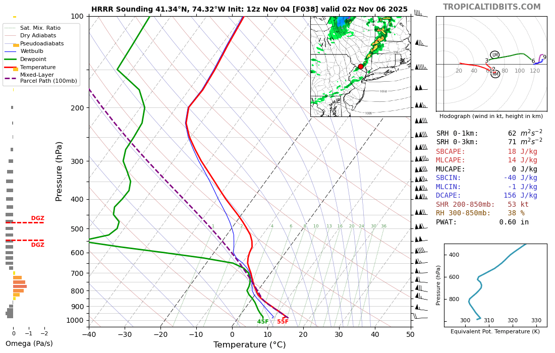
This is one of the more intriguing modeled wind setups we've had in a while. This is 12z NAM bufkit for BDL and for 2 AM. Like Scott said above, also have to watch for gusty showers/thunderstorms which could bring some locally damaging wind gusts but we should crank on the WNW flow. Strong pressure gradient and strong mixing overnight. Maybe some spots end up with just a bit of a near sfc inversion to keep the strongest gusts more to tree top level but there will be some 60+ mph gusts tomorrow night I'd think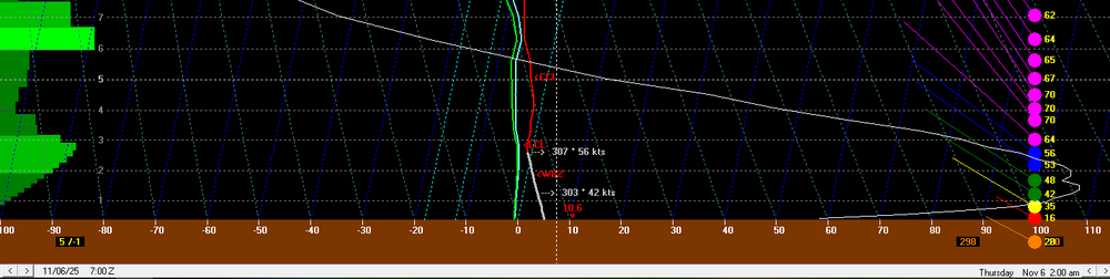
-
Things have definitely warmed after the 2016 super Nina and stayed in a permanent warmer base state due to the persistently torched pacific basin. Whether that is permanent is the question.
-
Interesting wind potential, but much higher well NE of the area.

-

November 2025 general discussions and probable topic derailings ...
CoastalWx replied to Typhoon Tip's topic in New England
Yeah this has my eye. Also, may need to watch some convective shwrs/iso tstm again. -
12z guidance coming in more impressive and now has a narrow squall line with 60 mph gust potential along and just behind Wednesday evening.
-
The charts that show life expectancy and the warming temp charts you can nearly lay on top of one another and you wouldn't know the difference.
-
Fascinating listen, not sure what to believe anymore.
-
-
 Far more interested in this than I was for the Halloween breezes.
 -
Yo that’s exactly the spot where I was! I live just south of there off Harned
-
There are several Coywolves around here, some are pretty damn big.
-
I’m not saying that we won’t see +PNA intervals, I’m just doubting that they are very frequent/long in duration. We both agree that we won’t see a 2022-23 style nuclear RNA. My reasoning: 2nd year Niña and the continued North PAC cooling since September 1st. Guess we’ll see what happens soon
-
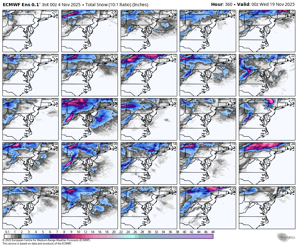
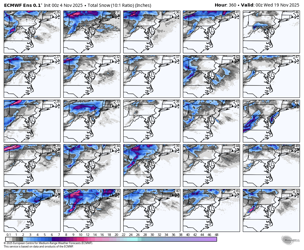
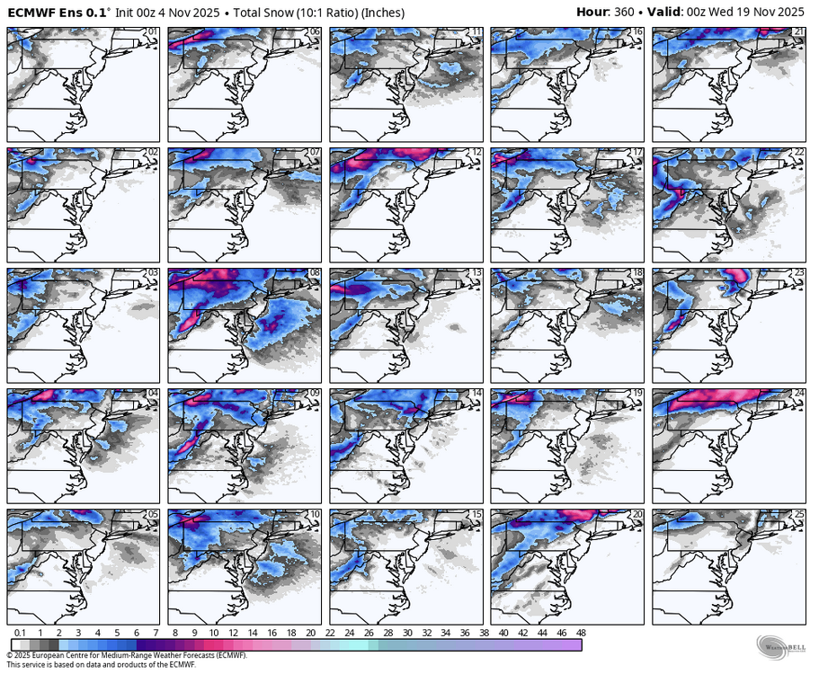
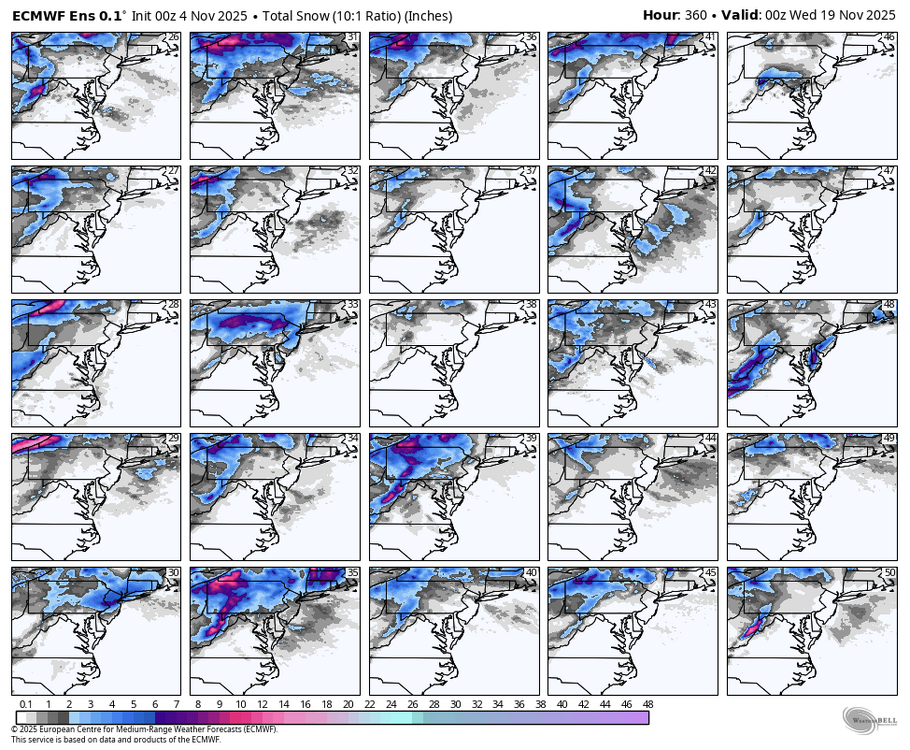
thru Nov 13, 0z EPS shows a whopping 25 hits out of 50 (50%).
-
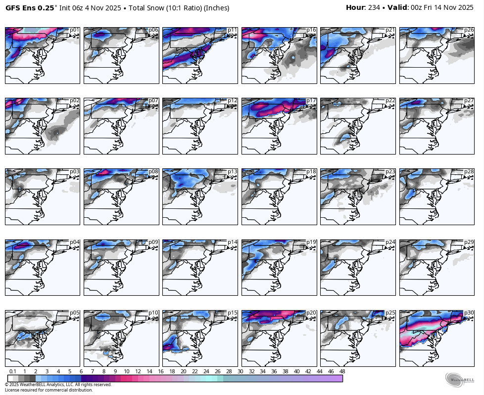
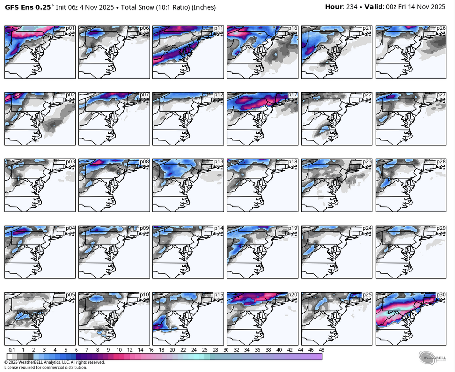
thru November 13, 06z GEFS show 11 hits (at least flurries) out of 30 (37%). p30 looks cool as well.
-
November 2025 general discussions and probable topic derailings ...
CoastalWx replied to Typhoon Tip's topic in New England
BOX going High Wind Watch for their domain tomorrow night. 55-65. -
They are everywhere here-hunting deer most likely
-

November 2025 general discussions and probable topic derailings ...
Layman replied to Typhoon Tip's topic in New England
So the squirrels...absolutely huge around here this year! After such a dry summer/Fall I thought they'd be their typically ragged and ratty little selves but they're not by any stretch. More like Chihuahua-sized and furry as I've ever seen. A selective mating outcome? Genetic anomaly? Local aberration? Or...are we in for a season to remember?! -
The general rule around NYC Metro following SSWs that occur during any month of winter is that the snowfall is directly proportional to the amount that fell before the SSW occurred. So a winter with very little snowfall prior to the SSW usually won’t have a very snowy outcome after. Conversely, a snowy pattern before the SSW will usually become enhanced following the event.
-
BWI: 19.2" DCA: 14.5" IAD: 22.2" RIC: 12.5" SBY: 9.0"