All Activity
- Past hour
-
Nov 28-30th Post Turkey Day Winter Storm
A-L-E-K replied to Chicago Storm's topic in Lakes/Ohio Valley
One last weenie band rolling down to cap this event off -

First Winter Storm to kickoff 2025-26 Winter season
CoastalWx replied to Baroclinic Zone's topic in New England
Any meteorologist saying that should get a mafia style slap across the face. That worked real well on 10/29/11. -

First Winter Storm to kickoff 2025-26 Winter season
Ginx snewx replied to Baroclinic Zone's topic in New England
Here where you can insert model bias in. GFS notorious for warming boundary layer too fast. Euro qpf outputs underestimated -

First Winter Storm to kickoff 2025-26 Winter season
moneypitmike replied to Baroclinic Zone's topic in New England
BOX had that in their AFD yesterday. Apparently, the sun angle is only low enough for day time accumulation between December 18 and December 24th. -
First Winter Storm to kickoff 2025-26 Winter season
Kitz Craver replied to Baroclinic Zone's topic in New England
Does central CT go isothermal with this look? -

First Winter Storm to kickoff 2025-26 Winter season
dendrite replied to Baroclinic Zone's topic in New England
-

Nov 28-30th Post Turkey Day Winter Storm
Mogget replied to Chicago Storm's topic in Lakes/Ohio Valley
More than 24 hours of snow—it’s still going at [almost] 6 AM. Next step: get out of bed and clean the driveway… -
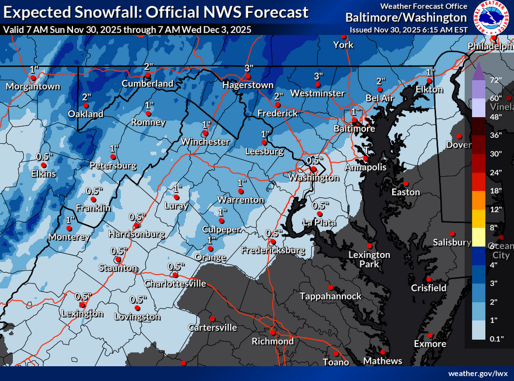
Light Snow here just southwest of Oregon Ridge
-
Jeff B started following November Discobs 2025
-

First Winter Storm to kickoff 2025-26 Winter season
CoastalWx replied to Baroclinic Zone's topic in New England
Euro is lean with QPF. Meh. Shoot the horse. -
i went to be at 1:30am for the euro and purposely set an alarm at 6:45 to see some snow showers. cloudy skies rn. I shall wait.
-

First Winter Storm to kickoff 2025-26 Winter season
CoastalWx replied to Baroclinic Zone's topic in New England
I already heard the “daytime” argument for accumulations and pavement temps. Christ we never learn. -

First Winter Storm to kickoff 2025-26 Winter season
CoastalWx replied to Baroclinic Zone's topic in New England
Gfs too warm. Even euro borderline. -

First Winter Storm to kickoff 2025-26 Winter season
moneypitmike replied to Baroclinic Zone's topic in New England
I think this is the intended. Those amounts and the rainy coast look NAMish. -
Central PA Fall Discussions and Obs
DDweatherman replied to ChescoWx's topic in Upstate New York/Pennsylvania
Snow this morning underway to get us in the mood -

First Winter Storm to kickoff 2025-26 Winter season
HoarfrostHubb replied to Baroclinic Zone's topic in New England
That BOX map is only thru 7PM Tuesday. Still several more hours of precip but yeah. It’s awful -
Nov 28-30th Post Turkey Day Winter Storm
totsata replied to Chicago Storm's topic in Lakes/Ohio Valley
-

First Winter Storm to kickoff 2025-26 Winter season
Ginx snewx replied to Baroclinic Zone's topic in New England
Yes GFS is definitely converging. From up over RI to this. Soundings are saturated here below 0 c with a bump to 33/34 at the surface. Thumpity my name is Humpity -
Nice burst of snow has laid down a dusting here. 34°. Winds S13 G23.
-
Better for all
-

First Winter Storm to kickoff 2025-26 Winter season
CoastalWx replied to Baroclinic Zone's topic in New England
Can we get Nam dynamics with gfs/euro position? -
6z brings it back similar to Tuesday but a few degrees colder.
-

First Winter Storm to kickoff 2025-26 Winter season
CoastalWx replied to Baroclinic Zone's topic in New England
I don’t understand how it goes out like that without someone seeing it? -
Flurries in McLean!!! First flakes of the season!
-
BWI: 18.9” DCA: 15.7” IAD: 22.1” RIC: 12.5” SBY (TB): 11.5”
-


